The number of trout in a southern Oregon stream system showed no decline one year after a fire burned almost the entire watershed, including riparian zone trees that had helped maintain optimal stream temperatures for the cold-water fish.
Read the full article…
Become a Member and get unlimited access to all articles.
https://staging.columbiabasinbulletin.org/wp-content/uploads/2020/10/erosion-fire.jpg7581140CBBhttps://staging.columbiabasinbulletin.org/wp-content/uploads/2026/02/logo-Columbia-Basin-Bulletin-horizontal-1068x150-1-1030x145.jpgCBB2022-10-05 15:27:002025-02-26 16:33:05How Fish Respond To Fire: Study Shows After Wildfire Burned Entire Oregon Watershed, Salmonids Showed Resiliency
The use of virtual fencing to manage cattle grazing on sagebrush rangelands has the potential to create fuel breaks needed to help fight wildfires, a recent Oregon State University and U.S. Department of Agriculture-Agricultural Research Service study found.
Virtual fencing involves placing collars on livestock. The collars communicate with GPS and reception towers to form a virtual fence set by the rancher. Auditory stimuli emit from the collar when the livestock reach the limit of the virtual fence and they receive a benign shock if they pass the fence limit.
“We’re seeing the challenge related to wildfires that land managers, particularly on public lands, are facing in the western U.S.,” said David Bohnert, director of Oregon State’s Eastern Oregon Agricultural Research Center in Burns. “They just don’t have the tools to manage those public lands in a way that is timely, particularly related to wildfire. This new study should help begin to change that.”
Wildfires on sagebrush landscapes, which cover much of the interior landscape of the western U.S., have increased dramatically in recent years, with more acres burning, the size of fires increasing and more federal dollars being spent to fight fires, USDA statistics show.
These changes are in part due to the expansion of nonnative annual grasses on the sagebrush landscape, the researchers note. The increased prevalence of these nonnative grasses, which dry out earlier in the growing season and grow faster than native perennial bunchgrass, leads to an increase in fuel for wildfires.
Most methods to reduce fuel for wildfires have focused on cutting or burning shrubs or trees. Recently there have been efforts to strategically place a network of fuel breaks across sagebrush landscapes to provide space where firefighters can safely seek to contain the spread of fires.
The new study from Oregon State and Agricultural Research Service scientists, published in Rangeland Ecology & Management, looked at whether cattle grazing and virtual fencing could be an effective tool to create those fuel breaks by eating the grass that fuels fires.
Virtual fencing has been around for decades, but in recent years, with advances in satellite, battery and GPS technology, it has gained more attention in the agricultural community, Bohnert said. It allows ranchers to control livestock distribution in rangeland landscapes without physical fences, which are costly to construct and maintain and also may be harmful to wildlife.
In this study, the researchers set up a 200-meter-wide by 3-kilometer-long fuel break in a roughly 1,000-acre pasture at OSU’s Northern Great Basin Experimental Range, about 35 miles west of Burns in southeastern Oregon. The fuel break area was bounded by a series of four virtual fences, each 35 meters apart.
In June 2021, 16 cows and 23 cow/calf pairs were placed in the fuel break area with several water sources inside it. All the cows, but not the calves, were fitted with virtual fence collars that use GPS positioning to contain them in the fuel break boundaries and record their locations every five minutes. After 30 days, the cows were removed.
After that, the researchers analyzed the data. Findings included:
–The daily percentage of the cows without calves in the fuel break area was 98.5%.
–The daily percentage of cow/calf pairs in the fuel break was 80.6%. The researchers believe the difference is due to the calves not wearing collars and being more likely to walk outside the fuel break to forage. Their mothers were then apt follow.
–The cows consumed 48.5% of the grass fuels inside the fuel break and only 5.5% of the grass fuels outside the fuel break.
The findings complement a growing body of evidence that indicate virtual fencing can successfully be used for a variety of livestock management applications, said Chad Boyd, a research leader for the Agricultural Research Service in Burns who has a courtesy appointment at Oregon State.
Additional research underway by the authors is evaluating the ability of virtual fencing to keep cattle out of riparian areas to protect critical salmon and steelhead spawning habitat. They also are studying the potential to mitigate wildfire risk by identifying high fuel load areas on rangelands through remote sensing and then strategically employing virtual fencing and grazing to meet fuel management objectives.
“Grazing shouldn’t be seen in absolutes,” Boyd said. “It’s one tool that can be used along with everything else. It requires knowledge of the land management objectives, and the grazing needs to be managed appropriately. Virtual fencing helps do that in a sustainable, strategic and defensible manner that helps not only the producer and land management agency but also has beneficial impacts on society.”
https://staging.columbiabasinbulletin.org/wp-content/uploads/2022/09/cows-with-collars-scaled.jpg19202560CBBhttps://staging.columbiabasinbulletin.org/wp-content/uploads/2026/02/logo-Columbia-Basin-Bulletin-horizontal-1068x150-1-1030x145.jpgCBB2022-09-29 14:20:312025-02-26 16:35:00With New Technology ‘Virtual Fences’ Getting More Attention; Can Be Used To Manage Cattle For Fuel Breaks, Keep Livestock Out Of Salmon Habitat
Walleye have spread throughout the Columbia River basin following an unauthorized introduction to Lake Roosevelt in the mid-20th century. These fish have remained downstream of Idaho’s salmon and steelhead rivers until recently.
Data collected at the Lower Granite Dam adult fish trap has shown that walleye have been moving through the fish ladder and likely passing over this dam since at least 2016 (2016=2; 2017=11; 2018=49; 2019=20; 2020=45; 2021=75), says Idaho Fish and Game.
The adult fish trap is located halfway up the fish ladder and allows biologists to trap and handle a portion of fish moving through the ladder. Because the adult trap collects only a portion of fish moving up the ladder, these numbers represent a fraction of what has actually passed upstream of the dam over the last handful of years.
“We estimate that 160 walleye in 2020 and 294 in 2021 passed over Lower Granite Dam, and passage in 2022 is shaping up to be the largest yet. Additionally, anglers are encountering walleye in Idaho’s anadromous waters with increasing frequency, including one fish caught over 80 miles up the Salmon River near the town of Riggins,” says IDFG.
Walleye are effective and opportunistic predators that will prey on emigrating salmon and steelhead smolts. Juvenile salmonids in Idaho rivers and streams are already affected through predation by native and non-native birds and fishes, and as more walleye continue to move and colonize upstream of Lower Granite, predation rates will continue to rise.
Researchers downriver have estimated that the average walleye eats around 2.5 smolts per day in the spring, and that non-native predators, including walleye, might be eating up to 17% of certain populations of juvenile emigrants. This scale of mortality can reduce adult returns.
Angling encounters with walleye will only increase as more of these fish pass above Lower Granite, so it might be time to brush up on your walleye identification skills.
Generally speaking, walleye have a dark green back, that transitions into a gold side, and a light white belly. The walleye is closely related to the yellow perch, but lacks the dark vertical bars that you would see on the side of a perch. Walleye have a long and slender shape with a tapered head, somewhat similar to the overall shape of a northern pikeminnow. However, these two species can easily be differentiated by remembering just a couple of key characteristics.
Walleye have two distinct dorsal fins (the first fin has spiny rays and the second has soft rays), while northern pikeminnow only have a single, soft-rayed dorsal fin. Additionally, walleye have sharp and obvious teeth, while northern pikeminnow have no teeth (don’t try to grab a walleye by the lip!).
Within Idaho’s anadromous waters (Clearwater River, Salmon River, and the Snake River below Hells Canyon) there are no restrictions on the daily bag, size, or possession limit of walleye.
“The average walleye that we’ve sampled from the ladder at Lower Granite over the last few years has been almost 18 inches and just under two pounds, with the largest fish coming in at 23 inches and four and a half pounds. As many folks know, these fish make tremendous table fare. So, if you happen to find one at the end of your line, we encourage you to keep it and enjoy your meal,” says IDFG.
https://staging.columbiabasinbulletin.org/wp-content/uploads/2022/09/walleye-chart-snake-river.png374624CBBhttps://staging.columbiabasinbulletin.org/wp-content/uploads/2026/02/logo-Columbia-Basin-Bulletin-horizontal-1068x150-1-1030x145.jpgCBB2022-09-29 14:15:252022-09-29 14:15:26Idaho Fish And Game Reports Increasing Numbers Of Invasive, Salmon-Eating Walleye Passing Lower Granite Dam
The lower Columbia River below Bonneville Dam will open additional areas for recreational salmon fishing beginning Oct. 1, fishery managers from Washington and Oregon announced Wednesday.
The lower river closed to recreational fishing in early September to protect lower Columbia River “tule” Chinook salmon, which are listed as threatened under the Endangered Species Act. Portions of the lower river reopened in mid-September for coho and Chinook fishing.
With the vast majority of the lower river “tule” Chinook having moved out of the mainstem Columbia River into the tributaries, fishery managers with the Washington Department of Fish and Wildlife and Oregon Department of Fish and Wildlife determined that fishing could resume throughout the lower river.
“Based on historic run timing and catch information, we’re able to reopen fishing across the lower river without exceeding our allowed impacts for ESA-listed fish,” said Ryan Lothrop, Columbia River fisheries manager with WDFW. “We continue to see coho and upriver Chinook moving upstream, so there should be some late-season mainstem opportunity for any anglers who want to brave the fall weather.”
Managers had closed all salmon fishing below Bonneville Dam on Sept. 2 after the recreational fishery exceeded its allowable impact to the ESA-listed lower Columbia River tule fall Chinook. On Sept.15, the states reopened Buoy 10 to retention of hatchery coho, and the area from Reed Island to Bonneville Dam to Chinook and hatchery coho, where impacts to lower Columbia River fall Chinook would be minimal.
In making their decision to reopen Chinook retention, fishery managers considered updated run sizes for upriver Chinook runs, catch projections, and past data which indicates the majority of lower river tule Chinook have entered the tributaries by late September. Reopening lower mainstem recreational Chinook retention will have minimal impacts on listed tule fall Chinook and will not affect planned commercial fishing seasons.
While managers don’t expect additional impacts to tules in the Columbia River mainstem, there are concerns about low numbers of those lower river Chinook that have returned to some area tributaries, particularly the Cowlitz and Washougal rivers. Washington fishery managers anticipate taking action to increase the likelihood that broodstock collection goals can be met for those rivers.
Salmon fishing will be open on the mainstem from Buoy 10 near the mouth of the Columbia to the Tongue Point/Rocky Point line with a daily adult bag limit of three salmon, only one of which may be a Chinook. Anglers must release all steelhead and salmon other than Chinook or hatchery coho.
From the Rocky Point/Tongue Point line to Bonneville Dam, the daily adult bag limit is two fish, only one of which may be a Chinook. Anglers must release all steelhead and salmon other than Chinook or hatchery coho.
https://staging.columbiabasinbulletin.org/wp-content/uploads/2022/05/columbia-river-fishing.jpg236420CBBhttps://staging.columbiabasinbulletin.org/wp-content/uploads/2026/02/logo-Columbia-Basin-Bulletin-horizontal-1068x150-1-1030x145.jpgCBB2022-09-28 07:20:002022-09-30 07:23:47Columbia River Harvest Managers Open Additional Areas Below Bonneville Dam For Recreational Salmon Fishing, Say Little Risk To ESA-Listed Chinook
Above: Location of Core Sagebrush Areas, Growth Opportunity Areas, and Other Rangeland Areas identified within the sagebrush biome of the United States of America.
A report published today by a team of scientists from a dozen organizations provides a product designed to boost efforts by land and wildlife managers to restore and conserve the imperiled sagebrush ecosystem across the full extent of its range, which covers more than 165 million acres.
The report’s approach, known as the Sagebrush Conservation Design, provides a roadmap for addressing threats to sagebrush by facilitating cooperative conversations that enable stakeholders to work together. The sheer size of rangeland the new design covers – 13 western states – is unmatched to date by previous efforts.
To develop this report, the Western Association of Fish and Wildlife Agencies brought together 21 leading scientists with diverse backgrounds and expertise from 12 different federal and state agencies, universities, and non-governmental organizations.
“We are committed to working with stakeholders to find solutions that improve habitat, stop the decline, and help people maintain quality of life and livelihoods,” said Tony Wasley, Director of the Nevada Department of Wildlife and Chair of the WAFWA Sagebrush Executive Oversight Committee. “Implementing a strategic, landscape-scale approach will require an unprecedented degree of collaboration. The Sagebrush Conservation Design gives us the tools we need to do exactly that.”
Sagebrush, home to more than 350 species of conservation concern, is being threatened and degraded by invasive annual grasses, wildfire, expanding conifers, climate change and human development. Despite increased investments into the sagebrush ecosystem in recent years, the report found an average of 1.3 million acres of sagebrush have been lost or degraded each year over the last 20 years.
“The Sagebrush Conservation Design allows for targeted conservation and monitoring and helps managers and landowners focus finite resources on protecting functioning habitat,” said Anne Kinsinger, Associate Director for Ecosystems at the U.S. Geological Survey.
The report’s innovative approach is based on remotely sensed data which was used to assess sagebrush habitats across its range, assigning areas to categories according to the status of the sagebrush and perennial grasses. Areas with intact sagebrush and perennial grasses are labeled Core Sagebrush Areas.
The design calls for a ‘Defend and Grow the Core’ approach, flipping the script by focusing first on these intact Core Sagebrush Areas that are of immediate high value to wildlife, and then growing them by working outward to more degraded areas rather than addressing the worst areas first. Core areas have the potential to provide anchor points and are most likely to maintain their condition as high-quality habitat. These are supplemented by Growth Opportunity Areas, which provide opportunities for improving habitat, but are lower priority given the presence of landscape-scale threats where restoration investments may be necessary.
The report also found that the identified threats to sagebrush habitats are complex, landscape-scale problems, such as invasive annual grasses, wildfire, conifer encroachment, climate change, and a range of other human modifications. These complex problems impact livestock forage, wildlife habitat, carbon storage and other critical ecosystem services provided by sagebrush landscapes.
“The Sagebrush Conservation Design provides a framework for engaging in collaborative conservation on a landscape scale,” said Matt Hogan, U.S. Fish and Wildlife Service Regional Director for the Mountain-Prairie Region. “It not only provides a roadmap for conservation but will facilitate conversations about shared goals and values among a wide array of stakeholders so that we can work collectively to achieve conservation success.”
The Sagebrush Conservation Design, say the researchers, can inform landscape-scale decisions and provides a starting place for incorporating the local stakeholder input and knowledge necessary to implement site-specific management strategies.
“A Sagebrush Conservation Design to Proactively Restore America’s Sagebrush Biome,” can be found here.
https://staging.columbiabasinbulletin.org/wp-content/uploads/2022/09/sagebrush-areas.png436600CBBhttps://staging.columbiabasinbulletin.org/wp-content/uploads/2026/02/logo-Columbia-Basin-Bulletin-horizontal-1068x150-1-1030x145.jpgCBB2022-09-22 14:48:372025-02-26 16:35:00Can We Save The West’s Disappearing Sagebrush Ecosystem? Scientists Provide Roadmap For Conservation Efforts
Starting Saturday, Sept. 24, anglers will be able to harvest coho salmon in the Grande Ronde River for the third time since they were reintroduced in 2017.
Coho returns to the Snake River basin have increased over the last three years with the 2021 return being the highest ever.
“The 2022 return is looking to be similar to last year,” said Kyle Bratcher, Oregon Department of Fish and Wildlife District Fish Biologist. “We’re excited that more folks are taking an interest in this fishery and that we can provide this opportunity.”
The Grande Ronde River is a tributary of the Snake River, 182 miles long, in northeastern Oregon and southeastern Washington in the United States. It drains an area southeast of the Blue Mountains and northwest of the Wallowa Mountains.
Coho salmon were reintroduced to provide for harvest in both treaty and non-treaty fisheries and to restore ecological function lost in their absence. Coho were extirpated in the early 1900s with multiple reintroduction efforts attempted up until the 1970s. Current pilot reintroduction efforts are aimed at assessing the success of reintroduction, using a lower Columbia River stock, prior to potential development of a localized hatchery stock.
While the fishery is opening on Sept. 24, there likely will not be a lot of fish in the Grande Ronde River for another week or two. Coho are just starting to cross the Lower Granite Dam and need time to make their way upriver to the Oregon section. During the past two years, catch rates have been very low with anglers primarily targeting steelhead and catching an occasional coho.
“I suspect that because anglers are focused on steelhead, we haven’t seen great fishing for coho,” said Bratcher. “I do think that once anglers start targeting them and figure out their habits, we’ll see catch rates increase.”
This year’s fishery has been extended to include the roadless section from the Wildcat Bridge up to the mouth of the Wallowa River. With two years of fisheries in the books, managers can lean on lessons learned and have extended the fishery knowing it presents a very low risk of over harvest.
In addition to a strong coho return, Bratcher says that fall Chinook salmon and bull trout are also encountered on an annual basis during the Grande Ronde steelhead fishery. “Having the diversity on the Grande Ronde is great and makes for a more interesting time on the water,” said Bratcher. “Anglers should brush up on species identification to stay out of trouble when harvesting steelhead and coho.”
Historically about one million coho salmon returned annually to the Columbia River and were abundant throughout the upper Columbia River and Snake River watersheds. By the 1980s, the fish were gone from the basin interior – extirpated. But today, in several rivers above Bonneville Dam, the coho are back.
Columbia River treaty tribes, despite resistance from others in the early days, were determined to return functionally extinct coho to interior basin waters as they worked to increase return numbers for struggling chinook, sockeye and steelhead. States and Tribes are now working together to bring back coho to interior rivers.
By 1987 no coho were counted at Lower Granite. They wouldn’t be seen again until the first adults from the Nez Perce Tribe’s Clearwater River reintroduction came back from the ocean in 1997.
Coho were extirpated from the Grande Ronde Basin as early as 1912 due to misguided fish culture practices, excessive harvest and habitat modifications.
The combination of recent investments in habitat improvements on private lands, stronger relationships among fishery co-managers, and improvements in fish culture and monitoring provide the NPT and ODFW confidence that current efforts will result in a successful reintroduction.
The regulations for the coho fishery on the Grande Ronde River will be as follows:
Dates Open: Sept. 24 through Nov. 30, 2022, or until further notice.
Open Area: The Grande Ronde River from the Oregon-Washington border upstream to the Wallowa River confluence.
Bag Limits: For adult coho salmon (>20 inches) the bag limit will be two (2). For Jack coho salmon (≤ 20 inches) the bag limit will be five (5) with two daily limits in possession.
https://staging.columbiabasinbulletin.org/wp-content/uploads/2022/09/grand-ronde.gif270360CBBhttps://staging.columbiabasinbulletin.org/wp-content/uploads/2026/02/logo-Columbia-Basin-Bulletin-horizontal-1068x150-1-1030x145.jpgCBB2022-09-22 10:31:192022-09-22 10:32:22ODFW Opens Grande Ronde River For Harvest Of Once Extinct Coho; Third Time Since Reintroduction In 2017
Plastics, now ubiquitous in the modern world, have become a rising threat to human and environmental health. Around the planet, evidence of plastic pollution stretches from grocery bags in the deep sea to microplastics in our food supplies and even in our blood.
Read the full article…
Become a Member and get unlimited access to all articles.
https://staging.columbiabasinbulletin.org/wp-content/uploads/2022/09/shoe-biodegradable.jpg262502CBBhttps://staging.columbiabasinbulletin.org/wp-content/uploads/2026/02/logo-Columbia-Basin-Bulletin-horizontal-1068x150-1-1030x145.jpgCBB2022-09-19 13:04:002025-02-26 16:33:06No More Plastic Polluting Flip-Flops? Scientists Develop New Polyurethane Materials That Biodegrade In Ocean Water
Above: A map of the network of 281 acoustic receivers researchers used in this project. Each circle represents a receiver. The circles that are filled in indicated receivers where detections occurred and are scaled according to the number of fish that were detected at each receiver.
Washington Department of Fish and Wildlife researchers wrapped up a project this summer that could have important implications for how fishery managers design future coastal steelhead fisheries and prioritize habitat restoration projects.
Initially launched in 2021, the project used acoustic and satellite tags — traditionally used for tracking wildlife like elk and wolves — to get a glimpse into the life of coastal steelhead as they had back out to sea.
Supported through a partnership with NOAA Fisheries and the University of Alaska Fairbanks, WDFW researchers used the project to learn more about the decline of repeat spawning in coastal steelhead over the past 30 years and better understand where, when, and for how long coastal steelhead are migrating through coastal rivers.
Unlike their cousins the Pacific salmon, anadromous rainbow trout commonly known as steelhead, are capable of having offspring many times over the course of their lives. In the context of widespread declines in abundance, fisheries managers have increasingly prioritized research on steelhead iteroparity because repeat spawners typically have higher productive capacity than first-time spawners.
The study included 37 female hatchery-origin steelhead and 49 wild-origin steelhead, collected and tagged at Forks Creek Hatchery as they migrated upstream in Forks Creek, a tributary of the Willapa River. Following tagging, WDFW staff released the wild fish upstream of the hatchery so they could migrate to wild spawning grounds and released the hatchery fish downstream of the hatchery after spawning them. Prior to release, WDFW staff collected and processed scales from each fish to determine their age and natal origin.
WDFW staff and colleagues placed a network of 281 acoustic receivers throughout the project area, indicated below, to better track steelhead migration and survival.
Of the wild fish tagged, 73.5% died on the spawning grounds. Of the wild fish that survived the spawning grounds, 23.1% reached the ocean. Of the tagged hatchery fish, 13.5 hatchery fish survived to reach the ocean.
Researchers also looked at velocity, or how fast the fish moved out to the ocean, as well as how much time steelhead spent in each area of their journey out to sea. As indicated below, this analysis did show that the fish that survived to reach the ocean, called ocean migrants, spent more time in each segment than those that didn’t. This suggests that using freshwater habitats, perhaps for feeding and post-spawn recovery, is an important factor for early survival.
The research also provided evidence that steelhead out-migrate through rivers at night, a finding that builds on previous literature.
WDFW staff shared the results of this research at the American Fisheries Society Conference in Spokane in summer 2022 and will also be presenting at the Wild Trout Symposium in West Yellowstone in fall 2022.
In the future, WDFW researchers want to build on this study with a focus on movement patterns relative to changes in stream temperature.
https://staging.columbiabasinbulletin.org/wp-content/uploads/2022/09/wdfw-steelhead-study-willapa-bay.png6171164CBBhttps://staging.columbiabasinbulletin.org/wp-content/uploads/2026/02/logo-Columbia-Basin-Bulletin-horizontal-1068x150-1-1030x145.jpgCBB2022-09-19 12:02:002022-09-22 12:05:18Tracking Coastal Steelhead Migration; Innovative Research Could Help Prioritize Habitat Restoration Projects
The Department of the Interior this week released new guidance to improve federal stewardship of public lands, waters and wildlife by strengthening the role of Tribal governments in federal land management.
“From wildfire prevention to managing drought and famine, our ancestors have used nature-based approaches to coexist among our lands, waters, wildlife and their habitats for millennia. As communities continue to face the effects of climate change, Indigenous knowledge will benefit the Department’s efforts to bolster resilience and protect all communities,” said Interior Secretary Deb Haaland. “By acknowledging and empowering Tribes as partners in co-stewardship of our country’s lands and waters, every American will benefit from strengthened management of our federal land and resources.”
In managing public lands and waters, the Interior Department is charged with trust responsibility and treaty rights to protect American Indian and Alaska Native Tribal interests and further the nation-to-nation relationship, and with distinct obligations to the Native Hawaiian Community. Tribal consultation and collaboration will continue to be implemented as components of, or in addition to, federal land management priorities and direction for recreation, range, timber, energy production, and other uses, and conservation of wilderness, refuges, watersheds, wildlife habitat, and other values.
The guidance will help further the directives from Joint Secretarial Order 3403 – signed by the Secretaries of the Interior and Agriculture during the 2021 White House Tribal Nations Summit – which outlines how the two departments will strengthen Tribal co-stewardship efforts. The guidance also outlines how agreements might proceed with Alaska Native corporations and the Native Hawaiian Community.
Since the Joint Secretarial Order was signed, the Interior Department has concluded a number of co-stewardship agreements, including:
–Bears Ears National Monument in Utah: On June 18, 2022, the BLM, U.S. Forest Service, and five Tribes of the Bears Ears Commission formalized their partnership for co-management of the Bears Ears National Monument. The BLM and U.S. Forest Service will provide resources to each Tribe through a separate process to support the work that the five Tribes will perform under this agreement and through their representatives on the Bears Ears Commission.
–Confederated Salish and Kootenai Tribes Bison Range Restoration in Montana: On January 2, 2022, the Confederated Salish and Kootenai Tribes (CSKT) assumed full management of the Bison Range. The FWS and CSKT continue to partner together to ensure the land and resources are managed at a high-level including prioritizing much needed improvements to address deferred maintenance to enhance safety to the public and wildlife.
–Rappahannock Indian Tribe’s Homeland Restoration in Virginia: On April 1, 2022, the Rappahannock Tribe’s re-acquired 465 acres of their ancestral homelands at Fones Cliffs, a sacred site to the Tribe and a globally significant Important Bird Area for resident and bald eagles and other migratory birds. The land is located within the authorized boundary of the Rappahannock River Valley National Wildlife Refuge; the parcel will be owned by the Tribe and be publicly accessible and held with a permanent conservation easement conveyed to FWS.
–Dworshak National Fish Hatchery Transfer to the Nez Perce Tribe in Idaho: On June 16, 2022, the Department transferred fish production at Dworshak National Fish Hatchery to the Nez Perce Tribe. The FWS will continue to provide support to the hatchery through the Idaho Fish and Wildlife Conservation Office and Pacific Region Fish Health Program.
The Interior Department is responsible for the management of millions of acres of federal lands and waters that were previously owned and managed by Tribes and also manages many important natural and cultural resources that once belonged to the Native Hawaiian Community. Those lands and waters contain cultural and natural resources of significance and value to Indigenous peoples, including sacred religious sites, burial sites, wildlife and its habitat, and sources of Indigenous foods and medicines. In addition, many of those lands and waters lie within areas where Tribes have the reserved right to hunt, fish, gather plants, and pray pursuant to ratified treaties and other long-standing legal agreements with the United States.
https://staging.columbiabasinbulletin.org/wp-content/uploads/2022/09/bears-tooth-monument.jpg4701200CBBhttps://staging.columbiabasinbulletin.org/wp-content/uploads/2026/02/logo-Columbia-Basin-Bulletin-horizontal-1068x150-1-1030x145.jpgCBB2022-09-13 16:31:002025-02-26 16:35:00Interior Department Releases New Guidance To Strengthen Role Of Tribal Governments In Managing Federal Lands, Waters
A new study led by Oregon State University suggests leaves in forest canopies are not able to cool themselves below the surrounding air temperature, likely meaning trees’ ability to avoid damaging temperature increases, and to pull carbon from the atmosphere, will be compromised in a warmer, drier climate.
Read the full article…
Become a Member and get unlimited access to all articles.
https://staging.columbiabasinbulletin.org/wp-content/uploads/2022/09/forest-drought.jpg127397CBBhttps://staging.columbiabasinbulletin.org/wp-content/uploads/2026/02/logo-Columbia-Basin-Bulletin-horizontal-1068x150-1-1030x145.jpgCBB2022-09-13 11:24:002025-02-26 16:33:06OSU Leaf Temperature Study Suggest Climate Change Will Reduce Forests’ Ability To Act As Carbon Sink, Leaves Get Too Warm
The U.S. effort to build a domestic supply of clean energy often begins with critical materials produced in far-off — and geopolitically sensitive — countries. Researchers at the U.S. Department of Energy’s Argonne National Laboratory recently contributed to a series of reports aimed at securing America’s clean energy supply chain and minimizing potential disruptions.
The DOE reports delve into 12 areas where the U.S. needs to ensure the availability of materials for clean energy sources such as wind turbines, fuel cells and solar panels. Some of these materials are rare earth minerals used in magnets that drive wind turbines, for example, or precious metals used in batteries for electric vehicles and electricity storage on the grid.
The U.S. needs a consistent and affordable supply of these materials to decarbonize its economy by 2050. Decarbonization, which includes zeroing out the use of fossil fuels, is necessary not only to avoid the worst effects of climate change but also to bolster the nation’s energy security.
Experts from Argonne, other federal agencies, DOE national labs, universities and the private sector collaborated on the supply chain deep dive assessment reports, which were produced in response to the 2021 Executive Order on America’s Supply Chains. DOE tapped Argonne for its expertise in rare earth supply chain analysis, battery technologies, hydrogen energy and other pertinent areas.
“We need a well-diversified and secure supply of critical materials to meet our decarbonization goals,” said Braeton Smith, a principal energy economist at Argonne who led the lab’s cross-cutting research contributions. “That requires us to look across the entire energy industrial base to identify potential shortages or disruptions.”
In particular, Argonne researchers led the investigation and writing for two of the supply chain reports, “Rare Earth Permanent Magnets” and “Platinum Group Metal Catalysts,” and technical contributions for the report “Competitiveness and Commercialization of Energy Technologies.” They also provided input on several other reports in the series.
China dominates the global supply chain for rare earth metals and magnets, controlling 92% of magnet manufacturing in 2020. Rare earth magnets help power wind turbine generators, especially for offshore turbines, and they go into traction motors for electric vehicles. Demand for rare earth magnets is only expected to grow as the U.S. continues to expand clean energy.
Scientists at Argonne have found in previous research that rare earth supply disruptions can have impacts that last well beyond a short-term event, creating price increases that vary depending on the specific material. They discovered these patterns using the Global Critical Materials (GCMat) model, which can be used to simulate future market developments and anticipate risks. GCMat relies on a simulation method called agent-based modeling, where the “agents” represent producers, consumers and other players in a market who are making decisions.
“A number of efforts to add magnet manufacturing and rare earth material processing capabilities are under way, both domestically and globally,” said Matthew Riddle, assistant energy scientist at Argonne. “In the reports, we highlighted a variety of these efforts to improve supply chain resilience.”
Platinum group metals, for which the U.S. is heavily dependent on imports, are catalyst agents that make chemical reactions happen more efficiently. Both platinum and iridium are important for producing “green hydrogen” for fuel cells by deriving the hydrogen from water instead of natural gas. Iridium is one of the rarest of these metals and is not produced in the U.S.
“The problem is not necessarily focused just on mining raw material,” Smith said. “The U.S. also lacks midstream production, where we can separate out and refine some of these important materials once they are mined.”
The DOE reports capture the current supply chain landscape in detail, identifying key risks and opportunities. Another hurdle is limited data across the supply chain.
“One of the challenges to analyzing critical material supply chains is the lack of publicly available data, particularly on process steps that happen after mining occurs,” said Diane Graziano, an Argonne chemical engineer.
The platinum group metals report recommended that the U.S. compile detailed information on suppliers and manufacturers, which could help prioritize catalyst investments.
In addition to boosting domestic refining and manufacturing for critical materials, other potential ways to bolster the supply chain include finding cheaper and more abundant substitute materials and increasing the ability to recover and recycle materials from end-of-life batteries and other sources.
The competitiveness and commercialization report looks at strategies for bringing innovative technologies to market and enhancing U.S. competitiveness in the clean energy industry. To that end, it laid out a six-step economic analysis framework that includes demand forecasting, policy analysis and scenario analysis.
“It’s not a perfect crystal ball. But conducting this end-to-end economic analysis of the supply chain, from mining through to recycling, helps us understand potential sources of competitive advantage for the U.S. and how to sustain them,” said Allison Bennett Irion, systems engineer and director of supply chain research at Argonne.
https://staging.columbiabasinbulletin.org/wp-content/uploads/2022/04/wind_and_solar.jpg9531429CBBhttps://staging.columbiabasinbulletin.org/wp-content/uploads/2026/02/logo-Columbia-Basin-Bulletin-horizontal-1068x150-1-1030x145.jpgCBB2022-09-12 16:45:002025-02-26 16:35:00Rare Earth Metals: New Reports Detail Supply Chain Challenges As U.S. Moves Toward Clean Energy, Decarbonization
https://staging.columbiabasinbulletin.org/wp-content/uploads/2022/09/montana-fishing-2.jpg10021336CBBhttps://staging.columbiabasinbulletin.org/wp-content/uploads/2026/02/logo-Columbia-Basin-Bulletin-horizontal-1068x150-1-1030x145.jpgCBB2022-09-08 14:01:512025-02-26 16:33:06Study Says 35 Percent Of Montana’s Cold-Water Habitats May Not Be Suitable For Trout By 2080; For Now, Anglers Adapting
https://staging.columbiabasinbulletin.org/wp-content/uploads/2022/09/ocean-fish.png468624CBBhttps://staging.columbiabasinbulletin.org/wp-content/uploads/2026/02/logo-Columbia-Basin-Bulletin-horizontal-1068x150-1-1030x145.jpgCBB2022-09-08 13:26:372025-02-26 16:33:06Research: If No Global Warming Mitigation, World’s Fish Stocks Will Drop 36 Percent Of Current Levels, Can’t Rebuild
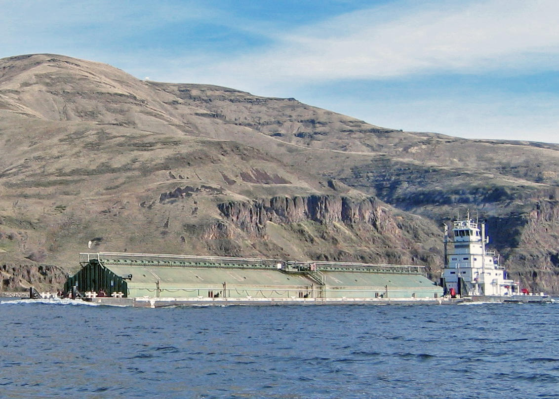
Leadership from the Ports of Longview and Kalama, and the U.S. Army Corps of Engineers have agreed to fund an estimated $2.1 million study that will investigate what changes or improvements engineers can make to turning basins in the Columbia River to help larger, deeper-drafting vessels, safely navigate when turning.
Currently, there are very few places on the lower Columbia River to turn large, fully loaded ships. These vessels need to be turned around before passing through Longview, Washington when Pacific Northwest storms force Columbia River Bar closures for unsafe conditions.
“It’s critical for us to ensure the Columbia River Federal Navigation Channel is reliable and safe,” said Col. Michael Helton, Portland District commander. “An additional turning basin and improvements to another in the system will provide additional safety in the lower river if the bar conditions require a vessel to change its course,” he said.
The primary benefit of improvements to the turning basins at the Ports of Kalama and Longview would be a decrease in transportation delay costs.
“Our region’s economy relies on the safe and efficient navigation of the Columbia River,” said Dan Stahl, Port of Longview chief executive officer. “Public investments in river infrastructure, such as the turning basins, ensure the Port of Longview can continue to safely move commerce to and from international markets while driving the local economy for decades to come.”
Cargo volumes have increased 17.4%, and larger, deeper-drafting vessels are making increased usage of the river system.
“The value of our partnerships with the Corps, neighboring ports and our stakeholders on the river can’t be overstated enough,” said Patrick Harbison, Port of Kalama commission president. “This important new infrastructure will assure the Port of Kalama’s continued growth, while providing system-wide improvements to navigational safety on the Columbia River.”
Corps staff are anticipating that improvements in the Longview and Kalama area would most efficiently serve the purpose with minimal environmental impacts and do so in the most congested areas of the river.
The Corps-led study will seek to improve navigation features at Kalama and Longview; however, these would only be recommendations. Congress would then need to authorize and fund.
The Columbia River is the number one U.S. export gateway for wheat and barley, the number two U.S. export gateway for corn and soy, and the number one U.S. export gateway for West Coast mineral bulk. The Columbia River system is also a national leader for wood exports and auto imports and exports.
A 2021 “Federal Legislative Agenda” from the Columbia River Steamship Operators’ Association says:
We support funding and maintenance of the critical turning basins on the Lower Columbia River. Because the Columbia River navigation channel is only 600’ wide and a Panamax vessel calling the Columbia River can be over 750’ long, the Columbia River Steamship Operators’ Association and the Columbia River Pilots who navigate our vessels rely on turning basins to safely turn around. Turning basins are necessary throughout the river system to ensure adequate area for safe maneuverability of fully laden vessels and during times of emergency.
• Establish a Federally Authorized Turning Basin at RM 77 (Kalama)
• Longview Turning Basin Maintenance
• Astoria Turning Basin Maintenance
• Albina Turning Basin Maintenance and Dredging Preparation
https://staging.columbiabasinbulletin.org/wp-content/uploads/2022/09/columbia-river-ships.jpg7501110CBBhttps://staging.columbiabasinbulletin.org/wp-content/uploads/2026/02/logo-Columbia-Basin-Bulletin-horizontal-1068x150-1-1030x145.jpgCBB2022-09-08 13:11:272025-02-26 16:35:00Ports, Corps To Study Improving, Adding Turning Basins To Help Larger, Deep Draft Vessels Navigate Columbia River
A new acoustic receiver developed by researchers at Pacific Northwest National Laboratory sends near-real-time fish tracking data to the digital cloud, providing timely information to dam operators and decision-makers about when, where, and how many fish are expected to pass through dams.
Read the full article…
Become a Member and get unlimited access to all articles.
https://staging.columbiabasinbulletin.org/wp-content/uploads/2022/08/fish-tracker-pnnl.jpg334445CBBhttps://staging.columbiabasinbulletin.org/wp-content/uploads/2026/02/logo-Columbia-Basin-Bulletin-horizontal-1068x150-1-1030x145.jpgCBB2022-08-25 09:08:502025-02-26 16:33:06PNNL Develops Faster Way To Track Fish Through Dams; Sends Real-Time Data To Cloud For Day-To-Day Decisions On Fish Passage
Stormwater runoff containing a toxic compound from automobile tires that washes into streams is lethal to protected coho salmon, Pacific steelhead, and Chinook salmon, according to new research published today. In contrast, sockeye salmon seem largely unaffected by the same compounds.
Read the full article…
Become a Member and get unlimited access to all articles.
https://staging.columbiabasinbulletin.org/wp-content/uploads/2022/08/chinook2.jpg434800CBBhttps://staging.columbiabasinbulletin.org/wp-content/uploads/2026/02/logo-Columbia-Basin-Bulletin-horizontal-1068x150-1-1030x145.jpgCBB2022-08-24 13:32:112025-02-26 16:33:06Roadway Runoff With Toxic Compound From Tires Killing ESA Salmon; Road Building With Federal Funds Must Consider Impacts
Photo: Greg and Angie Poulsen (left, middle) and Wendy Guess (right) of Eagle Mountain, Utah with a 124-inch white sturgeon from CJ Strike Reservoir, clinching the current catch-and-release state record.
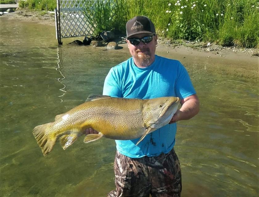
Well, it’s happened again. C.J. Strike Reservoir in southwestern Idaho – typically known for abundant crappie and smallmouth bass – has once again produced an eye-popping state record fish.
Although, this time it’s not a catfish. Greg and Angie Poulsen of Eagle Mountain, Utah traveled to Idaho, hoping to tangle with North America’s largest freshwater fish, the white sturgeon. While fishing on C.J. Strike Reservoir on Aug. 5, Greg Poulsen got his chance and hooked into a big one! Greg ultimately landed the 10-foot 4-inch monster sturgeon, and set the hook on a new state record in the process.
At 124 inches in length, this rare fish swam past the previous record of 119.5 inches, set in 2019 by Rusty Peterson and friends. While the Snake River around C.J. Strike Reservoir has good numbers of sturgeon, fish over 10 feet are exceedingly rare, and usually only seen in Hells Canyon.
Out of hundreds of fish collected during surveys from the Snake River around C.J. Strike Reservoir, only a handful of sturgeon in this class have been seen. Biologists from Idaho Power captured a 131.5-inch behemoth in 1993, as well as a 119-inch fish in 2015.
Downstream in Hells Canyon, where biologists have handled more than 4,000 sturgeon during surveys over the last 30 years, only 10 fish have ever exceeded the 10-foot mark. So yes, they do exist, but these are very rare and special fish.
Fishing for Idaho’s white sturgeon is allowed strictly on a catch-and-release basis, and they may not be removed from the water while handling. Sturgeon around C.J. Strike Reservoir can take 10-15 years to reach sexual maturity, while those in Hells Canyon take even longer. The slow growth, long lifespans and infrequent reproduction means these river giants are very susceptible to overfishing, meaning populations can take decades to rebuild.
Populations have significantly declined from historic levels as a result of overharvest, hydroelectric dams, pollution and other issues. In Idaho, sturgeon fishing has been catch-and-release only since 1971. However, Idaho Power and Fish and Game have active conservation programs helping to boost sturgeon populations throughout the Snake River. Hopefully, these ancient fish will continue to bend rods and exhaust anglers willing to tangle with a real river monster.
https://staging.columbiabasinbulletin.org/wp-content/uploads/2022/08/sturgeon-idaho-record.jpg8781170CBBhttps://staging.columbiabasinbulletin.org/wp-content/uploads/2026/02/logo-Columbia-Basin-Bulletin-horizontal-1068x150-1-1030x145.jpgCBB2022-08-23 13:49:202022-08-23 13:49:22Monster Sturgeon Caught In Snake River Reservoir Tops State Record List
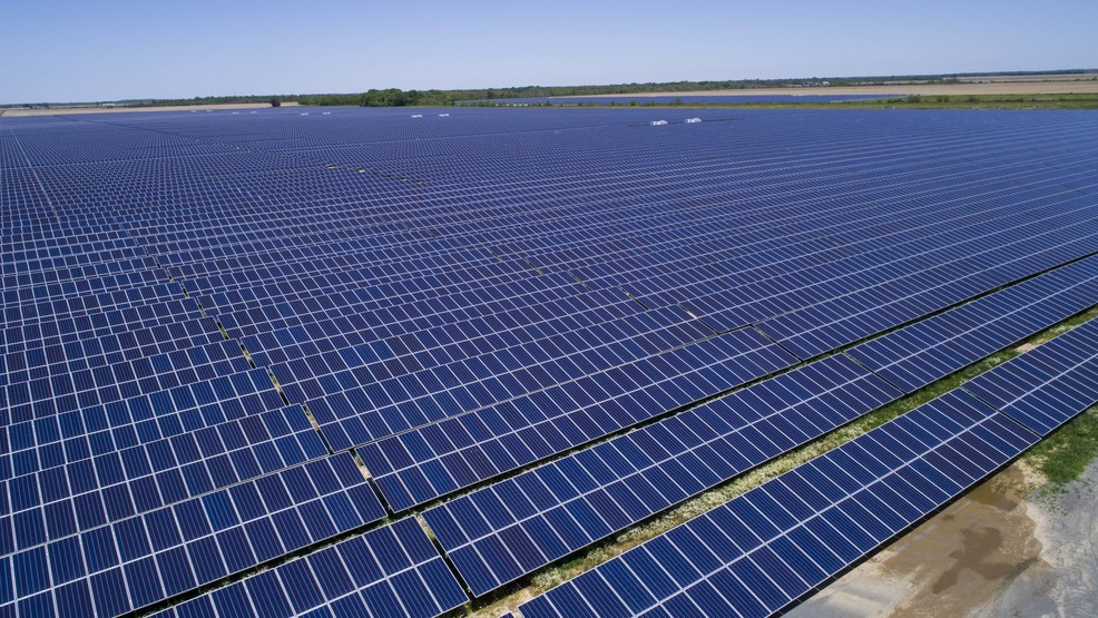
Wind energy continues to see strong growth, solid performance, and attractive prices in the U.S., according to a report released by the U.S. Department of Energy and prepared by Lawrence Berkeley National Laboratory. With levelized costs of just over $30 per megawatt-hour for newly built projects, the cost of wind is well below its grid-system, health, and climate benefits.
“Wind energy prices – particularly in the central United States, and supported by federal tax incentives – remain low even with ongoing supply chain pressures, with utilities and corporate buyers selecting wind as a low-cost option,” said Ryan Wiser, a senior scientist in Berkeley Lab’s Energy Technologies Area.
“Considering the health and climate benefits of wind energy makes the economics even better,” he added.
• Wind comprises a growing share of electricity supply. U.S. wind power capacity grew at a strong pace in 2021, with 13.4 gigawatts of new capacity added representing a $20 billion investment and 32% of all U.S. capacity additions. Wind energy output rose to account for more than 9% of the entire nation’s electricity supply. At least 247 GW of wind are seeking access to the transmission system; 77 GW of this capacity are offshore wind, and 19 GW are hybrid plants that pair wind with energy storage or solar.
• Wind project performance has increased over the decades. The average capacity factor (a measure of project performance) among recently completed projects was nearly 40%, considerably higher than projects built earlier. The highest capacity factors are seen in the interior of the country.
• Turbines continue to get larger. Improved plant performance has been driven by larger turbines mounted on taller towers and featuring longer blades. In 2011, no turbines employed blades that were 115 meters in diameter or larger, but in 2021, 89% of newly installed turbines featured such rotors. Proposed projects indicate that total turbine height will continue to rise.
• Low wind turbine pricing has pushed down installed project costs over the last decade. Wind turbine prices averaged $800 to $950/kilowatt in 2021, a 5% to 10% increase from the prior year but substantially lower than in 2010. The average installed cost of wind projects in 2021 was $1,500/kW, down more than 40% since the peak in 2010, though stable in recent years. The lowest costs were found in Texas.
• Wind energy prices have risen, but remain low, around $20/MWh in the interior “wind belt” of the country. After topping out at $75/MWh for power purchase agreements executed in 2009, the national average price of wind has dropped – though supply-chain pressures have resulted in increased prices in recent years. In the interior “wind belt” of the country, recent pricing is around $20/MWh. In the West and East, prices tend to average above $30/MWh. These prices, which are possible in part due to federal tax support, fall below the projected future fuel costs of gas-fired generation.
• Wind prices are often attractive compared to wind’s grid-system market value. The value of wind energy sold in wholesale power markets is affected by the location of wind plants, their hourly output profiles, and how those characteristics correlate with real-time electricity prices and capacity markets. The market value of wind increased in 2021 and varied regionally from below $20/MWh to over $40/MWh, a range roughly consistent with recent wind energy prices.
• The average levelized cost of wind energy was $32/MWh for plants built in 2021. Levelized costs vary across time and geography, but the national average stood at $32/MWh in 2021 – down substantially historically, though consistent with the previous three years. (Cost estimates do not count the effect of federal tax incentives for wind.)
• The health and climate benefits of wind in 2021 were larger than its grid-system value, and the combination of all three far exceeds the current levelized cost of wind. Wind generation reduces power-sector emissions of carbon dioxide, nitrogen oxides, and sulfur dioxide. These reductions, in turn, provide public health and climate benefits that vary regionally, but together are economically valued at an average of over $90/MWh-wind for plants built in 2021.
https://staging.columbiabasinbulletin.org/wp-content/uploads/2022/08/wind-farm.jpeg8191200CBBhttps://staging.columbiabasinbulletin.org/wp-content/uploads/2026/02/logo-Columbia-Basin-Bulletin-horizontal-1068x150-1-1030x145.jpgCBB2022-08-23 13:31:082025-02-26 16:35:01DOE Report: Wind Energy Value Now Far Exceeds Costs, Prices Remain Low
The Center for Biological Diversity notified the U.S. Fish and Wildlife Service this week that it intends “to sue over the agency’s failure to develop a national wolf recovery plan as required by the Endangered Species Act.” The planned lawsuit would seek to require the Service to draft a recovery plan that includes all populations of wolves in the contiguous United States.
“The Service’s piecemeal approach isn’t enough to protect and restore wolves,” said Sophia Ressler, a staff attorney at the Center. “By not completing a national recovery plan, which it’s legally required to do, the agency has failed wolves and the millions of people who want these amazing animals to thrive across the country.”
The Center filed a petition in 2010 requesting that the Service prepare a national recovery plan. So far, the agency’s approach has focused on individual wolf populations in separate geographic areas, instead of looking at both current and potential wolf habitat, and all existing populations in the lower 48 states.
In 2019 the Service denied this petition. This week’s notice of intent to sue challenges that denial and the Service’s failure to prepare a national recovery plan. The planned lawsuit would also challenge the Service’s failure to complete the required five-year status review of the species in a timely manner. The last review was completed more than a decade ago.
“We’ve seen time and time again that when the Endangered Species Act is implemented properly it really works,” said Ressler. “We’re asking the Service to comply with the law and allow the Act to truly work for wolves.”
The Endangered Species Act requires that parties submit a 60-day notice of intent to sue before a lawsuit can be filed. If the Service fails to remedy its legal violations within 60 days, the Center says it will file a formal lawsuit
A rule finalized in November 2020 removed all Endangered Species Act protections from gray wolves nationwide. A federal court vacated this rule and restored species protection in the lower 48 states. These protections do not extend to the Rocky Mountain population, which are currently not protected under the Act. The Center and its allies recently filed a lawsuit to restore those protections.
https://staging.columbiabasinbulletin.org/wp-content/uploads/2022/02/wolf-4.jpg571800CBBhttps://staging.columbiabasinbulletin.org/wp-content/uploads/2026/02/logo-Columbia-Basin-Bulletin-horizontal-1068x150-1-1030x145.jpgCBB2022-08-23 09:24:002022-08-25 09:26:41Lawsuit Call For USFWS To Develop National Wolf Recovery Plan, Says Piecemeal Policy Violates ESA
Oregon State University scientists are proposing management changes on western federal lands that they say would result in more wolves and beavers and would re-establish ecological processes. They suggest reducing by 29 percent the amount of western public lands allotted annually for livestock grazing.
In a paper published today in BioScience, “Rewilding the American West,” co-lead author William Ripple and 19 other authors suggest using portions of federal lands in 11 states to establish a network based on potential habitat for the gray wolf – an apex predator able to trigger powerful, widespread ecological effects.
In those states the authors identified areas, each at least 5,000 square kilometers, of contiguous, federally managed lands containing prime wolf habitat. The states in the proposed Western Rewilding Network, which would cover nearly 500,000 square kilometers, are Oregon, Washington, California, Nevada, Idaho, Montana, Wyoming, Colorado, Arizona, New Mexico and Utah.
“It’s an ambitious idea, but the American West is going through an unprecedented period of converging crises including extended drought and water scarcity, extreme heat waves, massive fires and loss of biodiversity,” said Ripple, distinguished professor of ecology in the OSU College of Forestry.
“Although our proposal may at first blush appear controversial or even quixotic, we believe that ultra ambitious action is required,” says the viewpoint paper. “We are in an unprecedented period of converging crises in the American West, including extended drought and water scarcity, extreme heat waves, massive fires triggered at least partly by climate change, and biodiversity loss with many threatened and endangered species. Furthermore, we note that the lands in the proposed network are already owned by the public and meat produced from all federal lands forage accounts for only approximately 2% of national meat production.”
Gray wolves were hunted to near extinction in the West but were reintroduced to parts of the northern Rocky Mountains and the Southwest starting in the 1990s through measures made possible by the Endangered Species Act.
“Still, the gray wolf’s current range in those 11 states is only about 14% of its historical range,” said co-lead author Christopher Wolf, a postdoctoral scholar in the College of Forestry. “They probably once numbered in the tens of thousands, but today there might only be 3,500 wolves across the entire West.”
Beaver populations, once robust across the West, declined roughly 90% after settler colonialism and are now nonexistent in many streams, meaning ecosystem services are going unprovided, the authors say.
By felling trees and shrubs and constructing dams, beavers enrich fish habitat, increase water and sediment retention, maintain water flows during drought, improve water quality, increase carbon sequestration and generally improve habitat for riparian plant and animal species.
“Beaver restoration is a cost-effective way to repair degraded riparian areas,” said co-author Robert Beschta, professor emeritus in the OSU College of Forestry. “Riparian areas occupy less than 2% of the land in the West but provide habitat for up to 70% of wildlife species.”
Similarly, wolf restoration offers significant ecological benefits by helping to naturally control native ungulates such as elk, according to the authors. They say wolves facilitate regrowth of vegetation species such as aspen, which supports diverse plant and animal communities and is declining in the West.
The paper includes a catalogue of 92 threatened and endangered plant and animal species that have at least 10% of their ranges within the proposed Western Rewilding Network; for each species, threats from human activity were analyzed.
The authors determined the most common threat was livestock grazing, which they say can cause stream and wetland degradation, affect fire regimes and make it harder for woody species, especially willow, to regenerate.
Nationally, about 2% of meat production results from federal grazing permits, the paper notes.
“We suggest the removal of grazing on federal allotments from approximately 285,000 square kilometers within the rewilding network, representing 29% of the total 985,000 square kilometers of federal lands in the 11 western states that are annually grazed,” Beschta said. “That means we need an economically and socially just federal compensation program for those who give up their grazing permits. Rewilding will be most effective when participation concerns for all stakeholders are considered, including Indigenous people and their governments.”
In addition to Beschta, Wolf and Ripple, authors from Oregon State include J. Boone Kauffman, Beverly Law and Michael Paul Nelson. Daniel Ashe, former director of the U.S. Fish and Wildlife Service and now the president of the Association of Zoos and Aquariums, is also a co-author.
The paper also included authors from the University of Washington, the University of Colorado, the Ohio State University, Virginia Tech, Michigan Technological University, the University of Victoria, the Turner Endangered Species Fund, the National Parks and Conservation Association, RESOLVE, the Florida Institute for Conservation Science, Public Lands Media and Wild Heritage.
———————-
https://staging.columbiabasinbulletin.org/wp-content/uploads/2020/06/beaver.jpg450600CBBhttps://staging.columbiabasinbulletin.org/wp-content/uploads/2026/02/logo-Columbia-Basin-Bulletin-horizontal-1068x150-1-1030x145.jpgCBB2022-08-11 13:16:002025-02-26 16:34:53Rewilding The West? OSU Scientists, Others Propose More Wolves, Beavers, Less Livestock Grazing On Public Lands
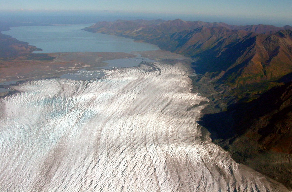
As glaciers worldwide retreat due to climate change, managers of national parks need to know what’s on the horizon to prepare for the future. A new study from the University of Washington and the National Park Service measures 38 years of change for glaciers in Kenai Fjords National Park, a stunning jewel about two hours south of Anchorage.
Read the full article…
Become a Member and get unlimited access to all articles.
https://staging.columbiabasinbulletin.org/wp-content/uploads/2022/08/glacier-holgate.jpg150150CBBhttps://staging.columbiabasinbulletin.org/wp-content/uploads/2026/02/logo-Columbia-Basin-Bulletin-horizontal-1068x150-1-1030x145.jpgCBB2022-08-11 12:16:542025-02-26 16:33:07New Study Measures 38 Years Of Glacier Change In Alaska’s Kenai Fjords; 13 Of 19 Show Substantial Retreat
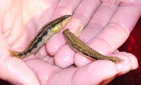
Hundreds of endangered northern leopard frogs will leap back into the wild at the Columbia National Wildlife Refuge in Washington’s Grant County this month.
The releases are made possible by a partnership of the Washington Department of Fish and Wildlife , U.S. Fish and Wildlife Service, Oregon Zoo, Washington State University, and Northwest Trek Wildlife Park.
WDFW collected northern leopard frog eggs earlier this spring, and after months of growing at the Oregon Zoo and Northwest Trek Wildlife Park, the frogs are almost ready for release.
WSU researchers will also fit a couple dozen of the frogs with small radio transmitters to help track the frogs’ movements and monitor their survival.
Once abundant throughout North America, northern leopard frogs are rapidly disappearing from their native ranges in Washington, Oregon, and western Canada.
The frog has experienced range-wide declines throughout the western states and Canada. Historical occurrences are from the Columbia Plateau, Okanogan and Canadian Rocky Mountain Ecoregions. Northern leopard frogs were found throughout eastern Washington, and 17 occupied sites were recognized throughout the Columbia, Crab Creek, Pend Oreille, Snake, Spokane, and Walla Walla river drainages. T
The last known population of northern leopard frogs in Washington is located in the Columbia Basin Wildlife Area.
The species has been listed as endangered in Washington since 1999, and with only one known wild population remaining in the wild in the state, there is still a long path to recovery for the frogs.
Likely causes of the frogs’ decline in the Pacific Northwest include habitat loss and degradation, disease, non-native species, and climate change.
“The Washington state population of northern leopard frogs has a unique genetic variation relative to the rest of the species range, and they are part of the natural diversity of amphibians of the region,” said Erica Crespi, WSU associate professor of biology. “We are working to keep them here.”
By raising eggs through tadpole stage to froglets at the Oregon Zoo and Northwest Trek Wildlife Park, the partners are working to bypass these threats through critical growth stages and establish a new population of northern leopard frogs in the region.
“Giving these frogs a headstart by raising them free of predators gives them a better chance of survival,” said Northwest Trek Zoological Curator Marc Heinzman. “We’re very pleased to participate in this critical effort to save an endangered species here in Washington.”
“We’re at a critical point for this species,” said Jennifer Osburn Eliot, who oversees the Oregon Zoo’s frog-rearing efforts. “We’re doing everything we can to help northern leopard frogs thrive again in the Pacific Northwest — and a big, healthy froglet has a much better chance of surviving in the wild than an egg or a tadpole.”
Frogs are often overlooked for their significant contribution to the environment, a fact the agencies and their partners are working to change.
“Northern leopard frogs are an important indicator of water quality due to their permeable skin,” said Emily Grabowsky, WDFW biologist. “If we improve and conserve wetland habitat that is good for frogs, other species will also benefit ranging from other amphibians to waterfowl and deer.”
Funding for the northern leopard frog reintroduction is being provided through a competitive state wildlife grant awarded to WDFW from USFWS’s Wildlife and Sport Fish Restoration program and Potholes Supplemental Feed Route mitigation funds provided by Department of Ecology.
https://staging.columbiabasinbulletin.org/wp-content/uploads/2022/08/frog-northern-leopard.jpg561840CBBhttps://staging.columbiabasinbulletin.org/wp-content/uploads/2026/02/logo-Columbia-Basin-Bulletin-horizontal-1068x150-1-1030x145.jpgCBB2022-08-11 11:45:432022-08-11 11:45:44Last Habitat For Northern Leopard Frogs; Raised Off-Site, Tagged, Released Into Columbia National Wildlife Refuge
The states of Washington and Oregon, and a coalition of organizations, joined together to send a letter to President Biden Tuesday calling for increased funding at the Hanford Nuclear Reservation.
The letter asks Biden and Congress to request and allocate adequate funding for Hanford now and in years to come, starting with $3.76 billion in Fiscal Year 2024.
Signees of the letter include Washington Gov. Jay Inslee, Oregon Gov. Kate Brown, Washington Department of Ecology, Washington State Commission on Hispanic Affairs, Tri-Cities Development Council, Tri-Cities Hispanic Chamber of Commerce, Hanford Communities, Hanford Challenge, Columbia Riverkeeper, Central Washington Building Trades Council, and the UA Local Union 598 Plumbers and Steamfitters.
The Confederated Tribes and Bands of the Yakama Nation also sent its own letter to Biden Tuesday.
The Hanford Site in southeast Washington State produced two-thirds of the nation’s plutonium stockpile during World War II and the Cold War, leaving behind one of the most contaminated nuclear cleanup sites in the world.
Parties are concerned that continued underfunding at Hanford will exponentially balloon the overall cost of cleanup, delay work by decades, and increase the risk of a catastrophic infrastructure failure or release of contamination.
Read the full letter below.
Dear President Biden,
We write to you regarding the importance of adequately funding – and successfully completing – cleanup of the Department of Energy’s Hanford Site in Washington State. This effort is a top priority for the state of Washington, regional tribes, residents of the Tri-Cities, and other impacted communities near Hanford.
As you may know, Hanford played a key role in the United States’ national security mission beginning in World War II and operating throughout the Cold War, ultimately producing approximately two-thirds of our nation’s plutonium stockpile. Hanford’s production mission transitioned to cleanup in 1989 with the signing of the Hanford Federal Facility Agreement and Consent Order, also known as the Tri-Party Agreement (TPA).
Given its role as the “workhorse” for plutonium production, the scope of Hanford cleanup is immense, representing one of the most complex and challenging environmental remediation efforts on the planet. Thirty-three years after the TPA was signed, much progress has been made at Hanford, including the remediation of over 1,300 waste sites, demolition of over 900 facilities, and treatment of over 27 billion gallons of groundwater, but there is much more work to do.
This remaining work includes remediation of hundreds of additional facilities and waste sites, packaging and shipment of the country’s largest volume of transuranic (TRU) waste, treatment of billions of gallons of additional groundwater, and retrieval and treatment of 56 million gallons of radioactive and chemical waste currently stored in 177 underground tanks. Importantly, this large volume of tank waste presents one of the most significant long-term risks at Hanford, and tank waste treatment is the largest cost driver for the entire cleanup effort.
In its “2022 Lifecycle Scope, Schedule and Cost Report” the Department of Energy (DOE) estimated the costs for Hanford cleanup to be between $300.2 billion and $640.6 billion, with active cleanup complete in the year 2078. On average, this equates to annual funding of between $5.36 billion and $11.44 billion. Notably, the report also identifies that significant budget increases will be needed beginning in Fiscal Year 2024 (FY24) to support a new scope of work for design, engineering, and construction of the High-Level Waste (HLW) facility in addition to the ongoing activities across the Hanford Site.
It is imperative that your FY24 budget request includes the necessary resources for this critical phase of Hanford cleanup, and for Congress to ensure that this funding is provided. Specifically, we believe that the appropriate funding level in FY24 is $3.76 billion – along with a recognition that this increased funding must be continued in subsequent fiscal years.
Doing otherwise will only increase long-term costs to the American people while increasing the risk to human health and the environment. We also recognize the important cleanup work taking place at other DOE Office of Environmental Management (EM) sites, and we strongly believe that all of these efforts should be fully funded. Therefore, we encourage the Administration and Congress to support an increased budget for the entire EM program.
Thank you for your careful consideration of this urgent national priority. We welcome the opportunity to discuss it with you further.
https://staging.columbiabasinbulletin.org/wp-content/uploads/2020/01/hanford-nuke-site.jpg360640CBBhttps://staging.columbiabasinbulletin.org/wp-content/uploads/2026/02/logo-Columbia-Basin-Bulletin-horizontal-1068x150-1-1030x145.jpgCBB2022-08-11 11:42:192022-08-11 11:42:20Agencies, Organizations Call On Biden To Increase Hanford Cleanup Funding; Seek $3.76 Billion In 2024
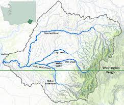
Though federal and state biologists have agreed to stop releasing hatchery winter and summer steelhead into the Hood River basin, a new study says that hatchery fish spawning in the river have little influence on wild winter steelhead productivity. Other variables, such as stream flow, abundance of sea lions in the Columbia River and ocean conditions have more influence than hatchery fish on the river’s spawning grounds.
Read the full article…
Become a Member and get unlimited access to all articles.
https://staging.columbiabasinbulletin.org/wp-content/uploads/2022/07/steelhead-odfw.jpg6871800CBBhttps://staging.columbiabasinbulletin.org/wp-content/uploads/2026/02/logo-Columbia-Basin-Bulletin-horizontal-1068x150-1-1030x145.jpgCBB2022-07-28 14:18:352025-02-26 16:33:07New Hood River Study: Spawning Hatchery Steelhead Have Little Influence On Wild Fish Productivity
Columbia Riverkeeper is a non-profit organization that for many years has been involved in key legislation regarding efforts to protect and restore the water quality of the Columbia River and its tributaries. It focuses on environmental laws to stop illegal pollution, protect salmon habitat, and challenge fossil fuel terminals. The organization has offices in Hood River and Portland, Oregon, and works throughout the Columbia River Basin. See more about its work here.
Below is a Columbia Basin Bulletin Question/Answer with Lauren Goldberg, who begins as executive director of Columbia Riverkeeper on August 1. Goldberg joined the organization in 2006 as a law clerk, became a staff attorney in 2008, and served as the legal and program director since 2016. She graduated cum laude from Lewis and Clark Law School with a certificate in Environmental Law. As Executive Director, Goldberg will oversee all aspects of the organization’s legal and policy work, operations, and development. She replaces Brett VandenHeuvel, who led the organization since 2009, and remains a board member.
CBB: The Environmental Protection Agency last year said the combination of dams and climate change are major factors in creating warm water temperatures impacting salmon and steelhead migrating through the Columbia and Snake rivers. And now we are well into summer. Is it fair to say that warming temperatures, water and air, are the most significant threat to the basin’s endangered and threatened salmonids?
The hydrosystem is the most significant threat to the basin’s endangered salmon and steelhead, for reasons including increased water temperatures caused by the dams and compounded by climate change. The hydrosystem has profoundly transformed the river. Columbia basin salmon evolved to migrate to the ocean in a fast, turbid, cold river—and migrate back to their spawning grounds in water that only occasionally reached 68 or 70 F. The series of dams on the Columbia (including in Canada) and the Snake flatten the hydrograph, reduce average water velocity, reduce sediment transportation and turbidity, and increase water temperatures in the summer and fall. Dams create large, stagnant reservoirs that soak up the sun’s energy, making the water too hot for salmon. All of these changes are bad for migrating salmon and increase salmon mortality due to poor water quality and predation—even before we start talking about problems with fish passing the dam structures. As the former director of EPA’s Office of Water and Watersheds explained: the predation problem for Columbia River salmon “is a symptom of managing the river solely to maximize power generation.” Add to these chronic problems the increasing pressure of climate change, and it is not surprising that government scientists predict salmon and steelhead will go extinct in the Snake River unless we significantly change the status quo.
CBB: Tackling temperature and pollution issues at the dams involves a lot of process, permitting and litigation that can get confusing to the public. So maybe we can sort some of this out. First, how does the Clean Water Act apply to the mainstem dams and the protection of salmon and steelhead?
Under the Clean Water Act, states create criteria that must be met to preserve the uses (like healthy fisheries) of all rivers and lakes. For the Columbia and Lower Snake rivers, Oregon and Washington set the standard of 68 F as the temperature necessary to protect salmon. Unfortunately, the Columbia and Lower Snake do not meet this standard, and the problem is getting worse.
CBB: The EPA has also released the Total Maximum Daily Load – TMDL — for temperature at the dams, setting temperature limits that are based on the state water quality standards. How does the TMDL fit into this picture, with the NPDES permits and the Clean Water Act?
Under the Clean Water Act, a TMDL is a plan to fix a waterway that is too polluted. Because of successful litigation by Columbia Riverkeeper and our partners, EPA wrote a temperature TMDL for the Columbia and Lower Snake. Now, EPA and states must implement the TMDL in the specific water pollution discharge permits (aka NPDES permits) and Clean Water Act section 401 water quality certifications for the dams. Bottomline: We have a new tool to tackle a long running problem—hot water—on the Columbia. And it took a lawsuit to make this possible.
CBB: The EPA has issued “National Pollution Discharge Elimination System permits” for the Lower Snake dams. EPA is expected to issue final NPDES permits for federal dams on the Lower Columbia this fall. It’s my understanding an NPDES permit includes conditions, in some cases prohibitions, on the discharge of pollutants from each of the dams, such as temperature, total dissolved gas, PCBs, and oil and grease. Are these permits an effective way to address temperature and pollution in the river? Can the issuance of these permits be considered progress? What happens next?
NPDES permits are among the most successful pollution reduction tools created under U.S. law; they have a multi-decade track record of significantly improving water quality in rivers and lakes all across America. So the issuance of legally-binding NPDES permits requiring the Army Corps to meet the TMDL’s temperature pollution reduction targets absolutely constitutes progress. But it’s not the end of the road. Reducing the reservoirs’ temperature pollution isn’t something that can be accomplished with the flip of a switch; it will take several years of careful study and planning to understand how the hydrosystem can be operated differently to reduce the reservoirs’ heat pollution. This may entail drawing down certain reservoirs in the summer and fall or moving water more quickly through the reservoirs. The Army Corps has long resisted studying or implementing such measures, but the NPDES permits mandate this long-overdue work.
CBB: Dams create reservoirs, warming water for salmon and steelhead. With all this process and permitting, do you see changes in the future that might actually reduce temperatures in the Columbia and Snake rivers?
Five words: Lower Snake River dam removal. Removing the dams would prevent water temperatures in the Lower Snake River from reaching levels that caused the massive fish kills seen in 2015 and 2021.
In our view, we must unite around solutions to remove the four Lower Snake River dams and reinvest in regional transportation, irrigation, and energy infrastructure. Working together, we can honor Tribal rights and interests and secure a future that includes salmon, agriculture, and clean energy.
The situation is dire. But there’s still time to restore the Snake’s and Columbia’s once-mighty salmon runs. Other dam removals in the Columbia Basin and the Pacific Northwest have resulted in dramatic and immediate improvements in salmon survival. There is every reason to believe the same would be true in the Snake River.
CBB: Will it be the states that enforce temperature limits at the dams? What happens if no progress? Litigation? If the Army Corps does not comply with the permits’ requirements to address the dams’ temperature pollution, Columbia Riverkeeper, the states, or EPA can bring an enforcement action against the Army Corps under the Clean Water Act.
CBB: EPA tucked its 2021 “Cold Water Refuge Plan” into the TMDL and added temperature, flow and cold water refuge targets for 13 tributary sites. The plan identifies cold water refuges along salmon and steelhead migration routes in the lower mainstem Columbia River. What’s your view of the plan and its potential effectiveness?
Cold water refuges are an important part of many freshwater ecosystems, including in the Columbia River basin. EPA’s Cold Water Refuges report is an informative document that explains where cold water refuges currently exist in the Lower and Mid-Columbia, as well as how salmon and steelhead use them. The Cold Water Refuges report does not—despite its inclusion in the TMDL—explain who is responsible for protecting and enhancing the existing cold water refuges in the Columbia or prescribe where and how to create additional refuges. Essentially, the Cold Water Refuges report contains a lot of good information, but is not a “plan” as it does not require any entity to take any specific action, and therefore is unlikely to improve water temperature conditions or fish survival without further action.
CBB: Columbia Riverkeeper over the years has been the leading group in addressing through litigation oil pollution at Columbia and Snake River dams. Riverkeeper has continually said the dams have a troubling history of acute oil spills and regular oil leaks, and other pollution. What is the status of this issue today? Is oil pollution at the dams being reduced?
The Army Corps recently admitted that, thanks to our litigation, oil handling practices and accountability at the dams has improved, and this has resulted in less oil entering the Columbia and Snake rivers. While certain dams still lack final Clean Water Act permits, our litigation has already made a difference in the amount of oil reaching the river.
CBB: Toxicity in Columbia River fish species is another issue in which Columbia Riverkeeper has been involved. Over the years research has shown alarming levels of heavy metals, toxic flame retardants, cancer-causing PCBs, and endocrine disrupting chemicals in some fish species, including salmon and steelhead. Can we assume that today these toxins are being reduced in the river?
Columbia Riverkeeper, along with many partners, tribes, state governments, and EPA are working to combat new and legacy sources of toxic contamination in the fish we eat. Some of those efforts are showing progress. We must celebrate incredible success stories, from Oregon’s historic decision to adopt some of the nation’s most protective water quality standards to protect people’s health to Clean Water Act enforcement to Pesticide Stewardship Partnerships. But monitoring of pollution in fish tissue is limited, and new chemicals are emerging all the time and reaching the river in ways that evade traditional treatment and Clean Water Act protections. We have a lot of work to do to protect all people that eat locally-caught fish.
CBB: A common refrain from some in Columbia River basin salmon recovery circles is that there is too much litigation. As Executive Director of a group that has effectively used litigation and often wins in court, how would you characterize the role of litigation in Columbia Basin salmon recovery?
Critical. Our government and industries–from hydro to ag to corporate polluters–had decades to prevent Endangered Species Act listings. And they’ve had decades to recover the the Northwest’s iconic salmon and steelhead. They failed. Litigation has, and will continue to be, critical to ensure the Columbia remains swimmable and fishable for generations to come. Uncertainty about the future of salmon abounds. We promise this: Columbia Riverkeeper will keep advocating for healthy, harvestable runs of Columbia Basin salmon—in the courtroom, streets, and media, and in Congress. Salmon, and the species and cultures they support, are simply too important to the Pacific Northwest to do anything else.
For background on some of the topics discussed above see:
https://staging.columbiabasinbulletin.org/wp-content/uploads/2022/07/goldberg.jpg600400CBBhttps://staging.columbiabasinbulletin.org/wp-content/uploads/2026/02/logo-Columbia-Basin-Bulletin-horizontal-1068x150-1-1030x145.jpgCBB2022-07-28 13:40:562025-02-26 16:35:01Columbia Basin Bulletin Q/A With Lauren Goldberg, Executive Director of Columbia Riverkeeper
A team of scientists concluded in a recent paper that breaching four dams in the Lower Snake River Basin in Washington provides the best and only reasonable opportunity to promote recovery of key fish species, including salmon and steelhead.
“We set out to answer the question of what should be done to maximize the likelihood of recovery of these critical fish species in the Lower Snake River Basin,” said Bob Hughes, one of the paper’s authors and associate professor in Oregon State University’s Department of Fisheries and Wildlife. “This analysis clearly showed that the aggressive action of breaching the dams is necessary.”
Dams have been built around the world to allow humans to store and alter the timing and amount of water released downstream and often to generate electricity. However, growing evidence indicates that dams also negatively affect ecosystems, said an OSU press release.
This has led to exponential growth in dam breaching over the last several decades, particularly in North America and Europe. In the United States alone, more than 1,200 dams have been breached, most in recent decades.
Breaching is viewed as a form of river rehabilitation because it can help restore river flows, water temperatures, sediment and particle transport, river and riparian ecosystems and access to upstream and downstream habitats essential for aquatic organisms to complete life cycles, said Hughes, an aquatic ecologist for more than 40 years, including the last 18 at Oregon State.
In 1960 and 1970s, the federal government built four dams on the Lower Snake River in southeastern Washington to improve navigation, produce hydropower and create recreational opportunities.
Since completion of the dams, despite considerable effort to improve habitat and provide for better passage conditions, native fish populations have been, and continue to be impaired, with many species or populations now facing extinction or extirpation, the authors of the paper note.
Nowhere is this decline more evident than in the Snake River Basin, they say. This basin once supported almost 50% of the chinook salmon and steelhead in the entire Columbia River Basin, which includes much of Oregon and Washington, almost all of Idaho and parts of Wyoming and Nevada.
Today, after decades of attempts to mitigate the effects of the dams, only 1% to 2% of historic wild salmon and steelhead numbers return and all populations in the basin face extinction or extirpation.
“The weight of evidence we’ve outlined in the paper points to a strong likelihood that breach, more so than any other measures that have been implemented in the past, will promote a real possibility of rehabilitation,” said Adam Storch, the lead author of the paper who is an analyst with the Oregon Department of Fish and Wildlife. “This is a particularly important consideration given the dire state of many populations.”
The researchers examined the impact of breaching the four Lower Snake River dams – Ice Harbor, Lower Monumental, Little Goose and Lower Granite – on the rehabilitation of salmon, steelhead, bull trout, white sturgeon and pacific lamprey.
For a comparison, they studied research from recent years about the Elwha River in Washington, where dams were breached and native populations of salmon, steelhead, bull trout and Pacific Lamprey have rebounded quickly.
They also looked at research that modeled fish extinction risk for Lower Snake River salmon and steelhead populations under current conditions and if dams were breached and spill over the four dams in the Lower Columbia Basin increased to aid fish passage.
And they considered climate change dynamics. The Snake River Basin currently contains 20% of the habitat occupied by salmon and steelhead in rivers of the Pacific Northwest; by 2080 it is forecast to contain 65% of the coldest, most climate-resilient stream habitats in the region that these cold-water species need.
Recent research has shown that even with the potential effects of climate change much of the habitat on the Snake River Basin will remain suitable for fishes. However, under current conditions with the dams, it is unclear how migratory fishes like salmon and steelhead will access those areas without succumbing to stress from warm water, said the press release.
All these factors led the authors of the paper to conclude the wealth of credible scientific evidence indicates clearly that breach of the four Lower Snake River dams and more spill over the Lower Columbia River dams is necessary to rehabilitate declining populations of Snake River salmon, steelhead, bull trout, white sturgeon and pacific lamprey.
“This rehabilitation would, in turn, benefit human populations that depend on these species economically, recreationally, and culturally,” they write.
In addition to his position at Oregon State, Hughes is a senior research scientist at the Amnis Opis Institute, a water resource consulting business. Other co-authors of the paper are Howard Schaller, Charles Petrosky, Robert Vadas Jr., Benjamin Clemens, Gary Sprague, Norman Mercado-Silva, Brett Roper, Michael Parsley; Edward Bowles and Jay Hesse.
Abstract:
Abundances of important and imperiled fishes of the Snake River Basin continue to decline. We assessed the rationale for breaching the four lower Snake River Basin dams to prevent complete loss of these fishes, and to maximize their likelihood of recovery. We summarize the science surrounding Sockeye Salmon (Oncorhynchus nerka), Chinook Salmon (O. tshawytscha), steelhead (O. mykiss), Bull Trout (Salvelinus confluentus), White Sturgeon (Acipenser transmontanus), and Pacific Lamprey (Entosphenus tridentatus). From this, we drew ten conclusions: (1) development of the Columbia River System (including the Snake River Basin) has converted mainstem rivers into reservoirs, altering fish behavior and survival; (2) most populations currently record their lowest abundance; (3) the Columbia River System dams reduce productivity of diadromous fishes in the highest-quality spawning grounds that could buffer against future climate dynamics; (4) past actions have done little to reduce impacts or precipitate recovery; (5) the Columbia River System constrains survival and productivity of salmon, steelhead and Bull Trout; (6) Snake River Basin salmon and steelhead remain at high extinction risk; (7) eliminating migration impediments and improving mainstem habitats are essential for maintaining genetic diversity and improving Bull Trout persistence; (8) the lower Snake River Basin dams preclude passage of adult White Sturgeon, constraining gene flow and recruitment; (9) the lower Snake River Basin dams impede dramatically passage of adult and juvenile Pacific Lamprey, and (10) Snake River Basin Pacific Lamprey is at high risk of extirpation. Breaching the four lower Snake River Basin dams is an action likely to prevent extirpation and extinction of these fishes. Lessons from the Columbia River System can inform conservation in other impounded rivers.
https://staging.columbiabasinbulletin.org/wp-content/uploads/2022/04/lower-granite-fish-facilites.jpg700917CBBhttps://staging.columbiabasinbulletin.org/wp-content/uploads/2026/02/logo-Columbia-Basin-Bulletin-horizontal-1068x150-1-1030x145.jpgCBB2022-07-27 14:11:122025-02-26 16:35:01New Paper Says Breaching Lower Snake Dams ‘Likely To Prevent Extirpation, Extinction’ Of Snake River Salmon, Steelhead
Though 100 degree-plus weather is on its way next week, unanticipated cool, wet weather in May and June prompted the Washington Department of Ecology to cancel the drought declaration for Central and Eastern Washington.
Water supply conditions have been much better than expected. As a result, no part of Washington is experiencing drought conditions, says the agency.
The decision to end the drought declaration came after the second-wettest May through June in Washington since 1895.
According to state law, a drought can be declared when the water supply in an area is below 75% of normal and there is an expectation of undue hardship. The lowest streamflow forecast in the state – the Colville River at 86% of normal – is now well above that threshold. Some streamflow forecasts are much higher.
Unseasonably cool weather over the spring and early summer has preserved snowpack, causing it to last longer into the summer, which will support late-summer water supply needs according to Jeff Marti, Ecology’s statewide drought coordinator.
“Conditions have improved. All areas of the state, including the five watersheds specified in the drought declaration, have received significantly above-normal precipitation,” Marti said. “The outlook is much better than forecast back in May.”
This year’s conditions are in stark contrast with last year’s. Spring 2021 was the second-driest on record, and then an unprecedented late-June heatwave smashed temperature records across the state.
In response, Ecology issued an emergency drought declaration in July 2021 covering 96% of the state. Only Seattle, Everett and Tacoma – cities with ample water storage – escaped the drought designation.
By May of this year, wetter temperatures brought relief to much of the state, but some portions of eastern Washington had yet to fully recover from 2021’s severe conditions. This led Ecology to extend the drought declaration for five eastern Washington watersheds.
What followed was weather that doubled the usual amount of rain in June for parts of eastern Washington.
“Conditions have been anything but drought-like,” Marti said. “We’ve experienced one of the wettest, coldest springs in recent memory. While the ‘Juneuary’ put a damper on gardening and outdoor activities, it provided a dramatic recovery for water supplies.”
It’s not the same picture for Oregon and southern Idaho.
With little change in drought conditions over recent weeks in Oregon, no new drought declarations have been submitted. Thus far in 2022, Oregon remains steady with 17 counties having Executive Orders issuing drought declarations under state law.
According to the US Drought Monitor, over 66% of Oregon is experiencing
moderate (D1) to exceptional (D4) drought conditions. Drought coverage and
intensity have remained steady over the past two weeks.
June precipitation was well above average throughout a majority of Oregon, with some parts of metro Portland measuring the wettest June on record.
More recently, precipitation over the first three weeks of July was well below average for much of the state, with exception in the southwest. Statewide precipitation at NRCS SNOTEL sites is measuring 103% of the long-term median over the water year to date.
June temperatures ranged within 1°C of the long-term average throughout the state. Temperatures were more variable over the past two weeks, with central and eastern Oregon experiencing more elevated temperatures.
With exception of northwestern Oregon, root zone and shallow groundwater soil moisture profiles remain average to well below average in terms of wetness. Surface soil moisture is more variable throughout the state.
The three-month seasonal climate outlook for July through September indicates probabilities favoring above average temperatures outside of western Oregon. Precipitation is projected to be near average throughout much of the state, with exception in northeastern Oregon which is forecasted for below average.
Streamflows throughout June were well above average for much of western and northern Oregon, including a number of record high flows. Flows in central and eastern Oregon ranged from below average to average.
Significant wildfire potential for July remains above average throughout Oregon’s central corridor. Potential in northwestern Oregon is below average. Conditions are projected to remain similar in August.
In central and southern Idaho, 67 percent of the area is abnormally dry, 45 percent moderate drought, 16 percent severe drought, and 3 percent extreme drought.
https://staging.columbiabasinbulletin.org/wp-content/uploads/2022/07/drought-map-july-12-2022.png25503300CBBhttps://staging.columbiabasinbulletin.org/wp-content/uploads/2026/02/logo-Columbia-Basin-Bulletin-horizontal-1068x150-1-1030x145.jpgCBB2022-07-20 11:26:472022-07-20 11:26:48Cool, Wet Spring Leads To Cancellation Of Drought Declaration For Central, Eastern Washington, Not As Rosy For Oregon, Idaho
ODFW marine biologists and fishery managers continue their work to decrease whale entanglements in crabbing gear with good success. The frequency of entanglements has lessened over the last few years across the West Coast.
However, a recreational fisherman recently spotted a dead orca with crabbing gear wrapped around its tail about 25 miles off Newport.
Caren Braby, who leads ODFW’s Marine Resources Program, says it is unknown if the orca was dead prior to being entangled or died because it was entangled in the crab gear. Braby said it is also unclear in which state or what coastal area the gear was from.
The dead orca was spotted a second time near the mouth of the Coquille River, and fishermen recovered the gear. Both ODFW and Oregon State University examined and evaluated the gear.
“The gear wasn’t marked with the owner’s identity, so it is not legal gear as per Oregon regulations. In fact, the gear is not consistent with regulations in Washington or California either,” Braby said. “The recovered gear had a sport-type crab pot and was relatively unfouled, suggesting it was deployed recently.”
Recreational crab pots or rings used in the open ocean water and bays must have surface buoys for buoyancy so the gear can be retrieved. By regulation, the buoys must be marked with the owners first and last name or business name and at least one of the following: permanent address, phone number, ODFW ID number or vessel identification number. The information must be visible, legible, and permanent. This regulation does not apply to recreational crabbing from piers, jetties, or the beach where the pot is attached to shore while it is fishing.
Marked surface buoys help managers identify which fisheries and areas along the coast are associated with marine life entanglements. More importantly, proper marking of buoys and floats helps managers develop ways to prevent entanglements in the future.
Report entangled whales or other marine animals to NOAA Fisheries’ Entanglement Reporting Hotline 1-877-SOS-WHAL (1-877-767-9425) or the U.S. Coast Guard on VHF CH-16. Photographs and videos showing entangled gear is helpful as is a general location and species if known.
https://staging.columbiabasinbulletin.org/wp-content/uploads/2022/07/crab-pot-id.jpg7201280CBBhttps://staging.columbiabasinbulletin.org/wp-content/uploads/2026/02/logo-Columbia-Basin-Bulletin-horizontal-1068x150-1-1030x145.jpgCBB2022-07-20 08:47:002022-07-20 12:49:56Mark Your Crabbing Buoy: Dead Orca Found Entangled Off Oregon Coast In Unmarked Crabbing Gear
The ill-fated “Into the Wild” adventurer chronicled by author Jon Krakauer and film director Sean Penn may have been able to cross the river that turned him back had he tried a day earlier or later, research by Oregon State University suggests.
Three decades after Christopher McCandless died in the Alaska wilderness, hydrologist David Hill and water resources graduate student Christina Aragon of the OSU College of Engineering conclude that McCandless was thwarted by high flows in the Teklanika River because of an intense, short-lived runoff event.
“Mr. McCandless had unfortunate timing,” said Hill, a professor of civil engineering. “The specific day of his attempted crossing – July 5, 1992 – coincided with a large amount of rainfall-driven runoff. Had his attempt occurred a bit on either side of that day, the conditions might have been more favorable and the outcome may have been different for him.”
How much water flows in a stream at any given time is determined by a combination of many factors, Hill said, including precipitation, snowmelt and evaporation, as well as infiltration of water into the soil.
“Those and many other complex processes determine the places water goes, how much of it goes where, and when it goes,” he said. “The two most significant drivers of streamflow are the patterns of precipitation and temperature.”
Using all of the relevant data they could obtain involving weather, land cover and elevation, Hill and Aragon applied a collection of computer models that have been widely used in snowy, high-latitude locations including Alaska. The goal was to compare the 1992 hydrology of the Alaska Range to other years and the July 5, 1992, Teklanika River conditions to the days before and after.
“David and Christina’s paper is fascinating to me for deeply personal reasons,” Krakauer said. “Over the three decades that have passed since Chris McCandless perished in Alaska, I’ve been eager to learn as much as possible about his experience from the moment he ‘walked into the wild’ in April 1992 until his death inside Bus 142 some four months later. This paper sheds a little more light about a key event during that period – his attempt to return to civilization halfway through his Alaska adventure.”
McCandless had hiked west along the Stampede Trail near Healy, Alaska, forded the Teklanika on April 28 and lived in Bus 142, an abandoned Fairbanks city transit vehicle, 8.6 miles from the river. Several weeks later when he sought to leave the wilderness, he found the river impassable, returned to the bus and died of starvation on Aug. 18.
“The spring snowmelt in 1992 was delayed, which kept flows in the Teklanika relatively low and made it possible for Mr. McCandless to cross the river and reach Bus 142 at the end of April,” Aragon said. “When the snowmelt finally happened, it happened fast. After that, the river got higher or lower on roughly a weekly basis depending on rain in the region. Streamflow in summer 1992 was more variable than usual because of the quick snowmelt followed by periods of heavy rain.”
For the 1992 water year – the period of Oct. 1, 1991, through Sept. 30, 1992 – the Teklanika watershed received just under 27 inches of precipitation, 20% greater than average. Also in 1992, mean daily temperature was a month slower than usual in rising above freezing, and summer rainfall was more intense than it normally is.
Exactly what that means in terms of streamflow and river hydraulics is hard to know, the researchers note, partly because of the difficulties associated with river monitoring in the nation’s largest, wildest state.
“Alaska is a challenge in terms of long-term gauging datasets,” Aragon said. “Remoteness, harshness and sheer scale mean many river basins are not gauged with the same coverage as those in the lower 48. The U.S. Geological Survey maintained a gauge on the Teklanika River for 10 consecutive years, but that ended in 1974.”
Though the researchers don’t have access to all the information necessary to say what the actual patterns of water elevation and velocity were at the Stampede Trail crossing of the Teklanika River in July 1992, the modeling techniques shed a great deal of light on the main driver of what makes a river fast and impassable: water quantity.
“Connecting relative changes in streamflow to hydraulic estimates of how velocity and stage vary with streamflow is a useful step toward understanding the ups and downs of the Teklanika River,” said Hill.
In the years following McCandless’ death and the “Into the Wild” book and movie, two hikers died in the river trying to visit Bus 142, which had been hauled into the wilderness in the 1950s so workers could live in it while upgrading a route to an antimony mine.
Many others needed to be rescued on pilgrimages to the bus, finally prompting the state of Alaska to enlist the National Guard to airlift it from the Stampede Trail with a Chinook helicopter on June 18, 2020. The 1946 International Harvester model K-5 is now on display at the University of Alaska Museum of the North in Fairbanks. “Although the paper can’t determine with certainty whether McCandless would have been able to safely exit the wild if he’d tried to cross the Teklanika River again at a later date, it raises poignant questions that are worthy of consideration,” Krakauer said. “Perhaps even more importantly, the paper conveys valuable information about the dynamics of Alaska’s rivers – the fording of which has always struck me as one of the most dangerous aspects of backcountry travel in Alaska, based on close calls I personally had on numerous trips into Brooks Range, the Alaska Range and the Coast Mountains of Southeast Alaska. David and Christina’s paper might help other adventurers avoid calamity going forward.”
https://staging.columbiabasinbulletin.org/wp-content/uploads/2022/07/teklanika-river.jpg5641200CBBhttps://staging.columbiabasinbulletin.org/wp-content/uploads/2026/02/logo-Columbia-Basin-Bulletin-horizontal-1068x150-1-1030x145.jpgCBB2022-07-20 06:33:002022-07-21 06:37:14Oregon State Researchers Go ‘Into The Wild’ To Study Alaska River’s Hydrology; Sheds Light On Why Adventurer Got ‘Stuck In The Wild’
NOAA Fisheries is recommending more than $95 million in funding for 19 new and continuing programs and projects to support West Coast salmon and steelhead populations, ranging from funds for efforts to reintroduce salmon and steelhead above Grand Coulee Dam, $24 million for habitat restoration in Washington and $7.2 million to Idaho Governor’s Office of Species Conservation to “fund projects that are compatible with the Columbia Basin Collaborative sustainability goals.”
The Columbia Basin Collaborative is a relatively new organization, still organizing, intended to bring basin stakeholders together to craft effective salmon recovery efforts aimed at delisting 13 species of salmon and steelhead listed under the Endangered Species Act since the 1990s. The Idaho Governor’s Office of Species Conservation website has been hosting information about the Collaborative. (For more on the Collaborative go here. )
“We are recommending $61 million in annual appropriation funding and $34 million in Infrastructure Investment and Jobs Act funding, awarded through the Pacific Coastal Salmon Recovery Fund,” says a NOAA Fisheries press release.
Below is information from NOAA Fisheries about the recipients, funding amount received, and recommended projects:
Alaska Department of Fish and Game ($5,400,000)
The Alaska Department of Fish and Game’s Alaska Sustainable Salmon Fund will support projects necessary to maintain healthy salmon populations as well as protect and restore their habitats. Projects funded by the program includes:
Protecting water quantity and quality
Conserving land
Improving fish passage
Removing invasive species
Restoring instream habitat
Monitoring of salmon populations used for native subsistence fishing
Bering Sea Fishermen’s Association ($1,400,000)
The Bering Sea Fishermen’s Association serves as the administrative agent for the Arctic-Yukon-Kuskokwim Consortia which consists of the Association of Village Council Presidents, Tanana Chiefs Conference, and Kawerak, Inc. The Consortia will rebuild salmon populations and bring relief to resource-dependent people in the region through the Arctic-Yukon-Kuskokwim Tribal Research and Restoration Program. Information from high-priority monitoring and applied research projects will contribute to an improved understanding by management agencies of the complex relationships between salmon and their freshwater, nearshore, and marine environments. It will also improve management and recovery of declined salmon populations to better provide sustainable harvest opportunities for subsistence uses.
Washington State Recreation and Conservation Office ($24,000,000)
The Washington’s Salmon Recovery Funding Board, through the Washington Recreation and Conservation Office, will fund habitat restoration and protection projects that result in measurable benefits. They will address threats and limiting factors of salmon recovery including protecting acres of land from development, restoring rivers, estuaries, and shorelines. They will also make progress towards implementing salmon recovery plans. They anticipate funding up to 120 discrete habitat projects with PCSRF and non-federal share funding. In addition to habitat restoration projects, they will also fund and support Washington Department of Fish and Wildlife and the Northwest Indian Fisheries Commission hatchery reform efforts. These efforts are a crucial component to salmon recovery and support the exercise of tribal treaty fishing rights. Finally, they will conduct status and trends monitoring, validation monitoring, and statewide project effectiveness monitoring to track progress and fish response at a watershed scale.
The Northwest Indian Fisheries Commission ($5,500,000)
The Northwest Indian Fisheries Commission is a support organization to 20 Puget Sound and Washington coastal treaty tribes. They will administer tribal sub-awards to support activities that:
Address factors limiting the viability of Endangered Species Act-listed salmon and steelhead
Restore and protect habitats
Conduct essential monitoring
Conduct projects that will promote a meaningful expression of tribal treaty fishing rights and advance the recovery and conservation of salmon and steelhead
The Confederated Tribes of the Colville Reservation ($393,688)
The Confederated Tribes of the Colville Reservation will implement studies of salmon reintroduction upstream of Chief Joseph and Grand Coulee Dams in the Upper Columbia Basin. The project will support the overall effort to implement Phase 2 feasibility evaluations of trapping and transporting adult salmon to the blocked area of the Upper Columbia basin. They will also assist in the restoration of native subsistence fishing in an area deprived of salmon for 80 years. This grant also supports U.S. efforts to support healthy Pacific salmon populations through modernization of the Columbia River Treaty regime.
The Cowlitz Indian Tribe ($697,000)
The Cowlitz Indian Tribe will implement Phase 4 of the Cispus-Yellowjacket Restoration project. It will alter physical habitat conditions to form a resilient, forested floodplain. It will also and increase habitat complexity, resulting in a higher quantity and quality of holding, spawning, and rearing habitat for juvenile and adult Chinook salmon, coho salmon, and steelhead in the Lower Columbia basin.
Idaho Governor’s Office of Species Conservation ($7,250,000)
The Idaho Pacific Coastal Salmon Recovery Program, administered by the Idaho Governor’s Office of Species Conservation, will fund projects that are compatible with the Columbia Basin Collaborative sustainability goals. These include enhancing the availability and quality of salmon habitats, improve management practices, and address major habitat limiting factors. The vision for the Idaho Program is to have delisted Snake River salmon and steelhead stocks that indicate clean and abundant water, reliable and clean energy, a robust economy, and vibrant cultural and spiritual traditions, all of which exist within sustainable ecosystems.
Coeur d’Alene Tribe ($522,329)
The Coeur d’Alene Tribe will gather baseline data to inform the full-scale feasibility of salmon reintroductions upstream of Chief Joseph and Grand Coulee dams by studying the downstream movement and survival of juvenile Chinook salmon. The Coeur d’Alene Tribe is a new PCSRF grant recipient. This grant also supports U.S. efforts to support healthy Pacific salmon populations through modernization of the Columbia River Treaty regime.
Shoshone Bannock Tribes ($40,000)
The Shoshone Bannock Tribes Cultural and Subsistence Fishery Monitoring and Management Program will use funds to participate in fishery forecasting and in-season management of tribal fisheries on Snake River spring/summer Chinook salmon.
Oregon Watershed Enhancement Board ($18,700,000)
The Oregon Watershed Enhancement Board will fund projects that help achieve salmon recovery goals across the state of Oregon by distributing funding to high-priority salmon recovery actions. They will also provide funding to the Oregon Department of Fish and Wildlife to support several of their salmon recovery programs that are integral to the Oregon Plan for Salmon and Watersheds and that align with Pacific Coast Salmon Recovery Fund program goals
Columbia River Inter-Tribal Fish Commission ($4,075,000)
The Columbia River Inter-Tribal Fish Commission is a support organization to the four Columbia River treaty tribes. They will administer sub-awards to its member tribes based on high-priority needs for salmon in tribal-ceded areas. Funded projects include all aspects of salmon recovery including planning and design, implementation, monitoring, and research.
Coquille Indian Tribe ($2,217,515)
The Coquille Indian Tribe will replace the Coaledo Tide Gate on Beaver Slough of the Coquille River. This will result in fish access to 490 acres of tidal wetlands for over-winter rearing coho salmon. This project will provide necessary upgraded infrastructure to provide access and manage water levels allowing for the restoration of this tidally influenced area, increase access to habitat, and enhance the ecological function of this off-channel habitat.
Cow Creek Band of Umpqua Tribe of Indians ($681,803)
The Cow Creek Band of Umpqua Tribe of Indians will implement Phase 3 of the Rogue River Ranch Side Channel Restoration Project. This project takes a multi-pronged approach to improving coho salmon critical habitat by:
Halting bank erosion to prevent fine sediment delivery to the stream
Restoring native vegetation in the riparian areas
Increasing stream complexity and side channel rearing habitat
Confederated Tribes of Coos, Lower Umpqua, and Siuslaw Indians ($3,800,000)
The Confederated Tribes of Coos, Lower Umpqua, and Siuslaw Indians will implement the multi-phased Waite Ranch Tidal Wetland Restoration Project. This phase of the project will contribute to filling more than 8,000 linear feet of agricultural drainage channels, removing 7,000 feet of existing fencing, and restoring 2,000 feet of tidal channels within the Siuslaw River estuary.
Confederated Tribes of Siletz Indians ($498,715)
The Confederated Tribes of Siletz Indians will implement Phase 3 of the Siletz River Restoration project constructing large wood structures located on 1.5 miles of the lower Siletz River. This is the Tribe’s first efforts to install large wood structures in a tidal zone. The addition of large wood structures will result in more habitat complexity that increases the availability and quality of habitat for Oregon Coast coho salmon.
California Department of Fish and Wildlife ($16,838,993)
The Fisheries Restoration Grant Program, through the California Department of Fish and Wildlife, will fund salmon and steelhead projects throughout the state of California. The funding will focus on large-scale, process-based habitat restoration projects that create self-sustaining natural ecosystem functions and processes. Objectives include the improvement of spawning success of adult salmon and steelhead, and increased the health and survival of all life stages of salmon and steelhead.
Klamath River Inter-Tribal Fish and Water Commission ($1,400,000)
The Klamath River Inter-Tribal Fish and Water Commission is a support organization to four federally recognized tribes in the Klamath Basin. They will administer sub-awards to its member tribes to conduct habitat restoration activities, monitoring, and research.
Tolowa Dee-ni Nation ($1,963,950)
The Tolowa Dee-ni Nation will remove and replace the Rowdy Creek Fish Hatchery diversion weir to restore fish passage to 13.1 stream miles, the highest priority barrier for removal on the state’s Fish Passage Priorities List. Tolowa Dee-ni Nation is a new PCSRF grant recipient.
The Wiyot Tribe ($150,000)
The Wiyot Tribe will build tribal capacity to conduct fisheries research, monitoring, and future restoration projects along the Eel River. The project outcomes are to reestablish the Tribe’s role as stewards of their ancestral territory by engaging with restoration partners and developing future restoration projects.
The Pacific Coastal Salmon Recovery Fund is a competitive grant program that distributes funds to states and tribes. Eligible projects include:
All phases of habitat restoration and protection activities that contribute to recovering Pacific salmon listed under the Endangered Species Act
Projects that support Pacific salmon and steelhead species important to tribal treaty and trust fishing rights and native subsistence fishing.
Since the program’s inception in 2000, it has provided more than $1.6 billion to implement more than 15,000 salmon recovery projects. NOAA says recipients have “protected, restored, and created nearly 1.2 million acres of salmon habitat and have opened 11,000 stream miles to salmon and steelhead.”
https://staging.columbiabasinbulletin.org/wp-content/uploads/2020/02/hood-river-steelhead.jpg287380CBBhttps://staging.columbiabasinbulletin.org/wp-content/uploads/2026/02/logo-Columbia-Basin-Bulletin-horizontal-1068x150-1-1030x145.jpgCBB2022-07-15 05:53:282022-07-15 08:01:37NOAA Fisheries Announces $95 Million For New, Continuing Regional Salmon Recovery Programs, Includes Funds For Re-Introducing Salmon Above Grand Coulee
Photo Credit: University of Oregon. Researchers had to wait until after sundown to test a portable laser that can measure the composition of glacial ice.
The latest technology to study glaciers fits in a backpack and can be carried up steep mountains.
University of Oregon researchers have developed a portable tool that uses lasers to measure the composition of glacial ice, data that can help determine how fast that ice is melting. The instrument can be used to study glaciers in remote wilderness areas, like those in Oregon’s Cascade Mountains. And it can help verify satellite data collected about bigger glaciers, like those in Greenland and Antarctica.
Oregon’s glaciers feed mountain streams and buffer against drought in the late summer once the annual snowpack has melted. Their cold melt water is important salmon and trout habitat. But the glaciers are now shrinking rapidly, one more casualty of global climate change.
“Studying how these glaciers respond to climate change is important for informing streamflow management both now and in the future,” said Johnny Ryan, a geographer at the UO who is using the new instrument in his research. Plus, “Many of the processes that we observe on Oregon glaciers also occur on the Greenland and Antarctic ice sheets. Oregon’s glaciers provide a great testing ground for new instrumentation and hypotheses.”
Oregon’s glaciers sit high on mountain slopes, in designated wilderness areas where motorized vehicles are prohibited. Scientists can’t trek in heavy equipment via helicopter and snowmobile, as they otherwise often do to collect samples of ice to analyze. The new tool is a way to gather data in wilderness areas, said Markus Allgaier, a postdoctoral physicist who led the design of the tool. He and his colleagues describe the development in a recent paper in the Journal of Glaciology.
Allgaier’s instrument works by measuring the way light scatters back from glacial ice. The device shoots a laser beam into the ice. Photons, tiny particles of light, bounce back when they hit air bubbles in the ice. By measuring how long it takes photons hitting the ice to reach a detector positioned a few feet away, scientists can estimate the composition of the ice.
And that, in turn, can provide insight into how much sunlight the glacier is absorbing versus reflecting. That data can be used to estimate how fast the ice is melting.
Allgaier usually builds devices that are used in a lab. If something malfunctions, he can adapt on the spot. Designing something that would be used in remote environments was a new challenge, he said.
“With field research, it has to work,” Allgaier said. “You may not get another chance to come back and try again.”
He and his colleagues had to wait for the perfect weather window to test the instrument in the mountains: late enough in the summer that the snow had melted off the surface of the glacier to expose bare ice but before new snow started falling. So first, they did lots of testing both in the lab and around town, finessing the instrument.
When conditions were right, Allgaier and his colleagues lugged the device to Crook Glacier on Broken Top near Bend, about a 3-mile hike in. The main device itself fits into a hard-shell plastic carrying case the size of a small briefcase. All the gear necessary to make it run, like batteries and extra cables, can be trekked up by a couple of people with backpacks.
They set up near the edge of the glacier during the day. Ambient light disrupts the data collection, so they waited till the sun set to turn on the lasers and carefully start making measurements on the chilly ice.
On a second, longer trip, they trekked to North Sister’s Collier Glacier, which has been studied by UO researchers for almost 100 years. It’s named after George H. Collier, a former professor of physics and chemistry at UO, and one of the university’s first faculty members.
The team used funding from the Office of the Vice President for Research and Innovation’s Renee James Seed Grant Initiative to develop the prototype device. Now, they plan to take it further.
“We’re hoping to take the instrument to Alaska and use what we’ve learned to do ground truthing of satellite data”,” Allgaier said, meaning it would make sure the data collected about glaciers from satellites squares with what’s recorded on the ground.
Ryan and UO geographer Sarah Cooley work with data from the NASA satellite ICESat-2, which measures elevation changes of ice sheets and sea ice.
“There are some uncertainties about how much the laser penetrates in snow and ice,” Ryan said. “We can use our ground-based instrument to measure the penetration depth of green laser in snow and ice and see how it varies across space and time.”
That will allow them to correct inaccuracies in this satellite data, ultimately improving the climate and environment predictions that are based on it.
https://staging.columbiabasinbulletin.org/wp-content/uploads/2022/07/glacier-laser.jpg282502CBBhttps://staging.columbiabasinbulletin.org/wp-content/uploads/2026/02/logo-Columbia-Basin-Bulletin-horizontal-1068x150-1-1030x145.jpgCBB2022-07-14 12:46:272022-07-14 12:46:29UO Researchers Develop New Way To Study How Fast Glacial Ice Melting; Informs Future Streamflow Management
In the Pacific Northwest, thirteen watersheds are “intensively monitored” to provide key data on regional salmon and steelhead recovery efforts. A new report has mixed messages about the success of habitat restoration in boosting returns of adult fish listed under the Endangered Species Act.
Read the full article…
Become a Member and get unlimited access to all articles.
https://staging.columbiabasinbulletin.org/wp-content/uploads/2022/07/habitat-restoration-pnamp.jpg149338CBBhttps://staging.columbiabasinbulletin.org/wp-content/uploads/2026/02/logo-Columbia-Basin-Bulletin-horizontal-1068x150-1-1030x145.jpgCBB2022-07-08 12:01:062025-02-26 16:33:07‘Intensively Monitored Watersheds’ Report Details Habitat Restoration Benefits For Juvenile Salmon, But Lack Of Increase In Adult Abundance
Recently, a group of 23 science and policy experts from the U.S. and Canada published a review of mining risks to watersheds ranging from Montana to British Columbia and Alaska.
Read the full article…
Become a Member and get unlimited access to all articles.
https://staging.columbiabasinbulletin.org/wp-content/uploads/2022/07/salmon-in-creek.jpg6301200CBBhttps://staging.columbiabasinbulletin.org/wp-content/uploads/2026/02/logo-Columbia-Basin-Bulletin-horizontal-1068x150-1-1030x145.jpgCBB2022-07-07 15:27:472025-02-26 16:33:07U.S., Canadian Scientists Publish Review Of Mining Risks To Salmon-Bearing Watersheds; 3,600 Active, Abandoned Mines Sitting In Fish Habitat
Oregon State University researchers will embark this month on a 3½-year partnership with the Yurok Tribe to study what the connections between river quality, water use and the aquatic food web will look like after four Klamath River dams are dismantled.
Read the full article…
Become a Member and get unlimited access to all articles.
https://staging.columbiabasinbulletin.org/wp-content/uploads/2022/07/klamath_river_hed.jpg5641200CBBhttps://staging.columbiabasinbulletin.org/wp-content/uploads/2026/02/logo-Columbia-Basin-Bulletin-horizontal-1068x150-1-1030x145.jpgCBB2022-07-07 15:16:252025-02-26 16:33:07OSU, Yurok Tribe Launch Partnership To Study What Klamath River Watershed Will Look Like After Dam Removal
A federal district court this week restored comprehensive Endangered Species Act regulatory protections to hundreds of species and the places they call home.
The Services filed a voluntary remand motion in December 2021 in response to a lawsuit filed by Earthjustice challenging rules put in place by the Trump administration in 2019.
Earthjustice represented the Center for Biological Diversity, Defenders of Wildlife, Sierra Club, Natural Resources Defense Council, National Parks Conservation Association, Wild Earth Guardians, and the Humane Society of the United States.
The federal agencies asked to partially rewrite Trump Endangered Species Act regulations while keeping them in place during a rulemaking process that could take years to complete. The court disagreed and vacated the 2019 ESA regulations instead.
“The Services themselves concede that they ‘have substantial concerns with the 2019 ESA Rules, both with respect to certain substantive provisions as well as certain procedures that were utilized in promulgating these regulatory revisions,’” wrote federal Judge Jon Tigar of the Northern California District in his ruling.
“. . . as the Services themselves explain many times, leaving the regulations in place will cause equal or greater confusion, given the flaws in the drafting and promulgation of those regulations,” said Tigar.
Conservation groups challenged the Trump administration rules for undermining protections for imperiled species and habitat necessary for their survival, and their lawsuit was joined by a group of states, led by California, as well as an animal welfare group.
The challengers said the Trump rules “threatened to upend decades of clarity and protections for hundreds of species that have benefited from the established policy.”
“The court spoke for species desperately in need of comprehensive federal protections without compromise,” said Kristen Boyles, an attorney at Earthjustice. “Threatened and endangered species do not have the luxury of waiting under rules that do not protect them.”
“Trump’s gutting of endangered species protections should have been rescinded on day one of the Biden presidency,” said Noah Greenwald, endangered species director at the Center for Biological Diversity. “With this court ruling, the Services can finally get on with the business of protecting and recovering imperiled species.”
https://staging.columbiabasinbulletin.org/wp-content/uploads/2019/05/litigation.jpg3401240CBBhttps://staging.columbiabasinbulletin.org/wp-content/uploads/2026/02/logo-Columbia-Basin-Bulletin-horizontal-1068x150-1-1030x145.jpgCBB2022-07-07 14:47:422022-07-07 14:47:43California Federal Court Throws Out Trump Endangered Species Act Rules; Feds Wanted To Keep In Place During Re-Write
Idaho Fish and Game staff have confirmed three separate incidents of bears attacking and killing livestock in the Panhandle’s Bonner and Boundary counties.
The first incident occurred on June 24 and was reported to Fish and Game on June 27. A pig was killed by a confirmed grizzly bear near Good Grief in Boundary County, just south of the Canadian border. In response to the incident, a Fish and Game Conservation Officer along with USDA Wildlife Services staff investigated the scene, provided the landowner with electric fencing to secure remaining livestock and set traps on the property to try and capture the bear.
The second and third incidents occurred near Elmira in Bonner County. A domestic pig was killed by a confirmed grizzly bear on June 28. On the evening of June 29, four goats were killed by a bear on a nearby property. Further investigation could not confirm the species of the bear responsible for the goats’ deaths, but given the close proximity to the previous attack, it is likely the same grizzly bear.
In response to the incidents, Fish and Game Conservation Officers and USDA Wildlife Services staff provided the landowners with electric fencing to secure remaining livestock and set multiple traps in an attempt to capture the bear.
If grizzly bears are successfully trapped at the location of any of the incidents, staff will check for lip tattoos and ear tags to determine whether or not the bears have been encountered before or if they are previously undocumented animals.
In addition, if bears are captured, US Fish and Wildlife staff along with Fish and Game will collect biological data including DNA, measurements, sex and age. If bears are relocated, a GPS collar will be placed on them for future tracking of their movements and behaviors.
Two Fish and Game employees are largely dedicated to grizzly bear management and education in the Panhandle Region. The first is a Grizzly Bear Enforcement and Education Senior Conservation Officer, and the second is a seasonal Grizzly Bear Management and Education Biologist.
The positions exist to respond to grizzly bear-human conflicts, work with landowners to prevent future bear conflicts and provide bear education and outreach. Both positions are based out of Boundary County, and as part of their program, supplies and support can be provided to the public for grizzly bear-human conflicts.
Landowners can request assistance with and a variety of educational materials for “living in bear country” by contacting the Panhandle Regional office at (208) 769-1414. We encourage the public to take advantage of the resources we have available to help. In addition, cost-sharing programs through other entities exist for reducing human-bear conflicts.
There are some simple steps homeowners and landowners can take to make their properties less attractive to bears and reduce the likelihood of potential problems.
Electric fences are the most effective deterrent for grizzly bears. If you have livestock, secure them overnight in a barn, or corral them in an electrified fence.
Properly dispose of attractants, including trash, animal carcasses, compost, livestock feed and beehives.
Securely store food, garbage and other attractants in a bear-resistant place.
Keep pet food secured as you do your own. Bears like pet food as much as your pet does.
Avoid filling bird feeders until wintertime.
Do not bury or throw garbage into the nearby woods.
Make sure to clean your grills and keep them in a building, if possible.
In addition, here are a few tips in the event you do encounter a bear:
Never approach bears, always stay at least 300 feet away.
Do not interrupt bear activities.
Never feed bears.
Carry bear spray and know how to use it.
Never run if you encounter a bear.
Know the difference between a defensive encounter and a predatory encounter and how to respond in each situation. Check out this helpful video for details.
https://staging.columbiabasinbulletin.org/wp-content/uploads/2022/07/grizzly-bear-trapped.jpg846750CBBhttps://staging.columbiabasinbulletin.org/wp-content/uploads/2026/02/logo-Columbia-Basin-Bulletin-horizontal-1068x150-1-1030x145.jpgCBB2022-07-07 14:36:502025-02-26 16:35:01Idaho Fish and Game Dealing With Grizzly Bear/Livestock Incidents In Panhandle
With numerous whales in poor body condition and several pregnancies reported, the Washington Department of Fish and Wildlife Thursday issued an emergency order requiring commercial whale-watching vessels to keep at least one-half nautical mile away from endangered Southern Resident killer whales this summer, and all boaters are urged to Be Whale Wise and do the same.
Using measurements from drone photographs, researchers from SR3 Sealife Response, Rehabilitation, and Research identified several pregnancies among the Southern Resident killer whale population and a dozen members in poor condition between September 2021 and April 2022.
“While we have reason to remain hopeful with the reports of recent pregnancies, the reality is that there are several Southern Residents that aren’t doing well and we’re very concerned about the population at large,” said WDFW Director Kelly Susewind. “We’re taking action today to address these immediate concerns, and we continue working with our partner organizations to implement the Governor’s Task Force recommendations for the long-term health of these orcas.”
According to SR3’s measurements from aerial images, three K-pod whales (K12, K20, and K27) were in the last nine months of pregnancy, and likely within the last six months (from a typical full term of 17-18 months), as of September 2021.
Based on recent online videos showing a calf with K pod, it is likely that at least one of these pregnancies was successful. Another whale, L72, was determined to be in the last six months of pregnancy as of January 2021, and we expect this whale is still in late-stage pregnancy. These females had body widths consistent with those of females who subsequently gave birth in the past.
Twelve J- and L-pod members were in poor condition based on measurements of the fatness behind the skull, which puts them at a two-to-three-times higher risk of mortality. Concerningly, one of the dozen whales in poor condition (L83) also appeared to be pregnant when last measured in January 2022.
In addition to the pregnancies and orcas in poor body condition, SR3’s results identified two young whales (J53 and L123) that were exhibiting slower-than-expected growth, which is measured by length. One of these (J53) is also exhibiting lower-than-average body condition.
“Our non-invasive photogrammetry research can identify whales in poor health that have a higher risk of death in the subsequent months, and our aim is to identify these vulnerable whales before their condition becomes terminal,” said Holly Fearnbach, marine mammal research director with SR3. “Similarly, we can identify females in the latter stages of pregnancy, which is an important but fragile time for successful reproduction.”
Listed as endangered under the Endangered Species Act in 2005, Southern Resident killer whales face three main threats: a lack of food, contaminants in their food, and vessel noise and disturbance as they forage and communicate using echolocation. Center for Whale Research’s December 2021 census recorded the Southern Resident population at just 73 individuals, although researchers are hopeful that the birth of J59 in early 2022, reports of a birth in K pod this May, and the pregnancies identified in SR3’s analysis will help the population number grow.
Based on the aerial photography measurements from SR3, WDFW on Thursday adopted an emergency rule that designates the whales in poor body condition and the whale likely to still be in the latter stages of pregnancy as “vulnerable.” To see a full list of whales designated as vulnerable, view the emergency rule.
This designation offers the whales extra space and further protection as part of the Department’s Commercial Whale Watching Licensing Program, by prohibiting motorized commercial whale watching operators from approaching a half-nautical mile bubble around the vulnerable whales and their traveling companions.
The new restrictions go into effect ahead of the July-September season when commercial viewing of Southern Resident orcas is otherwise permitted daily during certain hours. Licensed operators are not permitted to approach Southern Residents within a half-nautical mile outside of this viewing season, and thus, the whale-watching fleet has not been viewing Southern Residents at closer than one-half nautical mile for the past nine months.
“Whale-watching operators are often the first to spot and identify Southern Residents when they’re present in the Salish Sea,” said Erin Gless, executive director with the Pacific Whale Watch Association. “Our operators will be working closely with WDFW officers to communicate Southern Resident sightings whenever they’re spotted, while still giving them plenty of space.”
The new designation doesn’t affect commercial whale watching of other, healthier populations such as Bigg’s killer whales, humpback whales, gray whales, or any other whale species currently in the area, which comprise most whale-watching opportunities in Washington. These tours are available year-round.
All boaters are strongly encouraged to follow these increased restrictions, and to treat any killer whales as endangered Southern Resident killer whales, especially when unsure if one of the vulnerable whales is nearby.
Boaters’ adherence to Be Whale Wise guidance is especially important due to the established connection between boats and the whales’ foraging success, the high rate of failed pregnancies among Southern Residents in recent years, and the small number of breeding females in the population.
A key finding from research that NOAA Fisheries published in 2021 indicated the effects of vessel noise are especially prominent for females, which often cease foraging when boats approach within 400 yards. Research shows this tendency to stop foraging when boats are nearby may be most concerning for pregnant or nursing mothers that need to find more food to support calves. Typically, food consumption increases by 25 percent in the final month of gestation.
Washington law requires vessels to stay at least 300 yards from Southern Resident killer whales and at least 400 yards out of the path in front of and behind the whales. Vessels must also reduce their speed to seven knots within one-half nautical mile of Southern Residents.
“Each and every boater willing to stay farther away from orcas is critical, particularly when we have so many orcas doing poorly,” said Julie Watson, Ph.D., WDFW killer whale policy lead. “We urge everyone to Be Whale Wise and give orcas as much space as possible — especially if you are unsure whether one of these vulnerable individuals may be present — to allow this endangered population a chance to recover.”
Boaters are encouraged to watch for the Whale Warning Flag, an optional tool from the San Juan County Marine Resources Committee, that lets others know that there might be whales nearby. If boaters see the flag, they should slow down and continue to follow Be Whale Wise regulations.
https://staging.columbiabasinbulletin.org/wp-content/uploads/2022/07/whales-body-size-July-1.jpg747840CBBhttps://staging.columbiabasinbulletin.org/wp-content/uploads/2026/02/logo-Columbia-Basin-Bulletin-horizontal-1068x150-1-1030x145.jpgCBB2022-07-01 08:22:542022-07-01 08:22:55Washington Issues Emergency Order Requiring Whale Watching Boats To Stay Away From Killer Whales With Pregnancies, Poor Body Condition
A new study led by a University of Idaho researcher offers high-resolution details on how Chinook salmon habitats, due to climate change, are being lost on Bear Valley Creek, a headwater stream of the Salmon River in central Idaho.
Read the full article…
Become a Member and get unlimited access to all articles.
https://staging.columbiabasinbulletin.org/wp-content/uploads/2022/06/Bear-Valley-Creek.jpg576576CBBhttps://staging.columbiabasinbulletin.org/wp-content/uploads/2026/02/logo-Columbia-Basin-Bulletin-horizontal-1068x150-1-1030x145.jpgCBB2022-06-30 14:39:162025-02-26 16:33:07Using 60 Years Of Data, Idaho Study Details How Climate Change Is Shrinking Salmon Habitat
Animals that live in groups tend to be more protected from predators. That idea might be common sense, but it’s difficult to test for some species, especially for wild populations of fish that live in the ocean.
Read the full article…
Become a Member and get unlimited access to all articles.
https://staging.columbiabasinbulletin.org/wp-content/uploads/2022/02/salmon-school.jpg533800CBBhttps://staging.columbiabasinbulletin.org/wp-content/uploads/2026/02/logo-Columbia-Basin-Bulletin-horizontal-1068x150-1-1030x145.jpgCBB2022-06-30 14:22:342025-02-26 16:33:08Salmon Predation In The North Pacific: UW Study Shows How Salmon Group Size Affects Predation Risk, Foraging Success
While researchers have known for years that microplastics exist in Flathead Lake, the concentrations and origins of the microplastic pollution have remained a mystery.
Read the full article…
Become a Member and get unlimited access to all articles.
https://staging.columbiabasinbulletin.org/wp-content/uploads/2022/06/flathead-lake2.jpg5991920CBBhttps://staging.columbiabasinbulletin.org/wp-content/uploads/2026/02/logo-Columbia-Basin-Bulletin-horizontal-1068x150-1-1030x145.jpgCBB2022-06-30 14:14:542025-02-26 16:33:08Raining Microplastics: Flathead Lake May Look Clean, But Study Details Microplastic Pollution And Its Sources
The Oregon Department of Environmental Quality has issued a revised penalty to the Port of Morrow for additional violations involving overapplication of wastewater containing nitrogen to agricultural fields in the Lower Umatilla Basin, an area with longstanding groundwater contamination.
DEQ issued the original penalty in January. The additional violations increase the fine by $800,000, from $1.3 million to $2.1 million.
The Port of Morrow is one of many sources contributing to nitrate contamination in northern Morrow and Umatilla counties—an area known as the Lower Umatilla Basin Groundwater Management Area.
The primary source of contamination in the area (about 70%) is from fertilizer use on irrigated farmland. Additional contributors are dairy and cattle farms (about 20%), food processing facilities like the Port of Morrow that reuse wastewater to irrigate fields (about 5%), and residential septic systems and other sources (about 5%).
The Port of Morrow collects wastewater from food processors, storage facilities and data centers in its industrial park outside Boardman. The port has a DEQ water quality permit that allows it to use the nitrogen-rich wastewater for irrigation on nearby farms, but the permit includes limits on how much nitrogen can be applied to the farmland and how much nitrate and moisture can be present in soil prior to applications.
The amended notice cites the port for additional occurrences of applying wastewater containing nitrogen to fields that already had too much existing nitrate or moisture in the soil. Having too much nitrate or moisture in the soil when applying wastewater increases the likelihood of nitrates flowing down into the groundwater rather than remaining in the soil for crops to use.
The port documented additional violations to DEQ in its annual report and in email and phone reports of non-compliance. The additional violations occurred between November 2020 to February 2021 and November 2021 to February 2022.
https://staging.columbiabasinbulletin.org/wp-content/uploads/2022/06/port-of-morrow.jpg338600CBBhttps://staging.columbiabasinbulletin.org/wp-content/uploads/2026/02/logo-Columbia-Basin-Bulletin-horizontal-1068x150-1-1030x145.jpgCBB2022-06-23 13:46:502022-06-23 13:46:52Columbia River Oregon Port Fined $2.1 Million By State For Nitrate Violations In Lower Umatilla Basin
At a signing ceremony on Saturday, the Bureau of Land Management, the U.S. Forest Service, and the five Tribes of the Bears Ears Commission formalized and celebrated their partnership for co-management of the Bears Ears National Monument.
After signing the cooperative agreement formally recognizing their working relationship, the parties travelled to Highway 261 to unveil the Bears Ears National Monument sign, which includes insignias of the Hopi Tribe, Navajo Nation, Ute Mountain Ute Tribe, Ute Indian Tribe of the Uintah and Ouray Reservation, and the Pueblo of Zuni.
“We are so pleased to celebrate this unique partnership between Tribal Nations and federal agencies to manage and protect the remarkable and sacred Bears Ears landscape,” said BLM Director Tracy Stone-Manning. “This is an important step as we move forward together to ensure that Tribal expertise and traditional perspectives remain at the forefront of our joint decision-making for the Bears Ears National Monument. This type of true co-management will serve as a model for our work to honor the nation-to-nation relationship in the future.”
“It’s an honor for the Department of Agriculture to sign this one-of-a-kind cooperative agreement,” said USDA’s Under Secretary for Natural Resources and Environment Homer Wilkes. “This agreement outlines a common vision for management of Bear Ears National Monument and protection of these sacred lands that are important to so many.”
“Today, instead of being removed from a landscape to make way for a public park, we are being invited back to our ancestral homelands to help repair them and plan for a resilient future. We are being asked to apply our traditional knowledge to both the natural and human-caused ecological challenges, drought, erosion, visitation, etc.,” said Bears Ears Commission Co-Chair and Lieutenant Governor of Zuni Pueblo Carleton Bowekaty. “What can be a better avenue of restorative justice than giving Tribes the opportunity to participate in the management of lands their ancestors were removed from?”
To support the work that the five Tribes will perform under this agreement and through their representatives on the Bears Ears Commission, the BLM and U.S. Forest Service also announced that they will provide resources to each Tribe through a separate process.
On October 8, 2021, President Biden issued Proclamation 10285, which restored the Bears Ears National Monument, and recognized the importance of knowledge of Tribal Nations in managing the monument by re-constituting the Bears Ears Commission as established by President Obama in 2016, consisting of one elected officer each from the five Tribes.
The BLM and the U.S. Forest Service jointly manage the monument and will prepare a management plan for federal lands within the 1.36 million-acre boundaries of the Bears Ears National Monument working cooperatively with the Tribal members of the Bears Ears Commission to protect and restore the monument objects and values.
Bears Ears National Monument has a rich cultural heritage and is sacred to many Native American Tribes who rely on these lands for traditional and ceremonial uses. There are also world-class opportunities for scenic driving, photography, rock climbing, hiking, biking, camping, paleontological exploration, and wildlife viewing. Learn more at https://www.blm.gov/programs/national-conservation-lands/utah/bears-ears-national-monument
The agreement says:
“The Tribal Nations that make up the Bears Ears Commission and the Federal agencies that are charged with administration of the monument each serve important roles in the planning, management, conservation, restoration, and protection of the sacred lands within the Bears Ears monument, as well as in the protection of ceremonies, rituals, and traditional uses that are part of the Tribal Nations’ way of life on these lands since time immemorial. Tribal Nations, and particularly Tribal Elders, have important knowledge, local expertise, and an understanding of the spiritual significance of the Bears Ears region beyond the physical environment and is critical to inform the BLM and USFS planning processes and management of monument objects. As described in Proclamation 10285, the Bears Ears is both a cultural living space for Tribal members- holding the history of their traditions and cultural practices- and a location that is integral to their ceremonial practices and cultural traditions, as well as other activities and rituals. The Bears Ears is a living landscape that provides opportunities for Elders to convey to younger generations the stories, traditions, and practices of their people; to help them understand where they came from, who they are, and how to live. The landscape has been continually used by members of Tribal Nations since time immemorial to heal, practice their spirituality, pray, rejuvenate, and connect with their history. This agreement will serve, in part, to facilitate communication and understanding between the Tribal Nations and the Federal land managers to better protect ceremonial and traditional activities within the monument, as well as to preserve and integrate traditional knowledge of the region and apply that knowledge to inform Federal land management decisions.
“This Cooperative Agreement is made and entered into between the Bureau of Land Management, U.S. Forest Service, Hopi Tribe, Navajo Nation, Ute Mountain Ute Tribe, Ute Indian Tribe of the Uintah and Ouray Reservation, and the Pueblo of Zuni to implement the direction in the Proclamation that requires the BLM and USFS to obtain input from the Commission into the development and implementation ofthe monument management plan.
“Further, the purpose of this Cooperative Agreement is to facilitate coordination and cooperative management of the Federal lands within the Bears Ears, for purposes of implementing the Proclamation and to provide consistent, effective, and collaborative management of the lands and resources.”
https://staging.columbiabasinbulletin.org/wp-content/uploads/2022/06/bears-ears.jpg4701200CBBhttps://staging.columbiabasinbulletin.org/wp-content/uploads/2026/02/logo-Columbia-Basin-Bulletin-horizontal-1068x150-1-1030x145.jpgCBB2022-06-23 12:12:202025-02-26 16:35:01Agreement Formalizes Five Tribes As Co-Managers Of Bears Ears National Monument
Last week, an angler reported to Idaho Fish and Game that he had recently caught a walleye on the Snake River below Swan Falls Dam in Southwest Idaho. The angler provided photos, allowing fisheries biologists to confirm that it was a walleye. The angler will also provide the carcass to IDFG.
This report marks the third body of water this spring in which Southwest Idaho anglers have encountered walleye where they should not, with the other two coming from Lake Cascade and Lake Lowell.
“We are obviously seeing a recent trend here in the Southwest Region,” said Regional Fisheries Manager Art Butts. “It appears very likely that at least some of the walleye caught this spring were illegally introduced by irresponsible, self-serving individuals. While we can’t say that with 100 percent certainty just yet, we are actively working to confirm it.”
IDFG has taken samples from two walleye caught during spring – the one from Lake Cascade and the most recent one caught below Swan Falls Dam. Those samples will be tested at a lab for microchemistry analysis. Through that analysis, biologists should be able to determine how long each fish was in the water from which they were caught, and potentially the waterbody from which they originated.
It’s illegal for individuals without proper permits to transport and transplant any fish, and IDFG law enforcement staff is looking into each of the angler-reported walleye in the event that walleye were transplanted illegally. They are asking the public for any information regarding who may have done it, and rewards are available for information leading to a citation. People can provide information anonymously through the Citizens Against Poaching tipline, or by calling (800) 632-5999.
“So called ‘bucket biologists’ are so dead set on establishing more fishing opportunities for a particular species that they have no qualms about threatening existing fisheries that are critically important to many other anglers,” Butts said. “Whether you are a diehard smallmouth angler below Swan Falls Dam, perch angler on Lake Cascade, or a largemouth and panfish angler on Lake Lowell, illegally introduced walleye have the potential to dramatically and negatively affect the fishery you love, and it’s not something anglers should take lightly. If you see or hear something, report it.”
As with Lake Cascade and Lake Lowell, fisheries managers are concerned with the potential effects an established walleye population might have on existing and popular fisheries.
“The most recent report comes from a stretch of the Snake River that sits between two tremendously important trout, bass, crappie and white sturgeon fisheries that are likely to be harmed if walleye become established,” said Joe Kozfkay, State Fisheries Manager. “It feels like we’re playing Russian Roulette with five bullets in a six-bullet chamber.”
Walleye are nonnative in Idaho and are managed in a very limited numbers of waters in the state because walleye can be harmful to other game fish, take over popular fishing waters and lead to a decrease in fish available for anglers.
IDFG provides walleye in a few, carefully selected reservoirs that are in closed systems so the fish can’t migrate into other waters, and where walleye are suitable for those bodies of water. These include: Salmon Falls Creek Reservoir, Oakley Reservoir and Oneida Narrows Reservoir. Among these locations, walleye are valued by some anglers and diversify fishing opportunity in state. There are no IDFG-provided walleye fisheries in the Southwest Region.
While walleye aren’t “bad” fish, they’re just not suitable for most Idaho waters. Walleye are nonnative to Idaho and native to the upper Midwest where they rely on a prolific prey base of minnows and other small fish that are not typically found here. In the absence of those prey and forage minnows that are native and prolific in walleye’s home waters, walleye and other predatory fish are forced to prey on important and popular game fish, running the risk of collapsing those fisheries.
“Most of Idaho’s fisheries are a delicate balance of fish species and other factors that are painstakingly monitored and managed by Fish and Game biologists to ensure sustainable fishing opportunities into the future,” Butts added. “The addition of a predator like a walleye into those systems can completely throw off that balance, leading to a collapsed fishery and a loss of opportunity to fish for other species that are vitally important to other anglers.”
IDFG asks anglers who catch a walleye (in waters where they are not supposed to exist) to kill, remove and report them to a regional office. Anglers can keep the fillets, but are being asked to save the carcass and bring it to a regional office, or notify department staff and arrange for a pickup.
https://staging.columbiabasinbulletin.org/wp-content/uploads/2022/06/walleye3.jpg8781170CBBhttps://staging.columbiabasinbulletin.org/wp-content/uploads/2026/02/logo-Columbia-Basin-Bulletin-horizontal-1068x150-1-1030x145.jpgCBB2022-06-16 08:53:442025-02-26 16:35:01‘Bucket Biologists’ Illegally Introducing Walleye Into Idaho’s Waters, Threatening Fisheries; Third Body Of Water Hit
The Department of the Interior today transferred fish production at Dworshak National Fish Hatchery to the Nez Perce Tribe, which the agency says is “an important move underscoring the Biden Administration’s commitment to empowering Indigenous communities and supporting Tribal trust responsibility.”
Secretary of the Interior Deb Haaland joined leadership from the Nez Perce Tribe, U.S. Fish and Wildlife Service and U.S. Army Corps of Engineers to tour the hatchery and commemorate the transfer. The fish produced at the hatchery serve help to meet the United States’ trust responsibility for protecting the resources reserved in the treaties between the Nez Perce Tribe and the United States.
“The transfer of fish production at the Dworshak National Fish Hatchery to the Nez Perce Tribe is a triumph that is nearly 20 years in the making, and a testament to what can happen when we work collaboratively,” said Haaland. “There is much to be gained when we respect and integrate Indigenous knowledge into our conservation initiatives. Today’s event commemorates Native people’s resilience, conservation efforts guided by Indigenous knowledge, and the Biden-Harris administration’s commitment to honor our trust responsibility and treaty obligations to Tribes.”
The Dworshak hatchery, located in the heart of the Nez Perce Reservation in Orofino, Idaho, has been jointly managed by the U.S. Fish and Wildlife Service and Nez Perce Tribe since 2005. The Service will continue its partnership with the Nez Perce Tribe by continuing to provide support to the hatchery through the Idaho Fish and Wildlife Conservation Office and Pacific Region Fish Health Program.
“The U.S. Fish and Wildlife Service’s wildlife management and conservation efforts are strengthened when we incorporate Indigenous knowledge and rely on the best available science,” said U.S. Fish and Wildlife Service Director Martha Williams. “I am proud of the work the Service has done to manage the fish production at this hatchery jointly with the Tribe – and I look forward to its continued success as we work to ensure that the fish hatchery and surrounding community continue to thrive together.”
The hatchery is located at the confluence of the North Fork and mainstem Clearwater River, 3 miles west of Orofino. The hatchery was constructed by the Corps in the late 1960’s to mitigate for the loss of steelhead in the North Fork of the Clearwater River and its tributaries as a result of the construction of Dworshak Dam. The Corps will continue to own the facility.
The hatchery has been co-managed by USFWS and the Nez Perce as a result of the Snake River Basin Adjudication settlement agreement. The Service and Tribe have maintained existing production goals for steelhead trout, Chinook salmon, and coho salmon and continue working together to enhance fishery resources of the Clearwater River Basin.
The hatchery produces 2.1 million steelhead, 2.55 million spring Chinook, and 500,000 coho salmon annually. These are all anadromous fish, meaning they make a 550-mile journey down the Snake and Columbia rivers as juveniles to the Pacific Ocean, then return as adults to spawn.
Steelhead and salmon have and continue to play a key role in the cultural past of the Native communities that once lived in or near the Clearwater River basin. The fish produced provide harvest opportunities for the shared Tribal and non-Tribal fisheries in the Clearwater, Snake and Columbia Rivers in Idaho, Washington and Oregon.
The Nez Perce people, also known as the Nimiipuu, lived and thrived in this region since time immemorial. The town of Ahsahka, next to the Dworshak hatchery, was once the site of the largest inland fishing village for Native Americans throughout the Pacific Northwest. Each season, Tribes would gather on this site and harvest from the abundant North Fork runs of Chinook and steelhead.
The hatchery produces large B-steelhead trout to mitigate for habitat lost in the North Fork Clearwater River due to the construction of Dworshak Dam, and produces spring Chinook salmon to mitigate for lost habitat due to construction of the four federal lower Snake River dams. The Nez Perce Tribe is also rebuilding coho salmon runs in the Clearwater River Basin through the Coho Restoration Program at the hatchery.
In the winter, Chinook and coho eggs hatch and develop in the darkness of incubation trays. Hatchery employees use the winter months to prepare the nursery for the busy spring. Steelhead trapping continues and adults are spawned.
In the spring, Chinook and steelhead smolts are released. New Chinook and coho fry are ponded into raceways. New steelhead juveniles move into the nursery from incubators and then to outside Burrows ponds. Steelhead spawning continues.
In the summer, adult Chinook trapping is followed by spawning. Juvenile fish continue growing outside. Adipose fin clipping and coded-wire tagging occurs.
In the fall, coho are trapped and spawned. Steelhead trapping begins as well. Spring Chinook eggs are kept on chilled water to ensure they develop in tune with their natural cycle.
The famous Clearwater “B” strain of steelhead trout return to the hatchery from the Pacific Ocean, more than 500 miles away, from October until May, and are spawned from January through April.
Chinook salmon return from May to August, and are spawned from late August to early September.
Adult coho salmon return from October thru late November, with spawning occurring during that time.
https://staging.columbiabasinbulletin.org/wp-content/uploads/2021/03/dworshak-hatchery.jpg173292CBBhttps://staging.columbiabasinbulletin.org/wp-content/uploads/2026/02/logo-Columbia-Basin-Bulletin-horizontal-1068x150-1-1030x145.jpgCBB2022-06-16 02:29:002022-06-16 14:29:48Interior Transfers Dworshak National Fish Hatchery To Nez Perce Tribe; 2.1 Million Steelhead, 2.55 Million Spring Chinook, 500,000 Coho Annually
Cultural resource specialists with the Portland District, U.S. Army Corps of Engineers and partners have finalized an agreement that will enhance the protection of historic and cultural resources across the Willamette Valley, where the Corps manages 13 dams and reservoirs in addition thousands of acres of land, while carrying out critical Corps projects.
The Corps estimates that around 1,000 cultural and historical resources are located within its area of operations in the Willamette Valley. They include archaeological sites, historic buildings, landscapes with cultural or religious significance, and even the Corps’ own infrastructure—the protection of which helps to preserve the region’s history and heritage for future generations.
Section 106 of the National Historic Preservation Act of 1966 requires federal agencies to consider any potential impacts their projects may have on historic properties. The new 10-year document, referred to as a programmatic agreement, goes a step further by creating efficiency for the Corps, stakeholders, and partner agencies as the Corps works to minimize its effects on the region’s shared, public heritage resources.
“Through this agreement, our actions and decisions will align more deliberately and consistently with the expectations of the nation, tribes, states, and partners,” said Erik Petersen, the Corps’ Willamette Valley operations project manager. “The result will be better, more efficient protection and stewardship of important cultural and historic values and resources.”
The document standardizes and streamlines the Corps’ approach to accounting for potential impacts to cultural and historic resources—for example, by establishing agreement on low-risk projects that don’t warrant additional consultation with partner agencies, allowing the Corps to focus its time and energy instead on more complex projects likely to have a greater effect on the area’s resources.
The agreement defines roles, responsibilities, and communication protocols to ensure the Corps is using its funding and personnel wisely for the preservation of cultural resources. It also continues engagement with consulting parties to make sure cultural resources are considered early on in project planning.
To develop the agreement, the Corps collaborated with the Oregon State Historic Preservation Office; Advisory Council on Historic Preservation; tribal nations; federal, state and local agencies; and local heritage-focused organizations with an interest in the Corps’ Willamette Valley Project.
“It’s not every day that local governments, local organizations, state and federal agencies, sovereign tribal governments, and the Advisory Council on Historic Preservation engage together in the 106 process in the way that the legislation intended,” said Deputy State Historic Preservation Officer Chrissy Curran, who also signed the Corps agreement. “It’s not lost on me that successful collaboration, negotiation, and meaningful consultation represent something far bigger in our world today than a project agreement.”
The Corps’ Portland District operates 13 dams across the Willamette River Basin, from Detroit to Cottage Grove. Each dam contributes to a water resource management system that provides flood risk management, power generation, water quality improvement, irrigation, fish and wildlife habitat, and recreation for the Willamette River and many of its tributaries. Learn more: www.nwp.usace.army.mil/Locations/Willamette-Valley/
https://staging.columbiabasinbulletin.org/wp-content/uploads/2022/02/foster-dam.jpg179282CBBhttps://staging.columbiabasinbulletin.org/wp-content/uploads/2026/02/logo-Columbia-Basin-Bulletin-horizontal-1068x150-1-1030x145.jpgCBB2022-06-16 01:49:002025-02-26 16:35:01Corps Signs Programmatic Agreement To Protect Willamette Valley Cultural, Historic Resources
Using future projections of the latest generation of Earth system models, a new study found that most of the world’s ocean is steadily losing its year-to-year memory under global warming.
Read the full article…
Become a Member and get unlimited access to all articles.
In the future, cameras could spot blackbirds feeding on grapes in a vineyard and launch drones to drive off the avian irritants, then return to watch for the next invading flock. All without a human nearby.
Read the full article…
Become a Member and get unlimited access to all articles.
https://staging.columbiabasinbulletin.org/wp-content/uploads/2022/06/drone-wsu-project.jpg300225CBBhttps://staging.columbiabasinbulletin.org/wp-content/uploads/2026/02/logo-Columbia-Basin-Bulletin-horizontal-1068x150-1-1030x145.jpgCBB2022-06-08 16:16:072025-02-26 16:33:08WSU Researchers Develop Drone System To Chase Off Pest Birds: ‘We Could Make Drones Look Like Predators’
By Martin Koenig, Idaho Fish and Game Natural Resource Program Coordinator
Last summer was particularly dry and hot in much of Idaho, renewing concerns among some trout anglers about fishing when water temperatures climb. Anglers are often concerned that maybe they shouldn’t be fishing on the hottest days for fear that they might be reducing trout populations, but a recent study on Idaho rivers during a hot summer showed catch-and-release angling did not harm the trout population.
Higher stream temperatures have become more common in recent years, leading anglers to ask two common questions. First, is catch-and-release fishing actually causing harm to trout populations by fishing on summer days when water temperatures get warm? Secondly, should Fish and Game use “hoot owl” fishing closures to prohibit even catch-and-release fishing when water temperatures get too warm? Last summer, Idaho Fish and Game biologists performed a study to help answer these questions. Biologists also provide a real-world example to put this in perspective of actual trout populations.
HOW THE STUDY WORKED
The study included four streams in eastern Idaho, where anglers caught dozens of trout ranging from 7 to 15 inches, on days where water temperatures ranged from 56 to 78°F. Biologists marked each landed trout with a small external tag, recorded the water temperature when it was caught, and then released it back into the stream.
Anglers kept careful track of how long they fished, and how many trout they caught, so they could estimate a “catch rate” (or, how good the fishing is). A few weeks later, biologists returned and surveyed the trout population with electrofishing gear to look for the tagged trout. Using the tags from recaptured trout, biologists could see if water temperature at the time the fish were landed had affected which trout survived and which ones didn’t.
The study found that mortality was 69% higher for trout landed at 73°F water temperatures than for those landed when waters were less than 66°F. These results suggest that higher water temperatures were indeed decreasing the survival of caught-and-released trout. However, catch rates were much lower (77% lower!) at the higher water temperatures above 73°F, and much better when temperatures were below 66°F.
So while mortality was higher at the hottest temperatures, the number of trout caught was much lower because it was much harder to catch fish at those warmer temperatures. This phenomenon is well known to trout anglers, who often stop fishing in the heat of the day because catch rates are poor compared to cooler times of the day.
A REAL-WORLD EXAMPLE
Conditions for trout in the Big Wood River were tough during the summer of 2021. It started off with a low snowpack, and the weather got hot quickly in the spring, and stayed that way all summer. River flows peaked early and stayed low throughout much of the year. Fish and Game monitors the trout population here on a 3-year rotation in the fall. There were no “hoot owl” fishing restrictions in place during 2021, so the population surveys that fall offered a chance to see how the trout population was looking after a season of fishing during the long, hot summer. In addition, information reported by anglers catching tagged fish could be helpful to know how many fish in the population are typically caught.
In fall 2021, Fish and Game staff surveyed the trout (and whitefish) population of the Big Wood River. This was done using electrofishing gear and mark-recapture calculations to estimate the total number of trout in the river.
One way biologists estimate the number of trout caught by anglers is to tag them, then release them back into the river. In 2014, Fish and Game biologists tagged 159 trout throughout the Big Wood River. In the three years after being tagged, a total of 14% of those trout had been caught (and none were reported as being kept). Dividing that up evenly across the 3 years, the average annual encounter rate (amount of fish caught by anglers) is only about 5% per year.
Now let’s do a little basic math to estimate the impact of catch-and-release fishing on the population. The most recent population survey estimated the Hailey section of the Big Wood River had approximately 2,422 trout. While the tags reported 14% of trout were caught over the three years (encounter rate), let’s just assume they were all caught in the first year just to be cautious.
If anglers caught and released 14% of the Hailey reach trout population that would be about 340 trout.
(2,422 trout) x (14% encounter rate) = 340 trout caught
Of those caught and released, other studies typically suggest a 5% mortality rate. But let’s assume conditions were stressful and that 20% of the released trout died, which would be 68 trout that did not survive.
(340 trout caught) x (20% mortality) = 68 dead trout
Those 68 trout that died from catch-and-release fishing would make up about 2.8% of the total population.
(68 trout) ÷ (2,422 total Hailey reach trout) = 2.8% of the population
In the Big Wood River, the normal yearly mortality of trout is between 50-70%! So when we put that into perspective, catch-and-release fishing is having very little impact, even if we assume 20% of those caught trout died after being released, which biologists estimate is more like 5% actually. Even if the encounter rate was 50%, we still would only impact 10% of the trout population.
Despite the hot, dry summer, the fall 2021 population survey on the Big Wood River found the trout population is healthy. It doesn’t look like normal fishing activity during summer of 2021 had any impact on the overall trout population.
Most of the time, conditions during the winter are the real drivers of trout population changes. Low water flows and extremely cold temperatures can combine to make tough conditions for trout to survive in winters. Last year’s drought conditions meant low winter flows, so despite the stability of trout populations leading up to winter, we could see lower trout numbers coming into the 2022 fishing season, but time will tell.
WHAT IT MEANS
Trout anglers cause some low amount of fishing mortality regardless of the water temperature. However, while mortality of individual trout goes up at higher water temperatures, angler catch success goes down at the same time. Because catch rates drop as the water temperatures climb, anglers are causing as much fishing mortality at lower water temperatures as they are at higher water temperatures because they just catch fewer trout.
It goes without saying that warm water and wild trout do not go well together. Trout need cold, clean, well-oxygenated water to thrive. Droughts and hot summers have become more common lately, and biologists also consider the added stress trout face by living in warmer water. Stress is nothing new to trout, which are adapted to deal with stresses like being chased by predators like cormorants and river otters, or dealing with extreme flood waters in the spring. However, we need to keep in mind that trout populations are very resilient. After stressful events such as floods or drought, trout populations can rebound quickly when conditions are good.
Despite mortality of individual trout, studies show catch-and-release angling works well to recover overfished populations or conserve vulnerable populations. This is why Idaho Fish and Game is hesitant to close fishing in wild trout waters based on warm water temperatures. Keep in mind, water temperatures in trout streams above 73°F are rare.
We studied summer water temperature data for Idaho’s most prominent wild trout fisheries. In the last several years, temperatures exceeding 73°F are extremely rare, occurring in only about 1% of the 300,000+ hours of data we gathered. So in the vast majority of Idaho’s wild trout stream fisheries, they rarely see extremely warm water temperatures in the first place. On those occasions where trout streams do get above 73°F, anglers may want to pause fishing because catch rates are noticeably lower, but not because they are worried about harming the trout population.
https://staging.columbiabasinbulletin.org/wp-content/uploads/2022/06/Idaho-trout-fishing.jpg782522CBBhttps://staging.columbiabasinbulletin.org/wp-content/uploads/2026/02/logo-Columbia-Basin-Bulletin-horizontal-1068x150-1-1030x145.jpgCBB2022-06-08 15:51:522022-06-08 15:51:53Idaho Study Shows Catch-Release Trout Fishing During Low Water, High Temperatures Does Not Harm Trout Population Numbers
Idaho Fish and Game has received confirmation that six bats tested positive for a fungus that leads to a deadly disease known as “white-nose syndrome.” The bats were located in Minnetonka Cave in Bear Lake County, and it’s the first case of the fungus ever being detected in Idaho after a decade of testing.
The potential loss of bats has important economic and ecological implications for Idaho, and conserving bats is important to the state’s economy. Bats are voracious predators of insects, including many crop and forest pests, which makes them valuable to Idaho’s agricultural industry.
“We’re extremely concerned, but not surprised by this discovery,” said Rita Dixon, Idaho Fish and Game’s State Wildlife Action Plan Coordinator.” The fungus known as Pseudogymnoascus destructans, or Pd, and white-nose syndrome are found in neighboring states, and despite our best efforts to keep it out of Idaho, the fungus is now here.”
Dixon added only the fungus has been detected, not bats with white-nose syndrome, and no evidence exists that the fungus affects humans, pets, livestock, or other wildlife. Although no bats have been confirmed with the disease, discovery of the fungus is typically a precursor to bats eventually getting it.
Test results from Minnetonka Cave showed six of 33 bats swabbed in October 2021 tested positive for Pd. Samples were collected from individual bats emerging from the cave during a fall capture event led by Fish and Game, US Forest Service, and USGS National Wildlife Health Center.
Minnetonka Cave serves as a winter roost for at least seven bat species, and it is one of the largest and most species-rich bat habitats in the state. The six bats that tested positive for Pd included three species, Little Brown Myotis, Long-legged Myotis, and Yuma Myotis, all of which are known to be susceptible to white-nose syndrome. Testing was conducted at the USGS National Wildlife Health Center in Madison, Wisconsin.
The goal going forward, Dixon said, is to minimize the decline of resident bat populations should the fungus become established, and to reduce the likelihood of transmission to other sites.
Minnetonka Cave and adjacent lands are managed by the Caribou–Targhee National Forest. Fish and Game and the Forest Service have worked since 2012 to minimize the possibility of Pd introduction at Minnetonka Cave.
White-nose syndrome has been known to exist in the West since 2016 after being detected in Washington, and also confirmed in Montana and Wyoming. It is a deadly disease to hibernating bats spread primarily through bat-to-bat transmission, but possibly human-assisted transmission, such as clothing or equipment exposed to the fungus.
Since first detected in North America in 2006, white-nose syndrome has killed millions of bats and caused declines up to 90% to 100% at some sites. Because most bat species only produce one to two pups per year, it can take decades or longer for their populations to recover.
People can assist in the efforts to identify any bats in the state that may have white-nose syndrome by reporting more than five dead or sick bats at one location at the same time (within a week). Signs of white-nose syndrome include white or gray powdery fungus seen around the muzzle, ears, wings/limbs, or tail, and they are typically only seen November through May.
https://staging.columbiabasinbulletin.org/wp-content/uploads/2022/06/bat.jpg6881013CBBhttps://staging.columbiabasinbulletin.org/wp-content/uploads/2026/02/logo-Columbia-Basin-Bulletin-horizontal-1068x150-1-1030x145.jpgCBB2022-06-08 05:06:002022-06-08 17:09:39Idaho Detects White Nose Syndrome Fungus That Has Killed Millions Of Bats In North America; Economic, Ecological Implications
Two recreational boaters illegally approached endangered Southern Resident killer whales in rented boats last fall. They have agreed to pay fines for violating regulations that protect the whales from vessel traffic and noise.
Read the full article…
Become a Member and get unlimited access to all articles.
https://staging.columbiabasinbulletin.org/wp-content/uploads/2022/06/whales-too-close-boats.jpg6751200CBBhttps://staging.columbiabasinbulletin.org/wp-content/uploads/2026/02/logo-Columbia-Basin-Bulletin-horizontal-1068x150-1-1030x145.jpgCBB2022-06-03 12:57:212025-02-26 16:33:08Whale Watching Boaters Fined For Getting Too Close To Puget Sound’s Endangered Killer Whales; Boats Interrupt Feeding On Salmon
With another low run of summer steelhead forecast, angling closures for steelhead, bass and salmon will be in effect for parts of the Deschutes River this summer starting as early as June 1.
The closures are in keeping with the Deschutes River steelhead fishery framework that fishery managers presented earlier this year due to continued low forecasts for threatened summer steelhead runs to areas upriver of Bonneville Dam in the Columbia and Snake River Basins.
Last year’s upriver steelhead run to Bonneville Dam on the Columbia River was the lowest since records began in 1938, resulting in the first steelhead fishing closure on the Deschutes since 1978. Encounter rates from sport anglers that catch and release wild summer steelhead are typically high in mid-Columbia tributaries like the Deschutes, where fish stage before migrating to spawning areas throughout the Deschutes and Columbia Basin.
Pre-season forecasts for 2022 are similar to last year’s returns, so closures are necessary in these mixed stock fisheries even though anglers may be targeting hatchery steelhead.
Fisheries managers are predicting that the total run of summer steelhead this year will be 99,700 fish, with 31,600 of those fish wild. Last year’s preseason forecast was 101,400 fish, with an estimated 30,600 wild. However, the actual return was 31 percent lower at 69,699 fish, 21,880 wild.
Oregon and Washington fish and wildlife agencies also have implemented steelhead fishery restrictions throughout the Columbia River and tributaries since 2017 in order to minimize steelhead mortalities. Steps by the states to protect steelhead have included closing much of the mainstem Columbia River to steelhead angling during summer months, frontloading commercial fishing early in the seasons, establishing cold water sanctuaries in Oregon where retention of all salmon and steelhead is prohibited, closing a portion of Drano Lake in Washington near the Little White Salmon River mouth to steelhead angling, reduction of steelhead bag limits and hoot-owl restrictions (daytime closures at 2 pm when temperatures become too warm).
The closures have also helped hatcheries meet their broodstock needs to ensure the next generation of hatchery steelhead.
A hopeful sign for improvements to the size of future steelhead runs, as well as runs of salmon, is the recent NOAA estimation of 2021 ocean conditions, which showed the second best conditions in 24 years. Only 2008 ocean conditions were better. The improved conditions should result in better ocean survival and better adult returns.
As more summer steelhead pass Bonneville Dam from summer through fall, fishing seasons will be adjusted. Anglers should always check the Recreation Report for their fishing zone as regulations can change quickly, https://myodfw.com/recreation-report/fishing-report/central-zone
Under temporary rules adopted for the Deschutes River today:
• Steelhead and bass fishing is closed from June 1-Aug. 15 from the mouth at the west bound I-84 Bridge upstream to Pelton Dam.
• Chinook salmon fishing is closed from Aug. 1-15 from the mouth at the west bound I-84 Bridge upstream to upper railroad trestle (approx 3 miles downstream from Sherars Falls).
• Coho salmon fishing is closed from Aug. 1-15 from the mouth at the west bound I-84 Bridge upstream to upper railroad trestle (approximately 3 miles downstream from Sherars Falls) and from Sherars Falls upstream to Pelton Dam.
Normally under permanent regulations hatchery steelhead fishing is open all year, coho fishing is open Aug. 1-Dec.31 and Chinook fishing is open Aug. 1-Oct. 31. Salmon fishing closures are needed during these time periods as salmon anglers may encounter wild steelhead.
https://staging.columbiabasinbulletin.org/wp-content/uploads/2021/04/deschutes-river.jpg190266CBBhttps://staging.columbiabasinbulletin.org/wp-content/uploads/2026/02/logo-Columbia-Basin-Bulletin-horizontal-1068x150-1-1030x145.jpgCBB2022-05-25 03:36:002022-05-26 15:41:50Expecting Low Returns, Fishing Closures On Deschutes River Announced To Protect Summer Steelhead
This story was originally published by ProPublica and Oregon Public Broadcasting and is reprinted with permission.
By Tony Schick (OPB) and Irena Hwang (ProPublica)
The U.S. government promised Native tribes in the Pacific Northwest that they could keep fishing as they’d always done. But instead of preserving wild salmon, it propped up a failing system of hatcheries. Now, that system is falling apart.
——
The fish were on their way to be executed. One minute, they were swimming around a concrete pond. The next, they were being dumped onto a stainless steel table set on an incline. Hook-nosed and wide-eyed, they thrashed and thumped their way down the table toward an air-powered guillotine.
Hoses hanging from steel girders flushed blood through the grated metal floor. Hatchery workers in splattered chest waders gutted globs of bright orange eggs from the dead females and dropped them into buckets, then doused them first with a stream of sperm taken from the dead males and then with an iodine disinfectant.
The fertilized eggs were trucked around the corner to an incubation building where over 200 stacked plastic trays held more than a million salmon eggs. Once hatched, they would fatten and mature in rectangular concrete tanks sunk into the ground, safe from the perils of the wild, until it was time to make their journey to the ocean.
The Carson National Fish Hatchery was among the first hatcheries funded by Congress over 80 years ago to be part of the salvation of salmon, facilities created specifically to replace the vast numbers of wild salmon killed by the building of dozens of hydroelectric dams along the Northwest’s mightiest river, the Columbia. Tucked beside a river in the woods about 60 miles northeast of Portland, Carson has 50 tanks and ponds surrounded by chain-link fencing. They sit among wood-frame fish nursery buildings and a half-dozen cottages built for hatchery workers in the 1930s.
Today, there are hundreds of hatcheries in the Northwest run by federal, state and tribal governments, employing thousands and welcoming the community with visitor centers and gift shops. The fish they send to the Pacific Ocean have allowed restaurants and grocery seafood counters to offer “wild-caught” Chinook salmon even as the fish became endangered.
The hatcheries were supposed to stop the decline of salmon. They haven’t. The numbers of each of the six salmon species native to the Columbia basin have dropped to a fraction of what they once were, and 13 distinct populations are now considered threatened or endangered. Nearly 250 million young salmon, most of them from hatcheries, head to the ocean each year — roughly three times as many as before any dams were built. But the return rate today is less than one-fifth of what it was decades ago. Out of the million salmon eggs fertilized at Carson, only a few thousand will survive their journey to the ocean and return upriver as adults, where they can provide food and income for fishermen or give birth to a new generation.
Federal officials have propped up aging hatcheries despite their known failures, pouring more than $2.2 billion over the past 20 years into keeping them going instead of investing in new hatcheries and habitat restorations that could sustain salmon for the long term. At the largest cluster of federally subsidized hatcheries on the Columbia, the government spends between $250 and $650 for every salmon that returns to the river. So few fish survive that the network of hatcheries responsible for 80% of all the salmon in the Columbia River is at risk of collapse, unable to keep producing fish at meaningful levels, an investigation by Oregon Public Broadcasting and ProPublica has found.
These failures are all the more important because hatcheries represent the U.S. government’s best effort to fulfill a promise to the Northwest’s Indigenous people. The government and tribes signed treaties in the 1850s promising that the tribes’ access to salmon, and their way of life, would be preserved. Those treaties enshrined their right to fish in their “usual and accustomed places.” The pacts between sovereign nations did not stop the U.S. from moving forward with a massive decades-long construction project in the middle of the 20th century: the building of 18 dams that transformed a free-flowing river into a machine of irrigation, shipping and hydroelectric power.
The dams meet nearly 40% of today’s regional electricity needs. But they decimated wild salmon.
Many species of salmon are at or near their lowest numbers on record. Native fishermen say their way of life has been stolen from them and from future generations. But the government didn’t invest in making hatcheries better equipped to grow more resilient and abundant stocks. Instead, officials ushered in endangered species restrictions. They knew that hatchery fish were genetically weaker than wild salmon, so they put limits on the number of hatchery fish that could be released into rivers, where they might spawn with wild fish and weaken the gene pool. These restrictions hampered the productivity of the hatcheries, squeezing tribal fishing even more.
In recent years, salmon survival has dropped to some of the worst rates on record. The numbers of returning adult salmon have been so low that dozens of hatcheries have struggled to collect enough fish for breeding, putting future fishing seasons in jeopardy.
Each passing year of poor returns worsens the outlook for salmon. While salmon runs fluctuate from year to year and this year’s returns have been higher than those of the past few years, human-caused climate change continues to warm the ocean and rivers, and the failure to improve salmon survival rates has left the region’s tribes facing a future without either wild or hatchery fish. Federal scientists project that salmon survival will decline by as much as 90% over the next 40 years.
The federal agencies responsible for more than 200 hatchery programs — including the National Oceanic and Atmospheric Administration, the U.S. Fish and Wildlife Service and the Northwest Power and Conservation Council — have failed to implement recommendations from their own scientists about how to improve outcomes at the hatcheries they support.
Allyson Purcell is the director of West Coast hatcheries for NOAA, which oversees endangered salmon recovery, sets regulations for hatcheries and funds roughly a third of all Columbia River hatchery production. In an interview, she conceded that federal hatchery reform efforts have historically focused on saving wild salmon, but said that her agency is now researching ways to create more resilient hatchery fish.
“As soon as we have actionable science, we will implement changes,” Purcell said. She also acknowledged that hatcheries will need to change to sustain fish populations as the climate continues to change.
“We want to stay nimble,” she said. “In some cases you may want to change the goal of the hatchery. If you find that you need to rely on it to keep a population from going extinct, you’re going to operate that hatchery program differently.”
People like John Sirois, a former chair of the Confederated Tribes of the Colville Reservation in northeast Washington, have been waiting a long time for changes. Nearly a decade ago, he cut the ribbon at the opening of the Chief Joseph Hatchery, 545 miles upriver from the mouth of the Columbia. That hatchery, one of 23 facilities overseen by the Northwest Power and Conservation Council, opened in 2013.
But it is now struggling to return enough fish, and the upper Columbia’s spring Chinook population has fallen to one of its lowest levels on record. Last year the Colville Tribes, whose diet was once as much as 60% salmon, caught less than one fish for each of its 10,000 people.
“Despite all the efforts that we’ve done, the salmon run is looking pretty much on the ropes.” Sirois said. “If it’s more difficult for hatcheries to produce salmon, it is the beginning of the end.”
‘A finger in the dike’
There are many reasons that Columbia River salmon die, whether they were born in the wild or in hatcheries. Millions don’t survive their trip down the river, which has become a gantlet of dams and slackwater reservoirs, hot and polluted waters, and invasive predators. Millions more die in the ocean or get snared by commercial fishing ships, ending up as grocery fillets or pet food before they can return upriver toward their spawning grounds.
Some die-off is natural. But the dismal survival rates of salmon bred on the Columbia today are neither natural nor sustainable.
Oregon Public Broadcasting and ProPublica examined the yearly survival of eight Columbia River Basin hatchery populations of vulnerable salmon and steelhead trout, detected at a federal dam on their way out to sea as juveniles and on their way back upriver as adults. This dam-to-dam measure provides one of the only consistent indexes of how well salmon are surviving. But it’s a high-end estimate, because it only measures how well they’re surviving in the ocean. These numbers don’t account for the millions of juvenile fish that die migrating downriver before they’re counted at the dam or the many adults who pass the dam but die before reaching their destination upriver. Our analysis of the publicly available data provides a high-level and easily understandable snapshot of hatchery performance; previously, assessing the health of the hatchery system would have required combing through thousands of pages of government reports and academic research.
Even with this generous estimate, however, the survival rates of these hatchery fish have been well short of the established goals for rebuilding salmon populations, according to the Oregon Public Broadcasting and ProPublica analysis.
According to our analysis, salmon populations released from 2014 to 2018, the most recent years for which complete data was available, had some of the worst survival rates on record. In that time period, none of the eight populations had average returns exceeding 4%, the threshold necessary for a population to recover, which was adopted by the Northwest Power and Conservation Council and vetted by independent panels of experts. But even in the previous six years, when ocean conditions were favorable for salmon, only two achieved average returns above 4%.
That 4% goal was established for wild populations, but in a 2015 report to Congress, 17 scientists recommended that survival rates of hatchery fish would have to be high relative to wild fish “to effectively contribute to harvest and/or conservation.”
Most hatcheries, however, aren’t even aiming to meet the council’s recovery goals. Some aim to get less than half a percent of their fish back. But lately, they aren’t even getting that.
“It’s not self-sustaining. We don’t have the numbers,” said Aaron Penney, a member of the Nez Perce who spent more than 20 years managing his tribe’s hatchery on the Clearwater River in Idaho. Penney, now a biologist for the Coeur d’Alene Tribe in northern Idaho, says raising hatchery fish in worsening river and ocean habitat is like “putting a finger in a dike to stop a leak.”
Records obtained from NOAA show that over the past five years, dozens of hatchery programs have fallen short of their typical production levels, some by more than half. Some have tried to address that shortfall by capturing more wild fish to breed. Others used eggs that were shared by nearby hatcheries.
But major shortages across the Columbia basin in 2018 and 2019 left hatcheries scrambling to find enough egg-bearing female fish. Tribal hatcheries, which are located farther upriver where salmon face a longer, harder journey, bore the brunt. They’ve been planning for shortages to become commonplace as rivers and the Pacific Ocean get hotter.
In 2019, Idaho’s Nez Perce Tribe needed an influx of hundreds of fish from hatcheries 300 miles away in Washington to keep breeding salmon. Staff at the time called it a “dire emergency.”
In central Washington, the Yakama Nation’s share of eggs was so small that its hatchery on the Klickitat River was down to 30% of the number of fish it usually raises.
“It’s impacting the Indians a lot, man,” said Shane Patterson, a member of the Yakama Nation who fishes the Klickitat and works as a catch monitor for the tribe. “The seasons ain’t as long as they used to be, they’re smaller runs, everything.”
Between spring and fall, Patterson and his friend and fellow tribe member Chance Fiander spend evenings atop plywood scaffolds built into the rock face of the Klickitat River canyon, plunging dip nets 30 feet into the waters, awaiting the jolt of a salmon fighting its way upstream.
The Klickitat hatchery provides Patterson and Fiander fish to catch for their families and for the tribe’s longhouses, spiritual gathering centers that need salmon for weekly ceremonies, annual feasts, funerals and coming-of-age ceremonies known as name givings.
This April, there were so few spring Chinook salmon for the annual spring feast Patterson attended — held to honor the first foods of the new year — that it took donated bags of frozen salmon to feed everyone at the longhouse that day.
“That defeats the purpose. That ceremony was for that first food coming up the river,” Patterson said. “It’s just … kinda backwards.”
Power and fish
From the very start, federal agencies had evidence of hatcheries’ failures. But they didn’t leave themselves any other solutions.
Within two decades of enshrining in treaties the right of Northwest tribes to fish for salmon as they always had, the United States government had let commercial fishing deplete salmon runs to the point that the nation’s fish commissioner was devising ways to produce more of them.
In 1872, Spencer Baird, the founder of the agency now known as NOAA Fisheries, built the West Coast’s first salmon hatchery in California and three years later recommended the same solution for the Columbia River’s problems with habitat loss and overfishing.
Baird told fisherman and cannery operators that artificial production would “maintain the present numbers indefinitely, and even … increase them.” Oregon fishing commissioners seized on the idea, declaring that salmon required less labor and care to raise than vegetables.
But the early hatchery efforts faded. By the 1920s, the first analysis of hatcheries at the time found “no evidence” to suggest hatcheries had effectively conserved salmon. Similar research reached the federal Department of Fisheries, a precursor to what is now NOAA Fisheries, in 1929. Amid the poor results and the Great Depression, state and federal fisheries agencies largely abandoned costly large-scale efforts to breed salmon.
Overfishing was the first blow to salmon populations. Dams were the biggest. Between 1933 and 1975, 18 dams were built on the Columbia and Snake rivers. Nearly half of all salmon habitat in the Columbia basin was completely blocked; the rest was drastically altered as humans turned a free-flowing river system into a series of reservoirs and built farms and communities.
The dams destroyed the river’s most important tribal fishing sites and pushed many populations of wild salmon nearly to the point of extinction or wiped them out entirely. But despite the hatcheries’ failures in the early days, the federal government turned to them after damming up the Columbia and the Snake. It was the best offer officials made to the tribes that depended on salmon.
The federal government laid out its position in a 1947 memo, signed by the secretary of the Interior: “The overall benefits to the Pacific Northwest from a thorough-going development of the Snake and Columbia are such that the present salmon run must be sacrificed. Efforts should be directed toward ameliorating the impact of this development upon the injured interests and not toward a vain attempt to hold still the hands of the clock.”
Biologists for the Fish and Wildlife Service knew at the time there was no evidence to suggest hatcheries could make up for the impact. But four of those scientists, including the author of the 1920s research casting doubt on hatcheries, suggested hatcheries anyway; after seeing the government’s plans for dam construction, biologists knew that preserving existing salmon runs would be essentially impossible.
Hatcheries again failed to offset the damage. By the late 1970s, hatcheries were releasing three times more juvenile salmon than scientists estimate the wild fish ever produced themselves. But fish counts at federal dams showed that while tens of millions more juvenile salmon were heading downriver each year, the number of returning adult salmon kept dropping.
Part of the problem was how the fish were bred. Salmon have lasted millions of years, across multiple ice ages, because of the diversity in their populations. But in the hatcheries, that diversity started to disappear and fish developed traits that make it harder for them to survive in the wild.
Rob Jones, the former head of NOAA’s hatchery division, said the agencies running hatcheries have known this for as long as he can remember, which is why they have always depended on wild populations to bolster their stocks.
“Without infusing hatcheries, from time to time, with better-fit fish,” Jones said, “hatchery fish might taper off and not return anymore. Because their fitness is just so poor.”
In the early 1990s, several salmon populations landed on the endangered species list. Scientists and environmental advocates began to argue that hatchery fish posed a threat to wild salmon recovery.
“Fisheries scientists, by promoting hatchery technology and giving hatchery tours, have misled the public into thinking that hatcheries are necessary and can truly compensate for habitat loss,” Ray Hilborn, a prominent fisheries scientist at the University of Washington, wrote in a 1992 paper. “Hatchery programs that attempt to add additional fish to existing healthy wild stocks are ill advised and highly dangerous.”
By the end of the 1990s, a panel of scientists for the Northwest Power and Conservation Council concluded that hatcheries had failed in their objective to mitigate habitat damage and were harming wild populations by competing for food and spreading weaker genes. And, they noted, other scientific reviews had reached the same conclusion.
“Scientists and fish culturists should be concerned about the findings of three independent scientific panels that concluded hatcheries have generally failed to meet their objectives,” they wrote.
Congress created a task force to reform hatcheries in 2000, aiming to minimize competition between wild and hatchery fish and to keep weaker hatchery-fish genes out of the wild. Soon, hatcheries faced limits on which fish they could breed, how many wild fish they could capture, how many fish they could release, and how many of their fish were allowed to escape to spawn in the wild. Each hatchery program now requires a genetics management plan.
“There was a lot of work on genetics the past couple of decades, and that’s because that’s probably where our biggest concern was,” said Purcell, who succeeded Jones as head of NOAA hatcheries.
But as it focused on wild genetics, NOAA’s reforms largely ignored how hatcheries grow and release their fish. The agency did not require updates to outdated facilities, nor did it order changes to how hatchery fish were penned, fed or released.
Tribes had begun experimenting with new methods of breeding in their own hatcheries. At its hatchery in Cle Elum, Washington, the Yakama Nation painted concrete tanks to match streambeds, tried filling them with woody debris found in streams, and used underwater feeding tubes so fish didn’t get used to being fed at the surface by humans. They bred captured wild fish instead of hatchery stock and used a collection of earthen ponds to acclimate fish to the wild before they’re released. They documented some success at increasing abundance while minimizing the harm to wild genetics.
But endangered species regulations and environmental lawsuits alleged that releases of hatchery fish were threatening wild salmon and compromising their recovery. Tribes found that their only tool for putting fish back into rivers — and for exercising their treaty rights — was under threat.
The National Congress of American Indians in 2015 issued a resolution calling for the protection and maximization of hatchery production. In it, the tribes said that salmon production had been “reduced, restricted, and threatened” by endangered species protections, lack of funding and inaction by NOAA, adding that “a disproportionate burden of conservation” had been “placed on the tribal harvest and hatchery requirements.”
Purcell said NOAA has for many years been backlogged in reviewing hatcheries to make sure their breeding programs adequately protected wild fish. Those delays left hatcheries exposed to lawsuits from environmental groups that have blocked or reduced releases of hatchery fish. Purcell said the agency to date has reviewed about 75% of hatchery programs across Oregon, Washington, California and Idaho.
Purcell acknowledged concern for wild fish has led to some hatchery reductions, but said the agency has tried to avoid that when possible for the sake of tribes.
“NOAA Fisheries understands how important hatchery programs are to the tribes,” she said, “so we work hard to find solutions that work for all involved.”
‘It’s not hopeless’
When salmon return each June to north-central Washington’s Icicle Creek, Sirois, the former chair of the Colville Tribes, drives with a rod and tackle box to the Leavenworth Fish Hatchery, where he sleeps in his car so he can be there when the sun comes up.
He’ll spend a weekend casting for salmon from Icicle Creek. During last June’s run, Sirois fished beside his cousin, with his young nephew perched atop a concrete bridge, watching from above. Across the water, his friend Jason Whalawitsa was fishing with his son atop scaffolds they had built.
The Wenatchi people, part of 12 bands making up the Colville Tribes, spent decades battling in court to reclaim their legal right to fish for salmon in Icicle Creek.
Now, they worry how long the supply of fish will last.
“Our warmer ocean waters don’t allow our fish to get here,” Whalawitsa said.
Salmon numbers have always fluctuated, but salmon biologists say the latest downturn is different: Climate change is making temperatures increasingly inhospitable to salmon, which need cold water. They’ve died by the hundreds of thousands in unusually hot rivers. And in warmer oceans, fish starve without adequate food.
A 2021 study led by NOAA ecologist Lisa Crozier found that warming ocean temperatures could cause salmon survival to decline by roughly 90% within the next 40 years.
“We can imagine all kinds of new situations that could occur. Unfortunately, most of them don’t seem to be favorable for salmon,” Crozier said.
The obstacles to saving salmon are myriad. Large swaths of the Columbia River Basin remain impaired by the effects of excessive heat and chemical pollution, and biologists say habitat restoration efforts are far behind what is needed to give salmon a real chance of rebounding. Advocates of removing the four dams on the lower Snake River to save salmon have gotten the attention of elected officials, but that would only benefit one subset of the basin’s salmon. It wouldn’t help the Wenatchi on the upper Columbia. And salmon there and elsewhere would still need a major boost in fitness to survive the ocean journey.
But Crozier’s study also recommended “desperately needed” actions to restore freshwater habitat, improve river flows and change hatchery practices to give salmon a better chance in the ocean.
“My biggest concern about publishing that paper was that people would say, ‘Oh, salmon are doomed. Let’s give up on them,’” Crozier said. “It’s not hopeless.”
Barry Berejikian, the top hatchery scientist at NOAA’s Northwest Fisheries Science Center, agrees. He points to changes in fish tanks, water temperature and feeding schedules that can all increase hatchery fish’s survival odds. Facilities could also adjust how many fish are released and when: Longtime hatchery philosophy has been to flood the river with fish. But scientists have found that overloading the environment with too many fish can slow population growth, and that varying release times gives fish a better chance of survival.
As climate change damages the habitats of wild salmon, hatchery fish become all the more important.
“As we increasingly rely on them, we need to do them better,” Berejikian said of hatcheries. “Right now, the emphasis is not there.”
Officials at federal agencies governing hatcheries said they know salmon survival needs to improve, but demurred when asked about adopting the strategies Berejikian mentioned.
Most production at the 13 hatcheries run by the Fish and Wildlife Service is governed by legal agreements or settlements, giving the agency little flexibility, spokesperson Brent Lawrence said. He touted the agency’s success in keeping fish alive while they’re at the hatchery and said that fish survival in the wild is largely outside the agency’s control.
“We strive to release the healthiest salmon possible from our hatcheries to give the fish the best chance of survival,” Lawrence said.
Guy Norman, chair of the Northwest Power and Conservation Council, acknowledged changes are needed at hatcheries to produce stronger fish. But the council’s latest program called for no such changes. Norman said the council would help facilitate research and improvements, but that it has a limited role in prescribing operations at the state and tribal hatcheries in its program. However, the council has ordered changes in the past, such as stipulating that all hatcheries funded through its program needed to follow recommendations for protecting wild salmon.
Purcell, the NOAA hatcheries official, said her agency is limited in what it can require of hatcheries if the changes aren’t directly impacting an endangered population. And, because most of the region’s hatchery facilities are between 40 and 100 years old, she said recommended improvements like more natural rearing conditions “are not an option without a major rebuild.”
According to documents obtained from NOAA, much of the Columbia River Basin’s hatchery tanks and rearing facilities are near the end of their lifespans, and the basin’s capacity for hatchery production has diminished as failing infrastructure has been decommissioned or put into limited operation.
“That creates a lot of limitations to what we can implement,” Purcell said.
Existing operations at Northwest hatcheries are already underfunded by hundreds of millions of dollars, and in some cases parts of their infrastructure have literally crumbled and killed thousands of fish in the process.
At the Lookingglass Hatchery in northeast Oregon, outdated concrete “fish ladders” meant to help salmon escape upstream to spawn are instead blocking them, but the hatchery doesn’t have the $3.4 million needed to fix the problem. Meanwhile, the Lyons Ferry Hatchery in southeast Washington lost 250,000 fish this year because of a crumbling rubber gasket. Last year, it spent more than $5 million on a burst pipe and a pump failure.
In all, records show staff at federally funded hatcheries have identified more than $320 million in repairs and equipment upgrades they can’t make unless the government provides funding.
Congress has kept hatchery funding essentially flat for more than a decade, leaving those needs unaddressed. Sen. Maria Cantwell, a Democrat from Washington, sought to include $400 million for hatcheries as part of President Joe Biden’s Build Back Better plan. It would have been the single largest expenditure on hatcheries ever. That effort failed along with the bill. Cantwell did not respond to requests for comment.
Overhauling hatcheries to withstand climate change will cost hundreds of millions more. For instance, the Fish and Wildlife Service predicts that warming waters will lead to more disease and harm the growth of its fish, and that droughts could lead to water shortages on site. The agency has not yet requested additional funding to address what it calls “climate vulnerabilities” at Leavenworth or elsewhere.
‘All I can do is pray’
More than a decade ago, Whalawitsa and his son Chris began fishing beside the Leavenworth National Fish Hatchery, where the current system only supports about half the promised production levels.
Whalawitsa and Chris fish hook-and-line by day and with traditional dip nets all night, trying to fill orders for tribal elders, family members and sick neighbors to help sustain them through winters on the reservation.
“We’re doing the best we can to keep this alive,” Whalawitsa said. “All I can do is pray and hope that this gets better because I want to see my grandchildren fish this.”
When they first started, they’d easily fill five coolers in a single trip and end up racing back and forth to the reservation to make room for more.
Now, they say, they’re lucky to fill one.
————-
ProPublica’s Maya Miller contributed reporting.
This article was produced in partnership with the ProPublica Local Reporting Network.ProPublica is a nonprofit newsroom that investigates abuses of power. Sign up here to get its next investigation. OPB is a member of the ProPublica Local Reporting Network.
Graphics: Hatcheries aren’t rebuilding salmon populations in the Columbia basin
To rebuild the salmon populations, 4% of juveniles would have to return as adults:
Note: Survival rates are for four vulnerable populations of Chinook salmon that were released from hatcheries between 2014 and 2018, the most recent years for which complete data is available. Source: Columbia Basin Research estimates, map data (c) OpenStreetMap contributors.Irena Hwang / ProPublicaNote: Survival rates of two threatened populations of steelhead trout released from hatcheries between 2014 and 2018, the most recent years for which complete data is available. Source: Columbia Basin Research estimate. Source photo by John R. McMillan.Irena Hwang / ProPublicaNote: Survival rates are for vulnerable populations of coho and sockeye salmon that were released from hatcheries between 2014 and 2018, the most recent years for which complete data is available. Source: Columbia Basin Research estimates. Irena Hwang / ProPublica
https://staging.columbiabasinbulletin.org/wp-content/uploads/2021/11/salmon-jumping.jpg5641200CBBhttps://staging.columbiabasinbulletin.org/wp-content/uploads/2026/02/logo-Columbia-Basin-Bulletin-horizontal-1068x150-1-1030x145.jpgCBB2022-05-24 12:00:332025-02-26 16:35:01U.S. Has Spent More Than $2 Billion On Plan To Save Salmon. The Fish Are Vanishing Anyway
New research led by an Oregon State University scientist provides the first long-term study of methods to control the spread of wildfire in the sagebrush steppe ecosystem that dominates parts of the western United States.
Read the full article…
Become a Member and get unlimited access to all articles.
https://staging.columbiabasinbulletin.org/wp-content/uploads/2022/05/sagebrushfire_USGS-scaled.jpg19202560CBBhttps://staging.columbiabasinbulletin.org/wp-content/uploads/2026/02/logo-Columbia-Basin-Bulletin-horizontal-1068x150-1-1030x145.jpgCBB2022-05-18 17:23:002025-02-26 16:33:08Columbia Basin’s Sagebrush Steppe One Of Country’s Most Endangered Ecosystems; Study Looks At Ways To Control Wildfire
Travis Wendt of Lewiston, Idaho hooked a massive 23.5-inch smallmouth bass while fishing Dworshak Reservoir on May 10th. After a quick photo, Travis released the bass back into the lake, and secured a new catch-and-release state record.
His trophy bronzeback eclipsed the previous record of 22.75 inches set by Dustin Shepard only two years earlier in 2020.
Dworshak Reservoir – formed by the North Fork Clearwater River in north central Idaho – has a long and well-deserved reputation for trophy smallmouth bass. The reservoir has produced the last 2 catch-and-release records, but also holds all the certified-weight records for smallmouth bass since 1982.
A quick review of certified weight records, and you can see that Travis’ new 23.5″ fish easily competes with some of the heaviest bass recorded from Dworshak Reservoir, and may have been close to the existing weight record of 9.72lbs (23.75 inches).
Don Schiefelbein – 7.35 lbs – 20.75 inches – September 4, 1982
Dan Steigers – 8.3 lbs – 22.0 inches – October 14, 1995
Dan Steigers – 9.72 lbs – 23.75″ – October 28, 2006 (Still current!)
Biologists have learned that big bass in Dworshak have a cyclical pattern, related to the fluctuating numbers of kokanee in the reservoir. In years when kokanee are abundant – and usually smaller as a result – they provide the ample food needed to grow supersize smallmouth.
Fisheries biologist Eli Felts works on Dworshak, and started noticing the abundant small kokanee in the last two years. “The bass growth tends to lag a year, so I expect to really start seeing the effect of the recent increase in kokanee abundance this year,” he said.
Here is some growth data collected from two different Dworshak smallmouth bass, growing up in different years. The bass were the same age when collected – 7 years old – but were dramatically different in size. The first bass grew up during the lean years in 2014 when kokanee numbers had been low. The second bass was collected later in 2016 – only 1 year after near record kokanee numbers – and was almost 4 inches longer at the same age! After bass reach 10-12 inches, they are big enough to eat abundant kokanee and can achieve tremendous growth.
This is a good example of how reservoir conditions can influence the average size of fish by driving food resources. Felts said he thinks conditions in Dworshak could be ripe for another record soon. “Last fall I received multiple reports of smallmouth over 8 pounds being caught, and I wouldn’t be surprised to see the current state record be challenged over the next couple of years.”
https://staging.columbiabasinbulletin.org/wp-content/uploads/2022/05/Bass-idaho-catch-release-record.jpg6581170CBBhttps://staging.columbiabasinbulletin.org/wp-content/uploads/2026/02/logo-Columbia-Basin-Bulletin-horizontal-1068x150-1-1030x145.jpgCBB2022-05-18 15:11:002022-05-19 15:15:20Dworshak Reservoir Producing Monster Bass, State Record Broken Again
Northern crayfish were found in the Ashland canal, marking the first documented existence of this non-native species in Oregon.
Native to the Midwest, invasive populations of Northern crayfish exist in California and Washington.
This discovery could be bad news for Oregon’s native signal crayfish – Northern crayfish are much more aggressive. And as omnivores, they can prey on signal crayfish, the eggs of salmon and steelhead, and consume native vegetation.
Because Ashland canal leads to Bear Creek and the Rogue River, Rick Boatner, ODFW’s Invasive Species Coordinator, says Northern crayfish have the potential to duplicate what rusty crawfish did in the John Day River Basin.
It is believed rusty crayfish were released in the John Day River near Mitchell by a school group about 42 years ago. These crayfish have since taken over most of the river from native signal crayfish and are predicted to enter the Columbia River by 2025. Signal crayfish are now displaced and rarely seen today.
Although the Ashland canal can have low stormwater levels, crayfish can burrow in mud and wait for higher water. They can also travel over land to other water bodies.
Boatner and his team will begin surveying selected areas of the canal starting above Emigrant Reservoir to Lithia Park and trapping any Northern crayfish found. If the species is established, Boatner says they are most likely here to say and will continue to spread in the Rogue River Basin.
If anyone knows of a crayfish release in the Ashland area, please contact Boatner at 503-947-6308. Schools are reminded that classroom specimens cannot be released into the wild; a permit is required to import non-native crayfish into Oregon. Aquarium fish and other pets are also not allowed to be released. These actions can cause significant harm to Oregon’s native fish and wildlife species.
https://staging.columbiabasinbulletin.org/wp-content/uploads/2022/05/crayfish-northern.jpg600450CBBhttps://staging.columbiabasinbulletin.org/wp-content/uploads/2026/02/logo-Columbia-Basin-Bulletin-horizontal-1068x150-1-1030x145.jpgCBB2022-05-18 04:52:002022-05-19 16:58:59Invasive Crayfish Found In Southern Oregon, Omnivores That Prey On Native Crayfish, Salmon Eggs
Columbia Riverkeeper and Weyerhaeuser Company reached an agreement this week settling Riverkeeper’s Clean Water Act lawsuit against the timber giant at its Longview mill. The consent decree must undergo a 45-day review period for the U.S. Department of Justice and then be approved by a federal district court judge before it can go into effect.
As part of the agreement, Weyerhaeuser will need to make numerous improvements to its timber mill facility to reduce the company’s industrial pollution.
“People rely on the Columbia for clean water and strong salmon runs. No corporation, including Weyerhaeuser, has the right to flout the law and pollute this irreplaceable river,” says Simone Anter, staff attorney at Columbia Riverkeeper. “The requirements of this agreement will see significant steps to reduce pollution at this massive facility.”
In the settlement, Weyerhaeuser agreed to make significant changes to reduce the amount of pollution that flows off the 260-acre facility and into the Columbia River. Changes include rerouting a stormwater pipe to flow into a Waste Treatment Plant, instead of the Columbia River. Installation of aerators and particulate screens to reduce the biological oxygen demand and turbidity in discharges and installing flow meters to provide more timely data on stormwater discharges is also required under the agreement.
To make up for past pollution and deter any future violations of the Clean Water Act, the settlement requires Weyerhaeuser to make a payment in lieu of a penalty of $600,000 to the foundation Seeding Justice, which will award grants for projects benefiting water quality in the Columbia River Basin. The company will also be required to pay additional penalties up to $5,000 if certain violations recur in the future.
The Columbia River Basin, an area the size of France, accumulates pollution from industry, wastewater treatment plants, and runoff from agricultural lands, logging, industrial sites, and city streets, says Columbia Riverkeeper.
“As a result, the Columbia River and many tributaries are severely degraded by pollution. Toxic pollution threatens the health of people that eat local fish and jeopardizes the public’s right to eat fish caught locally. Rising water temperatures also threaten the health of salmon and other aquatic life that rely on cool water for survival.”
Columbia Riverkeeper’s staff attorney and Kampmeier & Knutsen PLLC represented Columbia Riverkeeper in the case.
The objective of the Clean Water Act, enacted in 1972, “is to restore and maintain the chemical, physical, and biological integrity of the Nation’s waters.” The Clean Water Act requires facilities that discharge wastewater into rivers or lakes to have permits limiting pollution. The Clean Water Act also empowers individuals and organizations to enforce those permits and protect the public’s right to clean, safe rivers.
Columbia Riverkeeper is a non-profit organization with over 16,000 members.
Weyerhaeuser is one of the world’s largest forest and forest products companies. Headquartered in Seattle, Washington, it employs about 9,000 people.
https://staging.columbiabasinbulletin.org/wp-content/uploads/2019/05/litigation.jpg3401240CBBhttps://staging.columbiabasinbulletin.org/wp-content/uploads/2026/02/logo-Columbia-Basin-Bulletin-horizontal-1068x150-1-1030x145.jpgCBB2022-05-12 07:41:002025-02-26 16:35:01Columbia Riverkeeper, Weyerhaeuser Company Reach Agreement To Reduce Columbia River Pollution At Longview Mill
Photo: Idaho Department of Fish and Game/Mike Thomas: Angler holds up a walleye caught in Lake Cascade on May 7, 2022. This is the second illegally-stocked walleye confirmed to be caught out of Lake Cascade.
By Brian Pearson, Regional Communications Manager, Idaho Fish and Game
On Saturday, May 7, off-duty Regional Fisheries Biologist Mike Thomas was fishing the Boulder Creek arm of Lake Cascade with local angler Chris Weber, when Weber landed an illegally stocked, 20-inch, nearly 3-pound mature male walleye. This is the second report of walleye in Lake Cascade in the past four years – with the first report back in 2018, when an angler reported catching a 19-inch walleye near Crown Point.
Under Idaho code, it is illegal to possess, transport or release live fish or their eggs in Idaho without the permission of the director of Idaho Fish and Game. Fish and Game has never stocked walleye into the lake or any of its tributaries because their presence is incompatible with not only the world-class perch fishery in Lake Cascade, but also other fisheries downstream as far as Brownlee, Oxbow, and Hells Canyon reservoirs.
(Lake Cascade is a reservoir on the Payette River near Donnelly, Idaho. From the dam and reservoir, the river heads south. North of Boise it turns west and flows into the Snake River near Weiser.)
“We know that the only way walleye could have gotten into Lake Cascade is through one or more individuals illegally transplanting them there,” Regional Fisheries Manager Jordan Messner said.
Idaho has just a few walleye fisheries that were established by Fish and Game, all of which are in isolated reservoirs. Salmon Falls Creek Reservoir in south central Idaho is one example; no outlets from the reservoir exist that might allow walleye to escape to other waters. It is because of their potential threat to existing fisheries that walleye have not been more widely stocked in other Idaho waters.
What does this mean for the Lake Cascade fishery?
The short answer is that Fish and Game does not know what this means for the Lake Cascade fishery yet but will be investing resources to answer that question by first determining how abundant walleye are in the lake.
“Two reports over a four-year span means Walleye could very well be established in the lake, but the fact that we haven’t encountered them during extensive fish population surveys or angler surveys means they are likely not very abundant yet,” Thomas said. “Our fisheries program will be shifting gears over the coming weeks to try to determine the extent of their occurrence in the lake, and we’ll develop a game-plan for moving forward.”
The illegal introduction of walleye into Lake Cascade is particularly disheartening for fisheries managers. Idaho Fish and Game spent years rebuilding Cascade as a world-class perch fishery, which has become known as a destination for catching giant perch in recent years. Idaho Fish and Game is currently working with the University of Idaho on a graduate research project to determine how predation by smallmouth bass, northern pikeminnow, and large jumbo perch influences juvenile perch production.
“Throwing walleye into the mix certainly adds another layer of complexity to this research project, but it is a good time for us to learn more about their occurrence and what it may mean for the future of the Cascade fishery,” Thomas noted.
The illegal stocking of walleye is a potential problem
Walleye are very efficient predators, and establishment of a walleye population in Lake Cascade could completely change the dynamics of that and other downstream fisheries.
Walleye are a popular sport fish among many anglers and are known for making great table fare, and Fish and Game is often asked why the agency is unwilling to provide a greater number of walleye fisheries in Idaho. In the case of Lake Cascade and many other Idaho waters, they simply do not have the prey bases needed to sustain quality walleye fisheries.
“It’s true that walleye commonly prey on yellow perch in their native range, and some anglers might look at a lake with a strong perch fishery, like Cascade, and question how Fish and Game can claim the prey base is not there,” Kozfkay said. “What those folks often fail to recognize is the lack of other forage fish that are common within the walleye’s native range, such as smelt, shad or various minnow species. Absent those forage fish in a system like Lake Cascade, a walleye’s diet is going to consist largely of other game fish species, which creates that potential threat to established and popular fisheries.”
The negative ramifications of this illegal stocking extends well beyond the shores of Lake Cascade. Fish and Game resources will be diverted away from other projects to expand fish sampling in Lake Cascade this year to see if more adult walleye are present and to determine whether reproduction is occurring within the lake.
Because of the illegal stocking and the threat walleye pose to Cascade’s and other downstream fisheries, Citizens Against Poaching (CAP) is offering a cash reward for information regarding this criminal case. Call the CAP hotline anytime at 1-800-632-5999 with information.
Idaho Fish and Game staff will continue providing updates on this case. In the meantime, we are asking that any anglers who encounter walleye in Lake Cascade, please harvest the fish (do not release) and report it to the Idaho Department of Fish and Game office in McCall (208) 634-8137.
https://staging.columbiabasinbulletin.org/wp-content/uploads/2022/05/walleye-Lake-Cascade.jpg701935CBBhttps://staging.columbiabasinbulletin.org/wp-content/uploads/2026/02/logo-Columbia-Basin-Bulletin-horizontal-1068x150-1-1030x145.jpgCBB2022-05-11 10:55:002022-05-13 10:58:04IDFG Confirms Second Walleye Found In Lake Cascade; Concerns About Fish Eventually Moving Downstream To Snake Reservoirs
The Washington Department of Fish and Wildlife is seeking public input on its draft periodic status review for snowy plover.
The agency is recommending maintaining the species’ classification as endangered in the state of Washington.
The Pacific coast breeding population of snowy plovers extends from Washington to northwestern Mexico. In Washington, the species is found only in Pacific and Grays Harbor counties. The Washington population consists of less than 100 adult birds and is dependent on immigration from Oregon.
Populations are responding to intensive conservation efforts, but viability analysis indicates that the Pacific coast population is unlikely to reach the federal recovery objective of 3,000 birds without further conservation actions.
The draft periodic status review for the Western snowy plover is available for review at WDFW’s publications webpage.
The public can provide comments on the drafts through Aug. 5.
Snowy plovers are small, pale-colored shorebirds with dark patches on either side of the upper breast.
The birds prefer coastal sand spits, dune-packed beaches, beaches at creek and river mouths and salt pans at lagoons and estuaries. The breeding season from April through early August. Biologists attribute the decline of the species to loss of nesting habitat due to development of dune areas, the encroachment of European beach grass into former open dune areas, human disturbance of nest sites, and nest predation by raccoons, ravens and non-native red foxes.
https://staging.columbiabasinbulletin.org/wp-content/uploads/2022/05/snowy-plover.jpg177250CBBhttps://staging.columbiabasinbulletin.org/wp-content/uploads/2026/02/logo-Columbia-Basin-Bulletin-horizontal-1068x150-1-1030x145.jpgCBB2022-05-11 10:23:002025-02-26 16:35:01WDFW Seeking Comment On Snowy Plover Status Review; Less Than 100 Adult Birds
Columbia Riverkeeper’s Board of Directors has unanimously named Lauren Goldberg the organization’s new Executive Director starting August 1, replacing Brett VandenHeuvel.
The organization said in a press release that “over the last two decades, the $3.5M organization has grown ten-fold while defeating over a dozen new fossil fuel terminals, reducing toxic pollution, and protecting salmon.”
“Columbia Riverkeeper has never been stronger—and the stakes have never been higher. I’m honored to continue the fight for clean water and our climate,” stated Goldberg.
VandenHeuvel, who has led the organization since 2009, will step down on August 1 to start a national consulting practice focused on climate and clean water strategies. He will join Columbia Riverkeeper’s board of directors.
“It has been a privilege to work shoulder to shoulder with amazing coworkers and partners,” stated VandenHeuvel. “I know that Riverkeeper’s future is bright with Lauren at the helm.”
“Under Brett’s leadership, Columbia Riverkeeper has been an important voice in advancing environmental protections in Washington,” said Laura Watson, director of the Washington State Department of Ecology. “I know that Lauren Goldberg will carry on that legacy as we continue the critical work to protect and restore the Columbia.”
Goldberg joined Columbia Riverkeeper in 2006 as a law clerk, became a staff attorney in 2008, and served as the legal and program director since 2016. She graduated cum laude from Lewis and Clark Law School with a certificate in Environmental Law. As Executive Director, Goldberg will oversee all aspects of the organization’s legal and policy work, operations, and development.
“Lauren Goldberg has worked in solidarity with Yakama Nation for over a decade. She’s been there to help fight against coal and oil trains, clean up toxic pollution, and protect sacred sites. Lauren will be a great leader for Columbia Riverkeeper,” said Davis Washines, Government Relations Liaison for Yakama Nation Fisheries.
“Lauren has built strong relationships throughout our region. Ten years ago, she supported the Confederated Tribes of the Umatilla Indian Reservation in pushing Oregon to pass the nation’s strongest limits on toxic pollution. Ever since she has been a trusted ally for protecting clean water, cleaning up nuclear waste, and restoring salmon runs,“ said Don Sampson, Executive Director, Confederated Tribes of the Umatilla Indian Reservation.
“While Brett is a hard act to follow, Lauren Goldberg is an excellent choice to lead Columbia Riverkeeper,” stated Melissa Powers, Professor, Lewis and Clark Law School. “Lauren is a natural leader and one of the most strategic legal thinkers I know. We are all lucky that Columbia Riverkeeper is going to be in such capable and skilled hands.”
“Columbia Riverkeeper is one of the most effective groups in the nation, and I am delighted that Lauren will lead the amazing Riverkeeper team,” said Kristen Boyles, Managing Attorney, Earthjustice Northwest Office. “I’ve seen Lauren’s innovative strategy and thoughtful engagement with communities earn admiration and respect throughout the Pacific Northwest.”
Columbia Riverkeeper says it uses legal advocacy and community organizing to stop pollution, fight fossil fuels, save salmon, engage communities, and clean up the Hanford Nuclear Site. The non-profit organization has offices in Hood River and Portland, Oregon, and works throughout the Columbia River Basin.
https://staging.columbiabasinbulletin.org/wp-content/uploads/2022/05/lauren-goldberg.png234390CBBhttps://staging.columbiabasinbulletin.org/wp-content/uploads/2026/02/logo-Columbia-Basin-Bulletin-horizontal-1068x150-1-1030x145.jpgCBB2022-05-04 04:51:002022-05-05 17:54:36Columbia Riverkeeper Names Goldberg New Executive Director
The Bonneville Power Administration has joined the Western Energy Imbalance Market, which the agency says gives it another tool for marketing surplus power from the Federal Columbia River Power System.
Read the full article…
Become a Member and get unlimited access to all articles.
https://staging.columbiabasinbulletin.org/wp-content/uploads/2021/12/Grand-Coulee-transmission.jpg307460CBBhttps://staging.columbiabasinbulletin.org/wp-content/uploads/2026/02/logo-Columbia-Basin-Bulletin-horizontal-1068x150-1-1030x145.jpgCBB2022-05-04 04:34:002022-05-06 16:55:28Rapidly Changing Energy Landscape: BPA Joins Regional Power Sales Market, Balances Supply/Demand Every Five Minutes
A new study provides the first direct evidence that translocations of Pacific Lamprey from lower Columbia River dams to the Snake River basin boosted larval abundance, increased juvenile production in the interior Columbia River and demonstrated successful migration to the Pacific Ocean.
Read the full article…
Become a Member and get unlimited access to all articles.
https://staging.columbiabasinbulletin.org/wp-content/uploads/2021/07/lamprey.jpg9001500CBBhttps://staging.columbiabasinbulletin.org/wp-content/uploads/2026/02/logo-Columbia-Basin-Bulletin-horizontal-1068x150-1-1030x145.jpgCBB2022-04-27 16:11:432025-02-26 16:33:08Study Offers First Direct Evidence That Translocating Imperiled Pacific Lamprey From Lower Columbia To Interior Increased Productivity
Since about 1900 Washington state’s Olympic Peninsula has lost half of its glacier area and since 1980, 35 glaciers and 16 perennial snowfields have disappeared.
Read the full article…
Become a Member and get unlimited access to all articles.
https://staging.columbiabasinbulletin.org/wp-content/uploads/2022/04/restuarant-menu-scaled.jpeg17072560CBBhttps://staging.columbiabasinbulletin.org/wp-content/uploads/2026/02/logo-Columbia-Basin-Bulletin-horizontal-1068x150-1-1030x145.jpgCBB2022-04-27 10:20:002025-02-26 16:33:09Menus As Climate Change Data? British Columbia Researchers Find Evidence Warming Waters Affect What Seafood Restaurants Serve
The Hood River Canal Bridge is a major source of mortality for migrating steelhead smolts, according to new research by NOAA Fisheries Northwest Fisheries Science Center scientists and the non-profit Long Live the Kings. Approximately half the smolts tracked by researchers died attempting to get past the bridge or soon after.
“We had no idea this bridge was causing such an impact on steelhead migrating out of Hood Canal,” says Megan Moore, a researcher biologist at the Northwest Fisheries Science Center and lead author of the study.
Using acoustic telemetry tags safely implanted in the fish and an array of more than 30 receivers at various points along their migration route, the researchers found the steelhead smolts slowed considerably at the bridge. The fish took one to two days on average to navigate past the bridge compared to just 5 to 7 hours to travel through open, unobstructed sections of the canal.
The Hood Canal Bridge spans the northern outlet of Hood Canal in Washington’s Puget Sound. It is called a floating bridge, but the construction actually extends 15 feet below the surface. Migrating steelhead tend to swim near the surface, so the submerged section of the bridge forms a partial barrier for steelhead migrating from Hood Canal to the Pacific Ocean.
“The fish coming down the river run essentially into this big concrete wall,” says Moore. “All the signals they use to navigate like currents and salinity are thrown off by the bridge. And so they slow down and pause, trying to figure out what to do.”
But the physical barrier of the bridge is only one part of the problem, notes Moore. The steelhead smolts can figure out how to eventually get past it. The real challenge faced by the migrating steelhead, say researchers, are the predators that congregate around the bridge.
Steelhead typically swim rapidly through Hood Canal toward the ocean. The Hood Canal Bridge acts as a speed bump, slowing their progress. But unlike a speed bump, the fish have a hard time figuring out which way to go. This pause makes them more vulnerable to predators, like harbor seals, which are now plentiful in the area.
The researchers have monitored these steelhead since 2006. They’ve seen mortality increase steadily over the years, likely due to a combination of an increased number of predators and those predators learning how and where to catch the steelhead.
Using the temperature and location data transmitted from the tag implanted in the fish, researchers can pinpoint when and where a steelhead smolt was likely eaten. A spike in temperature and a non-moving tag indicates that the fish has been eaten.
Puget Sound Steelhead are listed as threatened under the Endangered Species Act. Most populations have declined since listing in 2007. For the population to grow, more smolts need to make it from the rivers to the ocean and back again. Losing as many as half the migrating fish due to predation at the Hood Canal Bridge has a significant impact on the populations. Researchers estimate that only 1 in 10 migrating steelhead makes it to the ocean. Reducing mortality along the way, such as that at the Hood Canal Bridge, could possibly double their survival and help add individuals who could grow the population.
But solutions are hard to come by, say the researchers. Moore and her colleagues are looking at a range of solutions, including changing the bridge design and devices to deter predators when the steelhead are at their most vulnerable, that they look forward to testing in 2023.
In 2021, an angler brought in a cool $61,409 for hooking 7,185 salmon-eating northern pikeminnows from the Columbia River. That guy or gal could make even more this year.
Substantial reward increases for the Northern Pikeminnow Sport Reward Fishery make it potentially more profitable for anglers participating in the 2022 season.
Opening day for the northern pikeminnow sport reward season is May 1 and this year anglers will earn $6, $8 or $10 – up from $5, $6 and $8 – for each pikeminnow that is at least nine inches long. It’s the first reward increase since 2015. The more fish caught, the more each pikeminnow is worth. Specially tagged northern pikeminnow released by state fish and wildlife biologists into the Columbia and Snake rivers are each worth $200 to $500.
In addition to increasing reward amounts, program managers are making it easier to participate. Online registration and an app are expected to debut early in the 2022 season.
“These tools will make it more convenient for people to participate, particularly those who don’t live near a pikeminnow registration station,” said Eric Winther, Washington Department of Fish and Wildlife, Columbia River Predator Control Program project leader. “Currently, people have to drive to a station and fill out paperwork before heading out to fish. Registering online or through the app means they can go directly to the river, spend more time fishing and make one trip to the station to turn in their catch.”
Eighteen full-time stations will operate during the five-month season, with two to four additional satellite stations available later in the season. These satellite stations offer anglers additional pikeminnow harvest opportunities in areas with good fishing during short windows of time. Interested anglers are encouraged to get the most up-to-date information on the program website, www.pikeminnow.org, before heading out.
Details on how to register for the program and applicable state fishing regulations are also available on the website. Anglers will find resources on the site, including maps, how-to videos and free fishing clinics, to help boost their fishing game.
Northern pikeminnow consume millions of young salmon and steelhead each year. Since 1990, anglers paid through the program have removed nearly 5 million pikeminnow from the Columbia and Snake rivers.
The program is funded by the Bonneville Power Administration and administered by the Pacific States Marine Fisheries Commission in cooperation with the Washington and Oregon departments of fish and wildlife.
BPA says the program has reduced predation from pikeminnow on young salmon and steelhead by approximately 40% since it began.
In 2021, BPA paid out $699,867 for 89,612 caught fish. The top angler received $61,409 for 7,185 fish while 74 tagged fish ($500 each) had a payout of $37,000.
In 2020, for the 23rd consecutive season, the program, said BPA, met its annual goal to remove 10% to 20% of pikeminnow, 9 inches or longer, in the Columbia and Snake rivers that prey on juvenile salmon and steelhead. Due to Covid-19, however, catch numbers were far below average.
The agency says 103,114 were removed by 2,450 anglers. Average angler catch was 6.5 fish a day.
Total paid to anglers: $839,461.
The top angler earned $48,501 with 5,579 fish removed.
Average harvest for the past 29 years is approximately 174,000 fish.
In 2019, anglers removed approximately 146,000 northern pikeminnow from the Columbia and Snake rivers.
In May, 2019, the region’s Independent Science Advisory Board said the pikeminnow program that pays anglers a bounty to remove up the 30 percent of these native fish per year throughout the Columbia River basin should focus on areas where predation is the heaviest, which is in dam tailraces.
In addition, the ISAB said, studies that link removal with a change in predation are over 30 years old and need to be updated. The “evaluation of the program must do more than count pikeminnow removed; an ecosystem approach is needed.”
“There has been over 28 years of suppression with the sport reward program and about an average of 32 percent reduction in the potential predation, but we have never measured its effectiveness on salmonids,” the ISAB’s Dr. Stan Gregory told the Northwest Power and Conservation Council in May, 2019. “We’ve only measured the reduction in pikeminnow.”
A recent study of predatory fish in the Willamette River found that walleye, by far, were most likely to have juvenile salmon in their stomachs. In the early time period, 18.5% of walleye had salmon in their stomach contents. In the later period, 15.8% did. They were the only fish species in the later period that had salmon in their stomach.
Other predators in the early period with salmon in their stomachs were largemouth bass (5.7%), white crappie (3.1%) and then native northern pikeminnow (0.6%). The black crappie, cutthroat trout, rainbow trout and yellow bullhead studied during both time periods had no salmon in their stomachs.
https://staging.columbiabasinbulletin.org/wp-content/uploads/2019/05/northern-pike-minnow.jpg3401240CBBhttps://staging.columbiabasinbulletin.org/wp-content/uploads/2026/02/logo-Columbia-Basin-Bulletin-horizontal-1068x150-1-1030x145.jpgCBB2022-04-27 01:33:002022-04-28 13:36:23Northern Pikeminnow Sport Reward Fishery Starts With Higher Cash Payouts; Last Year One Angler Snagged $61,409
Last week, U.S. Sen. Maria Cantwell, D-WA, joined with science leaders to help break ground on a $75 million facility that will boost clean energy adoption and make the nation’s power grid more resilient, secure and flexible.
Speaking at the dedication ceremony at the Department of Energy’s Pacific Northwest National Laboratory in Richland, Cantwell said “The Grid Storage Launchpad represents a huge investment in PNNL, the Tri Cities, the State of Washington and the future of our nation. The Launchpad will help us make America’s grid more reliable and resilient, lead the world in inventing and exporting clean energy products, and accelerate the transition to a cleaner energy system. PNNL has my continued support as it strives to make the Launchpad the world’s premier energy storage research center.”
“Next-generation energy storage is foundational to our nation’s ambitious energy goals, serving as the bridge between renewable energy sources and a resilient power grid,” added PNNL Director Steven Ashby. “At the Grid Storage Launchpad, nationally renowned researchers from PNNL and across the country will forge fundamental discoveries and applied innovations critical to realizing our clean energy future.”
At the GSL, scientists will validate and test new grid storage technologies—from basic materials and components to prototype devices—under realistic operating conditions. It will promote rigorous grid performance requirements for all stages of technology development and accelerate the development of innovative technologies.
“The Grid Storage Launchpad facility will boost clean energy adaptation and accelerate the development and deployment of long-duration, low-cost grid energy storage,” said Gil Bindewald, acting principal deputy assistant secretary at DOE’s Office of Electricity, which provided funding for the GSL. “Energy storage is a critical step on the path to getting more renewable power on the system, supporting a growing fleet of electric vehicles, making our grid more reliable and securing our clean energy future. Breakthroughs at this exciting facility will help provide clean, affordable, and resilient energy to everyone, everywhere.”
The GSL supports DOE’s Energy Storage Grand Challenge, which draws on the extensive research capabilities of the DOE national laboratories, universities and industry to accelerate the development of energy storage technologies. The ESGC also helps sustain American global leadership in the creation of energy storage technologies while providing for a secure domestic manufacturing supply chain.
DOE’s Office of Electricity selected PNNL as the site for the GSL in August 2019, noting PNNL’s extensive work in grid energy storage and power grid modernization, as well as its research on improving battery performance, reliability and safety.
The 86,000-square-foot facility will include space for 35 research laboratories and offices for approximately 105 staff representing a breadth of scientific disciplines. It will include testing chambers to assess prototypes and new grid energy storage technologies up to 100 kilowatts under realistic operating conditions. A laboratory dedicated to understanding fundamental material properties of storage technologies will also be included.
A visualization laboratory with multimedia displays will allow scientists to analyze the role of energy storage in future grid scenarios and to develop new design criteria. The GSL will have flexible workstations and collaboration spaces, including dedicated space for researchers to develop storage technologies originating from the U.S. research and development community.
In addition to federal funding, the state of Washington contributed $8.3 million from the Clean Energy Fund for advanced research instruments that will bring about new insights into the behavior of battery materials in real time. With the funding, PNNL purchased two state-of-the-art Thermo Fisher electron microscopes and a Thermo Fisher spectrometer that will allow researchers to view changes to battery materials as they charge and discharge.
The Houston-based firms of Harvey-Cleary Builders and Kirksey Architecture were awarded the contract to design and build the GSL last April. The partnership also served as the design-build team for the Energy Sciences Center, a $90 million research facility that opened on the PNNL-Richland campus late last year.
The GSL is expected to be ready for occupancy as soon as 2023.
Founded in 1965, PNNL is operated by Battelle for the Department of Energy’s Office of Science, which is the single largest supporter of basic research in the physical sciences in the United States. For more information, visit https://energy.gov/science
https://staging.columbiabasinbulletin.org/wp-content/uploads/2022/04/grid-storage.jpg12001600CBBhttps://staging.columbiabasinbulletin.org/wp-content/uploads/2026/02/logo-Columbia-Basin-Bulletin-horizontal-1068x150-1-1030x145.jpgCBB2022-04-27 01:12:002022-04-28 14:15:18PNNL’s New $75 Million ‘Grid Storage Launchpad’ Will Accelerate Energy Storage Innovation, Grid Resilience
John’s letter includes at least the following distortions:
1. The Corps’ RSW at Lower Granite Dam passed a high percentage of steelhead and chinook smolts during low-flow years such as 1993. BUT, that was predicated on a strong upstream flow field associated with 7000 cfs surface-oriented attraction flow. Reducing RSW flow would reduce smolt passage rates.
2. As smolts are surface-oriented, especially during daylight hours, they pass much more quickly over the RSW than through turbine 60 ft deep intakes. Research affirms forebay delay is proportional to smolt mortality. Reducing RSW flow would result in greater smolt passage delay and higher forebay smolt mortality rates.
3. 98% survival via transportation is to the downriver release site only, and overlooks delayed mortality from truck and barge travel modes. Proof is that SARs in many years are higher for fish that passed in-river and were not transported. That’s why transportation rates are around 10%.
4. RSW spill survival is optimized by spilling a modest amount of flow in adjacent spill bays to assure flow from the RSW moves efficiently down the primary tail water channel and does not swirl in the tail race resulting in high aquatic predation rates. Extensive physical hydraulic modeling enabled RSW “training spill” schedules to accommodate the full suite of dam operating conditions for that purpose.
I was the NOAA Fisheries fish passage engineer before retiring in 2004, and co-authored a 2006 paper with Walla Walla District personnel that appeared in Hydro Review magazine on initial 2003 Lower Granite RSW bioengineering research results. Unfortunately, there are still those who cherry pick selective data to distort events from earlier decades. As always, the devil is in the details
Steve Rainey
https://staging.columbiabasinbulletin.org/wp-content/uploads/2022/04/spillway-weir.jpg205245CBBhttps://staging.columbiabasinbulletin.org/wp-content/uploads/2026/02/logo-Columbia-Basin-Bulletin-horizontal-1068x150-1-1030x145.jpgCBB2022-04-26 18:22:002022-04-28 18:23:11Letter To The Editor: When It Comes To Fish Passage Survival Data, The Devil In The Details
In early September 2020, severe winds, high heat, and prolonged drought conditions led to the explosive growth of wildfires along the western slopes of the Cascades Mountains in the Pacific Northwest. The fires engulfed enormous tracts of forestland, destroyed communities, took dozen of lives, and cost hundreds of millions to fight.
Read the full article…
Become a Member and get unlimited access to all articles.
https://staging.columbiabasinbulletin.org/wp-content/uploads/2020/09/hatchery-burning.jpg600840CBBhttps://staging.columbiabasinbulletin.org/wp-content/uploads/2026/02/logo-Columbia-Basin-Bulletin-horizontal-1068x150-1-1030x145.jpgCBB2022-04-26 14:58:002025-02-26 16:33:09First Study To Examine Burn Patterns Of 2020 Megafires In Oregon; Younger Trees, Low Canopy Height Most Susceptible To High Mortality
This Q&A is re-published after first appearing on NOAA Fisheries West Coast Region website.
Growing up in a Northern Californian fishing town, NOAA Fisheries scientist Nate Mantua’s family owned a business connected to the local salmon fishing industry. When one of the worst El Niño events ever recorded hit the West Coast in 1982 and 1983, the salmon fishery his family relied on suffered. Mantua would go on to study how to predict El Niño events in graduate school. Now he works to understand the impacts of climate change.
Mantua leads a team of salmon ecologists, biologists, freshwater and ocean experts at NOAA Fisheries’ Southwest Fisheries Science Center. These scientists are examining how changing conditions in freshwater, estuary, and ocean habitats affect salmon on the West Coast, sometimes in unexpected ways.
Mantua discusses why he started studying salmon as well as how climate change and anchovies are threatening salmon on the West Coast:
How did you go from studying El Niños to researching salmon?
Yeah, El Niño was a really big part of my career. It still is. About 25 years ago, I partnered with some people who were working on Alaska salmon. They had really exciting results showing that this El Niño-like pattern that we ended up calling the Pacific Decadal Oscillation had a big impact on Alaska salmon production. When it was warm, those Alaska salmon populations tended to increase dramatically, and when it was cold, they tended to decline. We found that just the opposite was happening at the southern end of Pacific salmon’s range; the warm periods tended to be bad for the West Coast salmon.
How has climate change impacted salmon in the western United States?
We’ve talked a lot about marine heat waves in the last seven years and we never talked about them in the 1990s or early 2000s. We just had a series of marine heat wave events that negatively impacted salmon in places like Alaska. Twenty years ago, we thought warming would probably be good for them, but that’s not true now. Warming in Alaska’s large salmon rivers—like the Yukon River and the Kuskokwim—has come with chronically low numbers of chum and Chinook salmon. These rivers traditionally supported subsistence and commercial fisheries that provide reliable and nutritious sources of food, critical to rural Alaskan culture.
Things here locally, in California, that are really troubling to see are extended drought periods. Small coastal streams won’t connect with the ocean because of a lack of rainfall, runoff, and streamflow. Adult salmon and steelhead have a limited window of time to enter their home streams in order to spawn in winter so that their eggs incubate in cold water, and their offspring hatch at times and in places where juvenile rearing conditions are suitable. During extended dry spells larger sections of our coastal streams are dry for unusually long periods of time, resulting in less rearing habitat. In the larger watersheds like the Klamath, Sacramento, and San Joaquin, drought has come with sharply limited supplies of the cold water that salmon need. This has intensified chronic conflicts with other uses for freshwater. These drought conditions have contributed to widespread declines in salmon abundance.
So you’re seeing these impacts inland—in streams and rivers. What about in the ocean?
Things that I’ve seen out of the ocean have been equally astounding in the last few years. Something that has come as a great surprise is the resurgent abundance of northern anchovies off Central California. Up until five years ago, the conventional wisdom was that California anchovies would be most abundant during the years with strong upwelling and cold ocean temperatures. But there was a sudden boom in anchovy abundance that started around the beginning of the marine heat wave in 2014. Anchovy abundance and spatial distribution kept expanding through the record warm period that extended into 2016. Right now the Central stock of California anchovies looks to be at a record high. Our La Jolla lab’s ecosystem survey in 2021 found that abundant anchovies dominated the forage fish community from San Diego to Cape Mendocino. It’s just another surprise. We look to have crossed an ecosystem threshold we didn’t know existed—or at least, I didn’t know existed!
If that continues, I would imagine that more and more West Coast salmon will be exposed to this incredible anchovy abundance. And they love anchovies, they grow really well on it. The salmon out in the ocean that I saw last year looked fat and healthy.
Does this abundance of anchovy raise any concerns?
Yes, it has created some new conditions for our salmon that we need to address and better understand. Thiamine deficiency is a new threat that was documented for the first time in 2020 in Central Valley Chinook salmon. California hatchery staff saw young salmon, or “fry,” behaving weirdly and dying at unusually high rates at multiple hatcheries. Fish health experts looking into this discovered that it was a thiamine deficiency. After putting symptomatic fry in a vitamin bath, sure enough, the fry recovered within a day, and started feeding and behaving normally.
There are at least two ideas proposed for thiamine deficiency in salmon. One focused on salmon feeding on forage fish that contain thiaminase, an enzyme that degrades or destroys thiamine in the gut cavity of the consumer. The other is that lipid-rich diets lead to oxidative stress that depletes salmon’s thiamine stores. A heavy anchovy diet looks to be problematic for salmon because anchovies are both lipid (fat) rich and they contain elevated levels of thiaminase. So both these ideas point towards anchovies being a problem when they dominate a predator’s diet. We have salmon gut content data from 2020 and 2021 showing that anchovies were by far the dominant prey item for Chinook salmon caught in ocean fisheries off California’s Central Coast. Fishermen reported the same for salmon caught in 2019.
How can we solve this problem?
You can treat fish by giving them vitamin supplements before they spawn or by putting the eggs in a vitamin bath before they’re fertilized and the offspring will be okay. But we can’t do that in natural spawning areas. We don’t have that ability to get our hands on all the fish. So if this persists it could drive affected salmon populations more in the direction of hatchery dominance.
We’ve partnered a lot with other agencies and organizations on research and hatcheries management. We’ve rapidly developed insights and treatment options for thiamine deficiency. They’ve come up with treatments that really work for fish that are in their hatcheries. Two hatcheries are injecting prenatal vitamins into the spawning females to reduce the impacts. But reliance on hatcheries comes with a lot of risks in terms of the lack of diversity in these fish, something that has been noted as a threat to the resilience of salmon populations that are already struggling for other reasons.
What else can be done to help salmon adapt to climate change?
On the good news side, we know what actions are needed to make things better for salmon, and some major actions are happening. Four big dams on the main stem of the Klamath River are going to be removed starting in either 2023 or 2024. Those dams have been there for about a century, blocking hundreds of miles of habitat—the coldest, highest elevation habitat in that system. That could be really dramatic for improving habitat options and quality for salmon in the Klamath River. Making some space for climate change is the way I think of it.
Other important actions include those that leave water in our rivers at times of year when the fish need it. People put great demands on California’s freshwater, and conflicts between in-stream and out-of-stream uses have been a lot more difficult to sort out, especially in drought years.
What is a challenge you have faced with this research?
COVID-19 made things harder. All of our research surveys were shut down in 2020, so we didn’t get out on the ocean at all. We had incredible support from commercial fishermen and charter boat captains that target the salmon fishery. There are people that have just gone way above and beyond the call of duty to help us out. Starting in 2020 during the pandemic, we relied on fishermen to collect samples for us when we couldn’t go out. They provided critical information for us. Now our surveys are back on the water, but the fishermen have continued to help us.
The Center for Biological Diversity filed a lawsuit this week to force the U.S. Fish and Wildlife Service to determine whether Suckley’s cuckoo bumblebees warrant protection under the Endangered Species Act.
These unique parasitic pollinators were once common in prairies, meadows and grasslands across the western United States and Canada but have declined by more than 78%. The last sighting of the bees was in Oregon in 2017. Over the past two decades, a few scattered individuals have been spotted in California, Alaska, Idaho, Oregon, Colorado, Wyoming and Montana.
“Protecting these parasitic bees may seem strange, but parasites play an irreplaceable role in keeping other bee populations healthy,” said Jess Tyler, a staff scientist at the Center and a petition co-author. “Imperiled insects like Suckley’s cuckoo bumblebees deserve the same rigorous protection consideration we give to mammals and fish. When we fail to aggressively prevent the extinction of small creatures, we create huge ecological ripple effects that end up harming many other species.”
Suckley’s cuckoo bumblebees are threatened by declines in their host species, habitat degradation, overgrazing, pesticide use and climate change.
“The fundamental purpose of the Endangered Species Act is to preserve imperiled species,” said Kylah Staley, a legal fellow at the Center. “Delays in providing Suckley’s cuckoo bumblebees the protections they need to survive undermines our laws protecting endangered wildlife.”
In April 2020 the Center petitioned to protect Suckley’s cuckoo bumblebees. The deadline for the Fish and Wildlife Service to make a final listing decision was April 2021. The lawsuit seeks to require the Service to complete its legally required review.
The U.S. Fish and Wildlife Service in May, 2021 announced that Suckley’s cuckoo bumblebee, an imperiled species that has recently declined by more than 90%, may warrant ESA protection. The announcement kicked off a one-year status assessment of the species.
After reviewing the information in the petition, the Service concluded there is substantial information that listing under the ESA may be warranted.
This would be the first cuckoo bumblebee protected under the ESA and the second bumblebee, with the rusty patched bumblebee being the first.
The decline of Suckley’s cuckoo bumblebees is part of a troubling downward trend in many of the 46 species of bumblebees and approximately 3,600 species of native bees in the United States that are needed to pollinate wild plants. The generalist pollinator is among a rare group of parasitic cuckoo bumblebees that play important regulatory roles in bumblebee communities and ecosystems.
While their specific methods remain unknown, female Suckley’s cuckoo bumblebees must fight or sneak into a host colony, then kill or subdue the host queen. The cuckoo bee then lays her own eggs and controls the workers to continue collecting pollen and nectar to feed her offspring.
The survival of Suckley’s cuckoo bumblebees is dependent on the welfare of their primary host, western bumblebees, who have declined by 93%. The Center is also working to obtain ESA protection for western bumblebees.
The legal complaint was filed in the U.S. District Court for the District of Arizona.
https://staging.columbiabasinbulletin.org/wp-content/uploads/2022/04/suckley-bee-map.jpg619800CBBhttps://staging.columbiabasinbulletin.org/wp-content/uploads/2026/02/logo-Columbia-Basin-Bulletin-horizontal-1068x150-1-1030x145.jpgCBB2022-04-20 01:24:002022-04-21 13:24:57Lawsuit Filed To Push USFWS To List Suckley’s Cuckoo Bumblebee Under ESA; Would Be Second Listed Bumblebee
Your article about spillway detectors in the April 15 CBB prompts me to write more about spill than my letter to the editor in that same edition.
In the late 90s when we at the Walla Walla District, Corps of Engineers, came up with the concept for making spill safer for fish, our first idea was to dedicate one spill bay for overflow for juvenile fish passage. As stated in my previous letter, this would be more natural like a stream exiting a lake. We thought that one spillway could be raised with concrete to create a 10-foot-deep sill rather than the normal 50-foot-deep spillway sills. However, upper echelons of the Corps insisted that the Standard Project Flood capacity of the dams had to be maintained. At the lower Snake River dams, the SPF is over 800 thousand cubic feet per second. Therefore, our engineers came up with the concept of the removable spillway weir constructed for Lower Granite, Lower Monumental, and Ice Harbor dams. Like a submarine, these massive steel structures can be sunk in the forebay if a never-never-day flood is projected. Like a submarine, compressed air would raise the structure after the flood passed. Since the lower Snake River dams went in, the largest flood has been around 300 thousand cfs, and normal floods are considerably smaller.
Our rough estimate of the cost of a concrete weir and new, smaller tainter gate was around $2 million. The removable spillway weirs have cost around $15 million each. Therefore, if the SPF requirement were waved (as global warming suggests it should be) and the overflow weir concept were properly used, the cost would be much less. Proper use means only one spill bay at the lower Snake River dams, and two at each lower Columbia River dam. The flow would go through the powerhouse unless the flood crest exceeded powerhouse/overflow spillway capacity. Thus, undershot spill would be minimized avoiding added stress and mortality from that passage route and eliminating stress and direct or latent mortality due to elevated dissolved gas levels in over 400 miles of the adult and juvenile fish migration corridor. At Lower Granite dam, one of eight spillway bays has the new PIT tag detectors. Full installation from Lower Granite through Bonneville would require installation on 12 bays, one at each lower Snake River dam, and two at each lower Columbia River dam. The increased income from generation now being wasted with the mass spill program would more than offset the cost of installing PIT tag detectors in 11 more overflow spill bays rather than a total of 116 spillway bays at the eight Snake and Columbia River Corps dams.
Currently the fishery agencies and environmentalists are tinkering with mass spill. This year they will be operating mass spill up to 125 percent TDG, a level that was considered an extinction threat for Columbia and Snake River salmon in the 1970s. Review of recent literature shows that mass spill has reduced the percentage of juvenile fish transported in 2021 to the lowest level since 1993, less than 10 percent. Transport historically provides 98 percent survival. In-river passage typically results in less than 50 percent survival through the system, lower now with the mass spill program.
If the fishery agencies and tribes worked with the Corps to operate the river with overflow weirs, powerhouse collection and bypass systems, and fish transportation, it is clear to me that the smolt portion of SARs would increase substantially. PIT tag detectors on all the overflow weir spill bays in concert with the powerhouse collection system PIT tag arrays would allow monitoring of most juveniles moving downstream whether bypassed or transported. Adults returning through Pit tag detectors already in adult passage systems at the dams, at hatcheries, and on spawning streams would greatly increase the validity of SARs. If the fishery management agencies would reevaluate escapement needs and allow more adults to spawn (more adults in the SARs), then SARs and populations would increase. As it is, when there are large runs predicted, the agencies allow more adults to be harvested compromising SARs and they keep telling the public the dams are the problem.
John McKern
Fish Passage Solutions, LLC
mckernj@charter.net
——-
Many Federal reports regarding declining Salmon populations in the Pacific Northwest were published in the late 1800’s; approximately 80 years prior to the construction of the Lower Snake River Dams.
Marshall McDonald’s 1894 report, titled “The Salmon Fisheries of the Columbia River Basin, Report of the United States Commissioner of Fish and Fisheries on Investigations in the Columbia River Basin In Regard to the Salmon Fisheries,
Government Printing Office, Washington D.C.;” states that “the investigations made by Professor Evermann and the parties under his direction establish conclusively the fact that there has been a very great reduction in the number of Salmon frequenting the head waters of the Columbia River and its tributaries.” (Pg 5)
McDonald’s report also states that “they were abundant in the Columbia River at Kettle Falls as late as 1878. Since then there has been a great decrease. They have been scarce since 1882. Since 1890 there have been scarcely any at Kettle Falls.” (Pg 5)
This report also states that “there is no reason to doubt- indeed the fact is beyond question- that the number of Salmon now reaching the head waters of streams in the Columbia River Basin is insignificant in comparison with the number which some years ago annually visited and spawned in these waters.” (Pg 5)
These documented statements were made long before the construction of the Lower Snake River Projects; and hopefully they will be given some consideration as part of the present discussions about the future of these Projects.
Gene R Spangrude
Walla Walla, WA 99362
https://staging.columbiabasinbulletin.org/wp-content/uploads/2022/04/spillway-graphic.jpg472640CBBhttps://staging.columbiabasinbulletin.org/wp-content/uploads/2026/02/logo-Columbia-Basin-Bulletin-horizontal-1068x150-1-1030x145.jpgCBB2022-04-19 07:28:002025-02-26 16:35:01Letters To The Editor: Spill And Spillway Detectors; 1880s Federal Salmon Reports
Entering another spring season of Columbia River basin salmon and steelhead juveniles being moved downriver with much higher spill levels at federal hydropower dams than in the past, the monitoring of results of such operations has become difficult. Higher spill is pushing tagged smolts away from detection facilities, which creates data gaps when measuring the effectiveness of more spill for fish.
Read the full article…
Become a Member and get unlimited access to all articles.
https://staging.columbiabasinbulletin.org/wp-content/uploads/2020/01/fish-detection.jpg458549CBBhttps://staging.columbiabasinbulletin.org/wp-content/uploads/2026/02/logo-Columbia-Basin-Bulletin-horizontal-1068x150-1-1030x145.jpgCBB2022-04-15 08:38:002025-02-26 16:33:09Without New Spillway Detectors Hard To Know If Higher Spill At Columbia/Snake Dams Is Benefitting Salmon
In the early morning hours of January 9, 2018, intense rainfall loosened debris and mud in the Santa Ynez mountains, in Santa Barbara County, that had been torched by the Thomas Fire just months before.
Read the full article…
Become a Member and get unlimited access to all articles.
https://staging.columbiabasinbulletin.org/wp-content/uploads/2022/04/Debris_Flow_2.jpg8851180CBBhttps://staging.columbiabasinbulletin.org/wp-content/uploads/2026/02/logo-Columbia-Basin-Bulletin-horizontal-1068x150-1-1030x145.jpgCBB2022-04-14 10:39:002025-02-26 16:33:09Climate Change Will Bring To PNW Extreme Rain Events Within 12 Months Of Extreme Wildfires, Devastating Debris Flows
Anglers in Washington can expect similar salmon fishing opportunities this year compared to 2021, with some improved opportunities in the ocean driven by strong expected coho returns, state fishery managers have announced.
The 2022-23 salmon fishing seasons, cooperatively developed by the Washington Department of Fish and Wildlife and treaty tribal co-managers, were tentatively set Tuesday afternoon at a week-long Pacific Fishery Management Council meeting held online and in-person in Seattle.
“We continue to see low returns of some stocks across Washington, especially Chinook stocks, and our first priority is to craft fisheries that conserve and aid recovery of those runs,” said WDFW Director Kelly Susewind. “At the same time, there are bright spots in this year’s forecast, and we developed what we believe are some novel ways to maximize opportunities in areas where healthy runs might mingle with those weaker stocks.”
Negotiations between WDFW and co-managers this year were guided in part by a new Puget Sound Harvest Management Plan that has been submitted to federal regulators and is expected to provide long-term fishery guidance for Puget Sound if approved.
“Now that we’ve met the challenge of providing harvest opportunities, the co-managers need to get back to the work of recovering salmon,” said Shawn Yanity, vice chair of the Northwest Indian Fisheries Commission. “Protecting treaty rights is not about fighting over the last fish. It’s about salmon recovery in the long term.”
Season recommendations now move forward for approval by the National Marine Fisheries Service and final rulemaking, including additional opportunity for public comment and consideration of those comments.
Puget Sound
Low returns of Stillaguamish Chinook are expected to continue affecting fisheries across Puget Sound. Stillaguamish and Snohomish Chinook returns will especially impact fishing in the San Juan Islands (Marine Area 7) and Admiralty Inlet (Marine Area 9). Managers have proposed a three-day hatchery Chinook and coho fishery from July 14-16 in those areas, followed by a coho-directed fishery starting Aug. 16.
“Strong catch rates and fishing pressure led to some early closures in these areas last year, and we wanted to make sure we do not exceed our catch allocations in 2022,” said Kyle Adicks, intergovernmental salmon manager with WDFW. “We heard from many anglers that they wanted an opportunity to fish in July in these areas, and this offers some opportunity while still hopefully preserving the chance to fish on what’s expected to be a solid coho run later in the summer.”
Winter Chinook fisheries will again be limited in Puget Sound in 2022-23, with some Chinook retention opportunity available in November and December in Marine Area 11 (Tacoma-Vashon Island), February and March in Marine Area 10 (Seattle-Bremerton), and March and April in Marine Area 5 (Sekiu).
Most Puget Sound marine areas will once again open for the summer season beginning in July or August, with June openers currently planned for Marine Areas 10 and 11.
Columbia River
Summer fisheries on the Columbia River are expected to be reduced compared to last year, with fishing from the Astoria-Megler bridge to Highway 395 bridge in Pasco starting June 16. The fishery below Bonneville is scheduled to be open through June 22. Sockeye retention is not allowed.
Fall fisheries from Buoy 10 to the Highway 395 bridge in Pasco is planned for an Aug. 1 opener, with different dates by area for Chinook and coho, and includes steelhead restrictions throughout the river. Another strong coho run is expected and a similar Chinook run size compared to last year should provide for some good fishing opportunities.
Ocean fisheries
Coho are expected to return in large numbers to the Washington coast in 2022, and in coastal marine areas coho quotas reflect those improved forecasts. Fishery managers agreed during this week’s PFMC meeting to recreational ocean quotas of 27,000 Chinook and 168,000 marked coho, more than double the 2021 coho quota.
LaPush (Marine Area 3) and Neah Bay (Marine Area 4) will open for salmon retention beginning June 18, followed by Ilwaco (Marine Area 1) on June 25 and Westport-Ocean Shores (Marine Area 2) on July 2. All areas are scheduled to remain open until Sept. 30 or until quotas are met, with species and size restrictions dependent on the area.
https://staging.columbiabasinbulletin.org/wp-content/uploads/2021/04/sport-fishing.jpg450600CBBhttps://staging.columbiabasinbulletin.org/wp-content/uploads/2026/02/logo-Columbia-Basin-Bulletin-horizontal-1068x150-1-1030x145.jpgCBB2022-04-14 07:18:002025-02-26 16:35:01Washington Tentatively Sets Salmon Fishing Seasons; Strong Coho Run Expected For Columbia River
The national economy is reenergizing, quite literally. In 2021, Americans used 5% more energy than in 2020, according to the most recent energy flow charts released by Lawrence Livermore National Laboratory.
Read the full article…
Become a Member and get unlimited access to all articles.
https://staging.columbiabasinbulletin.org/wp-content/uploads/2022/04/solar-farm.jpg334500CBBhttps://staging.columbiabasinbulletin.org/wp-content/uploads/2026/02/logo-Columbia-Basin-Bulletin-horizontal-1068x150-1-1030x145.jpgCBB2022-04-13 10:16:002025-02-26 16:33:09Solar, Wind Energy Production Sees Sharp Rise In 2021, Hydro Drops 12 Percent Due To Drought In West
Spring Chinook fishing will open under normal permanent regulations on Oregon’s Umatilla River this year for the first time since 2018.
Due to poor returns, the fishery was closed entirely in 2020 and 2019, and did not open until May 25 last year. Fishery managers are predicting a good return of approximately 3,000 spring Chinook for the Umatilla River this year, which is almost double last year’s actual return.
Regulations for the fishery are as follows:
-Open for adult hatchery Chinook from April 16 to June 10 from the Hwy 730 bridge to Three Mile Falls Dam and from April 16 to June 30 from Three Mile Falls Dam to the Confederated Tribes of the Umatilla Indian Reservation boundary (approximately 0.7 mi above Hwy 11 bridge).
-The catch limit is two adult hatchery salmon per day, and five hatchery jack salmon per day.
-All wild Chinook salmon must be released unharmed.
-One the harvest quota has been reached, the fishery will be closed.
According to Taylor McCroskey, ODFW fish biologist, the Umatilla fishery provides anglers opportunities of catching a spring Chinook both on the bank and also via boat in the first three quarters of a river mile above the Hwy 730 bridge.
McCroskey said the run usually peaks in mid to late May due to the warmer water temperatures in the Umatilla River. Anglers have multiple spots they can access the river and should check landownership prior to fishing to make sure they are allowed access at that location.
Meanwhile, ODFW has set the following regulations for a spring Chinook fishery on the Hood River:
–Open for adult hatchery Chinook from April 15 through June 30 from the mouth to mainstem confluence with the East Fork, and the West Fork from the confluence with the mainstem upstream to the angling deadline 200 feet downstream of Punchbowl Falls.
–The catch limit is one adult hatchery salmon per day, and five hatchery jack salmon per day.
— All wild Chinook salmon must be released unharmed.
Fishery managers are predicting a good return of about 1,200 adult hatchery fish for the Hood River, which is quite a bit higher than last year’s actual return.
There will be no season for spring Chinook on the Deschutes River for 2022 due to another year of predicted poor returns of both hatchery and wild fish.
According to Jason Seals, ODFW fish biologist, the Hood River fishery is one of the few places a bank angler has a pretty good chance of catching a Columbia River spring Chinook. Seals said the run usually peaks in late May due to colder water temperatures in the Hood River.
https://staging.columbiabasinbulletin.org/wp-content/uploads/2021/04/spring_chinook_rock_creek_miles_odfw.jpg271380CBBhttps://staging.columbiabasinbulletin.org/wp-content/uploads/2026/02/logo-Columbia-Basin-Bulletin-horizontal-1068x150-1-1030x145.jpgCBB2022-04-13 10:03:002022-04-15 10:05:26Good Expected Returns Has Seasons, Regs Set For Spring Chinook Fishing On Umatilla, Hood Rivers, No-Go For The Deschutes
Following a thorough review of the best available science, the U.S. Fish and Wildlife Service has reaffirmed the listing of the streaked horned lark as threatened under the Endangered Species Act with a revised 4(d) rule.
The streaked horned lark keeps a low profile, nesting on the ground in short and sparse vegetation. This slender, long-winged songbird is found in Oregon and Washington, living in open Willamette Valley and Puget Sound prairies, on sandy islands in the Columbia River, and along the Pacific coast.
“Ongoing habitat loss is negatively affecting streaked horned larks, but they have adapted to use some managed landscapes,” said Robyn Thorson, Regional Director for the Service’s Pacific Region. “We revised the 4(d) rule to promote future conservation and recovery by encouraging activities that support the creation and maintenance of habitat for this subspecies across its range.”
Historically, the lark’s habitat was maintained by disturbances such as flooding or fire. The loss of these natural cycles has made them depend on artificially maintained habitats, including agricultural lands, airports and dredged material placement sites. The Service is encouraged by the ongoing conservation efforts by partners to restore native prairies and maintain landscapes by mimicking natural disturbance processes, and are committed to working with partners and stakeholders to recover this bird using a variety of ESA tools.
Other factors contributing to the bird’s decline are its small population size, and recreational and land management activities that disturb the bird during nesting.
https://staging.columbiabasinbulletin.org/wp-content/uploads/2022/04/streaked-horned-lark.jpg147344CBBhttps://staging.columbiabasinbulletin.org/wp-content/uploads/2026/02/logo-Columbia-Basin-Bulletin-horizontal-1068x150-1-1030x145.jpgCBB2022-04-13 09:36:002025-02-26 16:35:02USFWS Reaffirms ESA Listing For Streaked Horned Lark, Lives in Northwest prairies, Columbia River Islands
As a Fish and Wildlife Biologist for the Walla Walla District, Corps of Engineers from 1971 to 2000, I was there when disinformation and misinformation began to spread and hints of breaching the four lower Snake River dams started. I was there through the “nitrogen” problem of the 70s. I was there during the development of the juvenile salmon bypass systems and the juvenile fish transportation program. I was there during the Endangered Species Act report development and listing. I was there when the Bonneville Power Administration Fish and Wildlife Program began.
I was also there when the Corps conducted one of its largest ever feasibility studies in the late 1990s addressing alternatives, including breaching the lower Snake River dams to save the salmon. In fact, Jim Waddell was a senior executive at the Walla Walla Corps at the time. He once told me that he favored breaching the dams because it would make years and millions of dollars of work for the Corps. Fortunately, the Corps did not agree with him then, preferring to continue efforts to modify the dams and their operations to improve salmon survival.
Continuing a program that started in the 1950s of working with the region’s fishery and environmental agencies, survival of adult spring chinook and steelhead has improved to over 99 percent per dam, and survival of juvenile spring chinook and steelhead is over 95 percent per dam through improved bypass systems and turbine and spill operations. I was involved in the development of the juvenile fish transportation program that has continuously since the 1980s provided over 98 percent survival through the eight Corps dam and reservoir complexes though use of this system has been curtailed by the fishery agencies and tribes. And since I left, one new turbine with 98.25 percent survival has been installed at Ice Harbor Dam, and a second one is under contract now.
I was there when we concluded that even though spill was not the safest way to get juvenile salmon downstream past the dams, we could make a modification that would make spill a safer and more effective way of passing the dams. We devised the overflow weir concept in the late 1990s. Knowing that juvenile salmon leaving a natural lake are attracted to and pass out of the lake by the outlet stream, we advocated modifying one spillway bay at each dam to make a “natural,” overflow outlet. The remaining 7 to 21 spillway bays the eight Corps Snake and Columbia dams spill under gates at a depth of 40 to 50 feet. Juvenile fish are forced to dive down to an unnatural outlet, shot under the gate at 45 miles per hour with rapid decompression to the dam tailrace where there is extreme turbulence and elevated dissolve gas levels. Using only the overflow weir would be the safest way of protecting the salmon and it would provide more electrical energy for future global warming needs.
In the 1970s, spillway passage was severely discouraged. I was there when the states and EPA tried to set Total Dissolved Gas limits at 105 percent. We said it was an impossible limit because water was coming from Hells Canyon at 108 percent. The limit was subsequently set at 110 percent, but the fishery agencies and environmentalists have forced the Corps to spill up to 120 percent and now up to 125 percent with mass spill. That means juvenile salmon must pass under 31 undershot spill gates at the Snake River Dams and over 80 more undershot spill gates at the four Columbia Corps dams. When the TDG level is elevated below Lower Granite Dam, it is boosted back up at each of the next seven dams and continues at a high level all the way to the estuary. While many self-appointed experts say spill is the safest way to get juvenile salmon past the dams, I say mass spill unnecessarily subjects juvenile salmon to harmful conditions TDG conditions for over 400 miles of the migration corridor.
Not only, are they subjecting juvenile salmon, adult salmon migrating upstream must migrate upstream intoxicated and debilitated by high dissolve gas levels in their blood. Far less has been learned about the effects of high TDG levels on adult salmon or their ultimate survival and success at spawning but it is known that there is substantial mortality to the hatcheries, spawning ground, and fisheries allowed above the dams.
Mr. Levy says, “It seems obvious that the Northwest Power Act, the Endangered Species Act and Article 6 of the U.S. Constitution all provide sufficient language for the judicial branch to order dam breaching.” For over six years, I was the Chief of the Environmental Section of the Walla Walla Corps. I was there when an Idaho representative of the Northwest Power and Conservation Council asked the question and was clearly reminded that only the US. Congress has the authority to breach the dams that were authorized by the US Congress. I am sure Judge Simon and his predecessors in this long litigious battle know this truth.
Mr. Levy advocates: “… promoting an open and honest dialogue concerning the plight of Idaho’s wild Salmon and Steelhead….” I am sure that if Mr. Levy, Mr. Waddell, and others like them spent more time seeking the real facts and less time litigating, spent more on the real solutions like restoring access and quality to spawning areas, and supported better regulation of harvest to return more, healthy adult fish to perpetuate the runs, much of the money wasted for the last three decades could have been more effectively spent for salmon survival.
John McKern
Fish Passage Solutions, LLC
mckernj@charter.net
https://staging.columbiabasinbulletin.org/wp-content/uploads/2021/07/Lower-Granite-tailwater.jpg700933CBBhttps://staging.columbiabasinbulletin.org/wp-content/uploads/2026/02/logo-Columbia-Basin-Bulletin-horizontal-1068x150-1-1030x145.jpgCBB2022-04-13 08:29:002022-04-15 11:33:49Letter To The Editor: Only U.S. Congress Has Authority To Breach Lower Snake Dams
Current and former researchers with the University of Montana’s Flathead Lake Biological Station were part of a scientific team that used modern environmental sensor technology to track freshwaters vital signs in near real time.
Read the full article…
Become a Member and get unlimited access to all articles.
https://staging.columbiabasinbulletin.org/wp-content/uploads/2022/04/flathead-lake-biological-station.jpg188400CBBhttps://staging.columbiabasinbulletin.org/wp-content/uploads/2026/02/logo-Columbia-Basin-Bulletin-horizontal-1068x150-1-1030x145.jpgCBB2022-04-07 14:54:412025-02-26 16:33:09Fitbit For Freshwater: Flathead Lake Biological Station Part Of Pioneering Research On Tracking River Health In Real Time
Fishery managers from Washington and Oregon last week approved an opportunity to catch and retain legal-size white sturgeon in the lower 40 miles of the Columbia River beginning May 11.
Staff with the Washington Department of Fish and Wildlife and Oregon Department of Fish and Wildlife agreed to open the sturgeon fishery on Wednesdays and Saturdays from May 11 through June 4, from Buoy 10 at the mouth of the Columbia River upstream to the Wauna powerlines, which cross Puget Island near Cathlamet. Adjacent Washington tributaries will also be open for sturgeon fishing those days.
Anglers will also have an opportunity to catch and keep sturgeon on Memorial Day, Monday, May 30.
All sturgeon fishing — including catch-and-release fishing — closes at 2 p.m. on those days.
Anglers may retain only white sturgeon measuring 44 to 50 inches from the tip of their nose to the fork in their tail (“fork length”). Catch limits during the season are one legal-size white sturgeon per day and two legal-size fish per year. Only one single-point, barbless hook is allowed when fishing for sturgeon. Anglers may not fish for or retain green sturgeon, which is a federally protected species.
Estuary anglers will be allowed to harvest up to 1,920 of the estimated 100,014 legal-size sturgeon below Bonneville Dam.
“There are fewer legal-size fish to retain in this year’s fishery, but we worked hard to develop a season that offers meaningful opportunity for anglers to catch some of these remarkable fish while still keeping us within our conservation guidelines,” said Laura Heironimus, sturgeon manager with WDFW. “We continue to focus efforts on conserving mature spawning adults to help rebuild the sturgeon population in the Columbia River.”
Catch-and-release fishing for sturgeon is also open year-round on many stretches of the Columbia River, including the lower Columbia River on days closed to retention. Be sure to check permanent rules in the Sport Fishing Regulations pamphlet at https://wdfw.wa.gov/fishing/regulations
Last month, fisheries managers noted a recent stock status report that said the number of legal-sized white sturgeon – 38 to 54 inches in fork length – in the lower Columbia River is trending downward, while the number of larger adult sized fish is trending upward.
Most concerning, however, is that the percentage of juvenile fish (under 38 inches) to the percentage of legal and adult fish in the lower river is lower than 60 percent, the conservation status threshold for juveniles, and far below the desired status of 95 percent of the total population.
Still, fisheries managers at the Oregon Department of Fish and Wildlife, which completed the 2021 stock status report, have determined that sturgeon abundance in the lower river is sufficient to allow for harvest this year as long as the harvest is set at a conservative level of catch.
The population status of white sturgeon in the lower river – Bonneville Dam to the river’s mouth – is far from what fisheries managers would like to see, but the population is still robust and not in danger of a population collapse.
The stock status report described white sturgeon status indicators as “mixed,” with about 312,144 fish that are larger in size than 21-inches fork length in the lower river.
The report – an annual joint effort by ODFW and the Washington Department of Fish and Wildlife – estimates the abundance of legal-sized white sturgeon (38 to 54 inches) in the lower river at 122,395 fish. While that’s a decline from previous years (last year’s abundance was estimated to be over 160,000 fish), it is still above the conservation status threshold. Estimates for legal sized fish had previously declined to a low of 72,700 fish in 2012, but increased steadily through 2016, reaching a peak of 224,000 fish. However, abundance began to decline again to 162,200 in 2018 and 168,200 in 2019. The 2020 estimate was 199,500 fish, 19 percent higher than in 2019.
https://staging.columbiabasinbulletin.org/wp-content/uploads/2022/04/white_sturgeon_4803_white_sturgeon_swart_odfw_4455050144.jpg263420CBBhttps://staging.columbiabasinbulletin.org/wp-content/uploads/2026/02/logo-Columbia-Basin-Bulletin-horizontal-1068x150-1-1030x145.jpgCBB2022-04-07 14:43:152022-04-07 14:43:16Fishery Managers Approve Recreational Sturgeon Fishery For Columbia River Estuary
Montana Fish, Wildlife & Parks fisheries biologists began tagging northern pike in portions of the Bitterroot, Clark Fork, and Clearwater rivers this week as part of a new study on pike movement in the Missoula area. The success of the study depends on reports from anglers who catch tagged fish.
Biologists believe the research will help identify movement patterns and extent, as well as identify key breeding areas in local watersheds.
In recent years, biologists have observed greater numbers of pike in rivers within the study area and consistent production of larger pike. While valued by many anglers, northern pike are also an introduced species that can impact wild trout populations and other species through predation and competition.
Angler reports of tagged fish are critical to the research. FWP fisheries crews will be netting and tagging northern pike over the next few months in several areas on the Bitterroot, Clark Fork, and Clearwater rivers where the fish are known to be concentrated. Floy tags are inserted near the dorsal fin and are color-coded with a unique number.
The tags include a phone number (406-542-5520) for anglers to call when the fish are caught. Information can also be reported online at fwp.mt.gov/fish/report-your-catch. Anglers are asked to report the tag number, color, location and date of the catch. Anglers reporting tagged fish will get information on their fish’s movements from FWP and will be entered in a prize drawing at the end of the summer.
Biologists plan to tag fish from early April through May and always appreciate recapture information from anglers. Research results will provide a better understanding of pike numbers, movement, and distribution to inform management of local fisheries.
This research effort comes as the state of Washington and federal agencies work farther downstream to suppress or eradicate invasive pike in Lake Roosevelt, the reservoir behind Grand Coulee Dam.
State and tribal biologists in February described substantial progress in efforts to suppress pike in Lake Roosevelt, including the removal of over 18,000 fish from the reservoir, good news for salmon and steelhead recovery efforts in the “anadromous zone” downstream of Grand Coulee and Chief Joseph dams on the Columbia River.
The large, voracious Northern Pike, an import from Midwest lakes, were first detected in Lake Roosevelt in 2007, and Tribes and the Washington Department of Fish and Wildlife began efforts in earnest to remove the fish from the reservoir in 2014, recording the first removals in 2015.
Fisheries managers in charge of Northern Pike suppression efforts in Lake Roosevelt say that the fish has now been limited to the upper half of the reservoir and that their numbers are waning.
https://staging.columbiabasinbulletin.org/wp-content/uploads/2022/04/pike-with-tag.jpg427613CBBhttps://staging.columbiabasinbulletin.org/wp-content/uploads/2026/02/logo-Columbia-Basin-Bulletin-horizontal-1068x150-1-1030x145.jpgCBB2022-04-07 14:18:282022-04-07 14:18:30Biologists Begin Tagging Study Of Pike Movement, Breeding Areas In Three Western Montana Watersheds; Anglers Urged To Report Tagged Fish
Whales are threatened by a variety of human activities off the West Coast of the United States, including fishing, ship traffic, and pollution. Overlap between these stressors can compound effects on whale populations, but are rarely addressed by current whale-protection policies in California, according to a study from the University of California, Davis.
Read the full article…
Become a Member and get unlimited access to all articles.
https://staging.columbiabasinbulletin.org/wp-content/uploads/2021/01/gray-whale-dying.jpg8101440CBBhttps://staging.columbiabasinbulletin.org/wp-content/uploads/2026/02/logo-Columbia-Basin-Bulletin-horizontal-1068x150-1-1030x145.jpgCBB2022-04-07 14:05:142025-02-26 16:33:09California Has Zero-Mortality Goal For Whales In California Current Ecosystem; Study Stresses Need For Holistic Approach
The people, economy, and ecosystems of the Pacific coast states of California, Oregon and Washington are highly dependent on cool-season atmospheric rivers for their annual water supply.
Read the full article…
Become a Member and get unlimited access to all articles.
https://staging.columbiabasinbulletin.org/wp-content/uploads/2021/03/snowpack.jpg12801920CBBhttps://staging.columbiabasinbulletin.org/wp-content/uploads/2026/02/logo-Columbia-Basin-Bulletin-horizontal-1068x150-1-1030x145.jpgCBB2022-04-07 13:49:242025-02-26 16:33:10NOAA Study Indicates Climate Warming Will Bring Less Atmospheric Rivers To Pacific Coast States, Less High-Elevation Precipitation
The Oregon Ocean Science Trust has awarded $1.1 million in state funding to ocean researchers to help Oregon better understand and monitor and ocean changes.
The funding was made available as a result of HB3114, which passed during the 2021 legislative session, and allocated the funds to the OOST to address ocean acidification and hypoxia (OAH) and the risks it poses to the state’s economy and ecosystems. Through competitive grants, the funds have been distributed to marine researchers.
“We have completed our competitive bid process to award all of the funding the 2021 Oregon Legislature allocated for these important ocean issues, and we’re excited to track and share the results of these important research projects,” said Laura Anderson, Chair of the Oregon Ocean Science Trust.
The funding by the 2021 Oregon Legislature addressed priority actions in Oregon’s OAH Plan. The grant funding that has been awarded to date will address OAH in a variety of ways, from developing best management practices that help conserve and restore submerged aquatic vegetation while supporting healthy shellfish populations and aquaculture, to better understanding ecosystem function in subtidal and intertidal marine reserves.
“Oregonians will have a better understanding of the science that drives changes in our ocean and estuaries, which will inform steps everyone can take to ensure we have healthy marine ecosystems for coastal economies and Oregon fisheries.” said Caren Braby, OAH Council Co-Chair.
OAH Council Co-Chair Jack Barth added, “Understanding factors that contribute to ocean acidification and low oxygen levels in water is critical for ocean and estuary conservation and management. The results from these research projects will improve our understanding of changes in oceans and estuaries, and inform conservation and management strategies to mitigate these changes.”
In March of 2022, the OOST awarded grants to:
— Dr. Tarang Khangaonkar and colleagues from the University of Washington along with partners from the South Slough National Estuarine Research Reserve, the University of Oregon, and the Confederated Tribes of Coos, Lower Umpqua and Siuslaw Indians to evaluate the interaction of water quality and eelgrass in Coos Bay using a biophysical model. A total of $131,126 will enhance Oregon’s ability to inform estuarine conservation and management.
— Dr. Melissa Ward and colleagues from San Diego State University and partners from Oregon State University to develop science-based management practices for co-management of Oregon submerged aquatic vegetation and shellfish. A total of $170,520 will support the conservation and restoration of estuarine submerged aquatic vegetation while supporting shellfish aquaculture and native shellfish populations.
In February of 2022, the OOST awarded grants to:
— Dr. Francis Chan of Oregon State University to enhance subtidal and intertidal OAH monitoring at Oregon’s Marine Reserves. A total of $385,088 will guide future state investments that protect ecologically important places in Oregon’s Territorial Sea.
— Dr. Robert Cowen of Oregon State University Hatfield Marine Science Center to establish a long-term OAH monitoring station in Yaquina Bay, including data collection and dissemination system. A total of $97,407 will help Oregonians understand impacts of ocean change in an important economic, research, and management hub for Oregon.
— Dr. George Waldbusser of Oregon State University to map the dynamics of OAH in the Yaquina Bay estuary and the related biological responses in native Olympia oysters. A total of $174,989 will expand scientific knowledge on an ecologically and culturally significant species that is potentially vulnerable to ocean change.
— Pathways Collaborative to develop messaging that helps the public understand the science, impacts, and solutions associated with ocean acidification and hypoxia. A total of $63,376 will empower coastal communities to take informed actions that contribute to a more robust future using positive, solutions-oriented messaging.
For more information on each project, and to track the progress of each project during the next two years, visit www.oostoahrfp.com and the OOST website. The OOST will announce additional competitive grant opportunities and awards for applied OAH research, management, and communications in the coming months as a result of House Bill 5202, which provided $1,000,000 in additional funding added to the OOST research grant program by the 2022 Oregon Legislature. The funds will be used for science and monitoring on nearshore keystone species, including sea otters, nearshore marine ecosystems, kelp and eelgrass habitat, and sequestration of blue carbon.
https://staging.columbiabasinbulletin.org/wp-content/uploads/2022/04/ocean-acidification-survey.jpg290300CBBhttps://staging.columbiabasinbulletin.org/wp-content/uploads/2026/02/logo-Columbia-Basin-Bulletin-horizontal-1068x150-1-1030x145.jpgCBB2022-04-07 13:23:462025-02-26 16:35:02Oregon Ocean Science Trust Awards Over $1 Million To Ocean Researchers To Study Acidification, Hypoxia
https://staging.columbiabasinbulletin.org/wp-content/uploads/2022/04/Arctic-Ice-sampling.png467700CBBhttps://staging.columbiabasinbulletin.org/wp-content/uploads/2026/02/logo-Columbia-Basin-Bulletin-horizontal-1068x150-1-1030x145.jpgCBB2022-04-07 13:06:462025-02-26 16:33:10Large Quantities Of Plastic Now Found In Arctic Ocean; Found In All Organisms From Plankton To Whales
Most everyone watching the dam/salmon drama will be surprised to learn that the litigants in the decades-long case, have never asked for dam breaching as a solution to the problem. Never.
Read the full article…
Become a Member and get unlimited access to all articles.
https://staging.columbiabasinbulletin.org/wp-content/uploads/2020/04/Lower_Monumental_Dam.jpg8411200CBBhttps://staging.columbiabasinbulletin.org/wp-content/uploads/2026/02/logo-Columbia-Basin-Bulletin-horizontal-1068x150-1-1030x145.jpgCBB2022-04-07 13:00:022025-02-26 16:35:02Letter To Editor: Time For Plaintiffs In Salmon BiOp Legal Challenge To Ask For Dam Breaching
A new report shows cooler waters on the West Coast were sandwiched between a marine heatwave and historically hot, dry conditions on land in 2021. NOAA Fisheries researchers from the Northwest and Southwest Fisheries Science Centers presented these findings to the Pacific Fishery Management Coun
Read the full article…
Become a Member and get unlimited access to all articles.
https://staging.columbiabasinbulletin.org/wp-content/uploads/2022/03/california-current2.jpg15362000CBBhttps://staging.columbiabasinbulletin.org/wp-content/uploads/2026/02/logo-Columbia-Basin-Bulletin-horizontal-1068x150-1-1030x145.jpgCBB2022-03-31 11:32:442025-02-26 16:33:102021 California Current Ecosystem Report: For Juvenile Salmon, Cooler Coastal Conditions Off NW Coast With Abundant Food
Traces of DNA that fish species leave behind in the water can reveal the abundance and distribution of fish over large areas of the ocean as accurately as conventional fisheries survey methods, new research shows.
The research published in Proceedings of the Royal Society B demonstrates for the first time that environmental DNA, known as eDNA, offers a less-expensive means of measuring populations of fish such as Pacific hake, or whiting, which supports the largest commercial fishery off the West Coast. Fishery managers and fishing fleets depend on such assessments to understand the distribution of species and how many fish fishing fleets can catch.“This information is a staple for fisheries management, and eDNA can potentially provide it in a cost-effective way,” said Andrew Shelton, a research scientist at NOAA Fisheries’ Northwest Fisheries Science Center in Seattle and lead author of the research. “It gives you a snapshot of what fish are in the water without ever catching any.”
Scientists tested the power of eDNA off the West Coast by gathering water samples at multiple depths across 186 locations off the West Coast during hake surveys on the NOAA research ship Bell M. Shimada in 2019. The ship simultaneously employed acoustic methods that used sound to gauge fish populations. Scientists validate the acoustic findings by trawling on targets identified from the acoustics, which provides valuable information on the year-classes of hake as well.
Researchers later analyzed the water samples in the laboratory for hake DNA, which the fish constantly shed into the environment as they swim. Charting the concentrations of hake DNA gauged the abundance of the species as accurately as acoustic and trawl findings across a swath of ocean about the size of South Carolina.
There are limits to the information that eDNA provides. While acoustic and trawl survey methods can often determine the size and age of fish, eDNA mainly shows abundance and distribution. Researchers said that eDNA results could be used initially to complement acoustic or other conventional survey methods, adding precision to stock assessments.
Earlier research demonstrated the value of eDNA surveys in assessing the presence of species in lakes, rivers, and coastal waters. For example, scientists last year used eDNA gathered from water near a wayward beluga whale that made a rare appearance in Puget Sound to determine it had likely come from the Arctic Ocean. However, the new research on hake is the first to employ eDNA at the large scale necessary to support ocean fishery management.
Stored water samples, such as those from the 2019 survey, also provide a snapshot in time that researchers can analyze later to determine the presence or distribution of other species. Advances in genetic science have made eDNA research possible by allowing scientists to detect and quantify even tiny fragments of DNA. This new genetic data provides new insight into the presence and abundance of species in the environment.
“We are not getting only the target species, we are getting information on all the other species that are out there at the same time,” said Krista Nichols, Genetics and Evolution Program Manager at the Northwest Fisheries Science Center and a coauthor of the research. She said she was surprised that eDNA produced such accurate data over such a large area. While the method is unlikely to replace existing survey methods anytime soon, she noted, “It is a powerful tool for understanding marine communities and the food web.”
https://staging.columbiabasinbulletin.org/wp-content/uploads/2022/03/eDNA-lab.jpg533800CBBhttps://staging.columbiabasinbulletin.org/wp-content/uploads/2026/02/logo-Columbia-Basin-Bulletin-horizontal-1068x150-1-1030x145.jpgCBB2022-03-31 11:26:212022-03-31 11:26:23Not Only For Lakes, Rivers: NOAA Researchers Find E-DNA Can Detect Presence, Distribution Of Fish Over Large Ocean Areas
Dworshak Reservoir is expected to be teeming with kokanee in 2022 based on annual surveys conducted in late summer 2021 that revealed record-high kokanee abundance in the reservoir, says Idaho Fish and Game.
The total kokanee abundance was estimated to be nearly 10 million in 2021 which is the highest estimate on record. As a point of reference, the average abundance since 2000 is around 3 million.
Most kokanee in Dworshak (on the North Fork Clearwater River) spawn at age-2, and these are the fish that anglers typically catch. The 1-year-old fish observed last summer are the fish anglers will be trying to catch this year. IDFG estimated there were nearly 4 million age-1 kokanee in the reservoir last summer, which is the highest estimate on record for that age class. The average number of 1 year old kokanee we have observed since 2000 is just under one million.
One downside of having so many kokanee is they grow slower when numbers are high. The average size of age-2 kokanee in Dworshak ranges from 8-12 inches, depending on the year. IDFG biologists expect that by this July a 2 year old kokanee will average approximately 8 inches. Anglers tend to be a little more effective in catching the largest kokanee, but IDFG expects the average angler-caught fish to be less than 9 inches this summer.
Despite the high abundance, kokanee fishing may be tough going early in the season before water temperatures warm. There is some evidence that small kokanee, especially those less than about 8 inches, are more difficult to catch. Due to the slow growth rates we expect this year, kokanee may not exceed 8 inches until later this season.
If you do fish early on before the water warms up, remember that kokanee can be very shallow. If you are having trouble catching fish early in the season, try fishing at depths less than 10 feet or even longlining with no weight at all. When the kokanee are in shallow water it’s unlikely that you will mark them on your fish finder so try fishing likely places even if you’re not marking fish, and be on the lookout for fish hitting the surface. As the water warms, the fish will go deeper and be easier to mark. However, kokanee can come up shallow to feed at almost any time of year, so it doesn’t hurt to run a shallow setup even when you’re marking fish deeper.
The other popular species in Dworshak is Smallmouth Bass, and for good reason. The current catch-and-release, and certified weight state record Smallmouth Bass both came from Dworshak. The high abundance of relatively small kokanee is a good thing for the smallmouth population. Smallmouth grow very fast when they have an abundant diet of kokanee.
This growth tends to lag a year, so IDFG expects to really start seeing the effects of the recent increase in kokanee abundance this coming year. Last fall the agency received multiple reports of smallmouth over 8 pounds being caught.
https://staging.columbiabasinbulletin.org/wp-content/uploads/2022/03/kokanee2.jpg155326CBBhttps://staging.columbiabasinbulletin.org/wp-content/uploads/2026/02/logo-Columbia-Basin-Bulletin-horizontal-1068x150-1-1030x145.jpgCBB2022-03-31 11:12:252022-03-31 11:12:26Dworshak Reservoir Loaded With (Record-High) Millions Of Small Kokanee, Gives Smallmouth Bass Opportunity To Beef Up
A new Cornell University study finds North American white-tailed deer – shown in 2021 surveys of five states to have coronavirus infection rates of up to 40% – shed and transmit the virus for up to five days once infected.
Read the full article…
Become a Member and get unlimited access to all articles.
https://staging.columbiabasinbulletin.org/wp-content/uploads/2021/11/deer-in-fire.jpg6831024CBBhttps://staging.columbiabasinbulletin.org/wp-content/uploads/2026/02/logo-Columbia-Basin-Bulletin-horizontal-1068x150-1-1030x145.jpgCBB2022-03-31 11:00:112025-02-26 16:33:10Covid Reservoir: Researchers Say White-Tailed Deer Can Transmit Covid For Five Days After Infection, In 5 States 40 Percent Infected
An angler caught a smallmouth bass on Feb. 19 while fishing on the Gardner River at its confluence with the Yellowstone River, just outside of Yellowstone National Park.
Smallmouth bass are not native to this area, and an established population could pose threats to native fish in the upper Yellowstone River and others.
How the bass arrived at this location is unknown. It is illegal for people to move live fish from one waterbody to another without prior authorization from Montana Fish, Wildlife & Parks.
Anglers have previously reported finding smallmouth bass in two locations on the upper Yellowstone River in the past seven years: Two smallmouth bass were caught at the Highway 89 bridge downstream of Livingston, and one near Emigrant. One smallmouth bass has also been found in the Shields River, a tributary to the Yellowstone east of Livingston.
FWP fisheries staff have not found smallmouth bass during yearly sampling efforts in the upper Yellowstone River.
One of FWP’s primary management goals in this area is to protect native Yellowstone cutthroat trout, which spawn in the tributaries and upper reaches of the Yellowstone River. An established population of invasive smallmouth bass could occupy the same areas, preying on and displacing trout and other native fish.
Anglers are the primary means of managing smallmouth bass where needed. FWP staff are preparing a proposed emergency rule for the Fish and Wildlife Commission to consider, which could require anglers to kill and report any smallmouth bass caught in the upper Yellowstone River.
Until any proposed rules can be implemented, anglers are asked to voluntarily kill, remove and document any smallmouth bass caught in the Yellowstone River and its tributaries between the Springdale Fishing Access Site east of Livingston upstream to the Yellowstone National Park boundary and provide them to FWP for testing.
https://staging.columbiabasinbulletin.org/wp-content/uploads/2019/05/smallmouth-bass.jpg3401240CBBhttps://staging.columbiabasinbulletin.org/wp-content/uploads/2026/02/logo-Columbia-Basin-Bulletin-horizontal-1068x150-1-1030x145.jpgCBB2022-03-31 10:55:192022-03-31 10:55:19Bass Alert! Smallmouth Bass Caught Just Outside Yellowstone Park, Montana Preparing Emergency Rule
As Russia’s invasion of Ukraine takes center stage, remote areas of the Arctic are thrust to the front row of global impacts to the environment, economics and human security.
In this month’s open-access journal Ambio, scientists from Michigan State University (MSU) and the University of Alaska Fairbanks outline the many ways the Arctic’s natural resources, ecosystems and people are tightly connected – both to the eight countries that have land in the Arctic, as well as to global events.
It’s critical, the paper notes, to understand the complexities of tightly bound actions and events of both people and nature, especially in times of crisis – most notably climate change and heated conflict between Russia and western countries.
“The current Russia-Ukraine War has cascading consequences for the Arctic and around the world,” said Jianguo “Jack” Liu, director of MSU’s Center for Systems Integration and Sustainability. “The socioeconomic and environmental impacts go far beyond the war zones.”
The Arctic is at the epicenter of complex and socioeconomic change. Climate change is providing more shipping routes, altering the habitats of critical fish and marine life on which indigenous communities depend for subsistence, and even facilitating the phenomenon of “last-chance” tourism. Increased access to and extraction of natural resources, such as oil and natural gas, holds the potential for both positive and negative outcomes.
And since the Arctic contains eight countries, with Russia and the United States being key players, the dynamic connections between human activity, nature and politics are intensifying.
“The crisis in Europe has directly impacted Arctic oil and gas development as well as Arctic regional and global shipping,” said Lawson Brigham, researcher at the University of Alaska Fairbanks. “The complex linkages of the Arctic to the globe have never been more apparent.”.
Researchers applied the framework of metacoupling, a relatively new way of looking at complex systems holistically to understand socioeconomic and environmental interactions and influences both near and far. In several key areas of the paper, the authors reveal how Russia is deeply involved:
–Oil and gas development. Russian investment in and development oil and gas exports have played a substantial role in shaping economic trajectories as well as vessel traffic patterns in the Arctic. Already, sanctions placed on Russia have slowed or halted development.
–Commercial fisheries. Pacific cod, for example, are harvested from neighboring regions of Alaska and Russia, yet are managed independently by each national government. This poses a threat to the sustainability of fish populations in the long term.
–Wildlife management. Chukchi Sea polar bears are co-managed by indigenous communities and representatives from the United States and Russia, who share knowledge and update policies to ensure the sustainability of this sub-population.
–Increased shipping traffic. As Arctic Sea ice declines, marine traffic has increased due to greater access and longer seasons of navigation – partly as Russia delivers more natural gas and oil to Asian and European markets, as well as other traffic including marine tourism. With these new marine operations can come noise pollution, introduction of invasive species, and injury or death to large marine mammals.
“In times of global challenges, it’s going to be important to be aware that Arctic communities and ecosystems affect and are affected by events both near and far. Considering these connections is critical if we hope to steer the course of the future towards sustainability,” said Kelly Kapsar, an MSU-CSIS PhD candidate and lead author of the paper.
https://staging.columbiabasinbulletin.org/wp-content/uploads/2022/03/arctic-ship.png467700CBBhttps://staging.columbiabasinbulletin.org/wp-content/uploads/2026/02/logo-Columbia-Basin-Bulletin-horizontal-1068x150-1-1030x145.jpgCBB2022-03-31 10:42:192022-03-31 10:42:20Russia-Ukraine War Has Cascading Consequences For Arctic; Impacts Fisheries, Wildlife Management, Natural Resource Extraction
NOAA issued its U.S. Spring Outlook today and for the second year in a row, forecasters predict prolonged, persistent drought in the West where below-average precipitation is most likely.
NOAA’s Climate Prediction Center — part of the National Weather Service — is also forecasting above-average temperatures for most of the U.S. from the Desert Southwest to the East Coast and north through the Midwest to the Canadian border from April to June.
“NOAA’s Spring Outlook helps build a more weather and climate ready nation by informing local decision makers and emergency managers of this spring’s hazardous weather, such as extreme drought,” said NOAA Administrator Rick Spinrad, Ph.D. “NOAA’s seasonal outlooks provide advanced warning of the conditions to come, enabling communities to make preparations that boost their resilience to these hazards.”
“Severe to exceptional drought has persisted in some areas of the West since the summer of 2020 and drought has expanded to the southern Plains and Lower Mississippi Valley,” said Jon Gottschalck, chief, Operational Prediction Branch, NOAA’s Climate Prediction Center. “With nearly 60% of the continental U.S. experiencing minor to exceptional drought conditions, this is the largest drought coverage we’ve seen in the U.S. since 2013.”
Short-term drought recently developed in a region stretching from North Carolina southward through parts of Florida. Dry conditions will bring an elevated risk of wildfires across the Southwest and southern Plains and north to the Central Plains, especially when high winds are present. Drought conditions in the Southwest are unlikely to improve until the late summer monsoon rainfall begins.
More than half of the U.S. is predicted to experience above-average temperatures this spring, with the greatest chances in the Southern Rockies and Southern Plains. Below-average temperatures are most likely in the Pacific Northwest and southeast Alaska.
Above-average precipitation is most likely in portions of the Great Lakes, Ohio Valley, mid-Atlantic and the west coast of Alaska, while below-average precipitation is forecast for portions of the Central Great Basin, Southwest, Central and Southern Rockies and Central and Southern Plains, eastward to the Central Gulf Coast.
There is a minor-to-moderate flood risk throughout much of the eastern half of continental U.S., including the Southeast, Tennessee Valley, lower Mississippi Valley, Ohio Valley, and portions of the Great Lakes, upper Mississippi Valley, and middle Mississippi Valley. An above-normal ice breakup and flood potential is also present in Alaska.
“Due to late fall and winter precipitation, which saturated soils and increased streamflows, major flood risk potential is expected for the Red River of the North in North Dakota and moderate flood potential for the James River in South Dakota,” said Ed Clark, director, NOAA’s National Water Center.
Spring snowmelt in the western U.S. is unlikely to cause flooding.
NOAA’s National Hydrologic Assessment evaluates a number of factors, including current conditions of snowpack, drought, soil saturation levels, frost depth, streamflow and precipitation.
NOAA produces seasonal outlooks to help communities prepare for weather and environmental conditions that are likely during the coming months to minimize impacts on lives and livelihoods. Heavy rainfall at any time can lead to flooding, even in areas where the overall risk is considered low. Rainfall intensity and location can only be accurately forecast days in the future, therefore flood risk can change rapidly. Stay current with flood risk in your area with the latest official watches and warnings at www.weather.gov. For detailed hydrologic conditions and forecasts, go to www.water.weather.gov
https://staging.columbiabasinbulletin.org/wp-content/uploads/2022/03/spring-outlook2.png460700CBBhttps://staging.columbiabasinbulletin.org/wp-content/uploads/2026/02/logo-Columbia-Basin-Bulletin-horizontal-1068x150-1-1030x145.jpgCBB2022-03-17 16:48:412022-03-17 16:48:42NOAA Spring Outlook Calling For Persistent Drought In West, Below Average Temps In Pacific Northwest
NOAA Fisheries has approved a Habitat Conservation Plan and Safe Harbor Agreement with California’s largest owner of private forestlands to protect habitat for salmon and steelhead.
Sierra Pacific Industries is the largest private forest landowner in the state of California, with about 1.8 million acres of timberland throughout the northern and central portions of the state. Rivers and streams on the company’s land in the Trinity River and Sacramento River basins provide habitat for salmon and steelhead species listed under the Endangered Species Act.
Safe Harbor Agreements are an important model for endangered species conservation and recovery. They engage the support of landowners who are critical to species recovery. Participating landowners voluntarily undertake activities on their property to enhance, restore, or maintain habitat benefiting ESA-listed species. In return, they receive assurances that they will not face new restrictions on their land because of their good stewardship practices.
Sierra Pacific Industries will carry out various conservation measures to support salmon and steelhead recovery. Actions include:
–Reducing erosion through road improvement projects
–Enhancing watershed resiliency by identifying and implementing projects designed to reduce wildfire behavior, intensity, and magnitude
SPI’s role and overall objective is ensuring streams and other wetlands on their lands continue to provide cold, clean water to salmon and steelhead habitat. They have also committed to maintaining the high-quality habitats identified in NOAA Fisheries’ recovery plans as being essential for ESA-listed species conservation and recovery.
“When SPI approached us about collaborating, we knew there were real gains to be made on all sides. We value such conservation-minded partners who share our commitment and desire to conserve at-risk salmon and steelhead,” said Cathy Marcinkevage, Assistant Regional Administrator in NOAA Fisheries’ California Central Valley Office. “We especially note the consideration of creative ways to contribute towards the recovery of salmon in the area. In particular, SPI’s work to maintain and improve upstream habitat, which will help advance NOAA Fisheries’ priority actions of reintroducing populations of listed salmon to their historic spawning grounds.”
The partnership has been almost 5 years in the making.
“Our work with NOAA Fisheries reflects our shared understanding that wildlife conservation and sustainable forestry management—combined with sound science—go hand in hand,” said Sierra Pacific Industries Vice President of Resources Dan Tomascheski. “We work to ensure our forests provide habitat features that support salmon, steelhead and other wildlife. This kind of conservation partnership maintains and produces thriving wildlife populations, while also providing SPI with the needed assurance to continue investing in our operations in a manner that provides for jobs, renewable forest products, recreation, and clean water and air.”
NOAA Fisheries notes that recovery of endangered fish populations in California cannot be achieved without re-establishing populations back into their historical habitats. Reintroducing these species into their native habitat is vital to support healthy, resilient populations.
Barriers such as dams have cut off salmon from 95 percent of their historical habitat. Numerous watersheds on lands owned by SPI in the Sacramento River and Trinity River basins are upstream of these barriers. They are no longer accessible to salmon and steelhead. These areas include historically occupied habitats that are necessary for the successful reintroduction of ESA-listed species proposed in recovery plans.
Species planned for reintroduction in the Sacramento River Basin include Sacramento River winter-run Chinook salmon, Central Valley spring-run Chinook salmon, and California Central Valley steelhead. In the Trinity River Basin, we have proposed reintroduction of Southern Oregon/Northern California Coast coho salmon.
https://staging.columbiabasinbulletin.org/wp-content/uploads/2022/03/mccloud-river-proposed-reintroduction.jpg500750CBBhttps://staging.columbiabasinbulletin.org/wp-content/uploads/2026/02/logo-Columbia-Basin-Bulletin-horizontal-1068x150-1-1030x145.jpgCBB2022-03-17 16:02:422022-03-17 16:02:44NOAA Fisheries Approves Habitat Conservation Plan With California’s Largest Private Forestland Owner; Goal Is To Protect Salmon Streams
Research on the ground following two large wildfires in California’s Sierra Nevada mountain range showed the vast majority of carbon stored in trees before the blazes was still there after the fires.
Read the full article…
Become a Member and get unlimited access to all articles.
https://staging.columbiabasinbulletin.org/wp-content/uploads/2021/06/fire.jpg150150CBBhttps://staging.columbiabasinbulletin.org/wp-content/uploads/2026/02/logo-Columbia-Basin-Bulletin-horizontal-1068x150-1-1030x145.jpgCBB2022-03-17 15:19:542025-02-26 16:33:10Oregon Researchers Say Amount Of Carbon Released During Large Western Wildfires Wildly Overstated; Could Misdirect Climate Mitigation Policy
Decades of logging and fire suppression have left California’s forests prone to drought, infestation and catastrophic wildfire. Climate change is only exacerbating these impacts. But for thousands of years before, during and after European colonization, Indigenous tribes have lived within and among these forests, intentionally lighting fires to manage landscapes and ecosystem mosaics, enhance habitat, produce food and basketry materials, clear trails, reduce pests and support ceremonial practices.
Read the full article…
Become a Member and get unlimited access to all articles.
https://staging.columbiabasinbulletin.org/wp-content/uploads/2019/05/wildfire.jpg3401240CBBhttps://staging.columbiabasinbulletin.org/wp-content/uploads/2026/02/logo-Columbia-Basin-Bulletin-horizontal-1068x150-1-1030x145.jpgCBB2022-03-17 15:15:332025-02-26 16:33:10Klamath Study Shows How Tribes Managed Forests For Millenia, Cultural Burning Practices Maintained Forest Structure
Contending there is a global extinction crisis, more than 150 groups are urging Congress to significantly increase the U.S. Fish and Wildlife Service’s budget for endangered species conservation from $300 million to $704 million — an increase of more than $400 million over the fiscal year 2022 budget.
The plea came one day after the Democratic-controlled Congress released its omnibus budget, which undercut President Biden’s budget request and maintained inadequate status quo funding levels for our most imperiled species, said the letter sent to Congress by the groups.
For example, the bill would increase funding for the recovery of the nation’s 1,800 endangered species by just $3 million, while funding for the listing program would remain frozen at last year’s levels.
According to the Service’s own data, hundreds of endangered animals and plants receive less than $1,000 for their recovery in a typical year, with several hundred receiving no funding at all from the agency. The requested budget increase would ensure every federally protected species receives a minimum of $50,000 per year to get them on the road to recovery.
“Congress needs to do more than the bare minimum if it truly wants to stop extinction, and that starts with fully funding the Endangered Species Act,” said Stephanie Kurose, a senior policy specialist at the Center for Biological Diversity. “We’ve already lost too many unique animals and plants to extinction. During a global extinction crisis, it’s heartbreaking that Congress continues to underfund this critical work.”
The letter notes that “the majority of extinctions are entirely preventable, so when we lose a species to extinction it represents an unforgiveable moral failure. The U.S. has one of the most powerful tools to end extinction — the Endangered Species Act — yet decades of underfunding has kept it from realizing its full potential.”
“Red lights and alarms have to be going off right now as the extinction crisis and biodiversity loss threatens life on this planet. Yet, our nation’s strongest conservation tool, the Endangered Species Act, is starving for adequate funding,” said Mary Beth Beetham, legislative affairs director for Defenders of Wildlife. “Tragically, hundreds of species are being left at the brink of extinction simply because there isn’t enough money to recover them. Next year’s appropriations must reflect the dire straits of the crisis we face.”
The proposed funding package requests $78.7 million for the Service’s listing program — nearly four times the wildlife agency’s current budget. The listing program has been chronically underfunded for decades, and as a result, more than 400 animals and plant species have been waiting in most cases more than a decade to be reviewed for protections under the Endangered Species Act.
In 2021 the Service announced it would remove 22 animals and one plant from the endangered species list because those species had gone extinct. These species will now join the list of 650 species in the United States that have likely been lost to extinction. Globally, an additional 1 million animal and plant species face extinction within the coming decades.
https://staging.columbiabasinbulletin.org/wp-content/uploads/2020/12/wolverine-snow.jpg99150CBBhttps://staging.columbiabasinbulletin.org/wp-content/uploads/2026/02/logo-Columbia-Basin-Bulletin-horizontal-1068x150-1-1030x145.jpgCBB2022-03-17 15:08:552022-03-17 15:08:56Over 150 Groups Urge Congress To Sharply Increase USFWS Budget For Endangered Species Conservation, Blasts Inadequate Status Quo Funding
The Washington Department of Fish and Wildlife is seeking additional help marking more than 110 million hatchery salmon and steelhead to identify them as hatchery fish before being released into state waters in 2022.
WDFW’s mass-marking program has played a vital role in salmon management since the mid-1990s. Hatchery fish are marked by clipping their adipose fin while still in the fry stage, before being released to make their way from their home waters to the ocean and back. This marking helps differentiate hatchery fish from natural-origin or “wild” fish, playing a key role in fisheries where anglers may encounter salmon stocks or species listed under the Endangered Species Act.
WDFW is currently hiring paid positions to perform this vital work, but staffing in recent years has been challenging, said Eric Kinne, WDFW’s Hatchery Division manager.
“This work is essential to fishing throughout the state, and critical to salmon conservation efforts,” said Kinne. “We continue working to recruit for these positions, but last year members of the community stepped up in a big way to help us complete this annual effort.”
This work is performed every year for several months in the spring and early summer, at hatchery facilities across Washington. Work is often performed in shifts throughout the day and even on weekends, so there are many opportunities to volunteer. Anyone interested in volunteering at a WDFW hatchery can visit WDFW’s website at https://wdfw.wa.gov/get-involved/volunteer
Anyone interested in applying for a paid marking position can look for positions in their area and apply through Kelly Services. These temporary, full-time positions pay $16.49 per hour with the ability to start immediately, no experience required and training provided.
WDFW requested additional funding ahead of this year’s legislative session to improve automation of its marking process and fund additional work, but much of the annual marking effort is still done by hand by employees and volunteers working in marking trailers.
“We have 11 million more fish to mark this year than last year, which is great news but also means we need even more help in 2022,” Kinne said. “If this work isn’t completed, it could have big impacts on fisheries in Washington.”
https://staging.columbiabasinbulletin.org/wp-content/uploads/2022/03/hatchery-fish.jpg630840CBBhttps://staging.columbiabasinbulletin.org/wp-content/uploads/2026/02/logo-Columbia-Basin-Bulletin-horizontal-1068x150-1-1030x145.jpgCBB2022-03-17 15:05:362022-03-17 15:05:38WDFW Seeking Additional Help Marking More Than 110 Million Hatchery Salmon, Steelhead
Oregon State University researchers have created a tool to assess the risk of hybridization among native and non-native fish, a development that could aid natural resource managers trying to protect threatened or endangered freshwater fish species.
Read the full article…
Become a Member and get unlimited access to all articles.
https://staging.columbiabasinbulletin.org/wp-content/uploads/2022/03/bulltrout3.jpg5641200CBBhttps://staging.columbiabasinbulletin.org/wp-content/uploads/2026/02/logo-Columbia-Basin-Bulletin-horizontal-1068x150-1-1030x145.jpgCBB2022-03-10 14:44:222025-02-26 16:33:10OSU Researchers Create Tool To Protect Native Fish From Hybridizing With Non-Natives; Studied 47 Columbia River Sub-basins
Washington fishery managers have unveiled salmon run forecasts for state waters in 2022, with many forecasts looking similar to last year’s predictions, and some slight improvements or declines by area. Columba River fall chinook are forecasted to be well below the 10-year average, with coho double the average.
Several stocks are down and are expected to limit lower river fisheries. The endangered Snake River sockeye run is forecasting only 200 fish and Lake Wenatchee sockeye forecast is below the escapement goal.
Cooperatively developed by the Washington Department of Fish and Wildlife and tribal co-managers, these forecasts mark the launching point for the annual North of Falcon process to develop Washington’s salmon fishing seasons. The forecasts cover expected returns of Chinook, coho, sockeye, and chum salmon in Puget Sound, the Columbia River, and Washington’s coastal areas.
The process includes extensive public meetings and opportunities to provide input through early April as WDFW works with the tribes to develop tentative fishing seasons for the upcoming angling year. North of Falcon is just one part of a larger process that includes the state, tribal governments, federal regulators, other U.S. states, and Canada.
Though forecasts for many areas look similar or somewhat improved from 2021’s forecasts, many returns remain below their historical averages and some fisheries will likely continue to see constraints to ensure conservation goals are met for threatened or endangered salmon populations.
The Department continues to work to preserve and restore habitat, address barriers to fish migration, and manage predation, but responsible fishery management remains a key part of salmon conservation efforts, said WDFW Director Kelly Susewind.
“Fishing is a critical part of Washington’s culture and economy, and we want to make sure people have plenty of opportunity to get out on the water in 2022,” Susewind said. “When we set salmon seasons, we always have to start from a place that ensures this iconic resource will be available for future generations, and that means we sometimes have to make tough decisions in the present.”
The forecasts are based on the latest scientific modeling and a variety of data including environmental indicators such as ocean conditions, numbers of juvenile salmon that migrated to marine waters, and numbers of adult salmon that returned in past years.
The following are summaries of this year’s forecasts, which vary by area:
Columbia River
About 230,400 “upriver bright” fall Chinook are expected to return to areas of the Columbia River above Bonneville Dam, a slight decrease from the 239,900 that returned in 2021 and well below the 10-year average.
Coho forecasts prior to any river or ocean fisheries occurring, are slightly up from 2021’s return of 829,800 fish, with just under 1 million fish expected to return in 2022, and is more than double than the 10-year average.
“The return of hatchery coho to the Columbia River is expected to be the largest we have seen since 2014, but as always we will have to plan fisheries that meet ESA limits for listed coho, Chinook, sockeye and steelhead,” said Kyle Adicks, WDFW’s intergovernmental salmon manager.
Coho fishing could be impacted if catches of other stocks are higher than anticipated, potentially restricting fishing access in specific areas as happened on a section of the mainstem below Bonneville Dam in 2021.
Sockeye returns to the Columbia are forecast to be up to nearly 200,000, compared to last year’s return of 152,309 fish. However, several stocks are down and are expected to limit lower river fisheries. The endangered Snake River sockeye run is forecasting only 200 fish and Lake Wenatchee sockeye forecast is below the escapement goal.
Washington’s ocean waters
Coho returns on the Washington coast, meanwhile, are expected to be up significantly over 2021’s forecast. An estimated 454,693 fish are expected to return to coastal areas, up more than 200,000 from last year’s forecast of 241,800 coho. The biggest increases are expected in Grays Harbor and Willapa Bay but returns to many coastal rivers are also expected to improve over 2021.
About 73,000 lower Columbia River “tule” Chinook are expected to return this year, very similar to last year’s forecast. These fish make up a sizeable portion of the recreational ocean fishery. The 2021 return came in slightly above forecast, but still below the 10-year average.
Puget Sound
Coho returns to Puget Sound and surrounding rivers are forecast to be up overall in 2022 over the previous year, at 666,648 wild and hatchery coho. The forecast called for about 615,000 fish in 2021. Continued low returns to some areas — including the Snohomish River, Hood Canal and the Strait of Juan de Fuca — are expected to impact fisheries in the region. North Sound stocks look slightly more positive, including returns to the Nooksack and Skagit rivers.
Puget Sound Chinook are also expected to be up slightly in 2022, reversing a downward trend from recent years. An estimated 250,440 Chinook are expected to return to the Puget Sound region, about 19,000 more than last year’s prediction. Despite this improvement, Adicks said that low returns of some stocks, like those returning to the Stillaguamish River are likely to constrain fisheries.
WDFW and co-managers recently submitted a 10-year Puget Sound Harvest Management Plan, which, if approved, would provide long-term Endangered Species Act coverage for Puget Sound fisheries. While federal regulators consider this plan, WDFW and the tribes expect to use the plan as a framework when developing this year’s salmon seasons in Puget Sound.
State, tribal, and federal fishery managers will meet with the Pacific Fishery Management Council March 8-14 to develop options for the year’s commercial and recreational ocean Chinook and coho salmon fisheries. The PFMC establishes fishing seasons in ocean waters 3 to 200 miles off the Pacific coast.
The public is invited to join WDFW at online public meetings throughout March and into April to discuss coastal and regional fishery issues and preferences for Puget Sound and Columbia River. Meetings offer opportunities for public comment, which fisheries managers use to help inform non-tribal fishing seasons.
The PFMC is expected to adopt final ocean fishing seasons and regional harvest levels for the western seaboard at a meeting spanning April 6-13. State and tribal co-managers will set a tentative 2022 salmon fisheries package for Washington’s inside waters.
https://staging.columbiabasinbulletin.org/wp-content/uploads/2021/04/sport-fishing.jpg450600CBBhttps://staging.columbiabasinbulletin.org/wp-content/uploads/2026/02/logo-Columbia-Basin-Bulletin-horizontal-1068x150-1-1030x145.jpgCBB2022-03-10 14:32:152025-02-26 16:35:02Washington Releases 2022 Salmon Forecasts For State Waters As Fishery Season-Setting Begins; Mixed Bag For Columbia/Snake
The US Army Corps of Engineers, Walla Walla District, in another stage of a $73 million project, has completed assembly on the second of three new advanced-designed hydroelectric turbines and begun its installation at Ice Harbor Lock and Dam, one of four dams on the lower Snake River.
These turbines “will be safer for fish, reduce maintenance costs and increase power generation efficiency by 3 to 4 percent,” said the Corps in a press release.
Final turbine and generator installations will take about 5 months with final commissioning scheduled for summer of 2022.
“The turbine is essentially the propeller that is rotated by water pressure to produce hydroelectric power,” said Project Manager Kevin Crum. “The adjustable blade turbine is fabricated with stainless steel blades that will resist corrosion and eliminate damage compared to the original carbon steel turbines. The new turbine units will utilize greaseless bushings and added improved seal technology to reduce infiltration into the river.”
The first of the 3 new turbines, a fixed blade turbine, was installed in Ice Harbor Dam in 2018. The second turbine, set into position on February 17, is an adjustable blade turbine runner that features adjustable turbine blades that can pass a wider range of water flow through the unit.
The original $73 million contract awarded to Voith Hydro Inc. included installing turbine replacements for three turbines — one fixed-blade runner and two adjustable blade runners – with the goal to improve the hydraulic flow conditions in the turbine water passageway. Field tests indicate significant hydraulic improvements to the flow conditions through the fixed blade turbine, and biological testing using balloon tagged fish in October 2019 resulted in a 98.25% direct survival rate.
The Corps anticipates the adjustable blade runner will have similar direct survival results when tests are conducted in the fall of 2022.
Ice Harbor Lock and Dam, located on the lower Snake River near Pasco, Washington, was constructed in the late 1950’s. Its first three hydro-turbine units were brought on-line in 1961 and three additional hydro-turbines became operational in 1976. Ice Harbor consists of the dam, powerhouse, spillway, navigation lock, two fish ladders, a removable spillway weir and a juvenile fish bypass facility.
“Ice Harbor Dam serves as a test bed for developing technical innovations aimed at raising survival rates of endangered and threatened fish in the region. Using an innovative design process to address fish survival, Ice Harbor Turbine replacement has become a model for future modernizations planned at McNary, John Day, and other Federal dams in the Northwest,” said Lt. Col Rick Childers, Commander of the Walla Walla District.
As the trio of 1961-vintage hydroelectric turbines approached the end of their design life, the Bonneville Power Administration and Walla Walla District recognized a window of opportunity to improve passage conditions for fish, said the press release.
“After 50 years of operation and increasing maintenance requirements, the need to replace the existing turbines at Ice Harbor presented the opportunity to pursue new turbine designs with fish passage improvement as a priority,” said Martin Ahmann, Hydraulic Engineer and Technical Lead for the turbine replacement project.
The Walla Walla District spearheaded an effort to partner federal agencies with the hydro-turbine industry to develop improved turbines designs. The design process combined Corps expertise in physical hydraulic modeling and fish passage, BPA economic expertise, and NOAA Fisheries’ knowledge of anadromous fish biology, with Voith Hydro Inc.’s industry expertise in designing large-scale hydro-turbines.
“The collaboration resulted in the fixed blade and adjustable blade turbines that improve hydraulic conditions for juvenile salmon and steelhead passing through the turbines,” says the press release.
“We are creating meaningful environmental and ecological improvements for these critical Northwest resources,” said Kevin Crum, Project Manager for the project.
https://staging.columbiabasinbulletin.org/wp-content/uploads/2020/04/Ice-Harbor.jpg201705CBBhttps://staging.columbiabasinbulletin.org/wp-content/uploads/2026/02/logo-Columbia-Basin-Bulletin-horizontal-1068x150-1-1030x145.jpgCBB2022-03-10 14:26:412022-03-10 14:26:42Corps Assembles, Begins Installing Second Advanced Technology Turbine At Ice Harbor Dam
The U.S. Geological Survey selected the Willamette River Basin in the Pacific Northwest as the latest location for an in-depth examination of factors affecting water supply and demand.
The Willamette River Basin is the fourth in a series of at least ten Integrated Water Science basin studies planned by USGS nationwide. Nested between Oregon’s Coast and Cascades Ranges, the river flows north through a fertile agricultural valley that is also home to two-thirds of Oregon’s population.
The basin was chosen because its hydrologic and environmental setting is representative of the challenges faced by conflicting water demands between humans and ecosystems—particularly salmon—throughout the entire Pacific Northwest.
“The integrated nature of river health and real-world water management is well represented by the Willamette River Basin. It supports major cities, fertile agriculture, and ecologically important species such as salmon, making it an ideal location to develop better science for future decisions that will affect both the environment and peoples of the region,” said Tanya Trujillo, Interior Assistant Secretary for Water and Science.
The USGS Integrated Water Science Basin studies date back to the 2009 SECURE Water Act, which directed the USGS to establish a national water availability assessment. Each Integrated Water Science basin is selected to represent a wide range of environmental, hydrologic, and landscape settings and human stressors of water resources to improve understanding of water availability across the nation.
The other three basins studied to date include the Delaware River Basin, the Upper Colorado River Basin, and the Illinois River Basin.
The USGS will use regionally focused innovative data collection, research, and modeling, such as the Next Generation Water Observing System (NGWOS), to provide high-fidelity, real-time data on water quantity, quality, and use. An Integrated Water Availability Assessment (IWAA) will provide a near-real-time census of the status, trends and forecasts of the amount of surface water and groundwater available to support various uses in the basin.
The USGS chose the Willamette River Basin based on a rigorous quantitative ranking that indicated it would be ideal for advancing the science used to manage the amount and quality of available water to diverse needs. The basin’s wide array of landscapes run the gamut from rural to urban, from forested to farmed. It is fed by diverse stream types, supporting varied aquatic ecosystems which are home to threatened and endangered species.
In particular, the studies will focus on applied science that can help balance human needs for water management such as flood control, water supply, recreation with the need to maintain ecological sustainability.
“Integration of USGS monitoring, research, and modeling in the Willamette River Basin will support innovation around issues that are common to many river systems of the Pacific Northwest. For example, we expect to it to bolster our scientific understanding of seasonal variation in precipitation, groundwater-surface water interactions, snowpack influence on summer low flows, watershed response to severe fire, and harmful algal bloom prediction,” said Don Cline, USGS Associate Director for Water.
https://staging.columbiabasinbulletin.org/wp-content/uploads/2020/05/willamette_falls.jpg250350CBBhttps://staging.columbiabasinbulletin.org/wp-content/uploads/2026/02/logo-Columbia-Basin-Bulletin-horizontal-1068x150-1-1030x145.jpgCBB2022-03-10 14:22:192022-03-10 14:22:21Integrated Water Science Basin: USGS Selects Willamette River Basin For In-Depth Study Of Water Supply, Demand, Conflicting Uses (Salmon)
As the name implies, California market squid are often sold in stores and typically found between Baja California and Monterey Bay. So, the squid’s periodic appearance in the Gulf of Alaska – about 745 miles north of its expected range – has given researchers pause.
Read the full article…
Become a Member and get unlimited access to all articles.
https://staging.columbiabasinbulletin.org/wp-content/uploads/2022/02/squid.jpg533800CBBhttps://staging.columbiabasinbulletin.org/wp-content/uploads/2026/02/logo-Columbia-Basin-Bulletin-horizontal-1068x150-1-1030x145.jpgCBB2022-03-10 14:16:492025-02-26 16:33:10Researchers Seek To Understand Why California Squid Being Found In Gulf Of Alaska; What Does It Mean For Salmon, Other Animals?
https://staging.columbiabasinbulletin.org/wp-content/uploads/2022/03/snowshoe-hare.png340700CBBhttps://staging.columbiabasinbulletin.org/wp-content/uploads/2026/02/logo-Columbia-Basin-Bulletin-horizontal-1068x150-1-1030x145.jpgCBB2022-03-10 14:06:232025-02-26 16:33:11Counting Snowshoe Hares, Indicator Species: WSU Researchers Use ‘Camera-Trapping’ Methods As Alternative To Live Trapping
Mountain regions have a large potential for hydropower that cannot be harnessed effectively by conventional technologies, says the International Institute for Applied Systems Analysis. IIASA researcher Julian Hunt and an international team of researchers developed an innovative hydropower technology based on electric trucks that could provide a flexible and clean solution for electricity generation in mountainous regions.
Read the full article…
Become a Member and get unlimited access to all articles.
https://staging.columbiabasinbulletin.org/wp-content/uploads/2022/03/electric-truck-hydropower.png203700CBBhttps://staging.columbiabasinbulletin.org/wp-content/uploads/2026/02/logo-Columbia-Basin-Bulletin-horizontal-1068x150-1-1030x145.jpgCBB2022-03-10 14:01:212025-02-26 16:33:11Electric Truck Hydropower? No Dams, No Reservoirs, No Disturbance To Fish Passage
Martha Williams has been sworn in as Director of the Fish and Wildlife Service by Interior Secretary Deb Haaland. Williams has been serving as Principal Deputy Director of the Fish and Wildlife Service since January 20, 2021, exercising the delegable authority of the Director.
“Martha’s decades of experience in conservation, wildlife management, and natural resources stewardship have been a crucial asset as the Department of the Interior tackles the dual climate and biodiversity crises,” said Secretary Haaland. “Her strategic vision and collaborative approach will be key in her role as Director of the Fish and Wildlife Service and as the Department works to conserve, connect, and restore America’s lands, waters and wildlife for current and future generations.”
“It’s an incredible honor to serve the American people as Director of the Fish and Wildlife Service at a time when the challenges and opportunities to maintain healthy ecosystems and wildlife have never been greater. I look forward to continuing my life’s work of collaborating with local communities and stakeholders to tackle conservation efforts and the tough wildlife and resource management issues facing the country,” said Williams.
As Director of the Fish and Wildlife Service, Williams will play a critical role in implementing the Bipartisan Infrastructure Law’s $1.4 billion investment in ecosystem restoration and resilience, which will help restore America’s lands, and fund stewardship contracts, ecosystem restoration projects, invasive species detection and prevention, and native vegetation restoration efforts.
Prior to joining the Biden-Harris administration, Williams served as the Director of the Montana Department of Fish, Wildlife and Parks from 2017 to 2020. Previously, Martha was an Assistant Professor of Law at the Blewett School of Law at the University of Montana in Missoula, Montana where she co-directed the university’s Land Use and Natural Resources Clinic.
Williams served as Deputy Solicitor for Parks and Wildlife between 2011 and 2013, providing counsel to the National Park Service and the Fish and Wildlife Service. She earned a bachelor’s degree from the University of Virginia and a juris doctor degree from the University of Montana School of Law.
https://staging.columbiabasinbulletin.org/wp-content/uploads/2022/03/martha-williams-sworn-in-secretary-haaland.jpg10671600CBBhttps://staging.columbiabasinbulletin.org/wp-content/uploads/2026/02/logo-Columbia-Basin-Bulletin-horizontal-1068x150-1-1030x145.jpgCBB2022-03-10 13:51:132022-03-10 13:51:14Williams Sworn In As Director Of Fish And Wildlife Service
If you have something on your mind about Columbia Basin salmon recovery and other fish and wildlife and natural resource issues, we want to hear from you. That’s why I am launching Letters To The Editor.
If you take issue with a Columbia Basin Bulletin story or have information and views to add to the topic, let us know. Send us your thoughts for others to consider.
And if you have an opinion or information on other natural resource issues not necessarily related to a CBB story, send us those thoughts too.
As we enter a key period for Columbia/Snake River salmon recovery and energy production, stakeholder dialogue is a must. And dialogue doesn’t just mean meetings, conferences, forums, or presentations among policymakers and organizations’ staff. It includes your personal view.
So send your views to billcrampton@bendcable.com , subject line Letters To The Editor. Include your place of residence, title if you wish, and phone number (not to be published) in case we have a question.
Short, medium, long (well not too long) all okay.
What’s not okay and won’t be published will be any submission that defames, insults, or speculates on others’ motives.
https://staging.columbiabasinbulletin.org/wp-content/uploads/2019/10/steelhead-ca-sea-grant-cropped-e1571923298926.jpg340604CBBhttps://staging.columbiabasinbulletin.org/wp-content/uploads/2026/02/logo-Columbia-Basin-Bulletin-horizontal-1068x150-1-1030x145.jpgCBB2022-03-10 06:39:002022-03-11 06:47:04EDITOR’S NOTEBOOK: Do You Have Something To Say About Columbia Basin Fish and Wildlife Issues?
This past December, a mind-boggling 18 feet of snowfall fell in the California Sierra Nevada Mountains! How does so much snow fall in one place in such a short period of time? One of the primary phenomena responsible for such extreme rain and snowfall, particularly in regions like the western U.S., is the atmospheric river. Like their terrestrial counterparts, atmospheric rivers carry tremendous amounts of water over thousands of miles. These aerial versions, however, often bring both severe disruption and great benefit through the heavy rain and mountain snows that they produce.
Atmospheric rivers are long, narrow corridors of moisture-laden air extending from the tropics to higher latitudes. They can produce heavy rain and snowfall in short periods of time, especially when the air is lifted over high terrain, cooling the air and condensing the moisture into droplets, like wringing out an atmospheric sponge. When you see these impressively long features on satellite imagery, it’s no wonder that they are compared to rivers. In fact, an average atmospheric river carries 25 times the amount of water as the Mississippi River!
They form when warm, moist air in lower latitudes is transported poleward like a conveyor belt ahead of a trailing cold front from a powerful mid-latitude storm. Around the globe, atmospheric rivers are responsible for more than 90% of the water vapor that is transported to the mid-latitudes from the tropics and are a critical source of water for many regions, such as California and Nevada. They also can be quite destructive, causing severe flooding and damaging winds, with the strongest atmospheric rivers in the western U.S. typically causing damages in the hundreds of millions of dollars.
Several notable atmospheric rivers have made landfall along the West Coast of the U.S. this past fall and winter. On October 24-25, 2021, an intense atmospheric river brought high winds and historic rain reaching up to a foot to the San Francisco Bay region, providing a temporary reprieve from an enduring drought (but clearly not enough to end it). The animation above shows the narrow, river-like corridor of concentrated water vapor that resulted in this historic rainfall.
California is no stranger to this “boom or bust” precipitation pattern. Incredibly, up to half of the annual precipitation in parts of California falls in just 5 to 10 wet days during the year (is it any wonder that seasonal prediction of precipitation is so hard?), and atmospheric rivers are a major source of those few wet days. California is unique in terms of such extreme precipitation variability, but other western states, like Washington and Oregon, also rely on atmospheric rivers for water supply.
Atmospheric rivers occur throughout much of the globe outside of the tropics and in all seasons, but they are most frequent in the storm tracks in the vicinity of jet streams. Their impacts on the U.S. are most pronounced in winter. The figure above shows that in a typical December–February period, atmospheric rivers near North America occur most often offshore in the North Pacific and North Atlantic. Although their importance is emphasized in the western U.S. because of their large contribution to annual rain and snow totals, they also frequently occur in central and eastern U.S. states, where we can expect approximately 10 winter days each year with an atmospheric river occurrence.
Don’t worry, we didn’t forget about the role of ENSO! Just as ENSO impacts the seasonal temperature and precipitation patterns over North America, it also affects the frequency of landfalling atmospheric rivers. Over the past 30 years, El Niño has brought more frequent than normal West Coast landfalling atmospheric rivers, whereas La Niña generally has brought less frequent occurrences. This winter has been pretty consistent with typical La Niña conditions, with below-average western U.S. atmospheric river activity. Despite a two-week period in December that brought atmospheric rivers and record snow to California, January was the second driest on record in California and Nevada.
But how well can we predict atmospheric rivers?
As with all extreme precipitation events, accurate forecasts of individual atmospheric rivers and their impacts are limited to short-range weather forecasts. However, the latest research efforts are advancing our ability to predict regional atmospheric river activity (not individual storms) on subseasonal (roughly 2-4 weeks in advance) and even seasonal time horizons.
On subseasonal timescales, the sources of atmospheric river predictability are rooted in large-scale climate patterns such as the Madden-Julian Oscillation and the Pacific-North American Pattern. On the seasonal side, a recent study led by guest co-author Dr. Kai-Chih Tseng indicates that one of the models participating in the North American Multi-Model Ensemble (NMME), SPEAR, can produce skillful seasonal forecasts of atmospheric river activity over some regions, including coastal California and Alaska, up to nine months in advance. The guiding hand of ENSO is one of the main reasons that seasonal atmospheric river forecasts may be possible.
Human-caused climate change is likely to increase atmospheric river intensity. Warming oceans lead to increasing available moisture for these powerful storms, enhancing the moisture transport and heavy precipitation that they produce. While several global climate model studies support the increasing intensity of atmospheric rivers with global warming, additional study is needed to better understand how other atmospheric river properties, like size, shape, frequency, and location, will change.
The bottom line is that any increase in atmospheric river intensity will contribute to the growing water resource challenges in the western U.S. Therefore, we can expect that improving our understanding and our ability to predict atmospheric rivers across a range of timescales will remain a major scientific priority.
Nat Johnson is with the NOAA Geophysical Fluid Dynamics Laboratory and Dr. Kai-Chih Tseng is a postdoctoral research scientist at Princeton University and the NOAA Geophysical Fluid Dynamics Laboratory who is an expert on climate variability and prediction, including the study of atmospheric rivers. In the summer of 2022, Dr. Tseng will begin an assistant professor position in the Department of Atmospheric Science at National Taiwan University.
https://staging.columbiabasinbulletin.org/wp-content/uploads/2022/03/atmospheric-river.jpg499620CBBhttps://staging.columbiabasinbulletin.org/wp-content/uploads/2026/02/logo-Columbia-Basin-Bulletin-horizontal-1068x150-1-1030x145.jpgCBB2022-03-03 16:44:112022-03-04 19:34:58GUEST COLUMN: When Rivers Reach The Sky; Atmospheric Rivers Large Contributor To U.S. West’s Annual Rain, Snow Totals
Washington Gov, Jay Inslee has appointed KC Golden to serve a three-year term on the Northwest Power and Conservation Council. His term, which begins Monday, March 7, will extend until January 15, 2025. Golden replaces Pat Oshie who announced his departure earlier this year.
“KC has been a leader on Northwest energy and environmental issues for his entire career,” said Inslee. “His expertise in the fields of energy efficiency and climate change make him ideally suited for this critical position. KC will work tirelessly to safeguard our environment for the future enjoyment of Washingtonians by helping ensure our region’s ongoing transition to a cleaner and more efficient energy system.”
Inslee also thanked Pat Oshie for his service on the Council. “Pat was appointed to the Council and quickly assumed a leadership role as Chair of the Power Committee. His expertise as a former regulator, combined with his extensive knowledge of the electric utility industry, was instrumental in guiding the development and completion of the 2021 Northwest Power Plan, which the Council adopted in February.”
The Council was authorized by Congress and approved by the legislatures of Idaho, Montana, Oregon, and Washington to give the states a stronger voice in shaping fundamental energy, fish, and wildlife policies in the Columbia River Basin. The Council is required by the 1980 Northwest Power Act to develop, and periodically update, a 20-year power plan for the region and a fish and wildlife program to protect all fish and wildlife in the basin affected by hydropower dams.
“KC’s impressive background and reputation precedes him, and we look forward to having him join the Council,” said Guy Norman, Washington Council member and current Council chair.
Golden served as senior policy advisor at Climate Solutions until his retirement in 2018. He also served as a special assistant to the mayor of Seattle for clean energy and climate protection initiatives and as an assistant director in Washington’s Department of Community, Trade, and Economic Development, where he directed the state’s Energy Policy Office. From 1989 to 1994, he was executive director of the Northwest Energy Coalition, a regional alliance working for a clean, affordable energy future.
Golden has served on the boards of 350.org and the U.S. Climate Action Network. He also has utility industry experience helping Seattle City Light become the first major carbon-free electric utility in the late 1990s and as a governor’s representative to the executive board of Energy Northwest, a regional public power consortium.
KC earned his bachelor’s degree at the University of California, Berkeley, and was a Kennedy Fellow at Harvard’s Kennedy School of Government, where he received a master’s in public policy.
https://staging.columbiabasinbulletin.org/wp-content/uploads/2026/02/logo-Columbia-Basin-Bulletin-horizontal-1068x150-1-1030x145.jpg00CBBhttps://staging.columbiabasinbulletin.org/wp-content/uploads/2026/02/logo-Columbia-Basin-Bulletin-horizontal-1068x150-1-1030x145.jpgCBB2022-03-03 16:25:022025-02-26 16:35:02Inslee Appoints KC Golden To Represent Washington On Northwest Power And Conservation Council
Small particles from tires inhibited the growth and caused adverse behavioral changes in organisms found in freshwater and coastal estuary ecosystems, two new Oregon State University studies found.
Read the full article…
Become a Member and get unlimited access to all articles.
https://staging.columbiabasinbulletin.org/wp-content/uploads/2022/03/tire_particles_in_vial.jpg10801920CBBhttps://staging.columbiabasinbulletin.org/wp-content/uploads/2026/02/logo-Columbia-Basin-Bulletin-horizontal-1068x150-1-1030x145.jpgCBB2022-03-03 16:21:252025-02-26 16:33:11Tire Particles Common Microplastic Found In Aquatic Ecosystems; Affecting Organisms’ Growth, Behavior
The first year-class of white sturgeon reared in Idaho’s Niagara Springs Sturgeon Hatchery recently underwent genetic testing to ensure that all fish released into the Snake River are capable of reproducing. These fish are unique from a typical hatchery fish, like rainbow trout, which are typically sterile when they are stocked so they can’t successfully spawn with wild fish.
The main goal of sturgeon conservation efforts at the Niagara Springs hatchery is to ensure sturgeon populations in the Snake River are healthy and can continue to support recreational sport fishing.
Eggs for this hatchery program are collected from natural spawning sturgeon in the Snake River between Bliss Dam and CJ Strike reservoir. Once collected, the eggs are brought back to the Niagara Springs Sturgeon Hatchery where they are reared for one year.
Prior to release, all sturgeon raised at the hatchery are marked by removing a single scute, or bony plate on their side and a small PIT tag is inserted under the skin. The mark will identify the fish as having a PIT tag which will give biologists, who may handle the fish years later, information about their age, stocking date and size at stocking.
During marking, blood is drawn from each fish that will allow biologists to determine the “ploidy”, or sets of chromosomes the fish has, which then determines if the fish is capable of reproducing or if the fish is sterile.
Sturgeon with 8 sets of chromosomes are capable of reproducing, which helps ensure the sturgeon hatchery achieves its conservation goal. While sturgeon with 10 or 12 sets of chromosomes can still reproduce, the majority of their offspring will either be sterile or future generations of fish from these adults will be sterile.
After testing, 13 of the 1,613 fish tested had abnormal ploidy levels and were culled. Although this is a very small percentage, it is important to remove these individuals from the population given the long life span of sturgeon and the high survival rates of stocked fish in some of the Snake River reaches.
By only stocking fish with normal ploidy levels will ensure that if these hatchery fish spawn naturally in the coming years, that their offspring will be viable, meeting the conservation goal of a healthy white sturgeon population in the Snake River, says Idaho Fish and Game.
The majority of the sturgeon will be stocked at one year of age into the Snake River after they have grown to a size of one foot or longer and weigh at least 7 ounces (200 grams).
The Niagara Springs hatchery, located south of Wendell, is a partnership between Idaho Fish and Game and Idaho Power Company. The hatchery, which came online in 2021, is designed to provide additional fishing opportunity to anglers who enjoy fishing for these native fish in the middle sections of the Snake River where natural production is low, and to build sturgeon populations so that additional reaches of the Snake River will have naturally reproducing populations.
For more information contact the Magic Valley Regional Office at (208) 324-4359 or visit the Idaho Power Company website at www.idahopower.com/fish
——————
https://staging.columbiabasinbulletin.org/wp-content/uploads/2022/03/sturgeon-baby-scaled.jpg18342560CBBhttps://staging.columbiabasinbulletin.org/wp-content/uploads/2026/02/logo-Columbia-Basin-Bulletin-horizontal-1068x150-1-1030x145.jpgCBB2022-03-03 16:11:462022-03-03 16:11:47Sturgeon Conservation: IDFG, Idaho Power Using Genetic Testing To Ensure All Hatchery Sturgeon Released Into Snake River Can Reproduce
Hatchery crews at Hoodsport Hatchery on Washington state’s Hood Canal identified a loss of more than 3.5 million chum salmon fry early Monday morning following extreme flooding that resulted in significant debris in the hatchery’s water intake system.
The incident coincided with an atmospheric river that prompted active flood warnings for the nearby Skokomish River. With standby hatchery staff responding to equipment alarms throughout the night, the debris ultimately resulted in inadequate flows to hatchery incubation trays.
WDFW is analyzing the incident and will take appropriate actions to mitigate future incidents at Hoodsport Hatchery.
“Our hatchery crews are deeply committed to the health and well-being of these fish and the fisheries they support,” said Joe Coutu, WDFW hatchery operations manager for Hood Canal and the Strait of Juan de Fuca. “We are disappointed by this loss alongside anglers, tribal co-managers and communities that depend on fishing.”
Hoodsport Hatchery is one of two other WDFW hatcheries that support Hood Canal chum production. This loss accounts for about 9 percent of planned Hood Canal chum salmon releases between WDFW’s Hoodsport and McKernan hatcheries. Hatchery crews will backfill the loss with surplus fry from McKernan hatchery.
This year’s release keeps pace with historic Hood Canal chum fry releases over the last 10 years. These fry were planned for release in April 2022. Other fish species raised at the Hoodsport Hatchery include fall Chinook and pink salmon, none of which this event impacted.
WDFW operates 80 hatcheries across Washington and raises about 48.4 million chum salmon fry annually.
https://staging.columbiabasinbulletin.org/wp-content/uploads/2022/03/Hoodsport-hatchery.jpg165305CBBhttps://staging.columbiabasinbulletin.org/wp-content/uploads/2026/02/logo-Columbia-Basin-Bulletin-horizontal-1068x150-1-1030x145.jpgCBB2022-03-03 15:30:002022-03-04 07:41:01Washington Hatchery Loses Over 3.5 Million Chum Salmon Fry When Flooding Brought Debris To Water Intake System
https://staging.columbiabasinbulletin.org/wp-content/uploads/2022/03/atlantic-salmon-farmed.jpg184274CBBhttps://staging.columbiabasinbulletin.org/wp-content/uploads/2026/02/logo-Columbia-Basin-Bulletin-horizontal-1068x150-1-1030x145.jpgCBB2022-03-03 15:03:552025-02-26 16:33:11Farmed Atlantic Salmon Require Wild-Caught Fish As Feed; Study Says Inefficient, Wastes Nutrients, Depletes Global Stocks
Change can be hard, especially when it involves soaring summer temperatures, mega-droughts, invasive species and other items from the list of unpleasant outcomes of climate change. In the Western U.S. where skiing, hiking, biking, hunting and other forms of outdoor recreation are core to many people’s lives, and where local economies rely on income generated by these activities, the impacts are already difficult to ignore.
Read the full article…
Become a Member and get unlimited access to all articles.
https://staging.columbiabasinbulletin.org/wp-content/uploads/2022/03/wildfire1.jpg194259CBBhttps://staging.columbiabasinbulletin.org/wp-content/uploads/2026/02/logo-Columbia-Basin-Bulletin-horizontal-1068x150-1-1030x145.jpgCBB2022-03-03 14:57:582025-02-26 16:33:11What Will Climate Change Mean For Future Of Outdoor Recreation In U.S. West?
In an effort to meet management objectives and provide necessary protection for dwindling wild steelhead populations, the Washington Department of Fish and Wildlife Wednesday announced a full closure to all sport fishing throughout the Washington Coast and the Strait of Juan de Fuca. The full closure will take effect Tuesday, March 1.
The closure follows the review of preliminary data that suggests the forecasted returns are likely coming back as low as 30 percent of what fishery managers expected, foreshadowing perhaps the lowest return ever recorded in some rivers.
For a complete list of all locations “closed to all fishing” for “all species” until further notice go here.
Results from WDFW, tribal co-managers and the National Park Service stock assessments from the last 50 years suggests that coastal steelhead populations are in decline. The most recent returns in 2021 failed to meet escapement goals, which reflects the number of steelhead surviving to the spawning grounds. The 2021 total returns to the Washington Coast were the lowest on record.
Based on historic return timing, most hatchery steelhead runs have ended and the wild steelhead returns are more than one-third of the way complete.
“Throughout our conversations with anglers and the broader coastal community, we’ve been upfront about our commitment to designing fisheries that meet our conservation objectives,” said Kelly Cunningham, WDFW fish program director. “With this preliminary data in hand that now suggests coastal steelhead returns are significantly lower than we expected, we need to take bold, swift actions for the future of these runs.”
Last week, WDFW fishery managers also kicked off a long-term planning process for coastal steelhead management with the first meeting of the Ad-hoc Coastal Steelhead Advisory Group. The group will be helping to inform the development of a long-term management plan to protect native and hatchery-produced steelhead for each river system of Grays Harbor, Willapa Bay, and coastal Olympic Peninsula, as required by the Washington Legislature in the 2021-23 budget.
WDFW will submit the ensuing plan to the Legislature by the end of 2022.
WDFW continues to operate under its Statewide Steelhead Management Plan, which requires the Department to prioritize the sustainability of wild coastal steelhead runs by focusing on healthy levels of abundance, productivity, diversity, and distribution.
Tribal governments along the coast are closely monitoring their coastal steelhead fisheries and considering in-season management steps to continue to support conservation.
To help support future, more robust in-season freshwater monitoring for coastal steelhead and other fisheries, WDFW is requesting $2.6 million in new state funding this legislative session.
https://staging.columbiabasinbulletin.org/wp-content/uploads/2022/02/steelhead-fishing-olympics.jpg3161024CBBhttps://staging.columbiabasinbulletin.org/wp-content/uploads/2026/02/logo-Columbia-Basin-Bulletin-horizontal-1068x150-1-1030x145.jpgCBB2022-02-24 13:48:552022-02-24 16:40:23To Protect Declining Wild Steelhead Washington State Shuts Down All Sport Fishing On Coast, Strait Of Juan De Fuca
Conservation and animal-protection groups announced a combined $22,500 reward this week for information leading to a conviction in the killing of a collared wolf outside the town of Cove in northeast Oregon.
On Feb. 15 Oregon State Police troopers, investigating a report from wildlife officials, found a collared wolf lying dead in a field. The troopers believe the black female wolf to be OR-109, who had been shot and killed that morning.
This killing follows 2021’s fatal poisoning of eight wolves in the same area of the state and another similar killing by firearm in January 2022, making this the 10th illegal killing over the past year alone. The combined reward offered by conservation groups for the killings totals at least $66,500.
“This onslaught of wolf killings in Oregon is deeply upsetting,” said Sophia Ressler, an Oregon-based staff attorney at the Center for Biological Diversity. “We need to find the poacher and hold them accountable for killing this precious wolf. We have a wolf-poaching crisis on our hands, and Oregon officials must take strong action.”
“Oregon’s wolf-poaching crisis is reaching a critical level,” said Kelly Peterson, Oregon state director at the Humane Society of the United States. “The death of OR-109 at the hands of a poacher is infuriating, especially given all of the other losses Oregon’s precious few wolves have suffered over the past two years. While this reward cannot bring her back, we hope it brings these cruel actors to justice and helps finally put an end to the illegal slaughter of our wolves.”
Anyone with information about any of these cases should contact the Oregon State Police TIP line at (800) 452-7888 or *OSP (677) or by e-mail at TIP@state.or.us. Callers may remain anonymous.
In Washington state, the Washington Department of Fish and Wildlife is inviting the public to submit written comment from Feb. 22 to April 11, 2022 on a proposed rule change and a new rule to address wolf-livestock conflict deterrence.
In September 2020, Gov. Jay Inslee directed WDFW to initiate rule making with the goal of instituting practices that would reduce the number of livestock killed or injured by wolves as well as the number of wolves lethally removed as a result of depredations of domestic animals.
The proposed rule change, if adopted, would amend the language of Washington Administrative Code (WAC) 220-440-080 to require that, to authorize lethal removal of wolves, the WDFW director (or WDFW staff designee) would need to confirm an owner of domestic animals has proactively implemented appropriate non-lethal conflict deterrence measures.
The proposal, if adopted, would also create a new rule (WAC 220-440-260) that directs WDFW staff, in consultation with willing, affected livestock producers, as well as affected federal, state, and tribal agencies, to author conflict mitigation plans that would establish area-specific criteria for the use of non-lethal and lethal measures to mitigate wolf-livestock conflict in areas of chronic conflict.
“If adopted, the proposed change to WAC 220-440-080 would align the code with the agency’s long-standing commitment to non-lethal conflict mitigation strategies,” said Wolf Policy Lead Julia Smith.
“The proposal creating WAC 220-440-260 aims to address areas that have experienced significant levels of livestock depredation and subsequent wolf removals year after year, an especially difficult scenario for all communities concerned about wolf conservation and management. This proposal focuses limited time and resources to areas where the most livestock and wolf loss has occurred in the state.”
In addition, a Draft Supplemental Environmental Impact Statement that analyzes the environmental impacts of four alternative rule making options and a Small Business Economic Impact Statement that evaluates the potential costs to businesses in the livestock industry resulting from the proposed rule and rule change were developed as part of the rule making process.
https://staging.columbiabasinbulletin.org/wp-content/uploads/2022/02/wolf-poached.jpg150200CBBhttps://staging.columbiabasinbulletin.org/wp-content/uploads/2026/02/logo-Columbia-Basin-Bulletin-horizontal-1068x150-1-1030x145.jpgCBB2022-02-24 13:17:102025-02-26 16:35:02$22,500 Reward For Another Killing Of Collared Wolf In Northeast Oregon; Washington Proposes New Wolf-Livestock Conflict Rule
The likelihood of hot, dry, windy autumn weather that can set the stage for severe fires in California and western Oregon has increased 40% due to human-caused climate change, new computer models show.
The study, “Anthropogenic Influence on Recent Severe Autumn Fire Weather in the West Coast of the United States,” led by Oregon State University’s Linnia Hawkins, which covered 2017 and 2018, looked at the role climate change may have played in extreme fire weather conditions that accompanied recent large September, October and November fires in those states.
The collaboration that included David Rupp of the Oregon Climate Change Research Institute examined the weather conditions during big fires driven by strong offshore winds such as California’s Santa Ana and Diablo winds and western Oregon’s East wind.
The modeling found that human influences on climate actually reduced the frequency of those winds in the two years studied. But higher temperatures and dryer fuels mean the four study areas were nevertheless much more likely to have extreme autumn fire weather than they would have had without human-caused increases in atmospheric aerosols and carbon dioxide.
“Over the last handful of years, California and western Oregon have experienced their largest and most destructive wildfires ever recorded,” said Hawkins, a postdoctoral researcher in the OSU College of Forestry. “The rapid and extensive growth of many of the fires was driven by strong, dry, offshore, downslope autumn winds blowing across fuels that had become very parched over the summer and stayed that way into fall.”
For this research, the scientists focused on conditions like those seen during recent catastrophic fires, including Northern California’s Wine Country fires in October 2017, the Camp Fire in November 2018 and the North Complex Glass fires in September 2020; Southern California’s Woolsey Fire in November 2018; and western Oregon’s Lionshead Fire in September 2020.
“Anthropogenic climate change has increased the likelihood of extremely hot, dry and windy weather in autumn, but it has not necessarily increased the likelihood of fire, nor did these fires occur because of climate change,” Hawkins said. “But those fires provided archetypes of extreme offshore-wind-driven autumn fire weather for us to study.”
To model a climate absent human activity, the scientists set the atmospheric CO2 and aerosol concentrations to mid-19th century levels. They performed thousands of simulations with present-day CO2 and aerosol concentrations and thousands more simulations with CO2 and aerosol concentrations set to pre-industrial levels.
The researchers then compared the likelihood of extreme autumn fire weather conditions – defined as conditions that, absent human influence, would occur once every 20 years – between the two ensembles of simulations.
“We found that when CO2 and aerosols from human activity were included, the chance of extreme conditions was 40% higher in those areas of California and Oregon where recent autumn fires have occurred,” Hawkins said. “The jump was mainly because of an increase in temperature and fuel aridity and not an increase in wind speeds. In fact, we found anthropogenic climate change slightly decreased the frequency of strong, dry, offshore winds.”
Hawkins emphasizes that the 40% increase in likelihood is the average across the western United States, and that the increase is smaller or larger in specific regions. She also stresses that this study examined extreme fire weather conditions as opposed to average conditions and only in one season of the year.
“What our research demonstrates is that anthropogenic climate change has already increased the likelihood of autumn wind-driven extreme fire weather conditions in the West,” she said. “Together with non-climatic factors like biomass accumulation and more and more people living in the wildland urban interface in fire-prone lands, that means overall fire risk is going up. Approaches such as we used here can guide fire risk assessments and fire adaptation efforts.”
The National Science Foundation and the National Oceanic and Atmospheric Administration supported this research.
https://staging.columbiabasinbulletin.org/wp-content/uploads/2019/05/wildfire.jpg3401240CBBhttps://staging.columbiabasinbulletin.org/wp-content/uploads/2026/02/logo-Columbia-Basin-Bulletin-horizontal-1068x150-1-1030x145.jpgCBB2022-02-24 13:07:322022-02-24 13:08:45Climate Change Has Increased Chances Of Extreme Autumn Fire Weather In West By 40 Percent
A first-of-its-kind, eight-year study has found widespread and frequent lead poisoning in North American bald and golden eagles impacting both species’ populations.
Read the full article…
Become a Member and get unlimited access to all articles.
https://staging.columbiabasinbulletin.org/wp-content/uploads/2022/02/goldeneagleinflight.png2871140CBBhttps://staging.columbiabasinbulletin.org/wp-content/uploads/2026/02/logo-Columbia-Basin-Bulletin-horizontal-1068x150-1-1030x145.jpgCBB2022-02-24 12:56:172025-02-26 16:33:11Groundbreaking Study Documents Widespread, Frequent Lead Poisoning In North American Bald, Golden Eagles
The Washington Department of Fish and Wildlife is seeking public input on its draft status report for the Cascade red fox.
The Department is recommending classifying Cascade red fox as threatened due its vulnerability to existing and potential threats such as climate change, small population size, and competition with other carnivores.
Although there appears to be suitable habitat for Cascade red fox throughout the Cascade Range, surveys have indicated no resident population north of the Interstate 90 corridor. A small population persists in the southwest Cascades, less than 50% of its historical range in the state.
The public can provide comments on the drafts through May 19, 2022.
“This is a species only found in Washington, and we are concerned about its status and the threats facing the declining and vulnerable population,” said Taylor Cotten, WDFW conservation assessment manager.
WDFW prepares status reports to recommend endangered, threatened, and sensitive status for species of conservation concern. If listed, WDFW prepares recovery plans to guide conservation and recovery efforts and periodically reviews the status of protected species in the state.
https://staging.columbiabasinbulletin.org/wp-content/uploads/2022/02/cascade-red-fox.jpg220250CBBhttps://staging.columbiabasinbulletin.org/wp-content/uploads/2026/02/logo-Columbia-Basin-Bulletin-horizontal-1068x150-1-1030x145.jpgCBB2022-02-24 12:48:372025-02-26 16:35:02WDFW Seeks Comment On Proposal To State List Cascade Red Fox As Threatened, Found Only In SW Cascades
Interesting things are happening in Oregon’s Willamette River basin when it comes to salmon and steelhead recovery. Maybe even a little overlooked for their significance. An Oregon federal judge is running the river, issuing significant directions for how federal dams and reservoirs should be operated to benefit fish.
And that’s what happens when populations of naturally producing salmon and steelhead listed under the Endangered Species Act start approaching extinction. Entities worried about the decline of the fish sue. And they win.
Then what? In the Columbia/Snake River basin, the 20 years of legal battles over the federal hydropower system’s impacts on salmon and steelhead have typically led to judges ordering “remands.” Kick it back to the agencies for a do over, and here we go again.
Not so for the mighty Willamette River, the Columbia’s largest tributary west of the Snake River. A judge is telling the Army Corps of Engineers it needs to take action to assist faltering salmon and steelhead NOW, not in some distance future. And with the help of an advisory panel, orders are being issued and followed now, not later.
The Willamette is a troubled, polluted river winding south-north through urban Oregon, flowing into the Columbia at Portland. Yet, its tributaries include beautiful salmon/steelhead bearing rivers, with excellent high country salmonid habitat above dams and reservoirs.
Three species of wild Willamette River fish are listed as threatened under the federal Endangered Species Act — bull trout, Upper Willamette River spring chinook salmon and Upper Willamette River winter steelhead. A series of 13 Willamette Project dams block access to upstream spawning grounds.
In August, 2020, Judge Marco Hernandez, Chief Judge of the U.S. District Court of Oregon, ruled the Corps was not moving fast enough to ensure survival and recovery of the wild spring chinook and wild winter steelhead. “Far short of moving towards recovery, the Corps is pushing the UWR Chinook and steelhead even closer to the brink of extinction. The record demonstrates that the listed salmonids are in a more precarious condition today than they were at the time NMFS issued the 2008 BiOp.”
The conservation groups who sued the Corps were alarmed by the rapidly dwindling numbers of salmon and steelhead and the ongoing delays in mitigating action. The court ruled in favor of the groups on all of their claims.
And now the judge is playing a substantial role in how these federal dams are operated. Already he has ordered:
• Deep reservoir drawdowns at Cougar Dam on the South Fork of the McKenzie River and at Fall Creek Dam on the Middle Fork Willamette to aid downstream migration of juvenile salmon and steelhead;
• Spring spill at Foster Dam on the South Santiam River to aid juvenile downstream migration;
• Adult outplanting, spring spill and juvenile passage at Green Peter Dam on the Middle Fork Santiam River;
• Spring spill and the use of regulating outlets at Lookout Point Dam on the Middle Fork Willamette River;
• Use of temperature control outlets at Detroit and Big Cliff dams on the North Fork Santiam River.
That’s no small potatoes. And it wouldn’t be happening without a judge.
In his 2020 ruling, Hernandez was blunt. “The reason the dams adversely affect salmonid migration is straightforward: Significant portions of the UWR Chinook and steelhead spawning habitat are located above the (Willamette Valley Projects) dams and salmonids cannot swim past dams, at least without operational and structural measures to facilitate such passage. Approximately 70% of historic UWR Chinook and 33% of UWR steelhead spawning, incubation, and rearing habitat in the North Santiam River and South Santiam River subbasins is blocked by dams. Approximately 16% of historic UWR Chinook habitat in the McKenzie River subbasin is blocked by dams. Over 90% of the historic habitat for UWR Chinook has been blocked by dams in the Middle Fork Willamette River subbasin.”
“The dams also adversely affect water quality, quantity, and temperature below the dams, and change the nature of the waterways above the dams in a variety of ways that can affect the ability of juvenile salmon to develop and survive downstream migration and the ability of adult salmonids to migrate upstream and spawn,” Hernandez wrote in his opinion.
The Willamette situation harkens back to another years-long legal imbroglio that forced judges to issue orders to save a Northwest species not being helped in other ways.
Remember the spotted owl?
The federal forests of the Pacific Northwest contain the last remaining pre-settlement “old growth” forests in the lower 48. The northern spotted owl, was designated by the Forest Service as a management indicator species for this habitat. The old growth areas’ streams are utilized by imperiled salmon runs. Preserving the old growth forests became the focal effort of environmental and recreational interests.
On the other side, the percentage of timber harvested from federal as opposed to state and private lands was comparatively large in these areas, creating dependency in the local economy on its availability. The stage was set for major conflict.
Eventually, judges ordered the Forest Service to halt further timber sales in spotted owl habitat in Washington, Oregon and Northern California until standards and guidelines ensuring the owl’s viability were in place.
Until the Northwest Forest Plan was finally approved by the courts, judges were running the woods.
Parties to the Columbia/Snake River basin long-running salmon/steelhead litigation are now in talks in Oregon District Court Judge Michael Simon’s court, aiming for some kind of settlement this summer.
If litigants and regional parties cannot agree on a plan to keep certain populations of ESA-listed salmon and steelhead from going functionally extinct, will a judge someday soon be ordering changes to the operations of the Columbia/Snake federal hydropower system, similar to what Hernandez is doing in the Willamette? Will a judge be running the river?
That’s a likely outcome. Hernandez was done with the foot dragging in the Willamette. Not hard to imagine another judge feeling the same way about the Columbia/Snake River.
https://staging.columbiabasinbulletin.org/wp-content/uploads/2020/10/green-peter-dam-scaled.jpg15362560CBBhttps://staging.columbiabasinbulletin.org/wp-content/uploads/2026/02/logo-Columbia-Basin-Bulletin-horizontal-1068x150-1-1030x145.jpgCBB2022-02-22 11:39:482022-03-03 14:31:45EDITOR’S NOTEBOOK: What Does It Look Like When A Federal Judge Takes Over? Check Out Willamette River Basin
A federal judge last week restored protection to some gray wolf populations, reversing a Trump-era rule that removed Endangered Species Act protection from the animals across most of the country. Today’s ruling prohibits wolf hunting and trapping in states outside of the northern Rocky Mountains.
The court ruling does not restore protection to wolves in the northern Rockies, as wolves in that region lost their protection prior to the delisting rule challenged in this case. However, in response to an emergency petition from the Center for Biological Diversity and its partners, the U.S. Fish and Wildlife Service determined in September that protecting the species in the northern Rockies may be warranted based largely on new laws in Idaho and Montana that authorize the widespread killing of wolves.
The USFWS, after completing the initial review of two petitions, said listing gray wolves again in the western U.S. under the Endangered Species Act may be warranted due to potential increases in human-caused mortality under new hunting and trapping rules in Idaho and Montana approved after wolves were de-listed.
Wolves lost their federal protections when the Trump administration finalized a national delisting rule in January. Since then, management of wolves has fallen to state wildlife agencies.
“This is a huge win for gray wolves and the many people across the country who care so deeply about them,” said Collette Adkins, carnivore conservation director at the center, of the recent ruling. “I hope this ruling finally convinces the Fish and Wildlife Service to abandon its longstanding, misguided efforts to remove federal wolf protections. The agency should work instead to restore these ecologically important top carnivores to places like the southern Rockies and northeastern United States.”
The 26-page ruling by U.S. District Judge Jeffrey S. White in Northern California reinstates protections for wolves in the Lower 48 outside of northern Rocky Mountain states. It puts federal officials in charge of managing wolf populations in the Great Lakes region, the Pacific coast and other parts of their range.
In delisting the wolves, the U.S. Fish and Wildlife Service analysis “relied on two core wolf populations to delist wolves nationally and failed to provide a reasonable interpretation of the ‘significant portion of its range’ standard,” said White in the ruling.
https://staging.columbiabasinbulletin.org/wp-content/uploads/2022/02/wolf-4.jpg571800CBBhttps://staging.columbiabasinbulletin.org/wp-content/uploads/2026/02/logo-Columbia-Basin-Bulletin-horizontal-1068x150-1-1030x145.jpgCBB2022-02-17 14:40:412022-02-17 14:40:43California Federal Judge Restores Protections For Some Gray Wolf Populations, Northern Rockies Wolves Not Covered
https://staging.columbiabasinbulletin.org/wp-content/uploads/2022/02/fire2.jpg600800CBBhttps://staging.columbiabasinbulletin.org/wp-content/uploads/2026/02/logo-Columbia-Basin-Bulletin-horizontal-1068x150-1-1030x145.jpgCBB2022-02-17 14:23:072025-02-26 16:33:11OSU Wildfires Study Contradicts Common Narrative; Shows Most Fires On Forest Lands Come From Private Property
Several bureaus across the Department of the Interior submitted to Congress their fiscal year 2022 blueprints for spending over $30 billion implementing the infrastructure bill approved last year.
“The Bipartisan Infrastructure Law is an opportunity for us to meet the moment and make critical investments in our climate and physical infrastructure. It will help ensure a healthy planet for current and future generations while creating jobs and advancing environmental justice,” said Interior Secretary Deb Haaland. “From cleaning toxic pollution and conserving habitats to protecting from drought and wildfires, the Department’s roadmap to implementing this historic law underscores how communities across the nation will directly benefit from these investments.”
As required by the Infrastructure Law, the Bureau of Indian Affairs, Bureau of Reclamation, U.S. Geological Survey, U.S. Fish and Wildlife Service, Office of Wildland Fire, and the Office of Surface Mining Reclamation and Enforcement have submitted their official spend plans to the U.S. Congress. The Department also submitted spend plans outlining efforts to plug and reclaim orphaned oil and gas wells, as well as a spend plan outlining efforts to restore ecosystems and protect habitats.
The spend plans outline how the Interior Department and bureaus will stand up new programs and expand existing work “to deliver results by building resilience to the devastating effects of drought and wildfires, putting Americans to work to clean up legacy pollution, strengthening Tribal water infrastructure and climate resilience, and identifying domestic supplies of mineral resources needed to advance new technologies.”
Programs authorized and appropriated by the infrastructure law, and outlined in bureau spend plans, include:
— $8.3 Billion Investment in Water and Drought Resilience. The investments will fund water efficiency and recycling programs, rural water projects, WaterSMART grants, and dam safety to ensure that irrigators, Tribes, and adjoining communities receive adequate assistance and support.
— $1.5 Billion Investment in Wildfire Resilience. The funds will help better prepare communities and ecosystems against the threat of wildland fire by making historic investments in forest restoration, hazardous fuels management and post-wildfire restoration activities across America’s national parks, forests and grasslands, as well as investing in our federal firefighters.
— $1.4 Billion Investment in Ecosystem Restoration and Resilience. The funding makes a critical investment in the resilience and restoration of America’s lands, including funding for stewardship contracts, ecosystem restoration projects, invasive species detection and prevention, and native vegetation restoration efforts. The investments also include $400 million for states, Tribes, and territories to participate in voluntary restoration efforts, as well as $100 million to address invasive species.
— $466 Million Investment in Tribal Climate Resilience and Infrastructure. The investments will support community-led transitions for the most vulnerable Tribal communities, including climate adaptation planning, ocean and coastal management planning, capacity building, and relocation, managed retreat, and protect-in-place planning for climate risks. It will also help fund construction, repair, improvement, and maintenance of irrigation and power systems, safety of dams, water sanitation, and other facilities in Tribal communities.
The infrastructure bill also invests in supporting and protecting communities by funding:
— $16 Billion Investment in Legacy Pollution Clean-Up. These funds will make investments to plug orphan wells and reclaim abandoned coal mine lands, which will help communities eliminate dangerous conditions and pollution caused by past extraction activities. These funds support jobs by funding projects that cap orphaned oil and gas wells, close dangerous mine shafts, reclaim unstable slopes, improve water quality by treating acid mine drainage, and restore water supplies damaged by mining.
— $2.5 Billion Investment in Indian Water Rights Settlements. These funds will be used for upholding trust responsibilities and delivering long-promised water resources to Tribes, certainty to non-Indian neighbors, and a solid foundation for future economic development for entire communities dependent on common water resources. The historic investments will help the Department fulfill settlements of Indian water rights claims. Additional information about each bureau’s spend plans can be accessed on the Department’s infrastructure webpage at https://www.doi.gov/priorities/investing-americas-infrastructure
https://staging.columbiabasinbulletin.org/wp-content/uploads/2021/06/irrigation.jpg159318CBBhttps://staging.columbiabasinbulletin.org/wp-content/uploads/2026/02/logo-Columbia-Basin-Bulletin-horizontal-1068x150-1-1030x145.jpgCBB2022-02-17 14:18:312022-02-17 14:18:33Interior Releases Blueprints To Congress For Spending Over $30 Billion In Infrastructure Spending
Abnormally low water this time of year in south coast streams is leaving native fish and redds vulnerable to disturbance. Wild winter steelhead are just starting to spawn while fall chinook fry are leaving their redds and emerging from stream gravel.
Biologists surveying wild winter steelhead spawning report an uptick of recreationists driving across creeks and streams and landowners cleaning up native streamside vegetation. This is attributed to the warm, dry weather.
Normally at this time of year, water flows would be much higher, and it would be raining. People would not be driving across streams or maintaining streamside vegetation.
Flows now are typical of late spring said district fish biologist Steve Mazur. He is concerned about people disturbing spawning fish and redds that are now being exposed due to low water.
Driving across streams can destroy the redds and fry and lower water quality by stirring up silt and gravel. Native streamside vegetation keeps streams cooler, provides cover for the fry, and stabilizes the riparian area.
Mazur asks coastal residents and visitors to help preserve wild fish by not driving ATVs or vehicles across streams. He also asks landowners to leave native streamside vegetation.
Mazur said winter steelhead spawn in south coast streams until early May. Spawning surveys continue through April.
The winter steelhead spawning surveys are a monitoring action included in the newly adopted Rogue-South Coast Multispecies Conservation and Management Plan.
https://staging.columbiabasinbulletin.org/wp-content/uploads/2022/02/atv-crossing.jpg258225CBBhttps://staging.columbiabasinbulletin.org/wp-content/uploads/2026/02/logo-Columbia-Basin-Bulletin-horizontal-1068x150-1-1030x145.jpgCBB2022-02-17 14:14:222022-02-17 14:15:09Abnormally Low Flows In South Oregon Coast Streams Exposing Redds To Disturbance: Don’t Cross Stream With That ATV
The Bonneville Power Administration this week reports that its “strong 2021 financial performance” has carried into the first quarter of 2022. BPA’s current net revenue forecast is $456 million compared to a rate case net revenue forecast of $178 million.
These results come on the heels of a FY 2021 performance that led to a $14 million distribution of reserves to its Power customers, lowering power rates for FY 2022.
“Our trading strategies and increased energy sales to our Power customers are promising, but it’s too early to celebrate,” said BPA Administrator and CEO John Hairston. “We have three more quarters to go, and last couple of years have taught us that weather and market uncertainty is the new normal. I am cautiously optimistic about our financial prospects for FY 2022.”
While the revenue forecast is stronger than the rate case expectation, BPA projects that its FY 2022 expenses will be $11 million higher than projected. Last year, BPA beat its expense projection by $35 million.
“We remain committed to cost discipline across the organization, which has been critical to improving the competitive position of both the Power and Transmission business lines, while strengthening their balance sheets through higher cash reserves and lower leverage,” said BPA Chief Financial Officer Marcus Harris. “This is the fifth year our programmatic costs have remained flat, with the exception of modest budget increases this fiscal year for IT and the Transmission business line. It has become increasingly difficult to meet our strict cost targets. We are seeing labor and material costs rising.
Continued success on this front will require continued refactoring to ensure we are achieving our highest priority business outcomes with less overall spending power. We will continue to focus on where we can save, what we can do less of and what we can stop doing altogether.”
BPA spends hundreds of millions a year on fish and wildlife projects recommended for funding by the Northwest Power and Conservation Council. It has worked to keep fish and wildlife funding flat for the past four years.
The first quarter forecast for FY 22 end-of-year reserves is coming in very strong, with both business lines forecast to be above the upper threshold for the reserves distribution clause, said the agency. The first quarter point forecast for end of year reserves for risk shows Power Services at $906 million, Transmission Services at $211 million and the agency at $1.1 billion.
“Our reserves are an important hedge against the uncertainty we face year to year in markets, water supply, runoff shape and the threat of unexpected weather-related costs,” said Harris. “At this early stage, we should be encouraged – but there is work left to do before we declare success.”
https://staging.columbiabasinbulletin.org/wp-content/uploads/2021/12/Grand-Coulee-transmission.jpg307460CBBhttps://staging.columbiabasinbulletin.org/wp-content/uploads/2026/02/logo-Columbia-Basin-Bulletin-horizontal-1068x150-1-1030x145.jpgCBB2022-02-10 15:17:512025-02-26 16:35:02BPA Net Revenues Off To Blistering Start For 2022; First Quarter Brought In $278 Million Above Forecast
If you are a wolf living in Yellowstone National Park, bears mess with you. They show up uninvited and steal kills from your pack. And when scavenging bears drive you away from tasty carcasses, you and your fellow wolves will – strangely enough – kill less often.
Read the full article…
Become a Member and get unlimited access to all articles.
https://staging.columbiabasinbulletin.org/wp-content/uploads/2022/02/wolf-bear-yellowstone.png502700CBBhttps://staging.columbiabasinbulletin.org/wp-content/uploads/2026/02/logo-Columbia-Basin-Bulletin-horizontal-1068x150-1-1030x145.jpgCBB2022-02-10 15:13:592025-02-26 16:33:11Study Explains Why Wolf Kill Rates Drop When Bears Are Around; ‘Wolf Foraging Behavior Doesn’t Occur In Vacuum’
The Deschutes River Conservancy is receiving $1.3 million as part of the Bureau of Reclamation’s $20.5 million package for a suite of 13 long-term drought resiliency projects in five Western states. The Deschutes Basin was the only project site to be selected in the Northwest.
The funding will be used by the DRC, its irrigation district partners in the Deschutes Basin Board of Control, and its municipal partners within the Central Oregon Cities Organization, to formalize and operate a Water Bank that can deploy a suite of time and resource-efficient mechanisms to move water between users and the river, to meet the most pressing demands.
The Bank will rely wholly on voluntary actions and will be locally controlled by bank partners, including the irrigation districts that hold the majority of the water rights in the basin. Bank activities will be focused on restoring critical streamflows, assuring that farmers get the water they need to grow crops, and securing future water for growing urban communities.
The grant will also fund critical elements of drought management, including enhanced metering and monitoring of water diversions, the ability to better forecast climate conditions and drought impacts on reservoir and river levels, and a strategy to tie these forecasts to needed responses in an accessible and web-based platform.
The formal establishment of a comprehensive bank builds on and ties together the extensive water management work already happening in the basin.
Irrigation districts are aggressively piping canals to conserve water.
DRC, Central Oregon Irrigation District, and Deschutes Soil and Water Conservation District are funding and implementing on-farm efficiency projects that save additional water.
The DRC’s 2022 water bank pilot is underway, providing interested Central Oregon Irrigation District patrons a cash payment to forego use of their water to help North Unit Irrigation District and the river.
Additional longstanding programs include the DRC’s Annual Instream Water Leasing Program that restores streamflows, and the Deschutes Groundwater Mitigation Program which provides a framework for cities to secure new water supplies. The market-based tools rely on the use of incentives to allow for water to move on a voluntary basis from less-valued uses to higher-valued uses. The Deschutes Water Bank will tie these efforts together, providing a coordinated umbrella to allow basin partners to meet river and community water needs, while greatly increasing water resiliency in the face of climate change and more frequent drought conditions.
The funding could not have come at a better time, says DRC.
Central Oregon is currently in a drought of historical significance. Extraordinary low precipitation, coupled with record-setting heatwaves, and compounded by several years of drought prior to this have resulted in devastation to agricultural communities, critical impacts to fish and wildlife throughout the basin, declining groundwater levels, and increased uncertainty for municipal water supplies.
According to water experts, forecasts for this summer offer no indication that this hot and dry trend will break soon.
“We are living in unprecedented times in the Western United States,” said Kate Fitzpatrick, Executive Director of the Deschutes River Conservancy. “The status quo system of water management is not working for rivers or farmers in the Deschutes Basin, and we’re seeing the consequences in our depleted rivers and in dried up, fallowed fields. Voluntary water banking is one of the ways we envision moving into a more resilient future. Paired with water conservation projects (irrigation district piping and on-farm efficiency improvements) and better stewardship, we feel confident that there will be the water supplies needed for rivers, farms, and communities. We are proud to model with our partners how communities can come together to solve difficult water issues.”
Craig Horrell, President of the Deschutes Basin Board of Control said, “Deschutes Basin irrigation districts are committed to adapting to the changing climate conditions and taking a collaborative approach to improving water reliability in a way that does the most good for farmers, the community, and the environment. The $1.37 million investment in the Deschutes Basin will be utilized to find better and more efficient ways to move and monitor water for years to come.”
“Climate change presents growing challenges to our communities across the West and the natural systems that we all depend on,” said Assistant Secretary for Water and Science Tanya Trujillo. “The Department of the Interior will continue to work with our partners to develop innovative solutions that address the challenges we face.”
The DRC was formed 25 years ago with a mission to restore streamflow and improve water quality in the Deschutes River Basin.
The Bureau’s 13 selected projects are:
Bear River Water Conservancy District (Utah), $2 million
Bella Vista Water District (California), $2 million
Casitas Municipal Water District (California), $2 million
City of Fresno (California), $293,450
City of Gallup (New Mexico), $2 million
City of Grand Junction (Colorado), $300,000
Delano-Earlimart Irrigation District (California), $2 million
Deschutes River Conservancy (Oregon), $1,370,473
North Kern Water Storage District (California), $500,000
Rancho California Water District (California), $2 million
San Bernardino Valley Municipal Water District (California), $2 million
South Coast Water District (California), $2 million
South San Joaquin Municipal Utility District (California), $2 million
https://staging.columbiabasinbulletin.org/wp-content/uploads/2022/02/deschutes-river-2.jpg400600CBBhttps://staging.columbiabasinbulletin.org/wp-content/uploads/2026/02/logo-Columbia-Basin-Bulletin-horizontal-1068x150-1-1030x145.jpgCBB2022-02-10 15:08:392022-02-10 15:08:40Deschutes River Conservancy Included In Reclamation’s $20 Million Funding Package For Long-Term Drought Resiliency
The first atlas to measure the movement and thickness of the world’s glaciers gives a clearer, but mixed picture of the globe’s ice-bound freshwater resources, according to researchers from the Institute of Environmental Geosciences and Dartmouth College.
Read the full article…
Become a Member and get unlimited access to all articles.
https://staging.columbiabasinbulletin.org/wp-content/uploads/2020/05/barry-glacier.jpg13652048CBBhttps://staging.columbiabasinbulletin.org/wp-content/uploads/2026/02/logo-Columbia-Basin-Bulletin-horizontal-1068x150-1-1030x145.jpgCBB2022-02-10 15:05:082025-02-26 16:33:12New Atlas Finds Globe’s Glaciers Have Less Ice Than Thought; Revises Outlook For Freshwater Availability, Sea Level Rise
Beating the bite of mosquitoes this spring and summer could hinge on your attire and your skin. New research led by scientists at the University of Washington indicates that a common mosquito species — after detecting a telltale gas that we exhale — flies toward specific colors, including red, orange, black and cyan.
The mosquitoes ignore other colors, such as green, purple, blue and white. The researchers believe these findings help explain how mosquitoes find hosts, since human skin, regardless of overall pigmentation, emits a strong red-orange “signal” to their eyes.
“Mosquitoes appear to use odors to help them distinguish what is nearby, like a host to bite,” said Jeffrey Riffell, a UW professor of biology. “When they smell specific compounds, like CO2 from our breath, that scent stimulates the eyes to scan for specific colors and other visual patterns, which are associated with a potential host, and head to them.”
The results, published Feb. 4 in Nature Communications, reveal how the mosquito sense of smell — known as olfaction — influences how the mosquito responds to visual cues. Knowing which colors attract hungry mosquitoes, and which ones do not, can help design better repellants, traps and other methods to keep mosquitoes at bay.
“One of the most common questions I’m asked is ‘What can I do to stop mosquitoes from biting me?’” said Riffell, who is senior author on the paper. “I used to say there are three major cues that attract mosquitoes: your breath, your sweat and the temperature of your skin. In this study, we found a fourth cue: the color red, which can not only be found on your clothes, but is also found in everyone’s skin. The shade of your skin doesn’t matter, we are all giving off a strong red signature. Filtering out those attractive colors in our skin, or wearing clothes that avoid those colors, could be another way to prevent a mosquito biting.”
In their experiments, the team tracked behavior of female yellow fever mosquitoes, Aedes aegypti, when presented with different types of visual and scent cues. Like all mosquito species, only females drink blood, and bites from A. aegypti can transmit dengue, yellow fever, chikungunya and Zika. The researchers tracked individual mosquitoes in miniature test chambers, into which they sprayed specific odors and presented different types of visual patterns — such as a colored dot or a tasty human hand.
Without any odor stimulus, mosquitoes largely ignored a dot at the bottom of the chamber, regardless of color. After a spritz of CO2 into the chamber, mosquitos continued to ignore the dot if it was green, blue or purple in color. But if the dot was red, orange, black or cyan, mosquitoes would fly toward it.
Humans can’t smell CO2, which is the gas we and other animals exhale with each breath. Mosquitoes can. Past research by Riffell’s team and other groups showed that smelling CO2 boosts female mosquitoes’ activity level — searching the space around them, presumably for a host. The colored-dot experiments revealed that after smelling CO2, these mosquitoes’ eyes prefer certain wavelengths in the visual spectrum.
It’s similar to what might happen when humans smell something good.
“Imagine you’re on a sidewalk and you smell pie crust and cinnamon,” said Riffell. “That’s probably a sign that there’s a bakery nearby, and you might start looking around for it. Here, we started to learn what visual elements that mosquitoes are looking for after smelling their own version of a bakery.”
Most humans have “true color” vision: We see different wavelengths of light as distinct colors: 650 nanometers shows up as red, while 450 nanometer wavelengths look blue, for example. The researchers do not know whether mosquitoes perceive colors the same way that our eyes do. But most of the colors the mosquitoes prefer after smelling CO2 — orange, red and black — correspond to longer wavelengths of light. Human skin, regardless of pigmentation, also gives off a long-wavelength signal in the red-orange range.
When Riffell’s team repeated the chamber experiments with human skintone pigmentation cards — or a researcher’s bare hand — mosquitoes again flew toward the visual stimulus only after CO2 was sprayed into the chamber. If the researchers used filters to remove long-wavelength signals, or had the researcher wear a green-colored glove, then CO2-primed mosquitoes no longer flew toward the stimulus.
Genes determine the preference of these females for red-orange colors. Mosquitoes with a mutant copy of a gene needed to smell CO2 no longer showed a color preference in the test chamber. Another strain of mutant mosquitoes, with a change related to vision so they could no longer “see” long wavelengths of light, were more color-blind in the presence of CO2.
“These experiments lay out the first steps mosquitoes use to find hosts,” said Riffell.
More research is needed to determine how other visual and odor cues — such as skin secretions — help mosquitoes target potential hosts at close range. Other mosquito species may also have different color preferences, based on their preferred host species. But these new findings add a new layer to mosquito control: color.
https://staging.columbiabasinbulletin.org/wp-content/uploads/2022/02/mosquito-color.jpg6831024CBBhttps://staging.columbiabasinbulletin.org/wp-content/uploads/2026/02/logo-Columbia-Basin-Bulletin-horizontal-1068x150-1-1030x145.jpgCBB2022-02-10 15:01:272022-02-10 15:01:29Don’t Bug Me: New UW Research Has Advice For Hiding From Mosquitoes – Hint, Don’t Wear Red
Whether the lower Snake River dams should be breached to revive flagging wild salmon and steelhead runs is certainly a top regional issue. And what the impacts would be to the Northwest power supply is a key factor in the breach/no breach debate.
For, against, or undecided, one would want to know with confidence the energy implications of either mothballing these four sources of hydropower or keeping them humming for the foreseeable future.
The lower Snake River dams currently provide about 4 percent of the Northwest’s electricity. With breaching, could that lost power be easily replaced without increasing regional carbon emissions? If not, why not?
The organization with the skills to tell us these answers — to thoroughly, objectively analyze the power supply implications of breaching — is the Northwest Power and Conservation Council.
Indeed, as dam-breaching hovers as a fundamental flash point in Columbia Basin salmon recovery, the Council next week is expected to approve a 20-year power plan for the region. Yet, the draft plan includes no analysis of the power supply implications of knocking the four Lower Snake dams offline.
That’s too bad. In my view, such analysis is what the Council was born to do. Many others feel the same way. Nearly 40 percent of the comments received on the draft plan said, with varying perspectives, that the 20-year power plan should address the power supply implications of Lower Snake River dam breaching.
The Council is at the nexus of salmon recovery and energy production. The power plan, in fact, includes the regional Columbia River Basin Fish and Wildlife Programintended to guide entities charged with mitigating the impacts of federal dams on protected salmonids.
One of the Council’s primary responsibilities, along with developing a fish and wildlife program, is to craft this 20-year power plan for the Pacific Northwest and update it at least every five years. The plan includes an electricity demand forecast, electricity and natural gas price forecasts, an assessment of the amount of cost-effective energy efficiency that can be acquired over the term of the plan, and a “least-cost” resources portfolio.
Much of the plan is basically a prognosis of long-term future energy needs. But the Council’s draft plan, set for final approval next week, avoids the dam-breaching issue.
“There are as yet no planned retirement dates for any mainstem dams on the Snake and Columbia,” says the draft plan. “So, the Council does not need to analyze the effects of the retirement of those plants for this power plan in order to develop the power plan’s new resource strategy and fit that strategy to the existing if changing power system. And it is not the Council’s task under the (Northwest Power) Act, in the power planning process, to analyze or recommend the retirement of existing system resources.”
I get that. Except that it’s a power plan looking 20 years out. A coming twenty years of continued warming waters, less snowpack and, yes, potential extinction of Snake/Salmon River basin wild salmon and steelhead. And the system resource – the Lower Snake River dams – is going to be a flashpoint, one way or another, that entire 20 years.
Even though Council members chose in their draft power plan to proceed with no analysis of the power supply implications of Lower Snake dam removal, it does recognize a need at some point.
“There may be value to the region in having the Council analyze the power system effects of the retirement of those dams,” says the draft plan. “Such an analysis could provide information to decision makers considering the future of the projects. “
Seems to me that time is now. Washington Gov. Jay Inslee and U.S. Sen. Patty Murray have pledged an assessment of whether and how to best replace the benefits of the dams, scheduled to be completed this summer. And the parties involved in litigation over the Columbia River basin Environmental Impact Statement/Biological Opinion for salmon and steelhead are in talks now, with hopes of presenting a collaborative product to the federal court within months. No doubt the lower Snake dams are at the center of those negotiations.
Considering these fast-moving developments, and the fact that energy planning and salmon recovery are inextricably linked in the Columbia River Basin, the Council, built for both power and fish, would be doing the region a service by analyzing how to replace the energy from the lower Snake River dams should they be breached to avoid extinction of wild Snake River basin salmon and steelhead.
https://staging.columbiabasinbulletin.org/wp-content/uploads/2020/08/steelhead-map.png657850CBBhttps://staging.columbiabasinbulletin.org/wp-content/uploads/2026/02/logo-Columbia-Basin-Bulletin-horizontal-1068x150-1-1030x145.jpgCBB2022-02-09 14:01:292022-02-17 14:08:11EDITOR’S NOTEBOOK: Timely Council Analysis Of Impacts Of Dam Breaching On Power Supply Would Be Useful For The Region
An annual salmon survival study by the Fish Passage Center says increasing smolt-to-adult returns to recovery levels for Snake River salmon and steelhead will require breaching the Lower Snake River dams and increasing spill at lower Columbia River dams.
Read the full article…
Become a Member and get unlimited access to all articles.
(This column is adapted from a longer piece published in the North Pacific Anadromous Fish Commission Newsletter.)
By Gregory T. Ruggerone (Natural Resources Consultants, Inc.), James R. Irvine (Fisheries and Oceans Canada, Pacific Biological Station), and Brendan Connors (Fisheries and Oceans Canada, Institute of Ocean Sciences)
At the Third NPAFC-IYS Virtual Workshop on Linkages between Pacific Salmon Production and Environmental Changes that took place in May 2021, we hypothesized that an overabundance of salmon, combined with effects of recent marine heat waves, may have been responsible for unexpectedly low returns of all five species of Pacific salmon across the North Pacific in 2020.
We were subsequently invited to provide this updated summary of our report for the NPAFC Newsletter so that our findings could reach a broader audience. We hope that our article, which includes updated and preliminary estimates of commercial catch for 2021, will stimulate further discussions about the interactions of salmon at sea, especially in light of the dynamic and shifting ocean environment in which they live.
Since everyone wants more salmon, the question “Are there too many salmon in the North Pacific Ocean?” might seem odd. However, it is worth considering the potential effects of healthy and abundant salmon populations that often migrate thousands of kilometers at sea where they intermingle and compete with distant depleted populations for prey.
It is not surprising that fishery managers are primarily concerned with maintaining those populations that return to regions they manage with little consideration for how these populations might adversely affect other salmon. Likewise, hatchery managers release large numbers of juvenile salmon to maximize harvests in nearby salmon fisheries, often with little consideration for, or understanding of, potential competition effects on other distant salmon populations that compete for the same common pool of resources at sea.
The numbers of Pacific salmon surviving to adulthood increased following the 1977 ocean regime shift, peaking in 2018 when approximately 950 million pink, chum, and sockeye salmon returned from the ocean. This increase was likely the result of favorable ocean conditions combined with the release of large numbers of hatchery-origin juvenile salmon. Releases of hatchery salmon into the North Pacific reached approximately 5.5 billion juvenile salmon in 2019, a sharp increase since the 1960s when approximately 0.6 billion hatchery salmon were released each year. Approximately 40% of the total salmon biomass in the Pacific during 1990 to 2015 was made up of hatchery salmon, especially chum and pink salmon. Clearly hatchery salmon are now key components of the epipelagic North Pacific Ocean. Then in 2020, the harvest of Pacific salmon unexpectedly and precipitously declined. We wanted to know why.
In 2019, salmon abundance remained exceptionally high (~854 million salmon). Together the 2018/2019 period was the highest two-year period of salmon abundance on record since 1925, nearly 20% greater than the previous two-year high in 2009/2010, and more than 3.2 times higher than average abundance during relatively low salmon production years from 1960 to 1975.
Pink salmon dominate the abundance of Pacific salmon returning from the North Pacific, reaching approximately 700 million maturing fish in 2018 and nearly 640 million fish in 2019. The exceptional return in 2018 was highly unusual because pink salmon abundance is typically highest in odd-numbered years.
Approximately 88% and 68% of the total pink salmon abundance were from Asia in 2018 and 2019, respectively. In contrast, peak abundance of pink salmon in North America occurred in 2013 and 2015 (more than 300 million fish per year). Overall, pink salmon represented approximately 74% of total salmon abundance in 2018/2019.
Most pink salmon are of natural origin, but abundance of hatchery pink salmon during 2005 to 2015 was greater than abundance of wild chum salmon and approximately equal to abundance of wild sockeye salmon. Total chum and sockeye salmon represented only 14% and 12%, respectively, of total salmon abundance in 2018/2019. These values exclude Chinook and coho salmon, whose combined reported commercial catch was 1.5% of total salmon catch from the North Pacific during 2018/2019 and approximately 5% of total salmon catch, on average, during 1925 to 2020.
The high abundance of Pacific salmon in recent decades came to an abrupt end in 2020. Commercial catch statistics for all salmon species indicate Pacific salmon harvests, which provide an index of abundance, declined more in 2020 than in any other year on record since 1930. Commercial salmon catch declined by approximately 187 million fish compared with average catch during the previous 10 years. Although the COVID-19 pandemic likely reduced commercial catch to some extent in some regions, most fishery reports and preliminary escapement estimates indicate that low abundance rather than harvest reductions from the COVID-19 pandemic were primarily responsible for the unusually low catch in 2020.
The following details illustrate the issue of commercial catch declines in 2020 for each species. Harvests of each species of Pacific salmon declined 35%, on average, in 2020 when compared with the previous 10-year average. Harvests of Chinook salmon in 2020 were the lowest on record since 1925, declining 54% compared with the previous ten years. Chum salmon harvests in 2020 declined 42%, followed by pink (-40%), coho (-27%), and sockeye salmon (-10%).
Sockeye salmon harvests declined relatively little because returns to Bristol Bay in the southeastern Bering Sea remained robust and offset the exceptionally low harvests of sockeye salmon in the Gulf of Alaska, British Columbia, Washington, and the Columbia River. The decline in sockeye harvests in regions beyond Bristol Bay and the Alaska Peninsula, which intercepts many Bristol Bay sockeye salmon, was 44%. Pink salmon returning to the Norton Sound region in northern Alaska in 2020 continued with relatively high returns that began in 2016, providing evidence for the beneficial effects of the warming ocean on some salmon species in the extreme north.
We hypothesized that a tipping point was reached in the North Pacific Ocean, leading to the substantial decline of all five species of Pacific salmon in 2020. We suggested that the tipping point was caused by the combined effects of unusually frequent marine heatwaves since and exceptionally abundant pink salmon during 2018 and 2019. This hypothesis is partially supported by recent research on the combined effects of sea surface temperature (SST) and pink salmon abundance on productivity (return per spawner) of 47 sockeye salmon populations (brood years 1976–2009) ranging from the Fraser River in British Columbia to Bristol Bay, Alaska.
This research found that a 1.5°C increase in SST was associated with a 23% increase in sockeye productivity in the Bering Sea, a 9% productivity increase in the Gulf of Alaska, but with a 12% decline in productivity in the southern region (British Columbia and Southeast Alaska). Frequent heatwaves likely contributed to the growing abundance of pink salmon in the north while also contributing to a northward shift in the adverse effects of high SST on production of other salmon species.
The research also found that a 119 million increase in pink salmon abundance was historically associated with a 9% decline in sockeye productivity in the Bering Sea and the Gulf of Alaska, and a 21% decline in British Columbia. This finding is consistent with a trophic cascade caused by abundant pink salmon and other studies indicating adverse effects of pink salmon on the growth, age-at-maturation, survival, and abundance of sockeye salmon, Chinook salmon, coho salmon, chum salmon, marine fishes, seabirds, and potentially southern resident killer whales. Additional evidence of adverse interactions between pink salmon and other species is shown by the biennial patterns in marine species that are consistent with the biennial pattern in pink salmon; a pattern that cannot be explained by physical oceanography alone.
The adverse effect of numerous pink salmon on vital rates of other salmon species has the potential to be far-reaching because salmon migrate long distances. For example, 11–38% of Chinook salmon sampled on the southeastern Bering Sea shelf during 2005–2010 originated from the west coast of the contiguous United States. Furthermore, commercial catch of Chinook salmon in Alaska, Russia, and British Columbia (which includes many southward migrating Chinook salmon), and the average weight of Chinook salmon in Alaska are negatively correlated with pink salmon abundance during the three years in which Chinook salmon overlap with pink salmon at sea. The diets of Chinook and pink salmon can significantly overlap, especially when pink salmon are in their second year at sea, as both species consume small fishes, squid, and zooplankton.
The tipping point hypothesis stems from the record-setting back-to-back-year abundances of pink salmon and unique ocean conditions leading up to the salmon decline in 2020. Both pink salmon abundance and SST were relatively high leading up to the salmon decline in 2020.
Furthermore, pink salmon abundance in 2018 did not decline as in past even-numbered years. This hypothesis is consistent with research that has uncovered non-stationary effects of ocean temperatures on salmon catch in the Gulf of Alaska, including negative effects of recent heatwaves on catch and the interactive effect of climate and competition among wild and hatchery pink salmon.
Preliminary 2021 commercial harvest data indicate a tremendous surge in pink salmon from the low numbers observed in 2020, despite the ongoing COVID-19 pandemic. Commercial harvests of pink salmon in Alaska and Russia rebounded and led to the largest harvest of pink salmon on record since 1925 (~515 million pink salmon, all regions combined).
Sockeye salmon abundance in Bristol Bay, Alaska, set a record high in 2021 — 66 million fish (catch and escapement). apparently in response to favorable early marine growth in the Bering Sea, relatively few pink salmon returning from the North Pacific in 2020, and few pink salmon in the Bristol Bay region. Pink salmon and Bristol Bay sockeye salmon are the primary reason for the resurgence of total salmon in 2021.
In contrast, overall commercial harvests of Chinook, chum, and coho salmon, as well as non-Bristol Bay sockeye salmon, remained low throughout Asia and North America during 2021. Relative to harvests during 2010 to 2019, chum salmon harvests declined the most (-38%), followed by Chinook (-33%), coho (-25%) and sockeye salmon beyond the Bristol Bay and the Alaska Peninsula management area (-27%).
In British Columbia, harvests of all five species appear to have been very low in 2021, with preliminary estimates of total commercial harvest being less than 10% of the average harvest during 2010–2019.
The jury is still out on the validity of our tipping point hypothesis in which the combined effects of high back-to-back pink salmon abundance (2018 and 2019) and frequent marine heatwaves led to large reductions in the abundance of all species in 2020.
The record high harvest of pink salmon in 2021 represented approximately 81% of all salmon harvests, and approximately 87% of all harvests if the large harvest of Bristol Bay sockeye salmon are excluded. In contrast, harvests of other salmon species in most regions of the North Pacific remained very low relative to 2010 to 2019.
Given the sudden and widespread decline in salmon abundance in 2020, we suspect that factors during late marine life were important to the widespread decline in addition to factors during early marine life and freshwater residence. The exceptional abundance of pink salmon in 2021 raises the concern for rapid recovery of salmon in many regions, but it is difficult to predict whether high pink salmon abundance will exacerbate poor feeding conditions for other salmon species in the near future or partially offset the benefit of favorable ocean conditions if conditions improve.
Regardless, with such high abundances of pink salmon returning from the North Pacific as it warms and their effect on the growth and survival of other salmon species, we ask: are there too many salmon in the ocean and if so, should hatcheries continue to release up to 5.5 billion salmon each year of which nearly 1.5 billion are pink salmon?
For the full report with graphs and research citations see the NPAFC newsletter.
https://staging.columbiabasinbulletin.org/wp-content/uploads/2021/06/pink-salmon.jpg357500CBBhttps://staging.columbiabasinbulletin.org/wp-content/uploads/2026/02/logo-Columbia-Basin-Bulletin-horizontal-1068x150-1-1030x145.jpgCBB2022-02-03 15:08:322022-02-03 17:40:50GUEST COLUMN: Tipping Point Theory — Are There Too Many Salmon in the North Pacific Ocean?
Hatchery crews at Lyons Ferry Hatchery in southeast Washington state detected a loss of roughly 249,770 steelhead smolts late last week due to an equipment failure that allowed smolts to escape a rearing pond and make their way into the mainstem Snake River.
Hatchery staff are pursuing better-engineered equipment and will implement increased equipment checks going forward to prevent a similar loss in the future.
This loss accounts for about 64 percent of Lyons Ferry Hatchery’s Wallowa stock summer steelhead production for release in 2022 but less than 8 percent of the overall hatchery steelhead production in the Snake River basin.
Staff became aware of a failure in a rotating screen system and rubber gasket meant to retain fish within a rearing pond when they lowered the water level in late January to collect fish for transport to Cottonwood Acclimation Pond on the Grande Ronde River.
“We share a deep concern alongside anglers and community members for the loss of these steelhead smolts,” said Chris Donley, WDFW’s Eastern Region fishery manager. “We remain committed to pursuing improved equipment and shifting to more frequent servicing to safeguard from equipment failures like this one going forward.”
The gasket, which operates under about 6 feet of water and isn’t readily visible without drawing down the rearing pond, was found to have deteriorated, leaving a 1.5-inch gap between the pond outlet and the rotating screen. Fish opportunistically used this gap to escape the rearing pond into the Snake River. Prior routine assessments to the rotating screen and gasket area didn’t indicate equipment failure or any fish losses. The failed gasket was serviced annually and had been newly installed in August 2021 prior to watering up the pond and populating it with steelhead fingerlings.
The loss of these smolts will likely be undetectable in adult harvest in the mainstem Columbia River and Snake River mixed-stock steelhead fisheries, due to the large number of fish released from facilities above Lower Granite dam and elsewhere in the basin. However, catch and harvest reductions will be detectable in the Touchet River and possibly in the Grande Ronde River, especially in the terminal areas around the acclimation pond release sites.
On Jan. 31 and Feb. 1, hatchery staff transported the remaining 135,230 Wallowa stock steelhead smolts to the Cottonwood Acclimation Pond. These fish will be acclimated there for the remainder of the winter and released into the Grande Ronde River in April. The majority of these smolts will spend one year in the ocean and return to the Columbia basin as adult steelhead in summer or fall of 2023. Fishery managers estimate that the Cottonwood Acclimation Pond release will be 90,000 smolts short of program goals. There will be no Wallowa stock steelhead smolt releases at Dayton Acclimation Pond, or on-station at Lyons Ferry in Spring 2022.
Given current freshwater migratory and ocean survival rates, WDFW fishery managers estimate that enough fish will return to the Grande Ronde River Cottonwood Creek adult trap in spring 2024 to ensure a full egg take. If insufficient numbers of fish return to the trap, WDFW plans to coordinate with Oregon to pursue additional Wallowa stock brood from Oregon facilities farther south in the Grande Ronde basin.
The department operates 80 hatcheries across Washington and raises about 5 million steelhead smolts annually.
Lyons Ferry Fish Hatchery was built in 1982 by the U.S. Army Corps of Engineers as part of the Lower Snake River Compensation Plan. The goal of the program is to restore dam-related losses of steelhead and Chinook salmon. The fish hatchery is named after the family who operated a ferry service in the late 1800s. Lyons Ferry FH is the only LSRCP facility producing Snake River fall Chinook salmon.
https://staging.columbiabasinbulletin.org/wp-content/uploads/2022/02/Lyons-Ferry.jpeg523650CBBhttps://staging.columbiabasinbulletin.org/wp-content/uploads/2026/02/logo-Columbia-Basin-Bulletin-horizontal-1068x150-1-1030x145.jpgCBB2022-02-03 15:00:002022-02-04 06:57:58Equipment Failure Leads To Steelhead Losses At Lyons Ferry Hatchery, WDFW To Implement Additional Safeguards
Photo: Marsh Creek, in the headwaters of the Middle Fork of the Salmon River, is one of the three highest salmon spawning areas in the world. All three are in central Idaho.(Courtesy of Kim Cross)
By Pat Ford
On a map, the heart of Idaho is the Middle Fork of the Salmon River, and its nearly two million-acre watershed. This is a big, wild heart.
The world comes to Idaho to run the Middle Fork, and taste for a week the wildness the river gathers. Idahoans can taste it any time we want. Whether from Paris or Pocatello, people who come to the Middle Fork leave exhilarated, and often redeemed.
Mountain Shoshoni and Nez Perce people have used the Middle Fork, and passed it on, for some 10,000 years. Today nearly all of it is public land, each one of us a co-owner. And almost all of it has permanent protection in the Frank Church River of No Return Wilderness. Thus secured, the Middle Fork is a cultural and economic engine, especially for central Idaho. It is also a place of pilgrimage.
Winter is its essential season. The watershed is a sponge, filled each year with snowmelt that is meted out through the year as glorious life. Salmon are its essential creatures. They have named its river and lands. They bring their ocean bodies up to 850 miles inland and 7,000 feet high to reproduce – and then, in death, feed plants, trees, insects, trout, ouzels, eagles, bears, otters and more.
Yet salmon are nearly gone from their river today. Biologists report that, in 2021, the Middle Fork watershed’s 500-plus miles of superb spawning habitat held just 362 salmon redds. (Redds are the nests female salmon scoop into streambed gravels, then fill with eggs.) Since 2017, for five years running, the best salmon habitat in the Northwest has hosted less than one redd per mile of stream. That is a flashing red light, whose message is extinction, soon.
Three Idaho scientists have estimated that the Middle Fork watershed hosted over 20,000 redds into the 1960s. Over 40,000 salmon! Such capacity still exists. The Middle Fork is the largest, highest, coldest, wildest, best-connected and best-protected salmon stronghold in the 48 states. The place being special, so are its Chinook salmon. Their wide native diversity, free of hatchery influence, equips them to persist.
There’s no mystery why this stronghold now holds so few salmon. Downstream of Idaho, eight federal dams and 320 miles of reservoir have, since 1975, massively degraded the migratory habitat through which salmon reach and return from the North Pacific Ocean. Mortality also now comes from heat, steadily rising in the ponded reservoirs. Summer water temperatures are routinely at or above 70 degrees for two months, killing and depleting cold-water salmon.
Kyle Dittmer, who studied climate change for Columbia Basin tribes, called the Middle Fork and the lands around it a “Noah’s Ark for Salmon,” our best chance to sustain salmon in an uncertain future. Five main reasons: its high cold spawning habitat, vast extent, high percentage of public and ceded lands, wide diversity within its salmon populations, and the comparatively hotter spawning conditions facing lower-elevation salmon. But the Ark in central Idaho meets an anti-Ark downstream. Salmon can survive a few dams; they did so into the 1960s, with four dams. But not eight, and not with the heat those added four dams now concentrate.
One Idaho political leader has responded. Congressman Mike Simpson has developed a balanced plan to remove four of the eight dams downstream, while extending life for the other four; replace and exceed the energy and agricultural benefits from the four dams that go; and expand state and tribal authority over federal salmon spending. Oregon Gov. Kate Brown and 57 Northwest tribes support his initiative. It will bring salmon, and steelhead trout, back into the Middle Fork and central Idaho.
So far, Idaho’s other elected leaders are sitting it out. Dismembering Creation in the evermore Salmonless River seems fine with them. The Shoshone-Bannock and Nez Perce Tribes see more deeply. The tribes’ skilled, prayerful advocacy for their own salmon people and traditions is defending all Idahoans, now and to come, against extinction of salmon in our state. Take a quiet moment, if you’re inclined, to send your thanks their way.
Spurred by tribal and non-tribal people in Washington, and by salmon-starved orca whales along their coast, Gov. Jay Inslee and U.S. Sen. Patty Murray of Washington are examining, in depth, if and how to restore the lower Snake River by removing its four dams. They promise a yes or no decision by July. If yes, the fulcrum of Northwest politics will shift, and Idaho salmon, including in the Middle Fork, will have what is likely a last chance.
I hope Murray and Inslee come see the Middle Fork this spring. If they come, they will remember. They will also better know what Idaho mountain salmon can do for people, justice, orcas, and resilience in Washington, if the lower Snake River is freed.
I believe I’ve been somewhere in the Middle Fork every year since 1986. For too many of those years, I let work keep my trips to one or two. Bob Dylan said it pretty well: ah, but I was so much older then. I’m younger than that now.
Pat Ford grew up in Idaho Falls. He worked for the Idaho Conservation League for seven years, and he worked for the Save Our wild Salmon Coalition for 22 years. He retired in 2014 and lives in Boise.
https://staging.columbiabasinbulletin.org/wp-content/uploads/2022/02/Middle-Fork-marsh-creek.jpg11521536CBBhttps://staging.columbiabasinbulletin.org/wp-content/uploads/2026/02/logo-Columbia-Basin-Bulletin-horizontal-1068x150-1-1030x145.jpgCBB2022-02-03 14:57:342025-02-26 16:35:02GUEST COLUMN: Declining Salmon Counts On Salmon River Flashing Red Light Warning Extinction
Idaho’s wolf population has remained stable and consistent over the last three years based on camera surveys done last summer and since 2019. The 2021 population estimate for Aug. 1 was 1,543 wolves. The 2020 and 2019 estimates were 1,556 and 1,566.
Idaho Fish and Game staff deploy cameras during summer when Idaho’s wolf population is near its annual peak. Biologists then monitor hunting, trapping, and other sources of mortality throughout the year to understand how the population varies from late spring when pups are born and throughout fall and winter when most hunting and trapping occurs.
“The population estimate is a valuable tool to measure the effectiveness of Fish and Game Commission’s wolf management and provide the public with a clear understanding of that management,” Idaho Fish and Game Director Ed Schriever said.
Documented mortality from July 1 through Dec. 31, 2021, was 300 wolves, which is 37 more than July through December of 2020, and 36 fewer than the same period in 2019, which was a record year for wolf harvest.
Most wolves are taken by hunters and trappers each year. Other mortality includes wolves killed during, or after, preying on livestock, and wolf management done by Fish and Game to reduce pressure on elk herds, as well as natural mortality.
Documented wolf mortality in Idaho over the last 5 years (2016 through 2020) has averaged 436 wolves annually. Wolf mortality is tracked from July through June rather than a calendar year.
In an effort to reduce wolf conflicts with livestock and elk herds, the Idaho Fish and Game Commission in 2021 expanded wolf seasons and hunting and trapping methods. The Idaho Legislature also passed SB1211, which further expanded methods of take and extended trapping seasons, mostly on private lands, in an effort to decrease depredation on livestock. Many of those enhanced methods did not take effect until July 1, 2021.
Documented human-caused mortality, along with estimates of natural mortality and reproduction rates, allow Fish and Game biologists to understand the annual wolf population cycle and estimate the minimum population at approximately 900 wolves in early spring before pups are born.
“It is important to understand both the annual population cycle and longer-term population trend from year to year,” Schriever said.
Idaho has committed to maintaining at least 150 wolves, Schriever said, and the Idaho Fish and Game Commission intends to manage for a smaller wolf population than the current number in order to reduce conflicts with livestock and manage a balance between wolves and their prey, which is primarily elk.
The Commission’s intent is similar to the U.S. Fish and Wildlife Service’s delisting criteria, which suggests a management range of about 500 wolves in Idaho. That number would likely reduce wolf and livestock conflicts while still maintaining a sustainable wolf population and also help elk herds in areas that are not meeting management goals.
The Fish and Wildlife Service’s 2009 delisting rule stated that more than 1,500 wolves across the entire Northern Rocky Mountain recovery area would “slowly reduce wild prey abundance in suitable wolf habitat” and “high rates of livestock depredation in these and surrounding areas would follow.”
The Fish and Wildlife Service’s delisting rule called for about 1,100 wolves within the Northern Rocky Mountains, which means Idaho’s population alone would meet the service’s objectives for Idaho, Montana, Wyoming and other states.
Idaho is the first state to use remote cameras to produce a statewide estimate of the wolf population, which is a method pioneered by a collaboration between the University of Montana and Idaho Fish and Game researchers.
To get the latest population estimate, Fish and Game crews deployed 533 cameras in July and August of 2021 that collected about 9 million photos. Then they used specialized computer software to identify photos that contained pictures of animals, and Fish and Game staff categorized those pictures by species.
Wolf monitoring is integrated into a larger statewide project that uses game cameras to estimate populations for a variety of species and complements other methods of surveying wildlife.
https://staging.columbiabasinbulletin.org/wp-content/uploads/2021/04/wolf-juvenile.jpg225300CBBhttps://staging.columbiabasinbulletin.org/wp-content/uploads/2026/02/logo-Columbia-Basin-Bulletin-horizontal-1068x150-1-1030x145.jpgCBB2022-02-03 14:46:082025-02-26 16:35:03Idaho Documents Latest Wolf Population Numbers, Impacts Of Expanded Hunting, Trapping That Began In July
The U.S. Department of Energy announced $25 million in funding to support increased research, development, and demonstration of technologies that harness wave power to create electricity. The funding supports eight projects that will make up the first round of open-water testing at the PacWave South test site off the Oregon coast.
In March, 2021, the Federal Energy Regulatory Commission issued Oregon State University a license to build and operate the nation’s first pre-permitted wave energy testing facility, culminating an unprecedented regulatory process that spanned nearly 10 years.
PacWave South is the first commercial-scale, utility grid-connected test site in the United States to obtain a FERC license and will be the first marine renewable energy research facility in federal waters off the Pacific Coast.
The test site, located about seven miles offshore southwest of Newport, Oregon, will offer wave energy developers the opportunity to try different technologies for harnessing the power of ocean waves and transmitting that energy to the local electrical grid.
The DOE funding awards are aimed at strengthening wave energy technologies to “accelerate their commercial viability and deploy them at scale to help decarbonize the grid and reach President Biden’s goal of net-zero carbon emissions by 2050,” said DOE.
“Harnessing the unrelenting power of the ocean is a clean, innovative, and sustainable way to curtail carbon pollution — benefitting American businesses and families, especially coastal communities hit hardest by the impacts of climate change,” said Secretary of Energy Jennifer M. Granholm. “Diversifying and expanding our clean energy sources will usher in a new era of energy independence that makes the grid more resilient, curbs the climate crisis, and saves Americans money on their energy bills.”
Waves are created when wind blows over the surface of open water in the ocean, and this movement results in a substantial amount of natural energy. Wave energy converters, which capture and convert waves into carbon-free electricity, require testing in realistic conditions to be deployed at scale. Obstacles to testing in the open ocean include permitting challenges and a scarcity of available test sites.
In 2016, DOE partnered with Oregon State University to build the PacWave South test facility, which will be the nation’s first accredited, grid-connected, pre-permitted, open-water wave energy test facility.
The selected projects are part of DOE’s Water Power Technologies Office “Advancing Wave Energy Technologies through Open Water Testing at PacWave” funding opportunity to support wave energy technologies through research, development, and eventual deployment.
The eight projects focus on:
Testing wave energy converter designs for use in geographically remote areas or on small, local energy grids.
–CalWave Power Technologies Inc. (Oakland, CA) (Award amount: $7,500,000)
–Columbia Power Technologies Inc. (Charlottesville, VA) (Award amount: $4,182,275)
Developing wave energy converter designs that can be either connected to or disconnected from the electricity grid.
–Oscilla Power Inc. (Seattle, WA) (Award amount: $1,800,000)
Performing research and development at PacWave related to environmental monitoring technologies, instrumentation systems that operators use to control wave energy converters, and other technologies.
–Littoral Power Systems, Inc. (New Bedford, MA) (Award amount: $3,976,401)
–Portland State University (Portland, OR) (Award amount: $4,507,330)
— University of Washington (Seattle, WA) (Award amount: $1,299,689)
“Wave energy is an essential piece of the strategy to combat the climate crisis, and
I’m gratified that Oregon State University, Portland State University and our state will play a central role in developing this energy source to its full potential,” said U.S. Senator Ron Wyden (D-OR). “I look forward very much to what the innovative minds at both OSU and PSU as well as elsewhere develop with these projects that put our country on the path to a clean energy future.”
https://staging.columbiabasinbulletin.org/wp-content/uploads/2021/03/pac-wave-facility.png554986CBBhttps://staging.columbiabasinbulletin.org/wp-content/uploads/2026/02/logo-Columbia-Basin-Bulletin-horizontal-1068x150-1-1030x145.jpgCBB2022-02-03 14:28:052022-02-03 14:28:07DOE Awards $25 Million For Projects Supporting Wave Energy Testing At PacWave South Off Oregon Coast
The Washington Department of Fish and Wildlife is seeking updated information for 14 wildlife species as part of a periodic review of species that are state-listed as endangered, threatened, or sensitive.
WDFW will accept public comments through January 2023 on the 14 species, which include three species of sea turtles, five species of whales, sea otter, pygmy rabbit, fisher, yellow-billed cuckoo, and Columbia sharp-tailed grouse. A full list of the species is available at https://wdfw.wa.gov/species-habitats/at-risk/status-review
The comment period is part of a process to update status reports for each species and determine whether the species warrants its current listing designation or should be reclassified or delisted.
WDFW is specifically looking for information regarding:
Species demographics
Habitat conditions
Threats and trends
Conservation measures that have benefited the species
New data collected since the last status review for the species
“Public input is an essential part of the periodic status review process,” said Taylor Cotten, WDFW conservation assessment manager. “Your input will help us assess the current classification of these species and whether a different status should be recommended.”
Following the status review, Department staff will brief the Fish and Wildlife Commission and any changes to species classification would be accomplished through public rule making process.
The public may submit written comments at via email to, or by mail to Taylor Cotten Washington Department of Fish and Wildlife, P.O. Box 43200, Olympia, WA 98504-3200.
Department staff will post updated status reports to WDFW’s website as they are completed. WDFW will solicit additional public comment if it proposes to change a species’ status after concluding its review. Updated status reports on those species will be posted online as they are completed.
The public will be invited to comment on several more endangered, threatened, or sensitive species in the coming years as WDFW conducts reviews.
The Washington Department of Fish and Wildlife works to preserve, protect and perpetuate fish, wildlife and ecosystems while providing sustainable fish and wildlife recreational and commercial opportunities.
Individuals who need to receive this information in an alternative format, language, or who need reasonable accommodations to participate in WDFW-sponsored public meetings or other activities may contact the Title VI/ADA Compliance Coordinator by phone at 360-902-2349, TTY (711), or email (Title6@dfw.wa.gov). For more information, see https://wdfw.wa.gov/accessibility/requests-accommodation.
https://staging.columbiabasinbulletin.org/wp-content/uploads/2020/06/sea-otter.jpg9601440CBBhttps://staging.columbiabasinbulletin.org/wp-content/uploads/2026/02/logo-Columbia-Basin-Bulletin-horizontal-1068x150-1-1030x145.jpgCBB2022-02-03 14:16:142025-02-26 16:35:03WDFW Seeks Updated Information On 14 Species Listed Under State ESA; Includes Turtles, Whales, Otters
For the second consecutive year, Oregon and Washington are expecting a big run of eulachon into the Columbia River, and so approved a limited conservation-level commercial test fishery through February.
Read the full article…
Become a Member and get unlimited access to all articles.
https://staging.columbiabasinbulletin.org/wp-content/uploads/2020/03/smelt.jpg194259CBBhttps://staging.columbiabasinbulletin.org/wp-content/uploads/2026/02/logo-Columbia-Basin-Bulletin-horizontal-1068x150-1-1030x145.jpgCBB2022-01-27 14:25:292025-02-26 16:33:12Another Big Return Of ESA-Listed Eulachon (Smelt) Expected For Columbia River; Commercial Test Fishery Approved
Hatchery-raised steelhead trout have offspring that are good at gaining size under hatchery conditions but don’t survive as well in streams as steelhead whose parents are wild fish, new research by Oregon State University shows.
Read the full article…
Become a Member and get unlimited access to all articles.
https://staging.columbiabasinbulletin.org/wp-content/uploads/2021/08/wild-steelhead.jpg355767CBBhttps://staging.columbiabasinbulletin.org/wp-content/uploads/2026/02/logo-Columbia-Basin-Bulletin-horizontal-1068x150-1-1030x145.jpgCBB2022-01-27 14:15:302025-02-26 16:33:12Study Says Hatchery-Reared Steelhead Grow Faster Than Wild Fish, But Show Lower Survival In Wild, Suggests Rearing Changes
A two-year study showed Idaho’s wild steelhead are caught by anglers less often than hatchery fish, and they survive at a very high rate after being caught and released.
Read the full article…
Become a Member and get unlimited access to all articles.
https://staging.columbiabasinbulletin.org/wp-content/uploads/2020/07/tagged-steelhead.jpg7801170CBBhttps://staging.columbiabasinbulletin.org/wp-content/uploads/2026/02/logo-Columbia-Basin-Bulletin-horizontal-1068x150-1-1030x145.jpgCBB2022-01-27 14:05:402025-02-26 16:33:12Idaho Wild Steelhead/Angling Study: Far Fewer Wild Fish Caught Than Hatchery, High Catch-Release Survival
https://staging.columbiabasinbulletin.org/wp-content/uploads/2022/01/Hoh-Steelhead.jpg9281500CBBhttps://staging.columbiabasinbulletin.org/wp-content/uploads/2026/02/logo-Columbia-Basin-Bulletin-horizontal-1068x150-1-1030x145.jpgCBB2022-01-27 13:59:582025-02-26 16:33:12Bad Trend For Olympic Peninsula Wild Steelhead: Populations Down More Than Half Since 1950s, Fish Returning 1-2 Months Later
The International Year of the Salmon (IYS) and the North Pacific Anadromous Fish Commission have announced the launch of the 2022 IYS Pan-Pacific Winter High Seas Expedition supported by NPAFC member countries (Canada, Japan, the Republic of Korea, the Russian Federation, and the United States of America) and partners.
Read the full article…
Become a Member and get unlimited access to all articles.
https://staging.columbiabasinbulletin.org/wp-content/uploads/2022/01/research-vessel-noaa.jpg638960CBBhttps://staging.columbiabasinbulletin.org/wp-content/uploads/2026/02/logo-Columbia-Basin-Bulletin-horizontal-1068x150-1-1030x145.jpgCBB2022-01-27 13:36:352025-02-26 16:33:12International Year Of Salmon Initiative Launches Largest Ever Pan-Pacific High Seas Research Expedition To Study Salmon
Ecologists need to understand wild animal behaviors in order to conserve species, but following animals around can be expensive, dangerous, or sometimes impossible in the case of animals that move underwater or into areas that can’t be reached easily.
Read the full article…
Become a Member and get unlimited access to all articles.
Agriculture Secretary Tom Vilsack and Forest Service Chief Randy Moore have launched a comprehensive response to the nation’s growing wildfire crisis – “Confronting the Wildfire Crisis: A Strategy for Protecting Communities and Improving Resilience in America’s Forests.”
The strategy calls for the Forest Service to treat up to an additional 20 million acres on national forests and grasslands and support treatment of up to an additional 30 million acres of other federal, state, Tribal, private and family lands. Fuels and forest health treatments, including the use of prescribed fire and thinning to reduce hazardous fuels, will be complemented by investments in fire-adapted communities and work to address post-fire risks, recovery and reforestation.
The Bipartisan Infrastructure Law provides nearly $3 billion to reduce hazardous fuels and restore America’s forests and grasslands, along with investments in fire-adapted communities and post fire reforestation. Funds will be used to begin implementing such work.
The strategy outlines the need to significantly increase fuels and forest health treatments to address the escalating crisis of wildfire danger that threatens millions of acres and numerous communities across the United States.
The Forest Service will work with other federal agencies, including the Department of the Interior, and with Tribes, states, local communities, private landowners, and other partners to focus fuels and forest health treatments more strategically and at the scale of the problem, based on the best available science.
The strategy highlights new research on what Forest Service scientists identified as high risk “firesheds” – large, forested landscapes with a high likelihood that an ignition could expose homes, communities, infrastructure and natural resources to wildfire. Firesheds, typically about 250,000 acres in size, are mapped to match the scale of community exposure to wildfire.
The Forest Service will use this risk-based information to engage with partners and create shared priorities for landscape scale work, “to equitably and meaningfully change the trajectory of risk for people, communities and natural resources, including areas important for water, carbon and wildlife.”
The groundwork in this new strategy will begin in areas identified as being at the highest risk, based on community exposure. Additional high risk areas for water and other values are being identified. Some of the highest risk areas based on community exposure include the Pacific Northwest, the Sierra Nevada Range in California, the front range in Colorado, and the Southwest.
In 2020, 2017, and 2015, more than 10 million acres burned nationwide, an area more than six times the size of Delaware. In the past 20 years, many states have had record catastrophic wildfires, harming people, communities and natural resources and causing billions of dollars in damage. In 2020, Coloradans saw all three of their largest fires on record. The running 5-year average number of structures destroyed by wildfires each year rose from 2,873 in 2014 to 12,255 in 2020 – a fourfold increase in just six years.
“The negative impacts of today’s largest wildfires far outpace the scale of efforts to protect homes, communities and natural resources,” said Vilsack. “Our experts expect the trend will only worsen with the effects of a changing climate, so working together toward common goals across boundaries and jurisdictions is essential to the future of these landscapes and the people who live there.”
“We already have the tools, the knowledge and the partnerships in place to begin this work in many of our national forests and grasslands, and now we have funding that will allow us to build on the research and the lessons learned to address this wildfire crisis facing many of our communities,” said Moore. “We want to thank Congress, the President and the American people for entrusting us to do this important work.”
https://staging.columbiabasinbulletin.org/wp-content/uploads/2020/10/erosion-fire.jpg7581140CBBhttps://staging.columbiabasinbulletin.org/wp-content/uploads/2026/02/logo-Columbia-Basin-Bulletin-horizontal-1068x150-1-1030x145.jpgCBB2022-01-27 11:39:142022-01-27 11:39:15Agriculture Announces $3 Billion Effort To Address Wildfires; Reduce Hazardous Fuels On Up To 50 Million Additional Acres In ‘Firesheds’
Idaho Power, PacifiCorp and the Bonneville Power Administration have reached a non-binding agreement that they say would “help meet growing customer demand, improve safety and reliability, and reinforce the Pacific Northwest transmission system.”
The agreement clarifies and updates roles and responsibilities for the Boardman (eastern Oregon) to Hemingway (southwest Idaho) B2H transmission line.
The proposed agreement is an important step for this 500-kilovolt, 290-mile transmission line, “which would deliver 1,000 megawatts of reliable, affordable power in each direction between the Pacific Northwest and Mountain west.”
The line would run approximately 290 miles across eastern Oregon and southwestern Idaho. It will connect the proposed Longhorn Substation four miles east of Boardman to Idaho Power’s existing Hemingway Substation in Owyhee County.
B2H is anticipated to come online in 2026.
“B2H is a major piece of Idaho Power’s long-term plan to meet customer needs,” said Mitch Colburn, Idaho Power Vice President of Planning, Engineering and Construction. “This agreement solidifies and simplifies a path forward for a project that will help us continue our century-long tradition of reliable, affordable, clean energy.”
“This project is a key element of PacifiCorp’s expansive Energy Gateway transmission plan to enable our customers and communities to grow with greater grid resilience, lower costs and provide more renewable energy supply by increasing the connectivity between PacifiCorp’s diverse Western and Eastern systems,” said Rick Link, PacifiCorp Senior Vice President, Resource Planning, Procurement, and Optimization.
“This arrangement paves the way toward a promising and economic solution for serving all of the participants and supports efforts to meet the region’s clean energy goals,” said Kim Thompson, BPA vice president, Northwest Requirements Marketing. “B2H is an important project, and this proposal offers BPA a durable, cost-effective means of reliably delivering federal power to our southeast Idaho customers.”
Key elements of the agreement, which benefit each organization’s customers and stakeholders, are listed below:
–Idaho Power and PacifiCorp will jointly own the B2H transmission line, with PacifiCorp owning 55% and Idaho Power owning 45%.
— Idaho Power will acquire an ownership interest in PacifiCorp transmission lines and other equipment between eastern Idaho and the Four Corners Substation in northwest New Mexico. B2H and those acquisitions amplify Idaho Power’s connections to key energy markets that will help the company meet rapidly growing customer demand.
–The Bonneville Power Administration will transfer its ownership interest in B2H to Idaho Power and will not participate in construction or have any ownership interest in the transmission line project. Facilities currently used by PacifiCorp to serve BPA’s customers in and around Southeast Idaho will be transferred to Idaho Power. BPA will acquire transmission service over Idaho Power’s transmission system, including the newly constructed B2H, to reliably and cost-effectively serve public utility customers in Idaho, Wyoming and Montana.
–PacifiCorp will acquire Idaho Power transmission assets across southern Idaho that, combined with its majority stake in Boardman-Hemingway, will increase its contiguous power transfer capability between its Western and Eastern systems, and will acquire additional transmission service from BPA to enable it to serve its growing customer base in central Oregon.
With the non-binding term sheet developed, the three organizations will move into a negotiation phase to finalize the agreements and seek regulatory approval.
https://staging.columbiabasinbulletin.org/wp-content/uploads/2022/01/transmission-line.jpg272460CBBhttps://staging.columbiabasinbulletin.org/wp-content/uploads/2026/02/logo-Columbia-Basin-Bulletin-horizontal-1068x150-1-1030x145.jpgCBB2022-01-27 11:28:582025-02-26 16:35:03Utilities, BPA Propose New Plan For Proposed 300-Mile Oregon-Idaho Transmission Line
In 2020, carbon dioxide emissions from Pacific Northwest power plants that burn coal and natural gas totaled 45.64 million metric tons, the lowest in at least 25 years and a roughly 20-percent decline from emissions in 2019 (2020 is the latest year for which emissions data is available). The data reflects emissions from electricity generation at power plants and does not account for ‘upstream’ emissions from, for example, coal mining and gas production.
There are several reasons for the emissions decline, said Gillian Charles, senior policy analyst in the Council’s Power Planning Division, at the January Council meeting. Aging and inefficient coal-fired power plants are being retired, a trend that will continue over the next decade, and more natural gas is being dispatched – gas produces only about half the carbon dioxide emissions as coal.
These trends will continue to contribute to lower carbon emissions, she said.
Another factor in the lower emissions is the proliferation of renewable (non-carbon) sources of power generation – particularly wind and solar. Hydropower also plays a role. Hydropower is the biggest source of electricity generation – about half – in our region. In good water years there is more hydropower generation and lower emissions from thermal plants, and in below-average water years there is more thermal generation, and thus more emissions.
Overall, carbon dioxide emissions have trended down over the last seven or eight years, even in years with similar hydropower output. For example, emissions dropped about 20 percent from 2013 to 2020 in very similar water years, Charles said. The continuing decline, even in similar water years, suggests that the key factor for this trend is that less power is being generated with coal.
“On average, coal generation has been declining while natural gas generation has been increasing,” she said. “Since 1995, more than 7,700 megawatts of new natural gas generation has been brought online in the Northwest. Overall, generation from coal and natural gas has increased over the last 25 years, but coal generation has been declining as natural gas generation increased.”
Since 1995, coal has accounted for about 78 percent of the region’s carbon dioxide emissions from power plants; in 2020, coal accounted for about 60 percent.
Does this trend imply that future emissions will continue to decline? Not exactly, she said. That’s because hydropower generation goes up and down from year to year, and in below-average water years there still will be more thermal generation to meet demand for power.
Over the next decade, some 4,400 megawatts of coal-fired generation is expected to be retired, Charles said (see the coal retirements map . Some of this generation may be replaced with existing natural gas and new renewable resources.“As gas dispatch increases and coal decreases, this will contribute to lower future emissions from power plants that use fossil fuels,” she said.
A somewhat similar downward trend in carbon dioxide emissions has been evident across the United States since 2007, she said, and pretty much for the same reasons – more gas and renewables, less coal, even though elsewhere in the country there is less hydropower than in the Northwest.
And the future – actually the data from last year?
“Early analysis indicates that 2021 emissions from the generation of electricity in the Northwest will likely continue to decline over the next few years,” Charles said. But, she added, that will depend on how the generation from retiring coal plants is replaced, how much new renewable energy comes online (thousands of megawatts are planned), and whether water years lead to more or less hydropower. However, the trend is a bit different for the country as a whole, she said. Emissions are likely to increase, thanks to an uptick in the economy as the pandemic eases.
https://staging.columbiabasinbulletin.org/wp-content/uploads/2022/01/coal-plant-emissions.jpg427640CBBhttps://staging.columbiabasinbulletin.org/wp-content/uploads/2026/02/logo-Columbia-Basin-Bulletin-horizontal-1068x150-1-1030x145.jpgCBB2022-01-27 11:16:422022-01-27 11:16:43Council: 2020 Carbon Dioxide Emissions From PNW Coal/Gas Power Plants Lowest In 25 Years
It’s widely understood that animals such as salmon, butterflies and birds have an innate magnetic sense, allowing them to use the Earth’s magnetic field for navigation to places such as feeding and breeding grounds.
Read the full article…
Become a Member and get unlimited access to all articles.
https://staging.columbiabasinbulletin.org/wp-content/uploads/2019/05/Homestead_coho_salmon_Tillamook_Forest.jpg3401240CBBhttps://staging.columbiabasinbulletin.org/wp-content/uploads/2026/02/logo-Columbia-Basin-Bulletin-horizontal-1068x150-1-1030x145.jpgCBB2022-01-13 17:08:412025-02-26 16:33:13How Do Salmon Find Way To Spawning Grounds? New Theory Focuses On Magnetite In Noses, Ancient Genetic Systems
In a new study, University of Montana researchers found that climate change drives native trout declines by reducing stream habitat and facilitating the expansion of invasive trout species.
Read the full article…
Become a Member and get unlimited access to all articles.
https://staging.columbiabasinbulletin.org/wp-content/uploads/2022/01/bull-trout-cutthroat.jpg620500CBBhttps://staging.columbiabasinbulletin.org/wp-content/uploads/2026/02/logo-Columbia-Basin-Bulletin-horizontal-1068x150-1-1030x145.jpgCBB2022-01-13 17:03:092025-02-26 16:33:13Montana Study Shows Climate Change, Invasive Species Driving Widespread Declines of Native Trout In Northern Rockies
https://staging.columbiabasinbulletin.org/wp-content/uploads/2020/03/steelhead-spawn.jpg278530CBBhttps://staging.columbiabasinbulletin.org/wp-content/uploads/2026/02/logo-Columbia-Basin-Bulletin-horizontal-1068x150-1-1030x145.jpgCBB2022-01-13 16:55:042025-02-26 16:33:13Study Shows Animals With ‘Site Fidelity’ (Salmon) Having Tough Time Adjusting To Climate Change, Habitat Disruption
The Pacific States Marine Fisheries Commission has initiated a new program to prevent delays during the transport of watercraft destined for the states of Washington, Oregon, Idaho, and Montana. The program, “Call Before You Haul,” provides a toll-free phone number boat transporters can call prior to transporting watercraft from outside the Pacific Northwest to one of the states. The program is currently being piloted in 10 states and is intended to be expanded to all states in 2022.
By calling the toll-free number, 1-844-311-4873, prior to hauling, and providing some basic information about the watercraft being transported, the destination state representative will reach out to boat transporters and provide them with information to facilitate and expedite the watercraft inspection process, and if needed, decontaminate.
Proactively arranging watercraft inspections can prevent costly and timely delays at inspection stations, or if boat transporters are intercepted hauling an infested vessel by law enforcement. All four states are communicating with one another and working with one of the four states will expedite transport across two or more Pacific Northwest states.
All Pacific Northwest states have regulations that make it illegal to transport aquatic invasive species (dead or alive) within their respective states, including penalties up to, and including, a no bond felony.
Much of the ongoing spread of aquatic invasive species to inland waters throughout North America can be attributed to the overland movement of watercraft that can be towed on trailers or atop vehicles. Invasive species can be carried in bilge water, live wells, and bait buckets as well as on boat and motor exteriors and trailers. Every time a boat is transported overland after use in an infested waterway, there is the possibility that it will transfer aquatic invasive species to uninfested waterways.
In addition to reaching out to boat transport companies, PSMFC is working directly with Departments of Transportation in 10 states (as part of the pilot program) to notify them of the toll-free number and make this information available on their permitting websites.
Call Before You Haul is intended to prevent unnecessary delays for boat transporters and their customers and help to ensure these companies will not be violating state, or federal, laws pertaining to unlawful transport of aquatic invasive species (e.g., quagga or zebra mussels).
The Oregon Department of Fish and Wildlife manages border inspection stations where all boats being transported are required to stop. Inspections generally take only 10 minutes and go a long way to help protect Oregon’s waterways. Fees from waterway access permits, out-of-state aquatic invasive species prevention permits and motorboat registrations through the Oregon State Marine Board help pay for inspection stations and other prevention efforts.
For more information on aquatic invasive species in the West, see: www.westernais.org
https://staging.columbiabasinbulletin.org/wp-content/uploads/2020/01/mussels-on-boat.jpeg250300CBBhttps://staging.columbiabasinbulletin.org/wp-content/uploads/2026/02/logo-Columbia-Basin-Bulletin-horizontal-1068x150-1-1030x145.jpgCBB2022-01-13 16:44:552022-01-13 16:44:57Call Before You Haul: PSMFC Initiates New Program For Boat Transporters To Prevent Spread Of Invasive Species
The year 2021 was marked by extremes across the U.S., including exceptional warmth, devastating severe weather and the second-highest number of billion-dollar weather and climate disasters on record.
The nation also saw an active wildfire year across the West as the north Atlantic Basin stayed busy with its third most-active Atlantic hurricane season on record, according to scientists from NOAA’s National Centers for Environmental Information.
Here’s a recap of the climate and extreme weather events across the U.S. in 2021:
Climate by the numbers
The December contiguous U.S. temperature was 39.3 degrees F, 6.7 degrees above average, making it the warmest December on record and exceeding the previous warmest December in 2015.
Ten states — Alabama, Arkansas, Kansas, Louisiana, Mississippi, Missouri, Nebraska, New Mexico, Oklahoma and Texas — also had their warmest Decembers on record.
For 2021, the average contiguous U.S. temperature was 54.5 degrees F, 2.5 degrees above the 20th-century average and ranked as the fourth-warmest year in the 127-year period of record. The six warmest years on record have all occurred since 2012.
Maine and New Hampshire had their second-warmest year on record with 19 additional states across the Northeast, Great Lakes, Plains and West experiencing a top-five warmest year. Meanwhile, Alaska’s average annual temperature was 26.4 degrees F, 0.4 of a degree above the long-term average and the coldest year since 2012.
Precipitation across the contiguous U.S. totaled 30.48 inches (0.54 of an inch above average), which placed 2021 in the middle third of the climate record. Massachusetts had its ninth-wettest year on record, while Montana ranked ninth driest on record for 2021.
According to the U.S. Drought Monitor, drought coverage remained fairly significant and steady throughout much of 2021, with a minimum extent of 43.4% occurring on May 25 and maximum coverage of 55.5% on December 7.
Billion-dollar disasters in 2021
Last year, the U.S. experienced 20 separate billion-dollar weather and climate disasters that killed at least 688 people — the most disaster-related fatalities for the contiguous U.S. since 2011 and more than double last year’s number of 262. The following 20 events, each exceeding $1 billion, put 2021 in second place for the highest number of disasters recorded in a calendar year, behind the record 22 separate billion-dollar events in 2020:
1 winter storm/cold wave event (focused across the deep south and Texas).
1 wildfire event (western wildfires across Arizona, California, Colorado, Idaho, Montana, Oregon and Washington).
1 drought and heat wave event (summer/fall across western U.S.).
2 flood events (in California and Louisiana).
3 tornado outbreaks (including the December tornado outbreaks).
4 tropical cyclones (Elsa, Fred, Ida and Nicholas).
8 severe weather events (across many parts of the country, including the December Midwest derecho).
Damages from these disasters totaled approximately $145 billion for all 20 events. This exceeds the total damage of $102 billion from the 22 events in 2020.
Hurricane Ida was the most costly event of 2021 at $75 billion and ranks among the top-five most costly hurricanes on record (since 1980) for the U.S. The combined cost of the four tropical systems was approximately $78.5 billion, more than 54% of the total U.S. billion-dollar disaster price tag in 2021.
The historic mid-February winter storm/cold wave was the costliest winter storm on record ($24 billion), more than double the previous record winter storm event — the Storm of the Century in March 1993.
The total cost over the last five years of these disasters (2017-2021) exceeds $742 billion — averaging $148 billion a year. These five-year and annual average costs both set record highs.
Other notable climate and weather events in 2021
The Atlantic hurricane season was busy: During 2021, 21 named storms formed in the North Atlantic Basin. This was the third most active Atlantic hurricane season on record. Category 4 Hurricane Sam was the most intense Atlantic hurricane of the season, while Category 4 Hurricane Ida was the strongest landfalling and most destructive hurricane of the season. This was the sixth year in a row with above-average tropical activity across the Atlantic Basin.
Numerous wildfires scorched the West: More than 7.1 million acres were burned across the western U.S. last year, which was 96% of the 10-year average. The second-largest fire in California history, the Dixie Fire, consumed nearly 964,000 acres in 2021. Smoke from several large fires created air quality and health concerns throughout much of the season.
An active tornado year: The tornado count for 2021 was above average across the contiguous U.S., with 1,376 tornadoes reported. By early January 2022, 193 tornadoes were confirmed in December alone — the greatest number of tornadoes for any December on record and nearly double the previous record of 97 in 2002.
The most notable events during the year were two outbreaks on March 17 and March 25 across the South, with a combined total of about 100 tornadoes, including an EF-4 tornado, an outbreak in Iowa on July 14, the December 10-11 Mid-Mississippi River Valley Tornado event that spawned two EF-4 tornadoes and the December 15 Midwest derecho event that produced more than 60 tornadoes across Nebraska and Iowa.
https://staging.columbiabasinbulletin.org/wp-content/uploads/2019/05/wildfire.jpg3401240CBBhttps://staging.columbiabasinbulletin.org/wp-content/uploads/2026/02/logo-Columbia-Basin-Bulletin-horizontal-1068x150-1-1030x145.jpgCBB2022-01-13 16:40:212022-01-13 16:40:22Heat Domes, Fires, Hurricanes, Tornadoes: 2021 Extreme Weather Leads To Second-Highest Number Of Climate Disasters
Alex Dietz of Bend was fly fishing with an egg pattern on the Deschutes River outside Warm Springs on Dec. 19, 2021 when he hooked a 5 pound 12 oz, 24-inch long mountain whitefish with a 14 inch girth.
“My fishing buddy Jason Schreiber saw that I had a big fish on and came over to check out what was going on,” Dietz explained. “We took pictures of it and kind of laughed about it for awhile.
I was getting ready to let the fish go when we realized this thing could be a state record.”
Dietz is almost exclusively a catch and release angler—but he kept this fish, bringing it to Newport Avenue Market in Bend for an official weigh-in on an Oregon Dept of Agriculture scale as required under the record rules.
ODFW certified the fish as the new state record mountain whitefish on Jan. 7, 2022 (beating the previous record, a 4 lb 14 oz mountain whitefish caught at Crane Prairie Reservoir in 1994 by Roger A Massey).
The mountain whitefish might actually be a world record as the current record is a 5 lb 8 oz whitefish taken by Albert Woo in 1995 from Albert’s River near Calgary according to the International Game Fish Association. Dietz is submitting the information to the IGFA to be certified.
Dietz grew up in Bend and has been fishing since he was in high school. He usually targets trout and steelhead and again, releases just about everything he catches. This record fish is being taxidermized for display at his home.
Beating the record is extra special because Dec. 19 was the first time he’d been fishing since he and his wife Andrea welcomed their first child, a baby girl, on Nov. 15, 2021.
“December 19 was the first time I got the green light from my wife to go fishing, so big thanks to her too,” Dietz said.
Mountain whitefish are a native migratory fish in Oregon and are distributed throughout most the Western United States and Canada. These fish are typically found in cool mountain streams, but also occur in lakes. Mountain whitefish have a subterminal mouth which helps them feed on a variety of food items that occur on the bottom of streams such as immature mayflies, stoneflies, and caddisflies, which the Deschutes River has in abundance.
“We have known for a long time that the lower Deschutes River has an abundance of mountain whitefish which anglers frequently catch while angling for trout,” said Jason Seals, ODFW Deschutes District Fish Biologist. “However, we never suspected that the Deschutes could have the state and possible world record mountain whitefish so this was a great surprise.”
https://staging.columbiabasinbulletin.org/wp-content/uploads/2022/01/whitefish-catch.jpg225300CBBhttps://staging.columbiabasinbulletin.org/wp-content/uploads/2026/02/logo-Columbia-Basin-Bulletin-horizontal-1068x150-1-1030x145.jpgCBB2022-01-13 15:37:222022-01-13 15:37:23Deschutes River Fly Fisherman May Have Caught World Record Mountain Whitefish, Oregon Record For Sure
The Department of the Interior announced today that it is seeking nominations for members of the new Advisory Committee on Reconciliation in Place Names. The committee will identify geographic names and federal land unit names that are considered derogatory and solicit proposals on replacement names.
On November 19, 2021, Interior Secretary Deb Haaland directed the National Park Service to form the committee as part of a broad effort to review and replace derogatory names of the nation’s geographic features. Secretary Haaland also declared “squaw” to be a derogatory term and instructed the Board on Geographic Names – the federal body tasked with naming geographic places – to implement procedures to remove the term from federal usage.
“Too many of our nation’s lands and waters continue to perpetuate a legacy of oppression. This important advisory committee will be integral to our efforts to identify places with derogatory terms whose expiration dates are long overdue,” said Haaland. “I look forward to broad engagement from Tribes, civil rights scholars and academics, stakeholders, and the general public as we advance our goals of equity and inclusion.”
“The establishment of this committee is a momentous step in making our nation’s public lands and waters more welcoming and open to people of all backgrounds,” said National Park Service Director Chuck Sams. “These committee members, who will reflect the diversity of America, will serve their country in an important way.”
The Committee will consist of no more than 17 discretionary members to be appointed by the Secretary, including:
At least four members of an Indian Tribe;
At least one representative of a Tribal organization;
At least one representative of a Native Hawaiian organization;
At least four people with backgrounds in civil rights or race relations;
At least four people with expertise in anthropology, cultural studies, geography, or history; and
At least three members of the general public.
Nominations must include a resume providing an adequate description of the nominee’s qualifications, including information that would enable the Department to make an informed decision regarding meeting the membership requirements of the committee and contact information. More details on the committee and how to apply are available in the Federal Register.
Nominations for the committee must be submitted to Joshua Winchell, Office of Policy, National Park Service, at joshua_winchell@nps.gov
https://staging.columbiabasinbulletin.org/wp-content/uploads/2019/05/glacier-mountain-range.jpg3401240CBBhttps://staging.columbiabasinbulletin.org/wp-content/uploads/2026/02/logo-Columbia-Basin-Bulletin-horizontal-1068x150-1-1030x145.jpgCBB2022-01-13 15:34:242025-02-26 16:35:03Interior Seeks Nominations For Committee To Replace Derogatory Geographic Names
NOAA Fisheries is reporting promising news for juvenile salmon – good ocean conditions existed off the West Coast of Oregon and Washington during 2021.
Read the full article…
Become a Member and get unlimited access to all articles.
https://staging.columbiabasinbulletin.org/wp-content/uploads/2022/01/Ocean-Condition-Indicators-Trend-no-numbers-DEC2021.png23332999CBBhttps://staging.columbiabasinbulletin.org/wp-content/uploads/2026/02/logo-Columbia-Basin-Bulletin-horizontal-1068x150-1-1030x145.jpgCBB2022-01-06 16:38:422025-02-26 16:33:13NOAA: 2021 West Coast Ocean Conditions Best In 24 Years, Should Bode Well For Juvenile Salmon Entering Sea
NOAA Fisheries five-year review of the status of Southern Resident killer whales says the species continues to face a high risk of extinction and should remain listed as endangered.
Read the full article…
Become a Member and get unlimited access to all articles.
https://staging.columbiabasinbulletin.org/wp-content/uploads/2021/08/killer-whales-vessel.jpg640960CBBhttps://staging.columbiabasinbulletin.org/wp-content/uploads/2026/02/logo-Columbia-Basin-Bulletin-horizontal-1068x150-1-1030x145.jpgCBB2022-01-06 16:02:212025-02-26 16:33:13ESA Status Review Of Puget Sound Killer Whales: Downward Trend, Face High Risk Of Extinction
NOAA Fisheries is seeking information about the sunflower sea star, a large sea star native to the West Coast. The agency is trying to determine whether the species warrants listing under the Endangered Species Act.
The sea star has declined in the last decade in association with sea star wasting syndrome, likely worsened by warmer ocean conditions.
The sunflower sea star measures up to 3 feet across, making it the second largest sea star in the world. The species most commonly inhabits shoreline and intertidal zones up to depths of about 400 feet. Its range stretches from Alaska south into Mexico, but its numbers have dropped substantially at the southern end of its range, from Washington to Mexico.
The Center for Biological Diversity petitioned NOAA Fisheries in August to list the sunflower sea star as threatened or endangered under the Endangered Species Act. Based on initial review, NOAA Fisheries determined that the petition presents substantial scientific or commercial information that listing may be warranted.
The next step outlined in the law is for the agency to conduct a thorough status review to assess whether listing is warranted. This review will consider the current status of the species and threats to the species.
NOAA Fisheries scientists are soliciting scientific and commercial information on the distribution, abundance, and status of this species, as well as information regarding factors affecting the species or its habitat. The status review will be based on the best scientific and commercial information available to determine whether the species needs protection under the Endangered Species Act. The review must be completed by August 2022, one year after the petition was received.
In August 2021, the International Union for the Conservation of Nature added the sunflower sea star to its Red List, classifying the species as critically endangered. The IUCN assessment noted that an outbreak of sea star wasting syndrome may be causing the deterioration and death of sea stars. The syndrome is linked to warmer ocean conditions in the eastern Pacific Ocean in the last decade.
A series of marine heatwaves, beginning about 2013 with a large heatwave known as “The Blob,” have pushed up temperatures in the eastern Pacific Ocean.
Surveys by divers and trawl vessels have found 80 to 100 percent declines in sunflower sea star abundance across nearly 2,000 miles of its range in Washington, Oregon, and California, according to peer-reviewed research. The outbreak of sea star wasting syndrome coincided with the heatwaves and has affected other sea stars, but none as severely as the sunflower sea star.
Studies have found cascading ecological effects following the removal of native species from kelp forest ecosystems across much of the West Coast. The decline of large sea stars that prey on sea urchins may lead to massive increases in urchin abundance. The numerous urchins graze on kelp. This can in turn contribute to the loss of kelp forests that provide habitat for many other ecologically and commercially important species.
https://staging.columbiabasinbulletin.org/wp-content/uploads/2020/12/sunflower-sea-star.jpg480640CBBhttps://staging.columbiabasinbulletin.org/wp-content/uploads/2026/02/logo-Columbia-Basin-Bulletin-horizontal-1068x150-1-1030x145.jpgCBB2022-01-06 15:50:382022-01-06 15:50:40NOAA To Consider ESA Protections For Declining Sunflower Sea Star, Key To Healthy Kelp Forests Along West Coast
Scientists have detected infection by at least three variants of the virus that causes COVID-19 in free-ranging white-tailed deer in six northeast Ohio locations, a research team has reported.
Read the full article…
Become a Member and get unlimited access to all articles.
— From Helen Neville, Ph.D., Senior Scientist, Trout Unlimited
Thank you for your concise summary of a busy year in the region’s long-running efforts to recover salmon and steelhead in the Columbia Basin. I share your view that Congressman Simpson did us a great service by coming forth with a bold proposal to remove the lower Snake River dams and invest in alternative ways of providing the dams’ benefits, and I am grateful for his leadership.
As you stated, the region is at a critical juncture where there is an urgent need for big actions, including removing the lower Snake River dams, and it remains to be seen whether the political leadership exists to rise to the challenge. I’m hopeful that the process Senator Murray and Governor Inslee have launched will be the breakthrough the region desperately needs.
You clearly and accurately observed that if one supports keeping the lower Snake River dams then one must admit that they are abandoning wild salmon and steelhead recovery in the Snake River Basin. But your readers may be misled by the statement that such an admission means “we’ll need to roll with hatchery fish and dams, not wild fish.”
There is no future for salmon with just hatchery fish. First, hatcheries require wild fish for broodstock; without a constant infusion of wild genes hatchery populations steadily weaken. Second, only wild fish possess the genetic and life-history diversity — and spatial distribution — that confer the resilience needed to withstand the impacts of climate change.
To put it succinctly: A future without wild salmon is ultimately a future without salmon.
Trout Unlimited is the nation’s oldest and largest coldwater fisheries conservation organization dedicated to caring for and recovering America’s rivers and streams so our children can experience the joy of wild and native trout and salmon. Across the country, TU brings to bear local, regional, and national grassroots organizing, durable partnerships, science-backed policy muscle, and legal firepower on behalf of trout and salmon fisheries, healthy waters and vibrant communities. Learn more at www.TU.org
https://staging.columbiabasinbulletin.org/wp-content/uploads/2019/04/chinook-salmon-at-dam.jpg3401240CBBhttps://staging.columbiabasinbulletin.org/wp-content/uploads/2026/02/logo-Columbia-Basin-Bulletin-horizontal-1068x150-1-1030x145.jpgCBB2021-12-26 06:47:002021-12-28 17:21:26Feedback To Editor’s Notebook: ‘A Future Without Wild Salmon Is A Future Without Salmon’
A year ago the region’s Independent Scientific Advisory Board was tasked with reviewing four scientific issues with important implications for Columbia River basin salmon management. This week the Northwest Power and Conservation Council heard a 75-minute presentation on three of these reviews.
Read the full article…
Become a Member and get unlimited access to all articles.
https://staging.columbiabasinbulletin.org/wp-content/uploads/2019/11/bypass-little-goose.png569850CBBhttps://staging.columbiabasinbulletin.org/wp-content/uploads/2026/02/logo-Columbia-Basin-Bulletin-horizontal-1068x150-1-1030x145.jpgCBB2021-12-17 09:13:572025-02-26 16:33:13NW Power/Conservation Council Hears Scientists’ Reviews Of Significant Salmon Survival Research
Canada and the United States met on December 9 to advance talks on the modernization of the Columbia River Treaty. During this round, the United States and Canada discussed ecosystem priorities, post-2024 flood risk management, and Canada’s desire for more operational flexibility.
On behalf of Canada, Canadian Columbia Basin Indigenous Nations made a presentation to the United States about ongoing ecosystem studies and analysis, as did United States federal agencies and tribal advisors, similarly presenting to Canada. British Columbia led a discussion about increasing flexibility in the Treaty.
This session expanded the conversation around each country’s key interests, building on proposals for a modernized agreement that were presented by Canada and the U.S. during the two rounds of talks in 2020.
The next round of negotiations will take place on Monday, January 10, 2022.
The U.S. Department of State leads a negotiating team consisting of representatives from the Bonneville Power Administration, the U.S. Army Corps of Engineers Northwestern Division, the U.S. Department of the Interior, and the National Oceanic and Atmospheric Administration.
The U.S. delegation also included the U.S. Department of Energy and expert-advisors from the Confederated Tribes of the Colville Reservation, the Kootenai Tribe of Idaho, and the Confederated Tribes of the Umatilla Indian Reservation.
The next round of negotiations will take place January 10, 2022, via videoconference. For more information on the Treaty, please visit: www.state.gov/columbia-river-treaty.
For background see:
— CBB, Dec. 2, 2021, U.S., CANADA TO HOLD ELEVENTH ROUND OF COLUMBIA RIVER TREATY NEGOTIATIONS NEXT WEEK
The Bureau of Reclamation is launching a new prize competition for improved snowpack water forecast techniques throughout the West. Developing better techniques to determine the amount of water stored as snowpack provides water managers more accurate information to make better water management decisions.
This competition is divided into two tracks. In track one, participants develop a model and calibrate it using historical information. The effectiveness and accuracy of the test model will be evaluated during the winter and spring using real-time snowpack measurements. For track two, models in the first track are eligible to submit a report that discusses their solution and approaches to solving the problem in track one.
Reclamation is partnering with Bonneville Power Administration, NASA – Goddard Space Flight Center, U.S. Army Corps of Engineers, USDA – Natural Resources Conservation Service, U.S. Geological Survey, National Center for Atmospheric Research, DrivenData, HeroX, Ensemble and NASA Tournament Lab.
Reclamation conducts prize competitions to spur innovation by engaging a non-traditional, problem-solver community. In the past six years, it has awarded more than $4 million in prizes through 29 competitions. Please visit Reclamation’s Water Prize Competition Center to learn more. https://www.usbr.gov/research/swe/index.html
Water resource managers use measurements and estimates of the amount of water stored in a snowpack (SWE) for streamflow and water supply forecasts, which then inform a wide range of management decisions, including managing reservoir storage levels, setting seasonal water allocations, and responding to extreme weather events such as floods and droughts.
Streamflow and water supply forecasts rely primarily on measuring SWE on the ground and air, which are limited in areas covered and times measured. High resolution satellite imagery offers promising opportunities to improve snow monitoring—using satellite imagery to estimate SWE remains an active research area. This challenge focuses on using machine learning methods that provide flexible and efficient algorithms for data-driven models and real-time prediction.
This challenge will include two tracks:
Track 1: Prediction Competition where solvers will develop and train machine learning models to estimate the current spatial distribution of SWE over the West. Models will be executed on a weekly basis to generate near real-time estimates of SWE throughout the winter and spring seasons. Models will be evaluated against ground truth data, and prizes will be awarded based on model performance. The total prize purse for the prediction competition is $440,000.
Track 2: Model Report Competition where solvers will submit additional documentation of their models. Documentation must contain additional model analysis and discussion of solution methodology, including detailed discussion of the robustness and interpretability. The total prize purse for the model report competition is $60,000.
Solvers must participate in Track 1 to be eligible for Track 2. To compete in Prediction Competition (Track 1), solvers must register and submit their ideas no later February 15, 2022 at 6:59 PM EST. To compete in the Model Report Competition(Track 2), solvers must submit their model reports no later than March 15, 2022 at 6:59 PM EST.
to learn more and ask your competition-specific questions.
https://staging.columbiabasinbulletin.org/wp-content/uploads/2021/10/snowpack-measuring.jpg5641200CBBhttps://staging.columbiabasinbulletin.org/wp-content/uploads/2026/02/logo-Columbia-Basin-Bulletin-horizontal-1068x150-1-1030x145.jpgCBB2021-12-16 16:31:592021-12-16 16:32:01Prize Competition Launched To Improve Snowpack Water Forecast Techniques For U.S. West
Retreating glaciers in the Pacific mountains of western North America could produce around 6,150 kilometers of new Pacific salmon habitat by the year 2100, according to a new study.
Read the full article…
Become a Member and get unlimited access to all articles.
https://staging.columbiabasinbulletin.org/wp-content/uploads/2021/12/Glacier..Alaska-Exit.png525700CBBhttps://staging.columbiabasinbulletin.org/wp-content/uploads/2026/02/logo-Columbia-Basin-Bulletin-horizontal-1068x150-1-1030x145.jpgCBB2021-12-09 13:04:422025-02-26 16:33:14Melting Western North America Glaciers Due To Climate Change May Produce Thousands Of Miles Of New Salmon Habitat
Rewards topped $43,000 this week for information on poisoning of the Catherine wolf pack in Oregon earlier this year.
Oregon State Police Fish and Wildlife troopers discovered five wolves, which comprised all the Catherine pack, deceased in a single location in Eastern Oregon in Feb. 2021. Troopers, responding to a call from state wildlife biologists that they had received a mortality signal from a collared wolf in the area, found carcasses of three male and two female wolves southeast of Mount Harris, within Union County.
Toxicology reports from the wolves, revealed they had been poisoned. Over the next several months, OSP Troopers and biologists located an additional three wolves, two magpies and a skunk, also poisoned.
Marc Cooke, president of the non-profit advocate group Wolves of the Rockies, rallied supporters to contribute to a reward.
“Poisoning is a horrific way to die and shows a blatant disregard of respect that we should have for our wolves and all wildlife,” he said.
Wildlife advocates closer to the scene agree.
“We are furious and appalled,” said Sristi Kamal, senior northwest representative for Defenders of Wildlife, “Such a targeted attack against these incredible creatures is unacceptable and we hope our reward will help bring the criminals who did this to justice.”
Oregon anti-poaching advocates sponsor reward programs through the Turn In Poachers (TIP) Line, which is a collaboration among state police, state wildlife officials, hunting organizations and conservation groups.
TIP Line: 800-452-7888 or *OSP (*677) from mobile
In 2019, state legislators created the Stop Poaching campaign, to bring awareness of Oregon’s poaching problem, and educate members of the public on how to report poaching.
“Poachers steal natural resources that belong to all of us,” said campaign coordinator Yvonne Shaw.
The reward funds are being offered by Wolves of the Rockies, Montana Trap Free, The 06 Legacy Project, Center for Biological Diversity, Cascadia Wildlands, Defenders of Wildlife, The Humane Society of the United States, Northeast Oregon Ecosystems, Oregon Wild, Predator Defense and WildEarth Guardians.
Members of the public who wish to donate to the reward fund may do so by clicking here.
If state officials are unable to close this case, donations will revert to the Oregon Wildlife Coalition TIP fund for future rewards for information on people who destroy fish, wildlife, or their habitat.
The Stop Poaching Campaign educates the public on how to recognize and report poaching. This campaign is a collaboration among hunters, conservationists, land owners and recreationists. The goal is to increase reporting of wildlife crimes through the TIP Line, increase detection by increasing the number of OSP Fish and Wildlife Troopers and increase prosecution. Oregon Hunters Association and Oregon Wildlife Coalition manage the TIP funds. This campaign helps to protect and enhance Oregon’s fish and wildlife and their habitat for the enjoyment of present and future generations. Contact campaign coordinator Yvonne Shaw for more information. Yvonne.L.Shaw@odfw.oregon.gov.
https://staging.columbiabasinbulletin.org/wp-content/uploads/2021/12/wolf-catherine-pack.jpg225300CBBhttps://staging.columbiabasinbulletin.org/wp-content/uploads/2026/02/logo-Columbia-Basin-Bulletin-horizontal-1068x150-1-1030x145.jpgCBB2021-12-09 12:19:222025-02-26 16:35:03Rewards Continue To Grow For Information On Poisoning of Entire Wolf Pack In Oregon
The U.S. Fish and Wildlife Service is announcing a Notice of Availability for the final Environmental Impact Statement to address a significant decline in the California bighorn sheep population on Hart Mountain National Antelope Refuge.
The Service is partnering with the Oregon Department of Fish and Wildlife to develop the bighorn sheep management plan for the refuge.
The bighorn sheep population on the refuge has declined by 67% in four years, dropping from 149 sheep in 2017 to 48 in 2020. This trend puts the population at severe risk of extirpation without management intervention. The population decline is a result of high cougar predation and declining habitat quality due to juniper encroachment and invasive plants. Of the 19 sheep radio-collared on the refuge in January 2019, 10 have died. Seven of those deaths are attributed to cougar predation.
The final management plan will include a combination of management strategies to reduce bighorn sheep predation mortality caused by cougars in the short-term while providing time to identify and correct habitat issues that may take decades to resolve. The Service will temporarily and strategically lethally remove cougars in bighorn sheep habitat to allow the herd size to recover to a sustainable level. Habitat management would focus on the herd range and address life history needs to expand and enhance habitat conditions.
“We’re extremely concerned about the steep decline in the population of bighorn sheep on the refuge,” said Robyn Thorson, Columbia-Pacific Northwest Regional Director for the Service. “The Service and ODFW are working together to develop this management plan that will enable us to avoid extirpation while implementing long-term solutions for habitat improvement. This plan will help us save this population of bighorn sheep.”
Bighorn sheep were extirpated from Oregon by the 1940s due to disease and unregulated hunting. The first successful reintroduction of this native species occurred at Hart Mountain in 1954, when 20 California bighorn sheep from British Columbia were successfully released. Hart Mountain’s population served as an important source population for bighorn sheep transplants to other parts of Oregon and surrounding states.
Bighorn sheep hunting on Hart Mountain has been suspended by ODFW due to the declining population. The Service, in coordination with the ODFW, would not restart any sheep hunting until their population reaches a sustainable level and predator control by the refuge is discontinued.
The final EIS and additional information on the refuge and the sheep population can be found here.
https://staging.columbiabasinbulletin.org/wp-content/uploads/2021/12/bighorn-sheep2.jpg160240CBBhttps://staging.columbiabasinbulletin.org/wp-content/uploads/2026/02/logo-Columbia-Basin-Bulletin-horizontal-1068x150-1-1030x145.jpgCBB2021-12-09 12:09:382021-12-09 12:09:40USFWS EIS Addresses Plummeting Population Decline Of Hart Mountain Bighorn Sheep Due To High Cougar Predation, Poor Habitat
A great many packages of sliced and vacuum-sealed smoked salmon find their way into Danish shopping carts every year. The vast majority of this smoked salmon is sourced from Norwegian aquaculture farms.
Read the full article…
Become a Member and get unlimited access to all articles.
https://staging.columbiabasinbulletin.org/wp-content/uploads/2021/12/smoked-salmon.jpg775970CBBhttps://staging.columbiabasinbulletin.org/wp-content/uploads/2026/02/logo-Columbia-Basin-Bulletin-horizontal-1068x150-1-1030x145.jpgCBB2021-12-09 12:05:592025-02-26 16:33:14Danish Food-Tasting Study: We Prefer Farmed Salmon As Long As We Don’t Know What We Are Eating
Amid forecasts for low steelhead returns, the Washington Department of Fish and Wildlife and tribal co-managers at the Hoh Tribe, Quileute Tribe, and Quinault Indian Nation, this week announced restrictions to sport and tribal fishing on Washington coastal rivers.
The measures are aimed to protect wild steelhead populations, provide sport fishing opportunity where possible, and support tribal treaty rights.
In effect from Dec. 1, 2021 through April 30, 2022, state-managed steelhead sport fisheries will close in the Quinault and Queets rivers and their tributaries. During this time, both tribal and state fisheries will close in the Chehalis River and its tributaries as well as the Humptulips River. Steelhead fishing in Willapa Bay rivers and the Quillayute and Hoh rivers will allow catch and release of unmarked steelhead and harvest of two hatchery steelhead. Fishing from a boat will not be permitted except on the mainstem of the Quillayute River below Highway 101 bridges on the Calawah and Bogachiel rivers.
“Grounded in a commitment to cooperative management, this joint approach unfolds under the stark reality of these dwindling coastal runs,” said Kelly Cunningham, WDFW fish program director. “We continue to share the same concern for recovering these wild fish as well as preserving a deep-rooted angling heritage that we’ve heard echoed in public feedback throughout this pre-season planning process. We applaud tribal co-managers in their work to champion these recovery efforts.”
“Fish and fishing are central to our culture and way of life, providing food, income, and recreation,” said Ed Johnstone, fisheries policy spokesperson for the Quinault Indian Nation. “It’s hard to restrict fisheries, but it has to be done. We have a shared responsibility to make tough decisions as stewards for the resource and to work together as co-managers to find the will and the means necessary to protect fish for future generations.”
Final fishing regulations for sport fisheries follow an extensive public engagement process, which included a four-part virtual town hall series during summer and fall 2021 and several WDFW staff updates to the Fish and Wildlife Commission. More than 1,000 people joined WDFW fishery managers during these virtual meetings, with over 600 people providing feedback on the Department’s coastal steelhead management web page.
This year’s season follows similar actions taken last season to help achieve conservation objectives, including restricting the use of bait and fishing from a boat, ultimately ending in an early closure to help increase the number of wild steelhead that returned to the spawning grounds.
Tribal co-managers along the coast continue to enact measures to restrict their fisheries alongside the Department to address concerns for declining returns of steelhead. The co-managers expedited data exchange, shared concerns, and supported more advance public notice and engagement throughout the pre-season planning process.
WDFW continues to operate under its Statewide Steelhead Management Plan, which requires the Department to prioritize the sustainability of wild coastal steelhead runs by focusing on healthy levels of abundance, productivity, diversity, and distribution.
For more information about coastal steelhead management, the pre-season planning process, and recordings of prior public meetings, please visit www.wdfw.wa.gov/coastal-steelhead
https://staging.columbiabasinbulletin.org/wp-content/uploads/2020/07/steelhead-2.jpg6301200CBBhttps://staging.columbiabasinbulletin.org/wp-content/uploads/2026/02/logo-Columbia-Basin-Bulletin-horizontal-1068x150-1-1030x145.jpgCBB2021-12-02 14:06:532025-02-26 16:35:03State, Tribal Fish Managers Announce Steelhead Fishing Closures, Restrictions For Washington Coastal Rivers; ‘Stark Reality Of Dwindling Runs’
More than 13 miles of fish rearing and spawning habitat has been restored on Oregon’s Eagle Creek, a tributary of the Clackamas River, after the Oregon Department of Fish and Wildlife and partners removed the Eagle Fern Dam earlier this year.
With the dam removed and natural flow restored, ESA-listed species including winter steelhead, Chinook salmon, coho salmon as well as cutthroat trout, Pacific lamprey, and other native resident fish and wildlife species will be able to better navigate this reach of Eagle Creek which was previously inaccessible during low water years.
The dam was located within Eagle Fern Park in Clackamas County and was originally constructed to create an impoundment for swimming and other water-based recreational activities. The structure had deteriorated, creating a safety hazard.
The low-head dam also created low flow passage barriers for late-summer and early-fall spawners such as coho and Chinook salmon, and for juvenile salmonids seeking out high quality habitat or thermal refugia as flows decrease and temperature increases during the summer months.
ODFW partnered with the Oregon Wildlife Foundation, Clackamas County, American Rivers, Confluence Consulting, Trout Unlimited, and Waterways Consulting to complete the project. Funding and support were provided by American Rivers through the Paul G. Allen Foundation and Oregon Wildlife Foundation through private and federal funding support.
“The partnership on this project was a key strength to its success,” said Dave Stewart, ODFW stream restoration biologist. “A team approach allowed each partner to contribute to their area of expertise and led to smooth project construction that was on-time and within budget.”
ODFW will continue to monitor the project site through standardized photo points, fish surveys, and topographical surveys to assess channel stability.
Other projects to remove barriers like low-head dams and culverts in the region involve partners at the federal, state and local level. “Looking back, the 2007 demolition of Marmot Dam was the largest dam removal to date and restored free flow to the Sandy River. Fourteen years on and the benefits for fish and their habitat are impressive,” said ODFW in a press release.
https://staging.columbiabasinbulletin.org/wp-content/uploads/2021/12/Eagle-Creek.jpg225300CBBhttps://staging.columbiabasinbulletin.org/wp-content/uploads/2026/02/logo-Columbia-Basin-Bulletin-horizontal-1068x150-1-1030x145.jpgCBB2021-12-02 13:43:472021-12-02 13:43:49Low-Head Dam Removal On Clackamas River Tributary (Oregon) Opens Up Miles Of Rearing, Spawning Habit For Salmonids, Lamprey
How much and how long a severely burned Pacific Northwest mountain landscape stays blanketed in winter snow is a key factor in the return of vegetation, research by Oregon State University and the University of Nevada, Reno shows.
Read the full article…
Become a Member and get unlimited access to all articles.
https://staging.columbiabasinbulletin.org/wp-content/uploads/2021/12/ponderosa-pines-1.png700582CBBhttps://staging.columbiabasinbulletin.org/wp-content/uploads/2026/02/logo-Columbia-Basin-Bulletin-horizontal-1068x150-1-1030x145.jpgCBB2021-12-02 13:38:002025-02-26 16:33:14Columbia River Basin Wildfires Study: Snow Cover Critical For Post-Fire Revegetation In Forest Mountain Regions
In California’s Sierra Nevada, western pine beetle infestations amped up by global warming were found to kill 30% more ponderosa pine trees than the beetles do under drought alone. A new supercomputer modeling study hints at the grim prospect of future catastrophic tree die-offs and offers insights for mitigating the combined risk of wildfires and insect outbreaks.
Read the full article…
Become a Member and get unlimited access to all articles.
https://staging.columbiabasinbulletin.org/wp-content/uploads/2021/12/western-pine-beetle-1.jpg363600CBBhttps://staging.columbiabasinbulletin.org/wp-content/uploads/2026/02/logo-Columbia-Basin-Bulletin-horizontal-1068x150-1-1030x145.jpgCBB2021-12-02 13:33:112025-02-26 16:33:14Global Warming Driving Western Pine Beetles To Kill Far More Ponderosa Pines In Western U.S.: Catastrophic Die-Offs Coming?
The U.S. Environmental Protection Agency, under its Columbia River Basin Restoration Program, is issuing two Request for Applications from eligible entities to improve water quality in the Lower Columbia River Estuary and/or the Middle and Upper Columbia River Basin through specific actions to reduce toxics, increase toxics monitoring, and/or increase public education and outreach on pollution prevention to reduce toxics.
Eligible projects must address at least one of the following project categories: eliminating or reducing pollution; cleaning up contaminated sites; improving water quality; monitoring to evaluate trends; reducing runoff; protecting habitat; or promoting citizen engagement or knowledge. Priority for funding will be given to projects which are consistent with federal fiscal years 2021 and 2022 (FY21/22) funding priorities as described in the RFA.
EPA is offering an informational webinar on Dec 14, 2021.
“We encourage potential applicants to attend one of the sessions to learn more about the Columbia River Basin Restoration Program and the grant application process. During the webinar, EPA will highlight any changes to the program, review eligibility criteria, funding limits and mandatory cost share requirements. Participants will have the opportunity to ask questions. Pre-registration is not required.”
•Tuesday, December 14, 9:30-11am (Pacific) (link will be provided, please check website)
More information about this funding opportunity and the informational webinars can be found at: EPA’s Columbia River Basin Website.
Applications must be submitted electronically by Tuesday, February 8, 2022 11:59 pm (Eastern) through www.grants.gov by following the instructions in the RFA.
https://staging.columbiabasinbulletin.org/wp-content/uploads/2019/05/habitat-1.jpg3401240CBBhttps://staging.columbiabasinbulletin.org/wp-content/uploads/2026/02/logo-Columbia-Basin-Bulletin-horizontal-1068x150-1-1030x145.jpgCBB2021-12-02 12:43:382025-02-26 16:35:03EPA Seeking Applications For Projects To Reduce Toxics In Columbia River Basin, Webinar Dec. 14
In order to protect the long-term health of sage-grouse populations, review new science and comply with court direction, the Bureau of Land Management is beginning a process to consider updates to the range-wide management plans for sagebrush habitat adopted in 2015 and amended in 2019.
More than 70 resource management plans currently guide habitat conservation and restoration on 67 million acres of greater sage-grouse habitat the bureau manages in 10 Western states.
“Notice of Intent To Amend Land Use Plans Regarding Greater Sage-Grouse Conservation and Prepare Associated Environmental Impact Statements,” can be found here.
“Safeguarding sagebrush habitat is considered essential to the long-term health of sage-grouse populations as well as more than 350 other species, which continue to experience pressure from development and a variety of factors including invasive grasses, wildfire and drought exacerbated by climate change,” said the BLM in a notice.
In 2015, the U.S. Fish and Wildlife Service cited the protections provided by conservation efforts in the federal land management plans, from states and from other federal, state and private parties, to determine that listing the greater sage-grouse to secure Endangered Species Act protections was not warranted.
“The BLM is committed to reversing long-term downward trends in sage-grouse populations and habitats in a manner that fulfills our multiple-use and sustained yield mission and meets the needs of Western communities,” said BLM Director Tracy Stone-Manning. “We remain dedicated to working closely with states, local governments, Tribes and other partners who have worked in a collaborative and bipartisan fashion for more than a decade toward sustainable and balanced management of sagebrush habitat.”
In its review, the BLM will examine new scientific information, including the effects of stressors like climate change, to assess what management actions may best support sagebrush habitat conservation and restoration on public lands to benefit sage-grouse, as well as the people who rely on this landscape to support their livelihoods and traditions. A related effort to evaluate the proposed withdrawal of public and Forest System lands in sagebrush focal areas from mineral location and entry is already underway.
“The 2015 plans established a solid foundation, but actions during the previous administration kept those plans from being put into action,” Stone-Manning said. “As we move to build upon the earlier plans, we are asking whether there are other steps we should take given new science to improve outcomes for sage-grouse and also for people in communities across the west who rely on a healthy sagebrush steppe.”
https://staging.columbiabasinbulletin.org/wp-content/uploads/2021/08/great-sage-grouse.jpg180180CBBhttps://staging.columbiabasinbulletin.org/wp-content/uploads/2026/02/logo-Columbia-Basin-Bulletin-horizontal-1068x150-1-1030x145.jpgCBB2021-12-02 12:36:242025-02-26 16:35:03Bureau Of Land Management To Evaluate Sage-Grouse Protection Plans, Consider Updates
Upper Columbia River tribes laid out plans this week that will cost the region about $176 million to reintroduce salmon and steelhead upstream of federal dams. The dams have been blocking access to the fish since Grand Coulee Dam was built in 1942.
Read the full article…
Become a Member and get unlimited access to all articles.
https://staging.columbiabasinbulletin.org/wp-content/uploads/2020/08/columbia-river-treaty-map.jpg964955CBBhttps://staging.columbiabasinbulletin.org/wp-content/uploads/2026/02/logo-Columbia-Basin-Bulletin-horizontal-1068x150-1-1030x145.jpgCBB2021-11-18 15:35:582025-02-26 16:33:14Phase 2 Reintroduction Of Anadromous Fish Above Grand Coulee Dam: Tribes Seek Support For Funding ($176 Million Over 21 Years), Implementation
More than 94 percent of migrating juvenile yearling chinook salmon pass upper-Columbia River publicly-owned dams safely, according to two studies by two of the dams’ owners.
Read the full article…
Become a Member and get unlimited access to all articles.
https://staging.columbiabasinbulletin.org/wp-content/uploads/2021/11/Rocky-Reach-dam.jpg207550CBBhttps://staging.columbiabasinbulletin.org/wp-content/uploads/2026/02/logo-Columbia-Basin-Bulletin-horizontal-1068x150-1-1030x145.jpgCBB2021-11-18 15:18:572025-02-26 16:33:14Studies Showing High Passage Of Juvenile Salmon Through Upper Columbia PUD Dams
The most abundant anadromous fish in the Columbia River basin is not salmon, nor is it steelhead. It is non-native shad, which outnumbers the basin’s iconic species in the river by millions of fish.
Read the full article…
Become a Member and get unlimited access to all articles.
https://staging.columbiabasinbulletin.org/wp-content/uploads/2021/11/shad2.png367804CBBhttps://staging.columbiabasinbulletin.org/wp-content/uploads/2026/02/logo-Columbia-Basin-Bulletin-horizontal-1068x150-1-1030x145.jpgCBB2021-11-18 15:06:232025-02-26 16:33:15Scientists Present Shad Findings To NW Power/Conservation Council; No Indication Upward Trend Will Level Out
Each year the Fish Passage Center produces its Comparative Survival Study, a compendium of salmon and steelhead survival and smolt-to-adult return statistics at Columbia and Snake river dams, but in general the FPC fails to say why the statistics are important and how they can be used by others in the region, according to a panel of scientists.
Read the full article…
Become a Member and get unlimited access to all articles.
https://staging.columbiabasinbulletin.org/wp-content/uploads/2026/02/logo-Columbia-Basin-Bulletin-horizontal-1068x150-1-1030x145.jpg00CBBhttps://staging.columbiabasinbulletin.org/wp-content/uploads/2026/02/logo-Columbia-Basin-Bulletin-horizontal-1068x150-1-1030x145.jpgCBB2021-11-18 14:56:212025-02-26 16:33:15Science Panel’s Review Of Draft Annual Salmon Survival Study Urges Better Communication On Report’s Importance; ‘Critical Data For Managers’
NOAA Administrator Rick Spinrad this week announced the breakdown of the nearly $3 billion his agency will receive under the Infrastructure Investment and Jobs Act signed Monday by President Biden.
Read the full article…
Become a Member and get unlimited access to all articles.
https://staging.columbiabasinbulletin.org/wp-content/uploads/2020/07/nooksack-dam.jpg500750CBBhttps://staging.columbiabasinbulletin.org/wp-content/uploads/2026/02/logo-Columbia-Basin-Bulletin-horizontal-1068x150-1-1030x145.jpgCBB2021-11-18 14:23:322025-02-26 16:33:15NOAA Details Breakdown Of $3 Billion To Be Received From Infrastructure Bill
Alongside national tribal leaders and federal partners at this week’s 2021 White House Tribal Nations Summit, the Environmental Protection Agency announced renewals of the Tribal Treaty Rights Memorandum of Understanding and the Sacred Sites Memorandum of Understanding.
“I am honored that EPA, along with 16 of its federal partners, have signed on to renew the 2016 Tribal Treaty Rights Memorandum of Understanding,” said EPA Administrator Michael S. Regan. “The revised MOU strongly reaffirms the federal government’s duty to protect on and off reservation treaty, reserved rights and other similar rights, such as rights guaranteed by federal statute.”
This MOU calls for early consideration of Tribal treaty and reserved rights in agency decision-making, for Tribal treaty and reserved rights to be integrated in agencies’ ongoing work to address the climate crisis, and for strengthening agency tribal consultation policies.
The revised Tribal Treaty Rights MOU replaces the current MOU, which is set to expire in December 2021. This revised MOU will expire in 2031.
The 22-page MOU says, “Treaty-protected rights to use of and access to natural and cultural resources are an intrinsic part of tribal life and are of deep cultural, economic, and subsistence importance to tribes. Many treaties protect not only the right to access natural resources, such as fisheries, but also protect the resource itself from significant degradation. Under the U.S. Constitution, treaties are part of
the supreme law of the land, with the same legal force and effect as federal statutes. Pursuant to this principle, and its trust relationship with federally recognized tribes, the United States has an obligation to honor the rights reserved through treaties, including rights to both on and, where applicable, off-reservation resources, and to ensure that its actions are consistent with those rights and their attendant protections. Accordingly. the Parties recognize the need to consider and account for the effects of their actions on the habitats that support treaty-protected rights,
including how those habitats will be impacted by climate change.
“Tribes, Alaskan Natives and Native Hawaiians that do not have formal treaties may also have rights that should be considered in federal decision-making and regulatory processes addressed by Parties under the framework of this MOU.”
The MOU notes that from 1778 to 1871, “the United States’ relations with American Indian tribes were defined and conducted largely through treaty-making. Through these treaties, Indian tribes ceded land and other natural and cultural resources to the United States, while retaining all rights not expressly granted. The United States Supreme Court has affirmed this principle of reserved rights, explaining that treaties are “not a grant of rights to the Indians, but a grant of rights from them, a reservation of those not granted.” United States v. Winans, I98 U.S. 371 , 38 I ( 1905). Many of these treaties guaranteed the signatory tribes a unique set of rights both on and, where applicable, off reservation, including rights to health care, education and rights reserved by tribes relating to natural resources, such as the right to hunt, fish , and gather on land ceded by tribes and on reservation land retained by tribes.”
Also highlighted at today’s panel discussion was the expansion of signatories and renewal of the Sacred Sites MOU, of which EPA is now a signatory. This MOU is to protect tribal sacred places, and allows signatories to leverage each other’s resources, expertise, and products. This MOU was first executed in 2012, renewed in 2016, and now expires in 2024.
https://staging.columbiabasinbulletin.org/wp-content/uploads/2019/05/yakama-tribal-member-fishing.jpg3401240CBBhttps://staging.columbiabasinbulletin.org/wp-content/uploads/2026/02/logo-Columbia-Basin-Bulletin-horizontal-1068x150-1-1030x145.jpgCBB2021-11-18 14:13:122021-11-18 14:13:14Renewals Of Tribal Treaty Rights, Sacred Sites MOUs Announced; Stresses Early Consideration Of Treaty Rights In Decision-Making
Researchers find that maintaining genetic variation is critical to allowing wild populations to survive, reproduce, and adapt to future environmental changes.
A new paper shows that genetic variation is crucial to a population’s short- and long-term viability. The paper, by a NOAA Fisheries Northwest Fisheries Science Center researcher, examined decades of theoretical and empirical evidence. It was published in the Proceedings of the National Academies of Science.
“The crucial role of genome-wide genetic variation in conservation,” can be found here.
The genomics revolution has made it possible to quickly and cheaply sequence entire genomes. These rapidly advancing technologies have expanded our understanding of wild populations like salmon and their interactions with the environment.
For example, researchers can look at genetic traits that influence a particular Pacific salmon population’s biodiversity, disease resistance, migration timing, and other adaptations. Such a deeper understanding of salmon genetics gives managers more information to help protect and recover them.
Some recent studies have pointed to wildlife populations such as musk ox, cheetahs, and island foxes that have low genetic variation and yet persist despite high levels of inbreeding. This has led some to conclude that genetic variation and inbreeding don’t matter as much as previously thought.
“Small population size and low genetic diversity are problematic,” says lead author Marty Kardos, a geneticist at NOAA’s Northwest Fisheries Science Center who focuses on the effects of inbreeding. “These conditions make populations more vulnerable to extinction.”
While there are outliers, Kardos and his coauthors found the safest and best conservation strategy is to protect and promote a rich genetic diversity within and among populations. This strategy is especially true for species of special concern, such as threatened and endangered Pacific salmon populations.
Instead, says Kardos, robust conservation goals promote natural connectivity patterns among small populations or grow those small populations. Maintaining high genetic diversity allows species to adapt to future environmental changes and avoid inbreeding.
Inbreeding, which happens when there are small, isolated populations, can reduce a species’ ability to survive and reproduce. Populations with low genetic diversity have a smaller buffer when it comes to evolving to their ever-changing environment.
“We can look at a salmon’s genome and select for certain traits like disease resistance,” says Kardos. “However, we shouldn’t lose sight that doing so may come at the cost of reducing genetic diversity. And genetic diversity is what will give populations the best chance at adapting to a changing climate.”
https://staging.columbiabasinbulletin.org/wp-content/uploads/2021/11/salmon-jumping.jpg5641200CBBhttps://staging.columbiabasinbulletin.org/wp-content/uploads/2026/02/logo-Columbia-Basin-Bulletin-horizontal-1068x150-1-1030x145.jpgCBB2021-11-18 14:08:562021-11-18 15:44:07NOAA Research: Preserving Genetic Diversity Gives Small Populations Of Wild Pacific Salmon Best Chance At Long-Term Survival
Former Oregon state legislator Ginny Burdick joined the Northwest Power and Conservation Council this month, replacing Richard Devlin.
Burdick, a fourth generation Oregonian, grew up in Portland and attended Chapman and Bridlemile elementary schools and Woodrow Wilson High School (now renamed Ida B. Wells-Barnett High School). She received her Bachelor of Arts degree from the University of Puget Sound and a Master of Arts degree in journalism from the University of Oregon.
Burdick worked for 10 years as a reporter and editor in the Pacific Northwest and Washington, D.C., specializing in environmental and energy policy. She switched from journalism to policy work in Washington, D.C. in the late 1970s and worked in the energy industry as a consultant and employee in Washington and Los Angeles for five years. Upon returning to Oregon in 1984, she continued her policy work and worked on political campaigns before starting her own business in 1989, specializing in crisis communications.
In 1996, Burdick was elected to an open Senate seat. She chaired several committees, including Judiciary, Rules and, most recently, Finance and Revenue. She was elected Senate President pro tempore in 2011 and served until 2015, when she was elected Senate Majority Leader. She held that job until 2020.
https://staging.columbiabasinbulletin.org/wp-content/uploads/2021/11/burdick.jpg730600CBBhttps://staging.columbiabasinbulletin.org/wp-content/uploads/2026/02/logo-Columbia-Basin-Bulletin-horizontal-1068x150-1-1030x145.jpgCBB2021-11-18 14:04:192021-11-18 14:04:19Former State Legislator Burdick New Oregon Member Of Northwest Power/Conservation Council
Invasive species cause biodiversity loss and about $120 billion in annual damages in the U.S. alone. Despite plentiful evidence that invasive species can change food webs, how invaders disrupt food webs and native species over time has remained unclear.
Read the full article…
Become a Member and get unlimited access to all articles.
https://staging.columbiabasinbulletin.org/wp-content/uploads/2021/11/Innvasive_Trout_at_Logging_Lake-002.jpg10131350CBBhttps://staging.columbiabasinbulletin.org/wp-content/uploads/2026/02/logo-Columbia-Basin-Bulletin-horizontal-1068x150-1-1030x145.jpgCBB2021-11-11 16:19:082025-02-26 16:33:15Montana Study Reveals How Invasive Species Over Time Disrupt Native Species’ Food Webs; Lake Trout Vs. Bull Trout
The U.S. Fish and Wildlife Service is finalizing a revised designation of critical habitat under the Endangered Species Act for the northern spotted owl, returning to the designation millions of acres excluded by the Trump Administration.
“After a thorough review of scientific and commercial information and evaluation of public comments received on the proposed rule, we are withdrawing the January 15, 2021 rule which would have excluded 3.4 million acres of designated critical habitat through section 4(b)(2) of the ESA. This final rule excludes 204,294 acres of the 9.6 million acres of critical habitat, which is approximately 2% of the 2012 northern spotted owl designation,” said the agency this week.
The northern spotted owl is protected as a threatened species under the ESA, and a critical habitat designation identifies those areas that are essential to recovery of the species. The Service found that the 3.4 million acres excluded in the January, 2021 revised designation would have left too little habitat to conserve the species, ultimately resulting in the extinction of the northern spotted owl.
Critical habitat does not provide additional protections for a species on non-federal lands unless proposed activities involve federal funding or permitting. Critical habitat designations also do not affect land ownership or establish a refuge, reserve, preserve or other conservation area, nor does it allow the government or public to access private lands.
The agency says the final rule will help conserve and recover spotted owls by identifying habitat needed for recovery of northern spotted owls in the long-term.
Active management of forests and invasive barred owl populations “to make forest ecosystems healthier and more resilient to disease, insect outbreaks and the effects of climate change, such as increased frequency of droughts and catastrophic wildfires, will be vital,” said USFWS.
“The importance of maintaining high quality habitat for northern spotted owls cannot be overstated in light of the challenges we’re facing with climate change and increasing competition from the invasive barred owl,” said Robyn Thorson, Service’s Regional Director for the Columbia-Pacific Northwest. “This designation provides a healthy and resilient landscape for the spotted owl and other native Northwest wildlife while still supporting sustainable timber harvest.”
This exclusion includes 184,133 acres of Bureau of Land Management-administered lands allocated for timber harvest in 15 Oregon counties. Their revised Resource Management Plans for western Oregon incorporate key aspects of the Northern Spotted Owl Recovery Plan that will continue to help conserve and improve habitat for the owl over time on these lands.
Additionally, approximately 20,000 acres of Indian lands are included in the exclusion. These are lands recently transferred under the Western Oregon Tribal Fairness Act to the Confederated Tribes of the Coos, Lower Umpqua and Siuslaw Indians and the Cow Creek Band of Umpqua Tribe of Indians.
NOAA this week announced it is seeking public comment on the first steps toward designating a new national marine sanctuary in a 7,000 square mile area off the central California coast, adjacent to San Luis Obispo and Santa Barbara counties.
The designation of a Chumash Heritage National Marine Sanctuary would protect the region’s important marine ecosystem, maritime heritage resources and cultural values of Indigenous communities, while allowing NOAA to manage compatible uses within its boundaries, said the agency. The National Marine Sanctuaries Act allows NOAA to designate and protect areas of marine and Great Lakes environments with special national significance.
“As directed by President Biden’s Executive Order on Tackling the Climate Crisis at Home and Abroad, NOAA and other federal agencies seek to take a holistic approach to curbing and building resilience to climate change and its impacts,” said the agency. “This includes conserving and restoring ocean and coastal habitats, supporting tribally and locally led stewardship, and advancing offshore wind and other clean energy projects. Advancing both the sanctuary designation process and wind energy development in the area, such as the proposed Morro Bay 399 Area, will demonstrate the Biden-Harris Administration’s commitments to these important and complementary goals.”
The Northern Chumash Tribal Council, led by the late Chief Fred Harvey Collins, nominated the area in 2015 asking NOAA to consider it for sanctuary designation noting that it was an important way to preserve and recognize tribal history, safeguard marine resources, and open new doors for research and economic growth.
NOAA says: “The nomination, championed with broad community support, also identifies opportunities for NOAA to expand upon existing local and state efforts to study, interpret, and manage the area’s unique natural and cultural resources. The area encompasses tribal history and an internationally significant ecological transition zone, where cooler, nutrient-rich temperate waters from the north meet warmer waters of the subtropics, providing a haven for marine mammals, invertebrates, sea birds, and fish. It includes kelp forests, vast sandy beaches and coastal dunes, as well as wetlands. These ecosystems serve as nurseries for numerous commercially and recreationally fished species, and critical habitat for threatened and endangered wildlife such as blue whales, the southern sea otter, black abalone, snowy plovers and leatherback sea turtles. In addition, NOAA has documented more than 200 shipwrecks in the area, two of which the agency worked to have listed on the National Register of Historic Places.”
NOAA is seeking public comment on a proposed designation that advances NCTC’s nomination, with the nomination’s boundaries adjusted to exclude the area that overlaps with the proposed Morro Bay 399 Area. On May 25, 2021, the Departments of the Interior and Defense, Gina McCarthy, Senior Climate Advisor to the President, and the State of California announced their agreement to identify 399 square miles near Morro Bay for wind energy development, which will contribute to towards the Administration’s goal to deploy 30 gigawatts of offshore wind by 2030.
“The proposed sanctuary will recognize and preserve Chumash tribal heritage, protect the area’s rich biodiversity, and build resilience to changing ocean conditions,” said Rick Spinrad, Ph.D., NOAA Administrator. “This special section of coast supports a way of life for many communities that rely on commercial fishing and enjoy recreational fishing, kayaking, surfing, diving, and wildlife watching. NOAA heard strong support from tribal leaders, a diverse set of groups, state officials, and several members of the California congressional delegation for moving forward with this proposed national marine sanctuary.”
NOAA requests specific input on the sanctuary name, sanctuary boundary, compatible uses, threats a new sanctuary would address, how best to promote marine science and education initiatives and other topics as described in the Notice of Intent.
The results of the scoping process will assist NOAA with the preparation of draft designation documents, which NOAA will also release for public comment. Multiple steps in the designation process will follow as NOAA continues to determine if final designation is warranted and, if so, what NOAA program and management actions are necessary.
The public can comment on the proposed sanctuary designation until January 10, 2022 through the Federal eRulemaking Portal, www.regulations.gov. The docket number is NOAA-NOS-2021-0080. NOAA will also host virtual public meetings on December 8, December 13, and January 6, during which members of the public can offer oral comments.
A detailed description of the proposed sanctuary, as well as additional information about opportunities to provide comment, can be found at http://sanctuaries.noaa.gov/Chumash-heritage
https://staging.columbiabasinbulletin.org/wp-content/uploads/2021/11/marine-sanctuary-scaled.jpg17072560CBBhttps://staging.columbiabasinbulletin.org/wp-content/uploads/2026/02/logo-Columbia-Basin-Bulletin-horizontal-1068x150-1-1030x145.jpgCBB2021-11-11 15:49:202025-02-26 16:35:03NOAA Takes First Steps To Designate New 7,000 Square-Mile Marine Sanctuary Off Central California Coast
The “Upper Columbia / Okanagan River 2021: One River, Ethics Matter” conference, hosted by Okanagan Nation Alliance and University of British Columbia Okanagan campus, will be held Nov. 17-18.
The conference focuses on “the history of the Columbia River Treaty and the treaty review process now underway and does so within a framework that emphasizes social and environmental justice, collaboration towards the common good, and the need for truth as well as reconciliation between Indigenous and non-Indigenous peoples. Some conference themes are treaty-specific while others focus on broader related topics such as the history of Indian residential schools and the calls to action of the Truth and Reconciliation Commission of Canada.”
The conference is held in a different location each year, alternating between the United States and Canada. The 2021 conference is co-hosted by the Okanagan Nation Alliance and the University of British Columbia Okanagan campus.
The main objective of next week’s two-day conference is to discuss the review process now underway to modernize the 57-year old Columbia River Treaty. Participants include traditional ecological knowledge keepers, environmental experts, along with academic and religious scholars from both sides of the 49th parallel.
Dr. Jeannette Armstrong, a Syilx knowledge keeper and UBCO associate professor who was recently appointed a Royal Society of Canada Scholar, will be one of several speakers at the event. Other leaders and panel experts include Grand Chief ʔaʔsiwɬ Stewart Phillip, who is president of the Union of British Columbia Indian Chiefs, Okanagan Indian Band Chief Byron Louis, University of Idaho Professor Emerita Barbara Cosens, along with Indigenous youth experts, historians, biologists, policy officials and Bishop Gregory Bittman of the Roman Catholic Church.
Pauline Terbasket, executive director of the Okanagan Nation Alliance, has been participating in the OREM conference since the first session in Spokane in 2014.
“These gatherings have been opportunities to feel the reality and impacts of colonization upon Indigenous Nations and the devastating impacts of the Columbia River Treaty. They also provide an opportunity to share stories that are familiar to all tribes along the Columbia River,” says Terbasket. “As the Indigenous people of the Columbia Basin, we are all salmon people, tied to the river for sustenance and to carry our responsibilities to care for all our lands, resources and peoples as we have since time immemorial.”
https://staging.columbiabasinbulletin.org/wp-content/uploads/2021/11/Okanogan_River.png327300CBBhttps://staging.columbiabasinbulletin.org/wp-content/uploads/2026/02/logo-Columbia-Basin-Bulletin-horizontal-1068x150-1-1030x145.jpgCBB2021-11-11 15:11:482021-11-11 15:15:23Upper Columbia/Okanagan River ‘One River, Ethics Matter’ Conference To Focus On Modernizing Columbia River Treaty
Mountain snowpacks around the world are on the decline, and if the planet continues to warm, climate models forecast that snowpacks could shrink dramatically and possibly even disappear altogether on certain mountains, including in the western United States, at some point in the next century.
Read the full article…
Become a Member and get unlimited access to all articles.
https://staging.columbiabasinbulletin.org/wp-content/uploads/2019/05/glacier-mountain-range.jpg3401240CBBhttps://staging.columbiabasinbulletin.org/wp-content/uploads/2026/02/logo-Columbia-Basin-Bulletin-horizontal-1068x150-1-1030x145.jpgCBB2021-11-04 12:53:272025-02-26 16:33:15Northwest Mountains’ Snowpack Steadily Declining; Study Looks At Impacts On Water Resources With ‘Low-To-No-Snow’ Future
Photo: Scientists examined otoliths, the ear bones of salmon, to understand the migration timing of fish that survived drought and poor ocean conditions. Credit: George Whitman and Kimberly Evans/UC Davis
In drought years and when marine heat waves warm the Pacific Ocean, late-migrating juvenile spring-run Chinook salmon of California’s Central Valley are the ultimate survivors. They are among the few salmon that return to spawning rivers in those difficult years to keep their populations alive, says a new study.
The trouble is that this late-migrating behavior hangs on only in a few rivers where water temperatures remain cool enough for the fish to survive the summer. Today, this habitat is primarily found above barrier dams. Those fish that spend a year in their home streams as juveniles leave in the fall. They arrive in the ocean larger and more likely to survive their 1–3 years at sea.
Scientists examined the ear bones of salmon, called otoliths. These bones incorporate the distinctive isotope ratios of different Central Valley Rivers and the ocean as they grow sequential layers. They looked at Chinook salmon from two tributaries of the Sacramento River without dams that begin beneath Lassen Peak, north of Sacramento. Late-migrating juveniles from Mill Creek and Deer Creek returned from the ocean at much higher rates than more abundant juveniles that leave for the ocean earlier in the spring.
The different timing characteristics of the fish are referred to as “life-history strategies.” Those with a late-migrating life history strategy represented only about 10 percent of outgoing juveniles sampled in fish monitoring traps. However, they were about 60 percent of the returning adult fish across all years, and more than 96 percent of adults from two of the driest years.
“Some years the late migrants were the only life-history strategy that was successful,” said Flora Cordoleani, lead author of the research and associate project scientist with NOAA Fisheries and UC Santa Cruz. “Those fish can make it through the difficult drought conditions on the landscape because they come from the few remaining rivers with accessible high-elevation habitats where water is cool enough through the summer.”
The finding underscores the importance of providing secure cool-water habitat for fish so they can survive difficult conditions during drought and ocean warming, said Rachel Johnson, a NOAA Fisheries research scientist, UC Davis researcher and senior author of the study. “Most salmon blocked from their historical habitats appear to migrate just too early and perish once they encounter the warmer water temperatures during droughts.”
“It appears the late-migrating life history has evolved as an insurance policy against the unfavorable spring river conditions that occur during droughts,” said Corey Phillis, a researcher at the Metropolitan Water District of Southern California and co-author on the study.
The study also projected how Central Valley river temperatures would rise with climate change, leaving only a few higher-elevation rivers cool enough to still sustain salmon. Many of those areas are above existing dams without fish passage.
NOAA Fisheries has outlined reintroduction of salmon to cold-water rivers above dams as a critical recovery strategy for endangered Sacramento River winter-run Chinook.
The reintroduction of threatened spring-run Chinook salmon to the San Joaquin River watershed has taken hold. Offspring of reintroduced spring-run Chinook salmon are now returning from the ocean. NOAA Fisheries is also advancing the reintroduction of spring-run Chinook to the upper Yuba River upstream of Englebright Dam.
The study found that temperatures would remain cool enough for salmon to survive in the north Yuba River as the climate changes.
“We need to reconnect salmon to their historical habitats so they can draw from their own climate-adapted bag of tricks to persist in a warming world,” Johnson said.
By growing for a year in their home river, the later-migrating fish head for the ocean bigger than the others and in cooler temperatures. That way, more survive and return to rivers to spawn when marine heatwaves warm the ocean and depress salmon survival. A Marine Heatwave Tracker developed by the Southwest Fisheries Science Center shows that heatwaves have become an increasing presence in the Pacific Ocean in the last decade.
A large heatwave currently stretching across the Pacific off Northern California and Oregon, as shown by the tracker, may affect salmon survival. Warmer ocean waters are generally less productive, reducing salmon survival and depressing returns to rivers.
NOAA Fisheries’ Northwest Fisheries Science Center has developed a “stoplight chart” that projects survival of different salmon species based on different factors at play in the ocean.
The researchers highlighted the importance of protecting varied life histories that may help their species survive climate change. This is particularly true in California, which is at the southern end of the range of many salmon and at the edge of conditions where they can survive.
“The rarest behaviors observed today may be the most important in our future climate,” said Anna Sturrock of the University of Essex and a co-author of the research.
“We show for the first time that the late-migrating strategy is the life-support for these populations during the current period of extreme warming,” the scientists concluded. “As environmental conditions continue to shift rapidly with climate change, maximizing habitat options across the landscape to enhance adaptive capacity and support climate-resilient behaviors may be crucial to prevent extinction.”
Researchers included:
NOAA Fisheries’ Southwest Fisheries Science Center
UC Santa Cruz
UC Davis
University of Essex
Metropolitan Water District of Southern California
Mediterranean Institute of Oceanography
Lawrence Livermore National Laboratory
https://staging.columbiabasinbulletin.org/wp-content/uploads/2021/11/otolith-finger.jpg487730CBBhttps://staging.columbiabasinbulletin.org/wp-content/uploads/2026/02/logo-Columbia-Basin-Bulletin-horizontal-1068x150-1-1030x145.jpgCBB2021-11-04 10:57:452021-11-04 11:02:21Study Highlights Importance Of Protecting Salmon’s Varied Life Histories To Help Survive Climate Change; ‘Rarest Behaviors May Be Most Important In Future’
The Columbia River Inter-Tribal Fish Commission announced that Aja K. DeCoteau was selected as the organization’s new executive director at its October meeting, effective November 1.
“This is a great day for CRITFC and its member tribes,” said CRITFC Treasurer Jeremy Takala (Yakama). “It is an honor as we see more and more Native American women take leadership roles nationally, in our tribal governments, and in the care and management of our First Foods. I believe Aja will carry on the tribal vision of putting fish back in the rivers that this organization has been working toward for nearly 50 years.”
DeCoteau had been serving in the executive director role on an interim basis since April, however this is the first time the organization has a woman serving as its official executive director.
“Our resilience is how the tribes have overcome challenges,” said CRITFC Vice-chair Ron Suppah (Warm Springs). “We bend and change, but always stay true to our culture and values. Our selection of Ms. DeCoteau is a positive change and I know that the future of CRITFC is in good hands.”
The selection committee, comprised of leadership from all four of CRITFC’s member tribes, was impressed by DeCoteau’s expertise shown in her career as well as the leadership abilities exhibited while serving as the organization’s interim executive director. “Aja has shown her skill in the needs and demands of this role over the past six months,” said CRITFC Secretary Jeremy Wolf (Umatilla). “I want to express my pride and congratulations, not only in her abilities, but also the unique perspectives she will bring to our work.”
DeCoteau is a citizen of the Confederated Tribes and Bands of the Yakama Nation and has other tribal lineage with the Cayuse, Nez Perce, and Turtle Mountain Band of Chippewa Indians. She grew up in Wapato, Washington on the Yakama Reservation and has worked in natural resources her entire career. For the past 12 years, she was the manager of CRITFC’s Watershed Department where she led a team focused on the implementation of Wy-Kan-Ush- Mi Wa-Kish-Wit—the tribes’ salmon restoration plan, activities that impact ecosystems at the watershed, river basin, and regional landscape levels and coordinated the organization’s climate change research and response.
“Since I was a child, my family, elders, and tribal leaders have taught me the significance of salmon as one of our First Foods and the importance of tribal treaty fishing rights,” said DeCoteau. “As tribal people, our natural resources are our cultural resources, which is why I have dedicated my career to protect them. I am honored and excited to lead CRITFC and work together with our member tribes to bridge traditional knowledge, scientific expertise, and cultural connection to ensure that we have salmon and other natural resources for generations to come.”
As CRITFC’s Executive Director, DeCoteau will work closely with its governing body to lead the organization’s strategic direction and a team of more than 130 employees in four locations in Oregon, Washington, and Idaho to put fish back in the rivers, protect treaty fishing rights, share salmon culture, and provide direct services to tribal fishers along the Columbia River.
“I thank Aja for her time, commitment, and dedication, not only the service to her tribe, but to Native Americans and the Columbia River Inter-Tribal Fish Commission,” said CRITFC Chair Quincy Ellenwood (Nez Perce). “There is a long road ahead of us and I have the ultimate confidence in her and look forward to working with her.”
DeCoteau also sits on the Board of Trustees for Earthjustice, the Board of Directors for the Columbia Land Trust and the Portland Energy Conservation, Inc, and the Board of Advisors for WorldOregon. She received her Bachelor of Arts in Environmental Studies and Native American Studies from Dartmouth College and holds a Master of Environmental Management from Yale University, School of the Environment.
The Portland-based Columbia River Inter-Tribal Fish Commission is the technical support and coordinating agency for fishery management policies of four Columbia River Basin treaty tribes: the Confederated Tribes of the Umatilla Indian Reservation, the Confederated Tribes of the Warm Springs Reservation of Oregon, the Confederated Tribes and Bands of the Yakama Nation and the Nez Perce Tribe.
CRITFC, formed in 1977, employs biologists, other scientists, public information specialists, policy analysts and administrators who work in fisheries research and analyses, advocacy, planning and coordination, harvest control and law enforcement.
https://staging.columbiabasinbulletin.org/wp-content/uploads/2021/11/Aja-decoteau-portrait-300x236-1.jpg236300CBBhttps://staging.columbiabasinbulletin.org/wp-content/uploads/2026/02/logo-Columbia-Basin-Bulletin-horizontal-1068x150-1-1030x145.jpgCBB2021-11-04 10:49:052025-02-26 16:35:03CRITFC Selects Yakama Nation’s Aja DeCoteau As New Executive Director
https://staging.columbiabasinbulletin.org/wp-content/uploads/2021/11/deer-in-fire.jpg6831024CBBhttps://staging.columbiabasinbulletin.org/wp-content/uploads/2026/02/logo-Columbia-Basin-Bulletin-horizontal-1068x150-1-1030x145.jpgCBB2021-11-04 10:44:452025-02-26 16:33:15After California Megafire, Fleeing Deer Returned Home Hours Later With Trees Still Smoldering
After more than 10 years of reporting indicators and comparing them to ecosystem recovery targets for 2020, the PSP says patterns emerge:
— Few indicators reached their 2020 ecosystem recovery targets, signaling that ecosystem conditions are not good enough to say the system is resilient or recovered.
— We see the most progress for the habitat goal. Success arises in areas where decision-makers and land managers have direct influence on habitat outcomes, for example, restoring estuaries and floodplains or preventing conversion of ecologically sensitive lands. Many indicators in the habitat goal measure restoration and land conversion. Where our recovery community is involved, we see progress.
— We see the least progress in indicators affected by multiple factors (such as salmon and orca population abundance) and large-scale forces, such as climate change (which affects marine water quality), and where we rely on decisions made nationally or even globally to create positive change.
— Taken all together, indicators send mixed signals about the health of Puget Sound.
— About half of indicators are either not improving or getting worse.
— Many indicators are not trending in any direction.
— Some indicators show mixed results as conditions may be better or worse, depending on location.
— Most Puget Sound Vital Signs are changing slowly at best.
“Puget Sound needs us to redouble our efforts to protect and restore habitat, clean up the water, cool our rivers and streams, and ensure there is local food to harvest. If we don’t, we risk losing our salmon and orca as the climate warms and our population inexorably grows. With their loss, we humans lose something of ourselves, too,” said Laura Blackmore, Executive Director of PSP.
Scientists have collected genetic material from the beluga whale that was first sighted in Puget Sound in early October. It indicates that the whale is likely from a large population of beluga whales in the Beaufort Sea, part of the Arctic Ocean north of Alaska.
The whale appears to have traveled thousands of miles south around Alaska through the Bering Sea and south to Puget Sound. It was last sighted on October 20 near Tacoma. The whale does not appear to be from the small and endangered Cook Inlet beluga population near Anchorage, Alaska.
The genetic analysis involved sequencing DNA extracted from a water sample collected near the beluga whale in Puget Sound earlier this month. This material is known as environmental DNA, or eDNA, because it comes from skin, fecal, or other cellular debris found in the environment near the animal.
“The information that we can obtain from eDNA is more limited than what we can generate from a tissue sample, but can provide insight about where the whale is likely from,” said Kim Parsons, a research scientist at NOAA Fisheries’ Northwest Fisheries Science Center.
The genetic sequence obtained from the whale is short but most closely matches other beluga whales from the Beaufort Sea and high Arctic. The Beaufort Sea population was estimated at about 40,000 whales in 1992. Researchers are analyzing results from a more recent survey in 2019. The population migrates between the United States, Canada, and Russia.
Beluga whales are known to occasionally roam beyond their usual range in Arctic waters. There have been several reports of beluga whales off the coast of Maine and as far south as New Jersey on the East Coast, and two specific accounts off Massachusetts. Another beluga was photographed off San Diego last summer.
The West Coast Marine Mammal Stranding Network is prepared to respond if the whale becomes stranded. Sightings should be passed along as soon as possible to Orca Network at (360) 331-3543. Please report any stranding on shore to the Stranding Hotline immediately at (866) 767-6114.
https://staging.columbiabasinbulletin.org/wp-content/uploads/2021/10/beluga-.jpg487730CBBhttps://staging.columbiabasinbulletin.org/wp-content/uploads/2026/02/logo-Columbia-Basin-Bulletin-horizontal-1068x150-1-1030x145.jpgCBB2021-10-28 14:19:582021-10-28 14:19:59Beluga Whale Travels Thousands Of Miles From Arctic To Puget Sound, Last Sighted Near Tacoma
Data gathered by backcountry skiers, avalanche forecasters and other snow recreationists and professionals has the potential to greatly improve snowpack modeling, research by the Oregon State University College of Engineering indicates.
The paper is the first documentation of CSO’s power to make snowpack modeling better through “organic, opportunistic” data – a notable outcome, said researcher David Hill.
“We have shown citizen scientist contributions are very valuable and that we can do great things in the absence of observational network infrastructure,” said Hill, professor of civil engineering at OSU. “In this study, we used a new data set collected by CSO participants in coastal Alaska to improve snow depth and snow-water equivalent outputs from a snow process model.”
In western North America, snow’s role in ecosystem function and water resource management is critical, the scientists say, and around the world more than a billion people live in watersheds where snow is a major component of the hydrologic system.
“Snowpack dynamics in the mountains have a big role in connecting atmospheric processes and the hydrologic cycle with downstream water users,” said Chris Cosgrove, an OSU graduate student during the research. “At our Alaska field site, hydroelectric power generation is the principal concern, but in the lower 48, many agricultural producers and municipal water systems rely on seasonal snow.”
In 2017, NASA enlisted Hill and doctoral student Ryan Crumley, as well as researchers at the University of Washington, the University of Alaska Fairbanks and the Alaska Division of Geological & Geophysical Surveys, to recruit citizen scientists and incorporate their data into computer models that generate important snowpack information for scientists, engineers and land and watershed managers.
Community Snow Observations kicked off in February 2017 and since then thousands of data entries have been made. Led by Hill, Gabe Wolken of Alaska Fairbanks and Anthony Arendt of the University of Washington, the project first focused primarily on Alaskan snowpacks. Researchers then recruited citizen scientists in the Pacific Northwest and in the Rocky Mountain region.
The work is ongoing and getting involved in Community Snow Observations is easy. A smartphone, the free Mountain Hub application and an avalanche probe with graduated markings in centimeters are the only tools needed.
As citizen scientists make their way through the mountains, they use their avalanche probes to take snow depth readings that they then upload into Mountain Hub, an app for the outdoor community.
That’s all there is to it.
“We’ve now taken our modeling work operational,” Hill said. “We serve up real-time grids on snow information at many sites across the United States, including the central Cascades in Oregon, at mountainsnow.org. The general public can go there and view real-time information on snow, snow changes and other things like satellite measurements of snow.”
In the recently published research, Hill and Crumley, who’s now at the Los Alamos National Laboratory, teamed with Wolken, Arendt, Cosgrove and OSU graduate student Christina Aragon to look at how snowpack models for the Thompson Pass region of Alaska’s Chugach Mountains improved when citizen science measurements were incorporated.
“Improvements were seen in 62% to 78% of the simulations depending on the model year,” Aragon said. “Our results suggest that even modest measurement efforts by citizen scientists have the potential to improve efforts to model snowpack processes in high mountain environments.”
Information about snow distribution reaches scientists from many sources, including telemetry stations and remote sensing via light detection and ranging, or LIDAR, but the simplicity of the citizen science data gathering approach allows for many gaps to be filled, the scientists say.
“Snow depth measurements can be made accurately and quickly by anyone with a measuring device,” Crumley said. “The potential of mobilizing a new type of data set collected by people like snowshoers and snow machiners is significant because those folks often go to remote mountain environments where so far there haven’t been many observations recorded. All of those people can gather data at scales much greater than the capacity of a small group of scientists.”
Also collaborating on this research was Katreen Jones of the Alaska Division of Geological and Geophysical Surveys.
https://staging.columbiabasinbulletin.org/wp-content/uploads/2021/10/snowpack-measuring.jpg5641200CBBhttps://staging.columbiabasinbulletin.org/wp-content/uploads/2026/02/logo-Columbia-Basin-Bulletin-horizontal-1068x150-1-1030x145.jpgCBB2021-10-28 14:15:052025-02-26 16:35:03OSU Research First Documentation ‘Community Snow Observations’ (Citizen Scientists) Improve Snowpack Modeling
Early fall wildfires in the western states and the smoke they generate pose a risk to birds migrating in the Pacific Flyway, according to a new study by the U.S. Geological Survey. GPS data from the 2020 wildfire season indicate that at least some migratory birds may take longer and use more energy to avoid wildfire smoke.
Read the full article…
Become a Member and get unlimited access to all articles.
https://staging.columbiabasinbulletin.org/wp-content/uploads/2021/10/geese-landing.jpg228340CBBhttps://staging.columbiabasinbulletin.org/wp-content/uploads/2026/02/logo-Columbia-Basin-Bulletin-horizontal-1068x150-1-1030x145.jpgCBB2021-10-21 16:23:252025-02-26 16:33:16USGS Study Indicates Early Fall Wildfires In West May Increasingly Disrupt Pacific Flyway Bird Migration
While most of the largest U.S. wildfires occur in the Western U.S., almost three-quarters of the smoke-related deaths and visits to the emergency room for asthma occur east of the Rocky Mountains.
Read the full article…
Become a Member and get unlimited access to all articles.
https://staging.columbiabasinbulletin.org/wp-content/uploads/2026/02/logo-Columbia-Basin-Bulletin-horizontal-1068x150-1-1030x145.jpg00CBBhttps://staging.columbiabasinbulletin.org/wp-content/uploads/2026/02/logo-Columbia-Basin-Bulletin-horizontal-1068x150-1-1030x145.jpgCBB2021-10-21 16:15:552025-02-26 16:33:16Western Wildfires Smoke Not Just A Western Problem: Study Details Smoke-Related Deaths, Health Impacts East Of Rockies
Oregon State University’s Marine Mammal Institute has been awarded a $2 million grant to collect data about distribution and density of marine mammals and seabirds that will be used to inform decisions about offshore wind energy development.
Read the full article…
Become a Member and get unlimited access to all articles.
https://staging.columbiabasinbulletin.org/wp-content/uploads/2021/10/whales-ships.jpg5641200CBBhttps://staging.columbiabasinbulletin.org/wp-content/uploads/2026/02/logo-Columbia-Basin-Bulletin-horizontal-1068x150-1-1030x145.jpgCBB2021-10-21 16:09:342025-02-26 16:33:17How Might Offshore Wind Farms Off West Coast Affect Wildlife? Researchers Receive Grant To Collect Data On Marine Mammal, Seabird Distribution
A 116-foot span bridge replaced a culvert that blocked fish from swimming upstream at Chico Creek in Kitsap County. This Fish Passage Barrier Removal Board-funded project is opening 16 miles of upstream habitat to support wild populations of coho salmon, steelhead, cutthroat, chum salmon, and occasional Chinook salmon. Photo: October 2021
The Brian Abbott Fish Barrier Removal Board will accept grant proposals beginning in November for projects to remove barriers that prevent salmon and steelhead from swimming upstream.
The board’s grant program is administered jointly by the Washington Department of Fish and Wildlife and the Washington State Recreation and Conservation Office.
The board will host an online workshop from 1:30 to 3:30 p.m. on Wednesday, Oct. 27 to highlight changes to the grant program and review the application process.
The board will accept applications from Nov. 1, 2021 through Jan. 13, 2022.
The board will evaluate all proposed projects and submit a prioritized list of projects to the Washington State Legislature for funding in the 2023-25 biennium. Funding comes from the sale of state bonds.
“Projects funded by the Brian Abbott Fish Barrier Removal Board are building on previous fish passage investments by local governments, landowners, the forest industry and the Washington State Department of Transportation,” said Matt Curtis, board manager for WDFW. “We appreciate the Legislature’s continued support of these salmon recovery efforts that also benefit our endangered Southern Resident killer whales.”
“These grants are incredibly important to help recover our treasured salmon,” said Megan Duffy, RCO director. “Salmon face many challenges to their survival and these grants help make sure that traveling from their home streams to the ocean and back to create the next generation is not one of them.”
Board members include representatives from the Washington Departments of Fish and Wildlife, Transportation and Natural Resources; Washington State Association of Counties; Association of Washington Cities; the Governor’s Salmon Recovery Office; the Confederated Tribe and Bands of the Yakama Nation; the Confederated Tribes of the Colville Reservation; and the salmon recovery Council of Regions.
The board is named after Brian Abbott, a lifelong fisherman and salmon recovery leader, who spearheaded the creation of the board while serving as executive coordinator of the Governor’s Salmon Recovery Office. To learn more, gohere.
https://staging.columbiabasinbulletin.org/wp-content/uploads/2021/10/bridge-culvert-photo-1.jpg630840CBBhttps://staging.columbiabasinbulletin.org/wp-content/uploads/2026/02/logo-Columbia-Basin-Bulletin-horizontal-1068x150-1-1030x145.jpgCBB2021-10-21 16:00:312021-10-21 16:00:33Remove A Barrier To Salmon, Steelhead Passage? Washington Board Accepting Grant Proposals
Portland General Electric and the Confederated Tribes of Warm Springs, co-owners of the Pelton Round Butte hydroelectric project on central Oregon’s Deschutes River, this week announced a $1 million grant to the Deschutes Land Trust for habitat restoration aiding migratory salmon in the Crooked River.
The grant was awarded through a special round of funding from the Pelton Round Butte Fund, through which PGE and the Tribes have contributed more than $27 million to 57 habitat and water quality projects in the Deschutes Basin over the last 15 years.
The Land Trust plans to use this funding to complete the first phase of a major restoration at Ochoco Preserve, the organization’s 185-acre wetland and wildlife preserve outside of Prineville, Oregon. The project includes floodplain restoration, development of side-channel and wetland habitat, and construction of an acclimation pond for juvenile fish.
“Supporting projects in the Crooked River is one of the best ways we can improve conditions for both juvenile and adult fish,” says Megan Hill, PGE natural resources manager and director of the Pelton Round Butte salmon reintroduction program.
Since 2010, PGE and the Tribes have been advancing an ambitious, long-term effort to restore sustainable populations of salmon and steelhead to the Deschutes Basin, including the Crooked and Metolius Rivers. “We’re finding that more returning adult fish are choosing to travel up the Crooked River compared to the other tributaries upstream of Lake Billy Chinook, so it’s critical for these fish to have high-quality habitat when they arrive.”
The first phase of restoration at Ochoco Preserve, beginning in Spring 2022, will focus on McKay Creek – a tributary to the Crooked. Construction crews will realign the creek to its historic floodplain and add more side channels, wetlands and natural structures to improve habitat for fish and wildlife.
The Land Trust will also build an acclimation pond that will eventually be used to hold juvenile spring Chinook and summer steelhead instream prior to release, a practice that helps fish imprint on the river’s unique scent and improves their chances of successfully returning as adults. Finally, part of the restoration process will also include identifying locations for future trails and educational sites so the Land Trust can share the preserve with the community.
“The Land Trust is so grateful for this funding from the Pelton Round Butte Fund,” said Rika Ayotte, executive director of the Deschutes Land Trust. “It helps continue our long-term partnership with PGE and the Confederated Tribes of Warm Springs to conserve and restore habitat for salmon and steelhead throughout Central Oregon.”
In addition to supporting habitat restoration in the Crooked River, PGE and the Tribes also recently provided funding to the new fish ladder at Opal Springs Dam and to the Crooked River Water Quality Partnership – a group developing a strategic action plan addressing water quality in the Crooked River Basin. Together, these investments are helping create accessible and hospitable fish habitat in this high-impact river system.
https://staging.columbiabasinbulletin.org/wp-content/uploads/2021/10/deschuteslandtrust_17167683_Full1.jpg18002400CBBhttps://staging.columbiabasinbulletin.org/wp-content/uploads/2026/02/logo-Columbia-Basin-Bulletin-horizontal-1068x150-1-1030x145.jpgCBB2021-10-21 15:27:412021-10-21 15:27:42PGE Announces $1 Million Grant To Deschutes Land Trust For Crooked River Habitat Restoration To Aid Salmon, Steelhead
As severe drought conditions continue, the Bureau of Reclamation’s Central Valley Project began the 2022 water year with 3.21 million acre-feet of water—one of the lowest starting points in recent years at 52 percent of a 15-year average.
CVP major reservoirs include: Trinity, Shasta, Folsom, New Melones, Millerton, and the federal share of San Luis Reservoir. The water year begins Oct. 1 each year and ends Sept. 30.
“After a dry 2020 water year, a critically dry 2021, and beginning the 2022 water year with one of the lowest carryover storage amounts in recent years, Reclamation remains all hands on deck and fully committed to planning for another dry year,” said Regional Director Ernest Conant. “We will continue to collaborate with our water users, stakeholders, and agency partners to develop and implement proactive measures and creative solutions to get through the coming water year together and best manage our critical water resources.”
Water years 2020 and 2021 are the second driest two-year period on record, behind 1976-1977. Although the Sacramento and San Joaquin valleys received well-below average rainfall, the snowpack in March 2021 indicated that sufficient reservoir inflow was likely available to meet CVP requirements. Conditions significantly changed at the end of April 2021, however, when reservoir inflow from snowmelt was significantly less than expected. Inflow to Shasta Reservoir, California’s largest reservoir, was the lowest on record during the 2021 water year.
The table below shows reservoir capacities and end-of-year storage amounts for water years 2020 and 2021 for major CVP reservoirs. The following table compares end-of-year storages from water year 2017 to 2021. The amount of stored water at the end of the water year reflects the amount carried over into the new water year. One acre-foot is the volume of water sufficient to cover an acre of land to a depth of one foot.
The CVP is the largest single source of irrigation water in California, typically supplying water to about 3 million acres of agricultural land in the San Joaquin and Sacramento valleys. The CVP also provides urban water for millions of people and industrial water essential to the San Francisco Bay Area’s economy. Water from the CVP is also essential for the environment, wildlife and fishery restoration, and hydroelectric power production.
During the 2021 water year, CVP powerplants generated about 2.9 billion kilowatt-hours; well below an average year, which is about 4.5 billion kilowatt-hours. Project use is anticipated to have consumed about 20 percent of this energy; the remaining energy was made available to public agency contractors serve by the Western Area Power Administration.
Reclamation continues to work with federal and state partner agencies and CVP water and power customers to prepare for potentially ongoing drought conditions. Another consecutive dry water year would present extreme operational challenges for the CVP.
https://staging.columbiabasinbulletin.org/wp-content/uploads/2021/10/drought-folsom-lake.jpg605907CBBhttps://staging.columbiabasinbulletin.org/wp-content/uploads/2026/02/logo-Columbia-Basin-Bulletin-horizontal-1068x150-1-1030x145.jpgCBB2021-10-21 15:01:162025-02-26 16:35:03Bureau Details Water Woes In California’s Central Valley: Reservoirs Down 52 Percent, Largest Source Of State’s Irrigation Water
In NOAA’s 2021 Winter Outlook issued today — which extends from December 2021 through February 2022 — wetter-than-average conditions are anticipated across portions of the Northern U.S., primarily in the Pacific Northwest, northern Rockies, Great Lakes, Ohio Valley and western Alaska.
Above-average temperatures are favored across the South and most of the eastern U.S. as La Nina climate conditions have emerged for the second winter in a row, according to NOAA’s Climate Prediction Center — a division of the National Weather Service.
“Using the most up-to-date observing technologies and computer models, our dedicated forecasters at the Climate Prediction Center produce timely and accurate seasonal outlooks to help communities prepare for the months ahead,” said Michael Farrar, Ph.D., director of the National Centers for Environmental Prediction.
NOAA experts also continue to monitor the widespread, ongoing drought that has persisted across much of the western half of the U.S. since late last year, keeping a close eye on the Southwest region.
“Consistent with typical La Nina conditions during winter months, we anticipate below-normal temperatures along portions of the northern tier of the U.S. while much of the South experiences above-normal temperatures,” said Jon Gottschalck, chief, Operational Prediction Branch, NOAA’s Climate Prediction Center. “The Southwest will certainly remain a region of concern as we anticipate below-normal precipitation where drought conditions continue in most areas.”
This U.S. Winter Outlook 2021-2022 map for temperature shows warmer-than-average conditions across the South and most of the eastern U.S., while below average temperatures are favored for southeast Alaska and the Pacific Northwest eastward to the Northern Plains. (NOAA Climate.gov, using NWS CPC data)
Temperature
Warmer-than-average conditions are most likely across the Southern tier of the U.S. and much of the Eastern U.S. with the greatest likelihood of above-average temperatures in the Southeast.
Below-average temperatures are favored for southeast Alaska and the Pacific Northwest eastward to the northern Plains.
The Upper Mississippi Valley and small areas of the Great Lakes have equal chances for below-, near- or above-average temperatures.
This 2021-2022 U.S. Winter Outlook map for precipitation shows wetter-than-average conditions are most likely in parts of the North, primarily in the Pacific Northwest, northern Rockies, Great Lakes, Ohio Valley and western Alaska. Drier-than-average conditions are favored in south-central Alaska, southern California, the Southwest, and the Southeast. (NOAA Climate.gov based on NWS CPC data)Download Image
Precipitation
The Pacific Northwest, northern Rockies, Great Lakes and parts of the Ohio Valley and western Alaska have the greatest chances for wetter-than-average conditions.
Drier-than-average conditions are favored in south-central Alaska, southern California, the Southwest, and the Southeast.
The forecast for the remainder of the U.S. shows equal chances for below-, near- or above-average precipitation during winter months.
Drought
Widespread severe to exceptional drought continues to dominate the western half of the continental U.S., Northern Plains, and the Missouri River Basin.
Drought conditions are forecast to persist and develop in the Southwest and Southern Plains.
The Pacific Northwest, northern California, the upper Midwest, and Hawaii are most likely to experience drought improvement.
https://staging.columbiabasinbulletin.org/wp-content/uploads/2026/02/logo-Columbia-Basin-Bulletin-horizontal-1068x150-1-1030x145.jpg00CBBhttps://staging.columbiabasinbulletin.org/wp-content/uploads/2026/02/logo-Columbia-Basin-Bulletin-horizontal-1068x150-1-1030x145.jpgCBB2021-10-21 14:53:542021-10-21 14:57:08NOAA Issues Winter Outlook Dec-Feb, Wetter Than Average For Pacific Northwest, Northern Rockies
Washington Gov. Jay Inslee and Sen. Patty Murray are exploring options to breach the lower Snake River dams and replace the benefits they provide, Inslee told a virtual gathering of Washington environmentalists Thursday.
Northwest tribes and conservation groups have ramped up efforts in recent months to have earthen berms removed from the four dams between Lewiston and the Tri-Cities in an effort to restore dwindling salmon runs, but the dams provide benefits to the region in the form of hydropower, barge transportation and irrigation.
In a virtual fundraiser organized by Washington Conservation Voters, the governor said he and Murray, his fellow Washington Democrat, are working on “a rigorous, robust and fast assessment of how to replace those services if we breach those dams.”
“The next step is for us to define how to replace the services of the Snake River dams if they are breached,” Inslee said. “We know that they are a salmon impediment, we know that the salmon are on the verge of extinction, and we also know that they do provide services upon which a lot of folks and our economy depends.”
The governor emphasized that the dams aren’t the only factor contributing to declining salmon runs, linking the problem with climate change and ocean acidification, which he called “the evil twin of global warming.”
Inslee offered no details, but the approach he outlined seems similar to that taken by Rep. Mike Simpson, an Idaho Republican who turned up the heat on the region’s long-simmering “salmon wars” when he unveiled a proposal in February to breach the dams and invest $33.5 billion to replace their benefits and reshape the economies of Lewiston and the Tri-Cities.
Simpson sought to include his proposal in the infrastructure package the Senate approved in August, but that effort fell flat amid strong opposition from his fellow Northwest Republicans and a lukewarm reception from most of the region’s Democrats, including Inslee and Murray.
Speaking with Washington Conservation Voters CEO Alyssa Macy alongside Shannon Wheeler, vice chairman of the Nez Perce Tribal Council and a prominent backer of Simpson’s plan, Inslee said the “main reason” for opposition to breaching the dams is “fear that all these services will all be disappeared, and nothing will replace them.”
“We ought to come up with a way of how to replace that relatively carbon-free electricity,” he said, as well as the irrigation and transportation the dams provide. “So I’m really happy to report that Sen. Murray and I are working on a process to do that.”
Simpson released his proposal after years of meetings with stakeholders throughout the Columbia Basin, but most of that work took place behind the scenes, and his recommendation to breach the dams was met with fierce opposition once he made it public.
Inslee signaled that he and Murray will gather input in the open. He added that a contractor will help lead the effort and produce a report by next summer.
“I’m not announcing a breaching decision today,” Inslee said, adding that Murray “will make some announcements in the next couple of weeks” about the next step in the process.
“I don’t want to prejudge that next step,” Inslee said, “but I do know what this state and country needs: We need an answer to those questions.”
Orion Donovan-Smith’s reporting for The Spokesman-Review is funded in part by Report for America and by members of the Spokane community. This story can be republished by other organizations for free under a Creative Commons license.
https://staging.columbiabasinbulletin.org/wp-content/uploads/2021/03/barge-lower-granite.jpg8081132CBBhttps://staging.columbiabasinbulletin.org/wp-content/uploads/2026/02/logo-Columbia-Basin-Bulletin-horizontal-1068x150-1-1030x145.jpgCBB2021-10-15 10:16:182025-02-26 16:35:04Inslee, Murray Plan To Release By Next Summer Assessment Of Breaching Lower Snake Dams, Replacing Services
A new study of the genetic profiles of wild and hatchery coho salmon demonstrates important distinctions in how the two types of fish form mating pairs.
Read the full article…
Become a Member and get unlimited access to all articles.
https://staging.columbiabasinbulletin.org/wp-content/uploads/2021/10/salmon-jumping.jpg5641200CBBhttps://staging.columbiabasinbulletin.org/wp-content/uploads/2026/02/logo-Columbia-Basin-Bulletin-horizontal-1068x150-1-1030x145.jpgCBB2021-10-14 15:59:142025-02-26 16:33:17Three-Year Oregon Wild/Hatchery Coho Study Seeks Information To Improve Hatchery Mating Strategies To Protect Wild Fish
A popular assumption that there are fewer Chinook salmon during the summer in Canadian waters for southern resident killer whales, compared to an abundance of fish for northern resident killer whales, has been challenged by a study led by scientists at the University of British Columbia.
Read the full article…
Become a Member and get unlimited access to all articles.
https://staging.columbiabasinbulletin.org/wp-content/uploads/2021/10/whale-near-vancouver.jpg6831024CBBhttps://staging.columbiabasinbulletin.org/wp-content/uploads/2026/02/logo-Columbia-Basin-Bulletin-horizontal-1068x150-1-1030x145.jpgCBB2021-10-14 15:45:002025-02-26 16:33:17UBC Study Suggests No Shortage Of Prey For Southern Resident Killer Whales In Canadian Waters During Summer
Due to drought conditions and low water levels, the Oregon Department of Fish and Wildlife has lifted all size limits (minimum and maximum), daily limits for all species of fish and gear limits from Oct. 11 through Dec. 31, 2021, in the Malheur Reservoir.
The reservoir has very limited water due to low winter and spring precipitation and exceptionally warm temperatures. ODFW staff have observed fish kills during previous winters when such conditions exist. Based on the developing La Nina and associated projections for a cooler winter, ODFW believes there is a high likelihood that conditions in the reservoir will become lethal for fish this winter.
The Eastern Oregon reservoir is on Willow Creek, which empties into the Snake River at Ontario.
“I’m not one to take lightly the liberalization of limits and gear restrictions but given the current water levels and past experience we expect fish will die during the winter due to low oxygen levels,” said Dave Banks, District Fish Biologist, ODFW. “My goal with the removal of limits and gear restrictions is to provide opportunities for anglers to use these fish,” Banks added.
ODFW plans to restock the reservoir next spring to begin rebuilding the fishery. Malheur Reservoir is a productive waterbody that will grow three-to-four-inch fingerling rainbow trout stocked in the spring into eight-to-11-inch fish by the fall. Those same fish will be 14 to 16 inches by their second fall in the reservoir.
Low water levels during the fall and ice in winter creates a low oxygen level situation that could be lethal for fish survival. When the reservoir surface freezes, it will trap any remaining oxygen under the ice.
“This would give the fish a very low oxygen supply to persist throughout the winter and normally results in fish dying under the ice,” said Banks.
ODFW encourages anglers to keep any fish that they catch because this will improve the likelihood of survival of fish that remain in the reservoir through the winter.
https://staging.columbiabasinbulletin.org/wp-content/uploads/2021/10/trout-fishing.jpg168300CBBhttps://staging.columbiabasinbulletin.org/wp-content/uploads/2026/02/logo-Columbia-Basin-Bulletin-horizontal-1068x150-1-1030x145.jpgCBB2021-10-14 15:26:482021-10-14 15:26:49All Gamefish Limits Lifted At Eastern Oregon Reservoir Due To Drought, Low Water
The Bonneville Power Administration made its 38th consecutive U.S. Treasury payment Oct. 5, on time and in full. This year’s $1.05 billion payment brings BPA’s cumulative payments to the Treasury to more than $32 billion since 1984.
“This payment, along with actions taken as part of BPA’s Financial Plan, reinforces the agency’s financial strength and demonstrates the agency has met all of its financial commitments,” said the agency in a press release.
This year’s payment to the U.S. Treasury includes $806 million in principal and $187 million in interest. The remaining $56 million covers a variety of other costs, including irrigation assistance that BPA provides to help irrigators repay their share of certain Bureau of Reclamation projects.
“I am pleased to announce our 38th consecutive annual treasury payment,” said Marcus Harris, BPA’s chief financial officer. “In the face of challenges such as Northwest wildfires, severe weather and an ongoing pandemic, BPA’s operational and financial position remain strong as we close out this period and begin a new fiscal year and rate cycle.”
Fiscal year 2021 brought the start of the next phase of the Regional Cooperation Debt program, a multiyear collaboration with Energy Northwest that allows for the extension of low-cost debt. While the first phase of the program focused on repaying high interest federal appropriations, this phase focuses on repaying federal bonds to replenish revolving Treasury borrowing authority. This year, Regional Cooperation Debt was extended, allowing for the early amortization of a like amount of $332 million in U.S. Treasury bonds.
BPA is a self-financed power marketing administration that receives no annual appropriation funding from Congress. Instead, BPA recovers its costs primarily through the sale of electric power and transmission services.
Each year BPA pays back to the U.S. Treasury a portion of the taxpayers’ investment in the Federal Columbia River Power System, which includes the federal hydropower dams that produce renewable electricity and the transmission system. BPA sets its rates to maintain an annual 97.5% probability of making this payment.
In Fiscal Year 2020, BPA’s fish and wildlife costs were $788.1 million, which includes $240.4 million in direct program costs, $174.4 million in lost revenue due to spill, $89.9 million in reimbursable costs, $105.8 million in fixed costs of the program, an estimated $177.6 million in power purchases for fish enhancement, an estimated $66.1 million in amortization and depreciation, about $39.7 million in interest, $5.6 million to support the Northwest Power and Conservation Council (the full Council budget for FY2021 is $11,893,000), $8.7 million for Bureau of Reclamation operation and maintenance, $26.7 million for the Lower Snake River Compensation Plan and about $48.9 million for U.S. Army Corps of Engineers O&M.
https://staging.columbiabasinbulletin.org/wp-content/uploads/2021/10/bpa-logo.png225225CBBhttps://staging.columbiabasinbulletin.org/wp-content/uploads/2026/02/logo-Columbia-Basin-Bulletin-horizontal-1068x150-1-1030x145.jpgCBB2021-10-14 15:11:092021-10-14 15:11:11Bonneville Power Makes Annual Treasury Payment Of $1.05 Billion
Changes in the northern Alaskan Arctic ocean environment have reached a point at which a previously rare phenomenon—widespread blooms of toxic algae—could become more commonplace. These blooms potentially threaten a wide range of marine wildlife and the people who rely on local marine resources for food.
That is the conclusion of a new study about harmful algal blooms of the toxic algae Alexandrium catenella published in the journal Proceedings of the National Academy of Science. Microscopic algae in the ocean are most often beneficial and serve as the base of the marine food web. However, some species produce potent neurotoxins that can directly and indirectly affect humans and wildlife.
“Evidence for massive and recurrent toxic blooms of Alexandrium catenella in the Alaskan Arctic,” can be found here.
The study was led by scientists at the Woods Hole Oceanographic Institution in collaboration with colleagues from NOAA’s Northwest Fisheries Science Center and researchers in the United States, Japan, and China.
It looked at samples from seafloor sediments and surface waters collected during 2018 and 2019. Samples were taken in the region extending from the Northern Bering Sea to the Chukchi and Beaufort Seas north of Alaska.
The sediment samples allowed the researchers to count and map Alexandrium cysts. The cysts are a seed-like resting stage that lies dormant in the seafloor for much of the year, germinating or hatching only when conditions are suitable. The newly hatched cells swim to the surface and rapidly multiply using the sun’s energy. This produces a “bloom” that can be dangerous due to the family of potent neurotoxins, called saxitoxins, that the adult cells produce.
When the algae are consumed by some fish and all shellfish, those toxins can accumulate to levels that can be dangerous to humans and wildlife. In fish, toxin levels can be high in digestive and excretory organs (e.g., stomach, kidney, liver), but are very low in muscle and roe.
Although fish can be potential toxin vectors, the human poisoning syndrome is called paralytic shellfish poisoning. Symptoms range from tingling lips, to respiratory distress, to death. The toxin can also cause illness and death of marine wildlife such as larger fish, marine mammals, and seabirds. This is of particular concern for members of coastal communities, Alaskan Native Villages, and Tribes in northern and western Alaska who rely on a variety of marine resources for food.
“We’ve known about human and marine wildlife health risks associated with Alexandrium and its toxins in Alaskan waters for a long time, including occasional events north of Bering Strait, but these results show increased potential for large and recurrent blooms of this species as a new hazard for Alaska’s Arctic,” said Don Anderson, WHOI senior scientist and Director of the U.S. National Office for Harmful Algal Blooms, who led the study. “The rapid warming that we’re seeing all across the Arctic is setting the stage for dangerous bloom events in the waters of western and northern Alaska that we formerly thought were too cold for significant germination and growth.”
“As the climate has warmed, the significant and ongoing reduction in extent and duration of seasonal ice cover along the coast of western and northern Alaska has resulted in dramatic changes” said Bob Pickart, a WHOI physical oceanographer and co-leader of the project with Anderson. “These include warming temperatures due to local heating of ice-free waters, as well as an increased influx of warmer, fresher water from the Pacific flowing north through the Bering Strait region into the Chukchi Sea.”
In addition, atmospheric conditions and less seasonal sea ice means organisms that rely on sunlight to grow, including Alexandrium, are able to thrive and multiply. As a result of this and related changes, the authors write, the Arctic Ocean ecosystem is witnessing an “unprecedented regime shift.”
Among these shifts is both the timing and favorability of ocean conditions that promote the germination of Alexandrium cysts on the seafloor in the Ledyard Bay area of the northeast Chukchi Sea. Previously, Alexandrium was known to exist in the Chukchi Sea as dormant cysts or as bloom cells. They were thought to be carried north through the Bering Strait from populations that originated in southeastern Alaska, the Aleutian Islands, or the east coast of Russia. The fast north-flowing currents through the narrow Bering Strait slow near Ledyard Bay, allowing Alexandrium cysts to settle to the seafloor. Over time, exceptionally dense and large beds of Alexandrium cysts have formed.
Until recently, water temperatures on the seafloor were thought to be too cold to allow significant germination to inoculate local blooms. However, the authors demonstrate that warming over the last two decades has increased bottom water temperatures in Ledyard Bay and nearby waters by nearly 2°C. That change is sufficient to nearly double the flux of germinated cells from the seafloor and also speeding up the process. This increase in temperature advanced bloom initiation by almost 3 weeks and lengthens the window for favorable growth and bloom formation in surface waters. The swimming Alexandrium cells in surface waters can grow and multiply. As a result, they find increased potential for large blooms of Alexandrium to produce dangerous levels of the shellfish toxins. These can enter the food web and threaten the people and wildlife of the Arctic ecosystem during warmer years.
“What we’re seeing now are very different Arctic Ocean conditions than anyone in living memory has known,” said Anderson. “We’ve learned from the Gulf of Maine how to monitor and manage Alexandrium bloom events and how to sustain commercial and recreational fisheries in the face of harmful algal blooms, but navigating this new Alaskan Arctic problem is going to take a great deal of targeted research and far more attention to the food security of coastal residents and Alaska Natives and the health of Arctic wildlife than we’ve paid so far.”
“The threat is clear, but we don’t yet know the extent to which these toxins will ultimately lead to increased human exposure or to impacts on the health of wildlife at all levels of the food web,” said Kathi Lefebvre, a research biologist at NOAA’s Northwest Fisheries Science Center. She is leading a parallel study in close collaboration with Alaskan subsistence communities on the effects, concentrations, and movements of these toxins in food webs. “To complicate the challenge, this is a new stress on northern marine ecosystems that are already undergoing unprecedented change, adding yet another concern for the food security of coastal peoples for whom the ocean is a primary source of food and a central element of their identity. Alaskan coastal communities are now aware of this emerging issue and have been active partners in the research process to protect their subsistence life as well as advance our understanding of the changing Arctic and what it means for the future.”
Support for this research was provided by:
U.S. National Science Foundation Office of Polar Programs and Ocean Sciences Division
NOAA’s Arctic Research Program, Northwest Fisheries Science Center and Alaska Fisheries Science Center
NOAA’s National Centers for Coastal Ocean Science ECOHAB Program
National Institutes of Health (NIH) Woods Hole Center for Oceans and Human Health
https://staging.columbiabasinbulletin.org/wp-content/uploads/2026/02/logo-Columbia-Basin-Bulletin-horizontal-1068x150-1-1030x145.jpg00CBBhttps://staging.columbiabasinbulletin.org/wp-content/uploads/2026/02/logo-Columbia-Basin-Bulletin-horizontal-1068x150-1-1030x145.jpgCBB2021-10-14 14:59:532021-10-14 14:59:55Study: Rapidly Warming Arctic Setting Stage For Dangerous Bloom Events In Western, Northern Alaska Waters
A La Nina has developed and will extend through the second winter in a row, according to NOAA’s Climate Prediction Center — a division of NOAA’s National Weather Service. La Nina is a natural ocean-atmospheric phenomenon marked by cooler-than-average sea surface temperatures across the central and eastern Pacific Ocean near the equator and is translated from Spanish as “little girl.”
La Niña intensifies the average atmospheric circulation—surface and high-altitude winds, rainfall, pressure patterns—in the tropical Pacific. Over the contiguous United States, the average location of the jet stream shifts northward. The southern tier of the country is often drier and warmer than average.
A typical La Niña winter in the U.S. brings cold and snow to the Northwest and unusually dry conditions to most of the southern tier of the U.S. The Southeast and Mid-Atlantic also tend to see warmer-than-average temperatures during a La Niña winter.
New England and the Upper Midwest into New York tend to see colder-than-average temperatures.
La Nina is one part of the El Nino Southern Oscillation (ENSO) cycle, which is characterized by opposing warm and cool phases of oceanic and atmospheric conditions in the tropical Pacific Ocean. Consecutive La Ninas following a transition through ENSO neutral conditions are not uncommon and can be referred to as a “double-dip.” In 2020, La Nina developed during the month of August and then dissipated in April 2021 as ENSO-neutral conditions returned.
“Our scientists have been tracking the potential development of a La Nina since this summer, and it was a factor in the above-normal hurricane season forecast, which we have seen unfold,” said Mike Halpert, deputy director of NOAA’s Climate Prediction Center. “La Nina also influences weather across the country during the winter, and it will influence our upcoming temperature and precipitation outlooks.”
This La Nina is expected to last through the early spring 2022. For the upcoming winter season, which extends from December 2021 through February 2022, there is an 87% chance of La Nina.
Previous La Ninas occurred during the winter of 2020-2021 and 2017-2018, and an El Nino developed in 2018-2019. When neither climate pattern is present, ENSO is neutral and does not influence global climate patterns.
https://staging.columbiabasinbulletin.org/wp-content/uploads/2021/10/la-nina.png5341120CBBhttps://staging.columbiabasinbulletin.org/wp-content/uploads/2026/02/logo-Columbia-Basin-Bulletin-horizontal-1068x150-1-1030x145.jpgCBB2021-10-14 14:54:092021-10-14 18:31:43La Nina Is Here For The Winter: Likely Cold, Snow For Northwest, Drier Farther South
The UW Climate Impacts Group, along with nine community, nonprofit, and university partners, is launching a program of community-led, justice-oriented climate adaptation work across Washington, Oregon, Idaho and Montana. The Northwest Climate Resilience Collaborative will be founded with a five-year, $5.6 million grant from the National Oceanic and Atmospheric Association.
The program will be one of eleven across the country funded through NOAA’s Regional Integrated Sciences and Assessments program.
“The Northwest Climate Resilience Collaborative will advance efforts to adapt to climate change in frontline communities — communities that have been excluded from spaces of power and who are disproportionately facing the impacts of climate change,” said a press release.
The program will be led by Climate Impacts Group Director Amy Snover, with several community members and university partners steering the direction of the Collaborative as members of the Leadership Team. The Leadership Team will include Snover along with Aurora Martin, co-executive director of Front and Centered; Don Sampson, climate change program director of the Affiliated Tribes of Northwest Indians; Jennifer Allen, associate professor and senior fellow of the Institute for Sustainable Solutions at Portland State University and Russell Callender, director of Washington Sea Grant.
“Many incredible organizations across Idaho, Montana, Oregon and Washington are joining with the UW Climate Impacts Group to work toward a future where all people and communities can thrive,” Snover said. “It is my hope that the Northwest Climate Resilience Collaborative will push the climate adaptation field toward equity and justice. I am proud that the Climate Impacts Group is helping to steward this shift, guided by the leadership of frontline communities, and I am honored by the trust and collaboration from these community partners.”
Projects led by the Collaborative will build climate resilience in rural communities and coastal tribal communities, while leveraging the successes from these projects to inform policy and work in other regions. The Collaborative is innovative in the climate adaptation sciences and services fields for its community engagement model; explicit focus on community priorities, equity and justice; and for centering the voices of frontline communities in its effort.
“This Collaborative aligns with Front and Centered’s approach which is data driven and follows the leadership, knowledge, and expertise of frontline communities disproportionately impacted by climate and environmental change,” Martin said. “We are excited to work with our partners to center equity — reducing uneven barriers to participation and climate preparedness and resilience — so that our communities and future generations can thrive.”
In the first year of the Resilience Collaborative, leadership and partners working in coastal tribal communities will focus on assessing the state of climate readiness among Northwest coastal tribes. From there, they will identify steps to accelerate tribal adaptation efforts. Members of the Collaborative will also convene large-group discussions focused on implementation.
“The Affiliated Tribes of Northwest Indians is excited to join the UW and the other Resilience Collaborative partners on this effort,” Sampson said. “We understand the importance of working together to increase our impact and this project has the potential for improving tribal climate resilience, which is a priority for ATNI’s Climate Change program.”
Leaders and partners working in rural communities will study how rural values are reflected in climate adaptation priorities, the potential consequences of climate change for rural communities in Washington, Oregon and Idaho, and economic strategies for implementing climate action. Collaborative members will work with farmworkers in the specialty fruit and vegetable crop industry to identify opportunities to prepare for the changing climate.
“American Farmland Trust is looking forward to collaborating with this amazing group of partners to work to further resiliency and climate justice in rural communities in Oregon, Washington and Idaho,” Gabrielle Roesch-McNally, American Farmland Trust’s Women for the Land Director, said. “As an implementation partner, American Farmland Trust will utilize our peer-to-peer networking model to reach women, underserved audiences and other natural resource managers to better engage populations who have yet to be adequately included in this work and who are likely to experience very severe disruptions from climate change.”
In addition to working with specific rural and coastal tribal communities, the Collaborative is designed to accelerate climate adaptation in the Northwest, across the Regional Integrated Sciences and Assessments network and in state and federal climate resilience programs and policies. This will be accomplished through a variety of initiatives that transfer successful community-based innovations to similar communities; that influence the state and federal entities shaping the laws, policies and investment strategies that will determine future community resilience; and that invest in community capacity to help them reduce their vulnerability to a changing climate while pursuing their own community values.
The Resilience Collaborative is “breaking the mold of traditional climate adaptation efforts,” Snover said, “which, while important and necessary, will not be sufficient for preparing for the impacts of climate change. As the climate continues to change, impacting our economies, ecosystems and communities in ways that are varied and inequitable, this work has never been more urgent.”
The Northwest Climate Resilience Collaborative will consist of the following partners:
Affiliated Tribes of Northwest Indians: Mr. Don Sampson; Dr. Chas Jones
American Farmland Trust: Ms. Addie Candib; Dr. Gabrielle Roesch-McNally
Front and Centered: Ms. Aurora Martin; Dr. Esther Min
Headwaters Economics: Dr. Megan Lawson; Ms. Patricia Hernandez
Idaho State University: Dr. Katrina Running
Portland State University: Dr. Jennifer Allen; Dr. Liliana Caughman; Dr. Vivek Shandas
UW Climate Impacts Group: Dr. Amy Snover; Dr. Meade Krosby; Dr. Guillaume Mauger; Dr. Crystal Raymond; Dr. Jason Vogel
Washington Sea Grant: Dr. Russell Callender; Mr. Jackson Blalock; Dr. Melissa Poe
Washington State University: Mr. Chad Kruger; Dr. Sonia Hall; Dr. Georgine Yorgey; Dr. Bernadita Sallato
The Washington Department of Fish and Wildlife is looking for public feedback on a scoping document to inform actions to conserve and rebuild Puget Sound Chinook salmon.
“We recognize the vast community of people invested in the conservation and restoration of Puget Sound Chinook salmon,” said Kyle Adicks, WDFW intergovernmental salmon manager. “It’s important that we have the right information in hand as we work to improve habitat protection, accelerate habitat restoration, and update with tribal co-managers a long-term fishery management plan for Puget Sound Chinook salmon.”
The Governor’s Salmon Recovery Office’s 2020 State of Salmon in Watersheds report categorized Puget Sound Chinook Salmon as “in crisis” due to the gap between the number of spawners and recovery goals, the slow progress in closing that gap, and the limited likelihood of progress in the near future.
WDFW’s scoping document provides information about fisheries management, tribal treaties, habitat protection, the Puget Sound Chinook Recovery Plan, coastwide fishery management forums, requirements for Endangered Species Act coverage, watershed specific information on habitat and Chinook salmon and Southern Resident killer whale recovery.
Public comment will be accepted through Oct. 22.
https://staging.columbiabasinbulletin.org/wp-content/uploads/2019/05/Chinook_salmon.jpg3401240CBBhttps://staging.columbiabasinbulletin.org/wp-content/uploads/2026/02/logo-Columbia-Basin-Bulletin-horizontal-1068x150-1-1030x145.jpgCBB2021-09-30 14:30:102025-02-26 16:34:53WDFW Seeks Public Comment On Effort To Rebuild Puget Sound Chinook Salmon; Fish ‘In Crisis’
The U.S. Fish and Wildlife Service is proposing to remove 23 species from the Endangered Species Act due to extinction, including the ivory-billed woodpecker, last seen in 1944.
“Based on rigorous reviews of the best available science for each of these species, the Service has determined these species are extinct, and thus no longer require listing under the ESA,” said the agency in a notice.
“The purpose of the ESA is to protect and recover imperiled species and the ecosystems upon which they depend. For the species proposed for delisting today, the protections of the ESA came too late, with most either extinct, functionally extinct, or in steep decline at the timing of listing.”
For a complete list of the extinct species delisted and background on each animal see the Federal Register notice.
“With climate change and natural area loss pushing more and more species to the brink, now is the time to lift up proactive, collaborative, and innovative efforts to save America’s wildlife. The Endangered Species Act has been incredibly effective at preventing species from going extinct and has also inspired action to conserve at-risk species and their habitat before they need to be listed as endangered or threatened,” said Interior Secretary Deb Haaland. “We will continue to ensure that states, Tribes, private landowners, and federal agencies have the tools they need to conserve America’s biodiversity and natural heritage.”
“These species extinctions highlight the importance of the ESA and efforts to conserve species before declines become irreversible,” says USFWS.
“The circumstances of each also underscore how human activity can drive species decline and extinction, by contributing to habitat loss, overuse and the introduction of invasive species and disease. The growing impacts of climate change are anticipated to further exacerbate these threats and their interactions. They also underscore ongoing conservation challenges of the Service. Almost 3 billion birds have been lost in North America since 1970. These extinctions highlight the need to take action to prevent further losses.”
Stemming this “extinction crisis” is a central component of the Biden Administration’s America the Beautiful initiative, says the agency, a locally led and voluntary, nationwide effort to conserve, connect, and restore 30 percent of lands and waters by 2030. One of the initiative’s goals is to enhance wildlife habitat and improve biodiversity — to keep species from reaching the point where they are in danger of extinction or are too far gone to save.
“The Service is actively engaged with diverse partners across the country to prevent further extinctions, recover listed species and prevent the need for federal protections in the first place,” said Martha Williams, Service Principal Deputy Director. “The Endangered Species Act has been incredibly successful at both preventing extinctions and at inspiring the diverse partnerships needed to meet our growing 21st century conservation challenges.”
Species being proposed for delisting include the ivory-billed woodpecker, Bachman’s warbler, two species of freshwater fishes, eight species of Southeastern freshwater mussels and eleven species from Hawaiʻi and the Pacific Islands.
Ivory-billed woodpecker – Once America’s largest woodpecker, it was listed in 1967 as endangered under the precursor to the ESA, the Endangered Species Preservation Act. The last commonly agreed upon sighting of the ivory-billed woodpecker was in April 1944 on the Singer Tract in the Tensas River region of northeast Louisiana. Despite decades of extensive survey efforts throughout the southeastern U.S. and Cuba, it has not been relocated. Primary threats leading to its extinction were the loss of mature forest habitat and collection.
Bachman’s warbler – As early as 1953, Bachman’s warbler was one of the rarest songbirds in North America. When first listed in 1967 as an endangered species under the Endangered Species Preservation Act, the bird had not been seen in the U.S. since 1962. Last documented in Cuba in 1981, there have been no verifiable sightings in that country since then. The loss of mature forest habitat and widespread collection are the primary reasons for its extinction.
Eight species of freshwater mussels – Reliant on healthy streams and rivers with clean, reliable water, freshwater mussels are some of the most imperiled species in the U.S., home to more than half of the world’s species of freshwater mussels. Mussels proposed for delisting due to extinction are all located in the Southeast, America’s biodiversity hot spot for freshwater mussels. They are the: flat pigtoe (Mississippi), southern acornshell (Alabama, Georgia, Tennessee), stirrupshell (Alabama), upland combshell, (Georgia, Alabama, Tennessee), green-blossom pearly (Tennessee, Virginia), turgid-blossom pearly mussel (Tennessee, Alabama, Arkansas), yellow-blossom pearly mussel (Tennessee, Alabama) and the tubercled-blossom pearly mussel(Alabama, Illinois, Indiana, Kentucky, Tennessee, West Virginia, southern Ontario, Canada).
Hawaiʻi and the Pacific Islands – Eleven species from Hawaiʻi and Guam are being proposed for delisting due to extinction, many of which had striking characteristics, such as the long curved beaks of the Kauai akialoa and nukupuʻu, the haunting call of the Kauai `o`o, and the brilliant colors of the Maui akepa and Molokai creeper. Species endemic to islands face a heightened risk of extinction due to their isolation and small geographic ranges. Hawaiʻi and the Pacific Islands are home to more than 650 species of plants and animals listed under the ESA. This is more than any other state, and most of these species are found nowhere else in the world.
San Marcos gambusia – Listed in 1980, this freshwater fish was found in the slow-flowing section of the San Marcos River in Texas. The San Marcos gambusia had a limited historic range of occurrence and has not been found in the wild since 1983. Primary reasons for its extinction include habitat alteration due to groundwater depletion, reduced spring flows, bottom plowing and reduced aquatic vegetation, as well as hybridization with other species of gambusia.
Scioto madtom – Listed as endangered in 1975, the Scioto madtom was a fish species found in a small section of the Big Darby Creek, a tributary of the Scioto River, in Ohio. The Scioto madtom was known to hide during the daylight hours under rocks or in vegetation and emerge after dark to forage along the bottom of the stream. Only 18 individuals of the madtom were ever collected with the last confirmed sighting in 1957. The exact cause of the Scioto madtom’s decline is unknown, but was likely due to modification of its habitat from siltation, industrial discharge into waterways and agricultural runoff.
https://staging.columbiabasinbulletin.org/wp-content/uploads/2021/09/ivory-billed-woodpecker.jpg261193CBBhttps://staging.columbiabasinbulletin.org/wp-content/uploads/2026/02/logo-Columbia-Basin-Bulletin-horizontal-1068x150-1-1030x145.jpgCBB2021-09-30 14:18:372021-09-30 14:40:39USFWS Proposes Removing 23 Extinct Species From ESA: Stresses Efforts To Stem ‘Extinction Crisis’
When warmwater fish species like bass, walleye and crappie that are not native to the Pacific Northwest, but prized by some anglers, overlap with baby spring chinook salmon in reservoirs in Oregon’s Willamette River they consume more baby salmon than native predatory fish per individual, new research found.
Read the full article…
Become a Member and get unlimited access to all articles.
https://staging.columbiabasinbulletin.org/wp-content/uploads/2020/08/walleye2.jpg74111CBBhttps://staging.columbiabasinbulletin.org/wp-content/uploads/2026/02/logo-Columbia-Basin-Bulletin-horizontal-1068x150-1-1030x145.jpgCBB2021-09-23 16:51:512025-02-26 16:33:17Study Analyzes Non-Native Warmwater Fish Consumption Of Juvenile Salmon In Reservoirs; Walleye Predation Much Higher Than Native Pikeminnow
A recent study has made a direct connection between the severity of gas bubble trauma in juvenile salmonids caused by total dissolved gas at dams and the pressure experienced in deeper water where the severity of GBT is less.
Read the full article…
Become a Member and get unlimited access to all articles.
https://staging.columbiabasinbulletin.org/wp-content/uploads/2021/09/gas-bubble-disease.jpg167301CBBhttps://staging.columbiabasinbulletin.org/wp-content/uploads/2026/02/logo-Columbia-Basin-Bulletin-horizontal-1068x150-1-1030x145.jpgCBB2021-09-23 16:47:312025-02-26 16:33:17Understanding Gas Bubble Trauma On Juvenile Fish At Dams: Study Deep Dives Into Relationship Between GBT, Depth
Starting next week, the Northwest Power and Conservation Council will be holding on-line public hearings in each of the four Northwest states on the draft 2021 Northwest Power Plan released by the Council last week.
“As more renewables are added to the power system, this affects when hydropower can be generated. The Columbia River hydropower system can be used to help integrate additional renewable resources into the regional power supply and ensure it remains adequate and reliable. But as the system increasingly is used in this way, it will be important to understand the potential impacts of operational changes at the dams, where there are legal constraints to assist fish passage,” says a summary of the plan.
“Increasing our dependence on sunshine and wind to make electricity has risks – primarily the risk of reduced output when the sun goes down and the wind stops blowing. Maintaining an adequate and reliable power supply will be challenging. This is a fundamental uncertainty the Council faced in developing the Draft 2021 Power Plan,” says the summary.
“Electricity imports from outside the region, particularly solar power from California, will be important to the future Northwest power supply. Solar and wind power have become so inexpensive that they are beating practically every other type of power in the wholesale market, making many inefficient thermal plants uneconomical to operate. The Council recognizes that the transition to an increasingly clean and low-cost power supply can’t happen so fast that reliability and adequacy are diminished, so the draft plan recognizes existing thermal plants – coal, natural gas, nuclear – as an important component of the power supply.”
The Northwest Power Act requires the Council to conduct at least one public hearing in each of the four Northwest states represented on the Council when accepting public comments on a draft power plan or fish and wildlife program. In order to protect public health during the pandemic, the Council has decided not to conduct in-person hearings. Instead, each of the states will host an online hearing, and persons are encouraged to attend their state’s hearing. However, people who live outside the host state are welcome to attend the hearings and testify.
The power plan guides decisions of the Bonneville Power Administration regarding how to meet future demand for electricity on behalf of its utility customers. The plan looks 20 years into the future, forecasts demand for power, and recommends least-cost, reliable generating and energy-efficiency resources to meet the anticipated demand.
Sign up to participate in one of the following hearings:
https://staging.columbiabasinbulletin.org/wp-content/uploads/2020/05/solar.jpg555986CBBhttps://staging.columbiabasinbulletin.org/wp-content/uploads/2026/02/logo-Columbia-Basin-Bulletin-horizontal-1068x150-1-1030x145.jpgCBB2021-09-23 15:49:162025-02-26 16:35:04State Hearings On NW Power/Conservation Council’s Draft 2021 Power Plan Starts Next Week; Looks 20 Years Ahead
An invasive fungus that causes white-nose syndrome, an often-fatal disease of hibernating bats, continues to spread in Washington. During spring and summer field work this year, scientists with the Washington Department of Fish and Wildlife, in partnership and with funding from the U.S. Forest Service, detected the fungus or disease in at least three additional counties in the state.
“These recent confirmations of white-nose syndrome and the causative fungus in new areas of Washington are very concerning, as they provide evidence that the disease is spreading,” said Abby Tobin, white-nose syndrome coordinator for WDFW. “This eventually may lead to population declines in several bat species that are vulnerable to white-nose syndrome.”
White-nose syndrome is harmful to hibernating bats, but does not affect humans, livestock, or other wildlife. The disease is caused by the fungus Pseudogymnoascus destructans, which attacks the skin of hibernating bats and damages their delicate wings, making it difficult to fly. Infected bats often leave hibernation too early, which causes them to deplete their fat reserves and become dehydrated or starve to death.
Washington is home to 15 bat species that are important predators of night-flying insects. These bats benefit humans by eating tons of insects that can negatively affect forest health, commercial crops, and human health and well-being.
In March 2016, the first case of white-nose syndrome in the western U.S. was confirmed in a little brown bat in King County. Since then, WDFW has confirmed over 100 cases of the disease in at least four bat species in the state. WDFW has confirmed white-nose syndrome in King, Chelan, Kittitas, and Pierce counties. In addition, the fungus that causes white-nose syndrome has been detected in Lewis, Mason, Snohomish, and Yakima counties.
A map showing fungus and white-nose syndrome detections in Washington is available online at https://wdfw.wa.gov/bats
Summary of 2021 white-nose syndrome or fungus detections
Chelan County: The fungus that causes white-nose syndrome was first detected in Chelan County in May 2020 from bat guano (feces). In April 2021, a local resident reported a dead bat to WDFW found near Malaga, WA. Biologists observed signs suggestive of white-nose syndrome infection when collecting the bat. With funding support from the U.S. Fish and Wildlife Service, additional testing at the USGS National Wildlife Health Center confirmed the bat had white-nose syndrome. The bat species was either a Yuma myotis (Myotis yumanensis) or little brown bat, two common bat species that are visually hard to tell apart.
Mason County: During routine bat monitoring work in summer 2021, WDFW scientists coordinated with USFS personnel to collect swab samples from a group of bats on USFS property and noticed a big brown bat (Eptesicus fuscus) with clinical signs suggestive of white-nose syndrome. WDFW sent samples to the Oregon Veterinary Diagnostic Laboratory at Oregon State University’s Carlson College of Veterinary Medicine for testing. While the laboratory test results were inconclusive, the observed clinical signs lead researchers to suspect the bat had white-nose syndrome.
Yakima County: In coordination with USFS personnel, WDFW scientists collected guano samples in late spring 2021 from a bat colony showing no obvious signs of disease on USFS property near Rimrock Lake. Testing at the USGS National Wildlife Health Center confirmed the presence of the fungus that causes white-nose syndrome. The bat genus was Myotis, but the specific species is unknown.
Even though the fungus is primarily spread from bat-to-bat contact, humans can unintentionally spread it as well. People can carry fungal spores on clothing, shoes, or recreation equipment that touches the fungus.
https://staging.columbiabasinbulletin.org/wp-content/uploads/2021/09/white-nose-bat-syndrome.jpg560840CBBhttps://staging.columbiabasinbulletin.org/wp-content/uploads/2026/02/logo-Columbia-Basin-Bulletin-horizontal-1068x150-1-1030x145.jpgCBB2021-09-23 15:37:442021-09-23 15:37:45Bat-Killing Fungus Causing White-Nose Syndrome Continues To Spread Into More Washington Counties
The 2021 Northern Pikeminnow Sport-Reward Fishery season has been extended through Oct. 17 at select registration stations. The reward program, in its 31st season, pays anglers to catch qualifying northern pikeminnow in the Columbia River Basin.
Anglers are paid $5 to $8 for each qualifying northern pikeminnow caught, and specially tagged fish are worth $500 each. Eligible fish are at least 9 inches long and caught according to program rules.
“Northern pikeminnow consume millions of young salmon and steelhead each year. Since 1990, anglers paid through the program have removed more than 5 million of these predators from the Columbia and Snake rivers, annually reducing predation on young salmon and steelhead by approximately 40%,” says the Bonneville Power Administration in a press release.
So far this season, anglers have caught more than 68,000 qualifying fish under the program. The two-week extension presents more opportunities to earn cash for additional catches.
“This is the time of year when catch rates are historically the highest of the season, and it’s great that we can offer people a couple of extra weeks to be rewarded for fishing,” said Eric Winther, Washington Department of Fish and Wildlife project manager. “Northern pikeminnow are a primary fish predator on juvenile salmon and steelhead in the Columbia and Snake river systems, and managing these populations is a key element of predator management in the basin.”
The fishery’s regular-season check stations will be open through Sept. 30. After Sept. 30, 13 stations will remain open: Cathlamet, Willow Grove, Ridgefield, Chinook Landing, Washougal, Stevenson, The Dalles, Giles French, Columbia Point, Vernita, Boyer Park and Greenbelt.
For the most up-to-date information on stations and times, visit the Northern Pikeminnow Sport-Reward Fishery website at www.pikeminnow.org.
The reward program is funded by BPA and administered by the Pacific States Marine Fisheries Commission in cooperation with the Washington and Oregon departments of fish and wildlife.
https://staging.columbiabasinbulletin.org/wp-content/uploads/2020/09/pikeminnow.jpg630420CBBhttps://staging.columbiabasinbulletin.org/wp-content/uploads/2026/02/logo-Columbia-Basin-Bulletin-horizontal-1068x150-1-1030x145.jpgCBB2021-09-23 15:33:332021-09-23 15:33:35Pikeminnow Sport Reward Fishery Extended Two Weeks, Tagged Fish Worth $500
The Confederated Tribes of the Umatilla Indian Reservation recently dedicated an enhanced, state-of-the-art hatchery that is expected to double the number of spring chinook salmon released into the Walla Walla River Basin annually.
The CTUIR’s long-term goal is to re-establish a self-sustaining, naturally spawning population of spring chinook in the South Fork Walla Walla River.
Located on the South Fork Walla Walla River about 9 miles east of Milton-Freewater, Oregon, the 33,000 square foot Walla Walla Spring Chinook Hatchery now supports full egg incubation and juvenile rearing capabilities, and has three new homes for hatchery workers.
The Bonneville Power Administration funded construction of the incubation and rearing infrastructure, which was built next to existing adult holding and spawning facilities. The agency will also provide the annual operation and maintenance costs for the entire facility as part of its mitigation responsibilities.
The hatchery is part of Northwest Power and Conservation Council’s Columbia River Basin Fish and Wildlife Program, which BPA funds. The program includes hundreds of BPA-funded projects each year that are implemented by tribes and other partners. Hatcheries, like the Walla Walla facility, are operated for species protection and population conservation. The majority of facilities in the Columbia Basin are operated to mitigate for the construction and operation of the federal hydropower system.
The newly upgraded hatchery will bring thousands more spring chinook salmon back to the area, providing the potential for fisheries in the mainstem Columbia River and Walla Walla Basin. The hatchery will play an important role in producing fish for tribal ceremonies and subsistence. It is the first hatchery fully owned and operated by CTUIR.
“This project is a critical component in the overall Walla Walla Basin water and fish restoration program with anticipated benefits for both Indian and non-Indian people,” said Gary James, CTUIR fisheries program manager. “The Tribe operates many hatchery satellite adult collection and juvenile acclimation stations in northeast Oregon, and we are looking forward to operating our first full hatchery facility.”
CTUIR plans to release up to half-a-million smolts into the river system each year beginning next spring. The hatchery received 170,000 juvenile spring chinook on July 19, jump-starting the onsite rearing capability for the Walla Walla River Basin. The first adults of the year were spawned at the hatchery Aug. 17, and juveniles developed from those eggs will be released in spring 2023. Within the next few years, fish spawned, reared and released from the hatchery will find their way to the sea and then return to the basin as adult chinook salmon.
The vision for the hatchery was born more than 30 years ago when tribal leaders were seeking a suitable location and saw that the water at the site is ideal for raising spring chinook salmon.
BPA committed to fund the hatchery in the Columbia Basin Fish Accords. Signed in 2008, the Accords pledged hundreds of millions of dollars in funding for projects, such as building and operating hatcheries.
“The Walla Walla hatchery clearly demonstrates the progress we can make for fish when we work together,” said Crystal Ball, director of BPA’s Fish and Wildlife Program. “Our partnerships with the tribes are critical to helping Bonneville meet its mitigation responsibilities and support the region’s goals for fish and wildlife.”
The CTUIR will use Walla Walla River water to incubate and rear young salmon before releasing them, helping the fish to imprint on their natal stream, potentially increasing their survivability and the ability to come back to their natal waters. The Tribe envisions a yearly goal of 5,000 adult chinook salmon originating from the hatchery to return to the river.
https://staging.columbiabasinbulletin.org/wp-content/uploads/2021/05/walla-walla-basin.jpg207243CBBhttps://staging.columbiabasinbulletin.org/wp-content/uploads/2026/02/logo-Columbia-Basin-Bulletin-horizontal-1068x150-1-1030x145.jpgCBB2021-09-16 15:41:472021-09-16 15:41:49Umatilla Tribes Dedicate New Spring Chinook Hatchery For Walla Walla River Basin With Goal Of 5,000 Returning Adults Yearly
The National Science Foundation has selected Oregon State University and the University of Washington to lead a collaborative research hub focused on increasing resiliency among coastal communities in the Pacific Northwest.
The Pacific Northwest coastline is at significant risk of earthquakes from the Cascadia Subduction Zone, which stretches nearly 700 miles along the coast from Cape Mendocino in California to Oregon, Washington and Vancouver Island, Canada.
In addition to this acute threat, the region also faces chronic risks such as coastal erosion, regional flooding and sea level rise due to climate change, said Peter Ruggiero, the project’s principal investigator and a professor in OSU’s College of Earth, Ocean, and Atmospheric Sciences.
“There are many dimensions to resilience, including quality of life, economics, health, engineering and more,” he said. “This research hub is a way to bring together many groups with interest in coastal resilience who have not had the resources to work together on these issues.”
The initial award for the Cascadia Coastlines and Peoples Hazards Research Hub, or Cascadia CoPes Hub, is for $7.2 million and the total request over five years is nearly $18.9 million. The hub will provide an avenue for coordinating research in Pacific Northwest coastal communities among numerous academic and government organizations to inform and enable integrated hazard assessment, mitigation and adaptation in collaboration with local communities.
“This issue requires a regional approach,” said co-principal investigator Ann Bostrom, a co-principal investigator and UW professor of public policy and governance. “This new research hub has the potential to achieve significant advances across the hazard sciences — from the understanding of governance systems, to having a four-dimensional understanding of Cascadia faults and how they work, to new ways of engaging with communities. There are a lot of aspects built into this project that have us all excited.”
Additional partners on the project include the University of Oregon, OSU-based Oregon Sea Grant, Washington Sea Grant, the William D. Ruckleshaus Center at Washington State University, Humboldt State University in Arcata, Calif., the United States Geological Survey, the Swinomish Indian Tribal Community, Georgia Tech and Arizona State University.
The hub is part of the National Science Foundation’s Coastlines and People Program, an effort to help coastal communities across the country become more resilient in the face of mounting environmental pressure. Nearly 40% of the U.S population lives within a coastal county. More than $29 million in grants were awarded to five proposals for the fiscal year 2021. Oregon State’s award is one of two “large-scale” hub awards.
The Cascadia hub will focus on two broad areas of research: advancing understanding of the risks of Cascadia Subduction Zone earthquakes and other chronic and acute geological hazards to coastal regions; and reducing disaster risk through comprehensive assessment, mitigation and adaptation planning and policymaking.
“Understanding not only who is vulnerable to coastal hazards, but how future adaptation and mitigation measures can impact different segments of the population, particularly underrepresented populations, is key to developing measures that are equitable and just,” said Jenna Tilt, an assistant professor in OSU’s College of Earth, Ocean, and Atmospheric Sciences who is part of the research hub leadership team. “This research hub provides the resources to do just that.”
Ruggiero said the project intentionally emphasizes incorporating traditional ecological knowledge from the region’s Native American tribes as well as local ecological knowledge from fishermen, farmers and others who have personal history and experience with coastal challenges and can provide unique perspectives on what coastal resiliency means to their communities.
“I’ve been working on the issue of coastal hazards my entire career,” he said. “Over the last decade, it has become clear that the best way to make a difference is to work closely with communities, starting with involving them in research design. The National Science Foundation will bring significant resources to this effort, but we also will bring in voices that have not been heard before.”
Researchers also plan to provide training for the next generation of coastal hazards scientists and leaders, with an emphasis on reaching underrepresented groups. The Cascadia Coastal Hazards and Resilience Training, Education and Research, or CHARTER, program will offer formal and informal training, education and hazards science research across the middle school, high school, undergraduate, graduate and postdoctoral levels.
A CHARTER Fellows program will provide undergraduate students opportunities to engage in research and serve as role models for high school students.
“This program provides a unique opportunity for students who identify as BIPOC (Black, Indigenous and people of color); Latinx; LGBTQ; first generation; and/or low-income, in all academic disciplines to participate in research,” said Dwaine Plaza, co-principal investigator and professor of sociology at Oregon State. “Fellows will be collecting meaningful data in Cascadia coastal communities and sharing their findings with middle and high school students in order to excite them about the possibilities of becoming coastal hazards scientists and leaders in the region.”
https://staging.columbiabasinbulletin.org/wp-content/uploads/2021/09/washington-coast.jpg159318CBBhttps://staging.columbiabasinbulletin.org/wp-content/uploads/2026/02/logo-Columbia-Basin-Bulletin-horizontal-1068x150-1-1030x145.jpgCBB2021-09-16 15:03:042025-02-26 16:35:04OSU, UW Selected To Lead Research Hub For Coastal Resiliency Funded By National Science Foundation
Last week watercraft inspectors at Montana’s Nashua watercraft inspection station intercepted an outboard motorboat with mussels on the transducer, gimbal and other areas of the transom. The motorboat was traveling from Lake Erie to Kalispell. This is the 50th mussel-fouled boat intercepted this year, surpassing the total number of 35 mussel-fouled boats intercepted in 2020.
The Nashua watercraft inspection station, located on Highway 2, is operated by the McCone Conservation District under a contract with Montana Fish, Wildlife & Parks.
Statewide, 94,800 watercraft inspections have been conducted this year, slightly down from the 112,300 number of inspections conducted at this time last year.
The check stations are part of the Pacific States Marine Fisheries Commission Columbia River Basin Team watercraft inspection network. Four Pacific Northwest states (Washington, Oregon, Idaho, and Montana), along with British Columbia and Alberta, make up a network of inspection stations that protect the Columbia River from introductions of zebra and quagga mussels. The stations work cooperatively to share and track watercraft fouled with invasive mussels.
Zebra and quagga mussels can clog pipes and mechanical systems of industrial plants, water systems, utilities, locks, and dams.
FWP reminds anyone transporting motorized or nonmotorized boats into Montana that an inspection is required before launching, and stopping at all open watercraft inspection stations is required. Failing to stop at an inspection station can result in a fine of up to $500.
Boaters should ensure their watercraft, trailer and all equipment that is in contact with water (anchor, lines, swim ladder, etc.) is clean, drained of water and dry.
Learn more at CleanDrainDryMT.com or call the FWP Aquatic Invasive Species Bureau at 406-444-2440.
https://staging.columbiabasinbulletin.org/wp-content/uploads/2021/09/mussel-boat.jpg683548CBBhttps://staging.columbiabasinbulletin.org/wp-content/uploads/2026/02/logo-Columbia-Basin-Bulletin-horizontal-1068x150-1-1030x145.jpgCBB2021-09-02 14:26:402021-09-02 14:26:41Montana Intercepts 50th Mussel-Fouled Boat This Year, Well Surpassing Last Year’s 35 Watercraft
In the 1970s, the tiny, endangered Tennessee fish, the snail darter, was in the news regularly — the subject of a Supreme Court ruling, an act of Congress, and a giant proposed dam that threatened it with extinction.
With Endangered Species Act protections over the last 40 years, conservation partners went to work protecting and restoring snail darters, conducting surveys that located additional populations, and reintroducing the fish to rivers it once called home.
“Due to these and other efforts and collaborations, our scientific status review has found the snail darter no longer faces the threat of extinction, and we are proposing it for delisting,” said the U.S. Fish and Wildlife Service this week.
“The Endangered Species Act was passed to ensure all wildlife, even species that some might view as insignificant, deserve to be preserved for future generations,” said Martha Williams, Service Principal Deputy Director. “It is very fitting that this fish, which was once a source of controversy, became the subject of cooperation and partnerships to save it. We would like to thank the many partners, including the Tennessee Valley Authority, which made this possible.”
The improvement to the status of the species is due to partnership work among federal and state agencies and the Reservoir Release Improvement Program managed by the Tennessee Valley Authority, which benefits darters and other species, said USFWS.
Snail darters grow to 2 ½ to 3 ½ inches long and eat insects, but mostly snails – hence their name.
The species first made news in 1975 when the Service listed it as endangered due to the threat posed by a proposed impoundment for the TVA’s Tellico Dam, near Lenoir City, Tenn. At that time, it was the only known location for the fish. Conservationists sued to stop the dam from being completed due to its threat to the fish. The snail darter was the first ESA case to reach the Supreme Court, and in 1978 the court ruled in favor of protections for the fish.
Following the Supreme Court finding, Congress passed an amendment exempting the Tellico Dam from ESA consultations on behalf of the fish so that it could be completed. President Jimmy Carter signed the bill into law in 1979.
Meanwhile, snail darters were collected from the Little Tennessee River and transplanted to the Hiwassee and Holston rivers in Tennessee and then to other locations within its native range.
TVA launched a Reservoir Release Improvement Program that increased dissolved oxygen concentrations in more than 300 miles of river downstream of TVA dams and improved water flows. In addition, TVA implemented several other techniques for increasing dissolved oxygen in its reservoirs, including turbine venting, compressors and weir dams. These programs increased water quality, allowing snail darters to recolonize the Tennessee River, benefitting not just the fish but countless other wildlife that also rely on clean, abundant water resources. Concurrently, environmental reviews conducted by TVA also helped minimize impacts to the species and its habitats.
In 2015, TVA biologists collected snail darters in new locations more than 100 river miles downstream of previously known occurrences. This initiated a focused sampling effort that extended throughout the entire length of the Tennessee River. TVA biologists have since documented snail darters in portions of eight of the nine Tennessee River reservoirs, a reach spanning 442 river miles.
“Environmental stewardship is an important part of TVA’s mission,” said Allen Clare, TVA vice president of River & Resources Stewardship. “We are committed to helping create healthy, oxygen-rich waters in which fish and other aquatic life can thrive, particularly in those areas below TVA’s dams. As part of our mission, we’ve contributed millions of dollars over the years to protect and improve water quality and habitat in the Valley, and these efforts were a key factor in improving the destiny of the snail darter.”
We are proud of the work we’re doing, and proud to support the U.S. Fish & Wildlife Service in their effort to protect and recover this species.”
The snail darter was downlisted from endangered to threatened in 1984 due to successful relocations and the discovery of new populations. It can now be found in Alabama, Georgia, Mississippi and Tennessee.
State water quality and wildlife laws will continue to protect the snail darter and its habitat if the species is delisted. In addition, its range overlaps with other federally protected aquatic animals, so its habitat will not be affected.
If finalized, the snail darter will join 52 species that have been removed from the ESA due to recovery since 1973, when the law was passed by Congress with bipartisan support. Another 56 species have been downlisted from endangered to threatened due to successful conservation efforts during this time. The Service’s current workplan includes planned actions that encompass an additional 60 species for potential downlisting or delisting due to successful recovery efforts.
https://staging.columbiabasinbulletin.org/wp-content/uploads/2021/09/snail-darter.jpg174289CBBhttps://staging.columbiabasinbulletin.org/wp-content/uploads/2026/02/logo-Columbia-Basin-Bulletin-horizontal-1068x150-1-1030x145.jpgCBB2021-09-02 14:08:292021-09-02 14:08:29USFWS Proposes Removing Famous Snail Darter From ESA Listing, Populations In Four States
In response to extremely low returns to date of Columbia Basin upriver summer steelhead, the Oregon Department of Fish and Wildlife is adopting additional emergency rules to increase protections for wild summer steelhead in central and eastern Oregon Columbia River tributaries.
“Passage counts of summer steelhead at Bonneville Dam from July 1 through Aug. 26 are the lowest since counts began in 1938,” says ODFW in tonight’s press release. “This continues a pattern of several years of low returns for many populations and comes during a period when flows throughout the basin are generally low because of drought. Within this run are ESA-listed wild summer steelhead destined for the Upper Columbia and Snake rivers, as well as several mid-Columbia tributaries. ”
On Aug. 16 and 23, fisheries scientists from the U.S. v Oregon Technical Advisory Committee (TAC) downgraded the forecast for A-index summer steelhead from an already low preseason estimate of 89,200 to an in-season estimate of 35,000.
“We’re in uncharted territory here” said Shaun Clements, ODFW Deputy Administrator for Fish Division. “The combination of a historically low run on top of multiple years of low runs, and the very poor environmental conditions that seem likely to continue based on the most recent drought forecast, mean this is a regional problem.
“We know these actions are going to negatively affect anglers this year and we don’t take that lightly,” Clements said. “But they are unfortunately necessary at this time to give the fish the best chance to rebound and ensure the populations can support fisheries in future years.”
These changes come on top of measures already taken in mainstem Columbia River fisheries aimed at protecting summer steelhead during their migration to the tributaries.
“Because of the low pre-season forecasts for summer steelhead, fishing seasons in 2021 were crafted with additional measures to protect steelhead. These included extensive closures to retention of steelhead in mainstem angling areas (including some tributary river mouths), and implementation of no-angling sanctuaries in Oregon tributary mouths that serve as cold-water refuges for migrating steelhead,” says ODFW.
The actions taken today says the agency “are part of a multistate response and put protections in place in mid-Columbia Oregon tributaries that are expected to have low to very low returns. While wild steelhead mortalities are generally low under normal fishing regulations, and fisheries are not generally a limiting factor for recovery, the additional restrictions will further reduce effects on wild summer steelhead during this unprecedented low return.”
“The fact that we’re having to make these restrictions underlines the urgency in addressing the factors that are ultimately causing these declines, notably addressing issues with the Columbia River hydrosystem and protecting/restoring habitat in the tributaries,” said Clements. “It is only by addressing these factors that we will really move the needle on recovery.”
Effective Sept. 1 the following emergency regulations are in place:
Deschutes River
• From markers at lower end of Moody Rapids upstream to Sherars Falls, closed to angling for steelhead from Sept. 1-30.
• From markers at lower end of Moody Rapids downstream to the mouth at Interstate 84 Bridge closed to angling (all species) from Sept. 1-30.
Managers will monitor the return and consider whether the fishery can reopen in October or whether further restrictions are needed.
Umatilla River
• From Hwy 730 Bridge upstream to Threemile Dam, closed to retention of steelhead Sept. 1-Dec. 31.
John Day River
• Upstream of Tumwater Falls, closed to angling for steelhead from Sept. 1-Dec. 31.
Walla Walla River
• Upstream of the Oregon/Washington state line, closed to retention of steelhead Sept. 1-Dec. 31.
Anglers are reminded that several previously adopted emergency rules in the Columbia River Zone and certain adjacent tributary mouths, including the Deschutes and John Day rivers, remain in place. Always check the angling zone report at MyODFW recreation report for the latest regulations, https://myodfw.com/recreation-report/fishing-report/
Regional fishery managers will continue to monitor passage counts and fisheries and will make further adjustments to fisheries as warranted as the fall progresses.
https://staging.columbiabasinbulletin.org/wp-content/uploads/2021/04/deschutes-river.jpg190266CBBhttps://staging.columbiabasinbulletin.org/wp-content/uploads/2026/02/logo-Columbia-Basin-Bulletin-horizontal-1068x150-1-1030x145.jpgCBB2021-08-27 19:17:292021-08-27 19:17:31Columbia River Steelhead Update: Lowest Return Since 1938 Prompts Oregon To Restrict Fishing In Key Tributaries, ‘Uncharted Territory’
The body condition of endangered Southern Resident killer whales reflects changes in Chinook salmon numbers in the Fraser River and the Salish Sea. This is according to new research using aerial photogrammetry from drones to track changes in their body condition over time.
Read the full article…
Become a Member and get unlimited access to all articles.
https://staging.columbiabasinbulletin.org/wp-content/uploads/2021/08/whale-body-size-1.jpg378700CBBhttps://staging.columbiabasinbulletin.org/wp-content/uploads/2026/02/logo-Columbia-Basin-Bulletin-horizontal-1068x150-1-1030x145.jpgCBB2021-08-26 15:03:492025-02-26 16:33:18New Research Documents How Less Available Salmon Leading To Poor Body Condition Of Killer Whales; Greater Risk Of Death
The Northwest Power and Conservation Council this week approved 8-0 the release of a draft 2021 Northwest Power Plan for public review and comment that calls for continued reliance on existing hydropower and remaining coal and gas plants, among other sources, to meet the region’s energy needs during a transition phase.
Factoring in the coming, warmer Northwest climate, the plan says electricity needs will shift from winter to summer. The region will see wetter, colder winters and drier, hotter summers, says the four-state Council, with each state having two members representing the four Northwest governors.
The Council says that retiring fossil fuel plant production will be replaced by solar and wind, with continued energy efficiency, by 2031.
But the plan itself as of today is not yet available for public perusal.
A Council write-up says the “draft plan looks 20 years into the future and charts a course for the Northwest electricity system. That system is transitioning away from fossil fuels to adapt to the changing economics of the power supply and to comply with state and local policies to lower carbon emissions.”
Past plans emphasized continued energy efficiency as the primary way to meet energy loads. Not this time.
“Electricity generating and energy efficiency resources in the Northwest have served the region’s electricity needs well, but today the region’s electricity supply is on the cusp of significant change. The draft plan emphasizes reliability, adequacy, and affordability of the power supply by meeting future demand for electricity with an evolving mix of solar; wind; existing hydropower; generation from natural gas and remaining coal power plants; and energy efficiency,” said the Council write-up.
With the Council’s approval to issue the draft plan for public comment, the Council has directed staff to finalize the draft for publication. Once the draft plan is published, it will be available on the Council’s website for review and a 60-day public comment period will begin, which will include public hearings in September and October. More information will be available at that time regarding how to submit comments, how to participate in the public hearings, and the comment deadline.
The coming transition of the power supply is addressed in Section Six of the draft plan, the resource strategy. The resource strategy recommends a power supply comprising:
–existing hydropower, which provides flexibility to support new renewable energy projects;
–solar;
–wind;
–energy efficiency;
–demand response (voluntary reductions in use during periods of high demand, with compensation);
–imports of power from outside the Northwest;
–existing nuclear power;
–electricity from remaining power plants fueled by coal;
–and natural gas plants to help during periods of high demand.
As fossil fuel plants retire in the region over the next decade, the lost capacity will be replaced by new solar and wind power plants and a continued emphasis on energy efficiency, says the plan.
“We expect the change in our power supply will be modest over the next five years or so, but is likely to be more aggressive after that,” Council Chair Richard Devlin said. “The draft plan prepares the Northwest to deal with the changes while maintaining the reliability and affordability of our system.”
The Council’s work on the 2021 Plan, which began nearly four years ago, included “close collaboration with regional energy experts to ensure the analyses that underlie the plan are based on the best current information and assumptions about the future power supply,” the Council said.
The Council is a federal compact of the four Northwest states and is directed by the Northwest Power Act of 1980 to plan for a future electricity supply that is adequate, efficient, economical and reliable, while also protecting, mitigating, and enhancing fish and wildlife that have been affected by the construction and operation of hydropower dams in the Columbia River Basin.
The Council’s summary of the plan, before the actual release for public review, says:
—Our analysts forecast demand for power and assess potential cost-effective generating and energy efficiency resources to meet the anticipated demand.
–The goal is to identify an adequate, efficient, economical, and reliable power supply for the region, consistent with requirements of the Northwest Power Act of 1980, the law that authorized the four Northwest states to form the Council.
–The future that we are analyzing and planning for in the 2021 Power Plan will be much different than the past, in terms of the electricity supply. In the last several years, a paradigm shift has occurred. In much of the region, clean energy policies and decarbonization goals have been adopted at the state, utility, and community levels, and significant coal unit retirements were announced and planned in the region and throughout the West (due not only to compliance with clean-energy policies, but also deteriorating economics of operating a coal plant in today’s power system shaped by inexpensive natural gas prices and inexpensive renewable resources). While the region adapts to new economic signals, new resource development and dispatch, changing system operations, and uncertainty about the future, the Council developed a resource strategy that propels the region through the changes while maintaining an adequate, economical, efficient, and reliable power system.
–Renewables: The Council recommends at least 3,500 megawatts of installed capacity for renewable resources for the region. These resources would meet the legislative requirements for clean and renewable energy in our region and provide energy and offset emissions from the existing fossil-fuel-based generating resources.
–Demand response: Low-cost, frequently deployable demand response is seen to be valuable in offsetting needs during peaking and ramping periods and in reducing emissions. Examples include demand voltage regulation and time-of-use rates.
— Energy Efficiency: In the 2021 Plan, the six-year cost-effective energy efficiency regional target is 750 to 1,000 average megawatts. This amount of energy efficiency reflects its value in maintaining an adequate system, offsetting load growth particularly related to future electrification, and minimizing risk from rapidly changing market dynamics with projections of significant amounts of low-cost renewable resources being developed. Energy efficiency that saves during the evening and morning net load ramping hours has the most value.
–Cost of renewables has decreased significantly over the past decade. Utility-scale solar photovoltaic and onshore wind are low-cost, carbon-free resource options that comply with clean-energy policies and goals. New renewables development is expected to increase significantly in the Western Electricity Coordinating Council (WECC) region, which comprises parts of 14 western states plus the provinces of Alberta and British Columbia, and part of Baja California, Mexico. This will cause changes to wholesale power market dynamics and generating resource dispatch.
–The region’s coal fleet is set to decline by 60 percent by 2028 with planned coal unit retirements. Across the WECC region, a similar amount of coal plant retirements is occurring and planned.
–Low market prices lead to operational challenges: Market fundamentals throughout the WECC region are changing with the advent of clean-energy policies. The subsequent renewable additions (mostly solar) are expected to cause very low prices during midday hours. This will lead to operational challenges for plants that have to commit ahead of time like coal and natural gas combined cycle combustion turbines. California has already seen some of these operational challenges. Consistently low market prices and significant market supply often leave a large portion of the region’s thermal fleet uncommitted, which means the region is less prepared for unexpected events that could lead to shortfalls and places more pressure on the region’s hydropower system.
–Policies and adequacy needs, plus the low cost of renewables, drive the renewable additions in the WECC region; policies and pressure to reduce CO2 emissions drive the renewable additions in the Northwest: Acquisition of renewables in the WECC region appears to be driven by their lower costs, regional clean-energy policies, limitations on new natural gas plant development, and partially by load growth. In the short term, acquisition of renewables in the region will be driven primarily by their lower costs, the speed at which these resources can be brought online, clean air policies, and the pressure to reduce emissions to meet clean energy targets.
— Fewer adequacy issues in the short term, more uncertainty later: The strategy in the Draft 2021 Power Plan shows that the regional power supply will be adequate in the near term. In later years, with the retirement of more fossil-fuel burning generators, adequacy takes a more prominent role in the regional strategy, especially under certain policy scenarios that increase regional demand (e.g., decarbonization policies). For the plan analyses, the Council used climate-change projections for temperature and precipitation rather than historical climate data, and this tended to shift resource adequacy needs from winter to summer – more precipitation and lower temperatures in winter, less precipitation and higher temperatures in summer.
Under the Northwest Power Act, the Council produces a Northwest Power Plan to assure the region an adequate, efficient, economical, and reliable power supply.
The plan includes a 20-year demand forecast and recommendations for resources to meet the anticipated demand, with highest priority to energy efficiency and cost-effective renewable resources.
The administrator of the Bonneville Power Administration is required by law (Northwest Power Act, 1980) to make decisions about the agency’s future power supply that are consistent with the Council’s power plan.
The Council revises the plan every five years. The last revision was in 2016.
https://staging.columbiabasinbulletin.org/wp-content/uploads/2020/10/boardman-coal-plant.jpg168299CBBhttps://staging.columbiabasinbulletin.org/wp-content/uploads/2026/02/logo-Columbia-Basin-Bulletin-horizontal-1068x150-1-1030x145.jpgCBB2021-08-26 14:52:032025-02-26 16:35:04Council Approves Release Of Draft Power Plan Looking 20 Years Into Future For Northwest Electricity System
The White House has announced the intent to nominate Northwest Power and Conservation Council member Charles F. “Chuck” Sams III as Director of the National Park Service. The nomination will now be considered by the U.S. Senate. Sams has represented Oregon on the Council since April.
“The diverse experience that Chuck brings to the National Park Service will be an incredible asset as we work to conserve and protect our national parks to make them more accessible for everyone. I look forward to working with him to welcome Americans from every corner of our country into our national park system. The outdoors are for everyone, and we have an obligation to protect them for generations to come,” said Interior Secretary Deb Haaland.
Sams has worked in state and Tribal governments and the non-profit natural resource and conservation management fields for more than 25 years.
He has held a variety of roles with the Confederated Tribes of the Umatilla Indian Reservation, most recently as their Executive Director. He has also had roles as the President/Chief Executive Officer of the Indian Country Conservancy, Executive Director for the Umatilla Tribal Community Foundation, National Director of the Tribal & Native Lands Program for the Trust for Public Land, Executive Director for the Columbia Slough Watershed Council, Executive Director for the Community Energy Project, and President/Chief Executive Officer for the Earth Conservation Corps.
Sams holds a bachelor’s of science degree in Business Administration from Concordia University-Portland and a master’s of legal studies in Indigenous Peoples Law from the University of Oklahoma. He is a veteran of the U.S. Navy. Chuck is an enrolled member, Cayuse and Walla Walla, of the Confederated Tribes of the Umatilla Indian Reservation.
https://staging.columbiabasinbulletin.org/wp-content/uploads/2021/08/sams.jpg576500CBBhttps://staging.columbiabasinbulletin.org/wp-content/uploads/2026/02/logo-Columbia-Basin-Bulletin-horizontal-1068x150-1-1030x145.jpgCBB2021-08-26 14:34:092025-02-26 16:35:04Oregon NW Power/Conservation Council Member Sams Nominated To Be National Park Service Director
Management of many of the largest fisheries in the world assumes incorrectly that many small fish reproduce as well as fewer large ones with similar total masses, a new analysis has found. That can lead to overharvesting the largest, most prolific fish that can contribute the most to the population.
Better protection of larger, mature females could improve the productivity of major fisheries. This is crucial at a time when fisheries are increasingly important in providing food resources around the world. The results were published in Proceedings of the National Academy of Sciences this week.
“It is a fundamental question in fisheries management—how much reproduction can you count on?” said Dustin Marshall of Monash University in Australia, lead author of the research. “When you are expecting smaller females to produce the same number of eggs per body mass as larger, older females, you’re not going to have an accurate picture.”
The new research applies previous findings that questioned longtime assumptions of fisheries management. Traditional thinking held that reproduction is a function of biomass. That means that fish representing a certain mass would produce similar numbers of offspring regardless of their age or maturity. However, syntheses of previous research by some of the same authors demonstrated that larger, older, and more mature fish produce more offspring. Also, previous work suggests that offspring of these older, larger mothers may survive at higher rates.
Management measures, such as establishing Marine Protected Areas that provide refuge for fish to grow larger, can help boost the yields of fisheries and replenish depressed species. They can in effect provide a reservoir of more mature fish with greater reproductive capacity.
“We need to ask, ‘How can we make the most of these fish that reproduce more efficiently—both to sustain the species and to support sustainable fisheries?” said E.J. Dick, a fisheries research biologist at NOAA Fisheries’ Southwest Fisheries Science Center and senior author of the paper.
By contrast, when fishing removes the more prolific larger fish, the traditional assumptions tend to overestimate the production of eggs and the population’s capacity to replenish itself. That can lead to overharvesting which for many of the largest fisheries could remove around twice as many fish as intended, the scientists found.
“In this paper, we connect the dots between early findings that large, old Pacific rockfish produced more eggs per body mass than smaller ones did, and Professor Marshall’s more recent work showing that many other species do, too,” said Marc Mangel, professor emeritus of mathematical biology at UC Santa Cruz and a coauthor. “Without recognizing this, fisheries scientists and managers may overestimate the number of spawning fish needed to produce a certain level of recruitment, and set mortality levels from fishing too high.”
In their new analysis, the scientists examined whether the largest fisheries in the world take the findings into account. In many cases, they found, fisheries do not.
“This systematic error could help to explain why some stocks have collapsed despite active management,” the scientists wrote. They recommended that managers recalibrate future species stock assessments to recognize the greater reproductive capacity of larger fish. This could reduce overharvesting and may even boost the yields of fisheries.
“Such reductions could have negative repercussions in the short-term, for both food security and the economy, but will yield positive benefits in the long-term,” the scientists wrote. They said that better recognizing the capacity of larger fish could help boost the catches of Atlantic cod fisheries in the longer term, for example.
“Our work suggests that modern management could respond to this challenge by better leveraging the reproductive potential of larger, older fish in exploited stocks more so than is presently the case, using relatively simple policy innovations,” they said.
The research was conducted by scientists from:
Monash University
Queensland University of Technology
University of California Santa Cruz
Leibniz Institute of Freshwater Ecology and Inland Fisheries
NOAA Fisheries
https://staging.columbiabasinbulletin.org/wp-content/uploads/2021/08/rockfish.jpg421700CBBhttps://staging.columbiabasinbulletin.org/wp-content/uploads/2026/02/logo-Columbia-Basin-Bulletin-horizontal-1068x150-1-1030x145.jpgCBB2021-08-26 14:27:332021-08-26 14:27:34Want To Boost Productivity Of Fisheries? Protect Largest, Most Prolific Fish, Says Study
The National Marine Fisheries Service denied two petitions this week that, if they had been approved, would have separated spring chinook from the fall chinook evolutionary significant unit along two areas of the Oregon and California coast. The petitions also asked for spring chinook, once separated from its fall chinook ESU, to be listed separately as a threatened or endangered species under the federal Endangered Species Act.
Read the full article…
Become a Member and get unlimited access to all articles.
https://staging.columbiabasinbulletin.org/wp-content/uploads/2021/08/spring-chinook-rogue-river.jpg394590CBBhttps://staging.columbiabasinbulletin.org/wp-content/uploads/2026/02/logo-Columbia-Basin-Bulletin-horizontal-1068x150-1-1030x145.jpgCBB2021-08-19 12:50:512025-02-26 16:33:18NMFS Denies Petitions To List Coastal Spring Chinook As Separate ‘Evolutionary Significant Unit’ From Fall Chinook
Marine heatwaves in the Pacific Ocean will increase in both intensity and duration as will ocean acidification along the Pacific Northwest coast, says the latest report from the Intergovernmental Panel on Climate Change released this week.
Read the full article…
Become a Member and get unlimited access to all articles.
The California Department of Fish and Wildlife and the National Oceanic and Atmospheric Administration Fisheries announced this week a “Voluntary Drought Initiative” designed to protect populations of salmon, steelhead, and sturgeon from the effects of the current unprecedented drought.
The initiative provides a framework for water users to enter into individual agreements with the two agencies to maintain enough water for fish spawning and survival, and implement other collaborative actions like fish rescue, relocation, monitoring, and habitat restoration.
In return, landowners and water users will benefit from a simplified permitting process under the federal and state endangered species laws and may receive incidental take authorizations for California Endangered Species Act (CESA)-listed fish in case a participant unintentionally takes a listed fish species.
While individual agreements under this initiative expire December 31, 2021 and may be renewed on an annual basis, prospective participants may enroll at any time.
“This severe drought impacts all of California and presents unique challenges for salmon, steelhead, and sturgeon listed under the Endangered Species Act,” said Barry Thom, Regional Administrator for NOAA Fisheries, West Coast Region. “To help imperiled fish survive these conditions, we are asking private landowners to work with us and CDFW to implement actions that may protect sensitive aquatic ecosystems as part of a Voluntary Drought Initiative.”
As an example of how the initiative can be beneficial, in 2014 CDFW worked with Los Molinas Mutual Water Company on Mill Creek in Tehama County. The company provided access through its properties for fish population monitoring and provided flows in the creek for the benefit of spring-run Chinook salmon.
“Drought conditions create substantial challenges for many landowners or water users throughout California,” said CDFW Director Charlton H. Bonham. “NOAA and CDFW have found that open dialogue with drought-affected landowners or water users regarding voluntary steps to reduce significant risks to federal- and state-listed species from drought has been an effective way to achieve mutually beneficial outcomes.”
A nearly identical initiative was created during the drought of 2014, but that agreement only applied to a few priority watersheds like the Klamath, Russian, and Sacramento/San Joaquin and it concluded with the end of the drought. The new Voluntary Drought Initiative does not expire but will instead be considered a “living document” that can be updated by NOAA Fisheries and CDFW at any time. Additionally, the new, ongoing initiative allows for agreements in any watershed within the state containing salmon, steelhead, or sturgeon listed under the federal Endangered Species Act or CESA, when and where determined a high priority by CDFW or NOAA Fisheries.
The initiative is separate from actions the State Water Resources Control Board may take under its authorities, or independent actions that it may pursue related to droughts, including emergency curtailments. Individual agreements cannot supersede water right priorities under the authority of the State Water Resources Control Board.
The Voluntary Drought Initiative represents the “shared vision of NOAA Fisheries and CDFW that voluntary, collaborative solutions memorialized in writing can best minimize the impacts of water use on participating individuals and entities as well as vulnerable species, while providing improved regulatory certainty for local communities during drought,” said the agencies.
https://staging.columbiabasinbulletin.org/wp-content/uploads/2021/08/mill-creek-california.jpg219346CBBhttps://staging.columbiabasinbulletin.org/wp-content/uploads/2026/02/logo-Columbia-Basin-Bulletin-horizontal-1068x150-1-1030x145.jpgCBB2021-08-12 13:40:562021-08-12 13:40:56CDFW, NOAA Fisheries Move Forward On ‘Voluntary Drought Initiative’ To Help Protect Salmon, Steelhead; Agreements With Landowners, Water Users
The Oregon Fish and Wildlife Commission last week approved the purchase of nearly 5,000 acres of land along the Minam River in northeast Oregon as part of Phase one of a project that will eventually create the 15,000-acre Minam River Wildlife Area.
Oregon Department of Fish and Wildlife, Rocky Mountain Elk Foundation and Hancock Natural Resource Group are partnering on this a project to purchase property in Wallowa and Union County along the Minam River. This will permanently protect crucial big game winter range and provide habitat for salmon, bulltrout, and Oregon Conservation Strategy Species including white-headed woodpecker, Rocky Mountain tailed frog and several priority bat species.
Located about 30 miles northeast of La Grande, the property is currently managed by Hancock Natural Resource Group with a recent appraised value of $18.7 million. Final purchase price will be determined by updated appraisals. The Rocky Mountain Elk Foundation has committed a minimum of $5.15 million apportioned to both phases. Phase one funding came from RMEF and the Wildlife Restoration Program (a federal excise tax on guns and ammunition).
Completing phase two is contingent on securing additional funding through a USDA Forest Legacy program grant, which will be matched with RMEF funds to purchase the remaining 10,964 acres. Oregon Hunters Association, the Oregon chapter of FNAWS and other organizations are also contributing funds towards the purchase.
The properties will be added to ODFW’s current 440-acre Minam River Wildlife Area, turning it into one of the state’s major wildlife areas providing wildlife habitat and outdoor recreation opportunities. Future management will be determined through the adoption of a Wildlife Area Management Plan. Managers envision the property as a “working landscape” where livestock grazing and active forest management assist with habitat management goals. ODFW will continue to pay fire protection and in-lieu of property taxes for parcels in each respective county.
Recreation opportunities on the new property could include hunting, fishing, hiking, birdwatching, horseback riding, kayaking and other activities. A footbridge over the Minam River is being considered to facilitate improved public access to the historic Minam River Trail, which travels for six miles through the property. The trail connects recreationists to the Wallowa Mountains and Eagle Cap Wilderness in the neighboring National Forest.
https://staging.columbiabasinbulletin.org/wp-content/uploads/2021/08/minam-river2.jpg225300CBBhttps://staging.columbiabasinbulletin.org/wp-content/uploads/2026/02/logo-Columbia-Basin-Bulletin-horizontal-1068x150-1-1030x145.jpgCBB2021-08-12 13:26:112025-02-26 16:35:04Oregon Commission Approves Purchase Of Minam River Land To Eventually Create 15,000-Acre Wildlife Area; Protect Salmon, Bull Trout
Lorraine Loomis, Northwest Indian Fisheries Commission chairperson and Swinomish fisheries manager, passed away August 10 at the age of 81.
Loomis became fisheries manager for the Swinomish Indian Tribal Community after the 1974 Boldt decision that reaffirmed tribes’ treaty-protected fishing rights. She began working in fish processing in 1970, and thought fisheries management would be easier than working 14 to 15 hours a day, seven days a week.
She was wrong. For the rest of her life, Loomis worked tirelessly to fight for treaty rights, not only for the Swinomish Tribe, but for all of the treaty tribes in western Washington.
Loomis served as NWIFC commissioner for more than 40 years. She served as vice chair from 1995 to 2014, when she became chairperson following the passing of Billy Frank Jr.
“I love fisheries management,” she said at the time. “When we have a fishery opening – and salmon fishing is not open a lot these days – you see the happy faces of the tribal fishermen. You know you have done your job. I live for that. It’s my life.”
In October 2020, Loomis was honored with the Billy Frank Jr. Leadership Award for her decades of work defending treaty fishing rights. The award recognizes initiative, commitment and accomplishment in protecting tribal sovereignty and natural resources in western Washington.
“Our hearts are heavy with the loss of Lorraine Loomis, who dedicated her life to defending tribal treaty rights,” said Justin Parker, NWIFC executive director. “Our thoughts are with the Wilbur family and the entire Swinomish Indian Tribal Community. She also was the matriarch of the Northwest Indian Fisheries Commission family, leading us for decades in fisheries management.”
In addition to being the lead negotiator for tribes in the North of Falcon salmon fisheries planning process with the state of Washington, Loomis was involved in developing and implementing the U.S./Canada Pacific Salmon Treaty and served on the Fraser River Panel that manages sockeye and pink salmon.
“We have been rocked by another tremendous loss,” said Stillaguamish Chairman and NWIFC Vice Chair Shawn Yanity. “Prayers for the family and all of us. Her powerful leadership, guidance, friendship and presence will be missed.”
“I can’t put in words how much I’m going to miss her spirit in my world,” said W. Ron Allen, Jamestown S’Klallam Tribal Chairman/CEO and NWIFC commissioner. “She made a difference for all of us just like Billy. Now we have both their spirits to keep us moving forward to protect and restore our salmon.”
Washington Gov. Jay Inslee said, “I am deeply saddened to hear about the passing of Lorraine Loomis, chair of the Northwest Indian Fish Commission. She was strong leader and tireless advocate for tribal treaty rights. As a tribal elder, community leader and friend to many, her gentle voice will echo loudly for future generations.
“Trudi and I extend our sincere sympathies to Lorraine’s family, the Swinomish Indian Tribal Community and all other tribal communities that mourn the loss of this amazing leader. Washington is a little less bright without her.”
U.S. Washington Sen. Maria Cantwell said, “I am deeply saddened to learn of the passing of Lorraine Loomis. Lorraine dedicated her life to protecting and advancing Tribal Treaty Rights. For more than four decades, Lorraine worked tirelessly to preserve the health of our environment and recover Pacific salmon populations Pacific Northwest Tribes rely on. As the Chairperson of the Northwest Indian Fisheries Commission, she was a leading light for Tribes throughout the region, fostering cooperation and consensus, and raising up everyone around her to make sure future generations may fish.
“I send my condolences to Lorraine’s family and friends, her colleagues, and the Swinomish Tribal Community.”
In her first Being Frank column after becoming NWIFC chairperson, Loomis wrote: “None of us tribal natural resources managers are working for today. We are all working for tomorrow. We are working to make certain there will be salmon for the next seven generations.”
—————————————
https://staging.columbiabasinbulletin.org/wp-content/uploads/2021/08/lorraine-loomis.jpeg6401280CBBhttps://staging.columbiabasinbulletin.org/wp-content/uploads/2026/02/logo-Columbia-Basin-Bulletin-horizontal-1068x150-1-1030x145.jpgCBB2021-08-12 13:16:062021-08-12 13:16:07Lorraine Loomis, Strong Advocate For Pacific Salmon, Tribal Treaty Rights, Dies At Age 81
Increased abundance of salmon in the inland waters of the Salish Sea increased the odds of endangered Southern Resident killer whales capturing salmon as prey, but increased speeds of nearby boats did just the opposite, according to new research findings.
Read the full article…
Become a Member and get unlimited access to all articles.
https://staging.columbiabasinbulletin.org/wp-content/uploads/2021/08/killer-whales-vessel.jpg640960CBBhttps://staging.columbiabasinbulletin.org/wp-content/uploads/2026/02/logo-Columbia-Basin-Bulletin-horizontal-1068x150-1-1030x145.jpgCBB2021-08-05 14:07:352025-02-26 16:33:18Research: When Nearby Boats Have Navigational Sonar Turned On, Travel Fast, Killer Whales Struggle To Capture Prey
The U.S. Environmental Protection Agency and Environment and Climate Change Canada have released their joint “The Health of the Salish Sea Report” analyzing 10 indicators of the health of the Salish Sea, the shared estuary that includes the Strait of Juan De Fuca, Puget Sound, and Georgia Basin.
Read the full article…
Become a Member and get unlimited access to all articles.
Plastic pollution has become one of the most pressing threats to marine wildlife. It is estimated that more than 700 marine species, from blue whales to small barnacles, have had interactions with plastics in the oceans. Plastics now make up 80% of all marine debris and can be found everywhere, from surface waters to deep-sea sediments.
Plastics in the oceans come in the form of macroplastics (>1mm) and microplastics (<1mm).
Plastic ingestion and entanglement (which can cause suffocation) has now been documented for every species of marine turtle. Small juvenile turtles are thought to be most at risk, as this life stage is most prone to entanglement and ingestion due to their feeding preferences, while the oceanic zones they inhabit overlap with areas of high plastic pollution.
Ingestion of plastic is thought to lead to mortality through laceration, obstruction, or perforation of the gastrointestinal tract. It is also suspected to lead to malnutrition and chemical contamination.
To study just how much and what type of plastics are ingested by small juvenile turtles, researchers examined the contents of the stomach, intestines, cloaca and bladder of stranded or bycaught specimens from the Indian Ocean off Western Australia and the Pacific Ocean off Eastern Australia. They looked for plastics inside green (36 in the Pacific and 22 in the Indian Ocean), loggerhead (7 and 14), olive ridley (seven in the Pacific), hawksbill (five and two), and flatback turtles (10 and 18). They classified plastics according to color and type (for example, hard plastics, rope, or plastic bags) and identified the sources of plastic polymers found.
Plastics were only found in the gastrointestinal tract. The amount of plastics (>1mm) that were ingested varied by oceans and by species. The highest number of ingested plastic pieces occurred in green turtles: one animal in the Indian Ocean contained 343 pieces, and one animal in the Pacific Ocean contained 144. No plastic ingestion was found in sampled hawksbill turtles from either ocean, but this might have been due to the small sample size.
The proportion of turtles that had ingested plastic was much higher in the Pacific Ocean than in the Indian Ocean. From the specimens collected from the Pacific Ocean, green turtles were most likely to contain plastics (83%), followed by loggerheads (86%), flatbacks (80%), and olive ridleys (29%). On the other hand, from the specimens from the Indian Ocean, the flatback turtles contained the most plastics (28%), followed by loggerheads (21%) and green turtles (9%).
For green turtles in the Pacific Ocean, from 0% to 0.9% of the total body mass was ingested plastic, and from 0% to 2% for flatback turtles in the Indian Ocean.
The types of plastic also varied between the two study sites. “Plastic in the Pacific turtles was mostly hard fragments, which could come from a vast range of products used by humans, while Indian Ocean plastics were mostly fibers – possibly from fishing ropes or nets,” says lead author Emily Duncan of the University of Exeter.
The researchers bring attention to the potential evolutionary trap that plastic pollution has created for juvenile turtles. An evolutionary trap occurs when a previously adaptive behavior or habitat now has negative effects on overall survival and reproduction.
Post-hatchling turtles have adapted to enter the oceanic zone (for green, loggerhead, hawksbill, and olive ridley turtles) or neritic waters (flatback turtles) where they feed and grow into maturity. Normally, these habitats are ideal for their development, but the rapid introduction of plastic debris has made them risky for juvenile turtles.
Actions to mitigate and prevent plastic pollution are necessary. “The polymers most commonly ingested by turtles in both oceans were polyethylene and polypropylene. These polymers are so widely used in plastic products that it’s impossible to pin down the likely sources of the fragments we found, so interventions are needed to stop plastic pollution from land-based sources,” says Duncan.
“The next stage of our research is to find out if and how plastic ingestion affects the health and survival of these turtles. This will require close collaboration with researchers and veterinarians around the world.”
https://staging.columbiabasinbulletin.org/wp-content/uploads/2021/08/green-turtle.jpg695820CBBhttps://staging.columbiabasinbulletin.org/wp-content/uploads/2026/02/logo-Columbia-Basin-Bulletin-horizontal-1068x150-1-1030x145.jpgCBB2021-08-05 12:44:272021-08-05 12:45:21Study: Baby Marine Turtles’ Stomachs Packed With Plastic Debris, For Pacific Green Turtles Up To Nearly 1 Percent Body Mass
“Severe and sustained droughts are part of life in the Western U.S., resulting in water shortages, affecting agriculture, municipalities, tribes and ecosystem functions,” says the Bureau of Reclamation in a new web portal providing real-time drought-related information and details of drought actions.
“Climate change is altering the weather and streamflow patterns that framed the development of water and power systems across the West.”
Reclamation’s 2021 SECURE Water Act Report includes a drought-specific analysis using paleohydrology (tree rings), combined with projections of future climate conditions. The findings show that in the Western United States, the duration, severity, and frequency of drought will increase in the future.
“The impact of the current drought on Reclamation’s reservoirs has been substantial. With most facilities realizing below average inflows, storage across the West is also below average at many facilities. In California and in the Colorado River Basin, multiple reservoirs have reached 30-year storage lows for this time of year,” says the Bureau.
The ‘science-based web portal’ is designed to increase understanding of drought conditions and government efforts to mitigate these conditions.
The portal provides Bureau explanations and current information on science, drought actions, current conditions and “climate change visualizations that will help the public understand the complex drought conditions in the West.”
“Reclamation recognizes the 2021 water year is a historically difficult year for the 17 Western states and for Tribes, fisheries, wildlife, farmers and ranchers, and communities. We hope this tool will be a helpful resource for viewing real-time updates on drought conditions and learn more about what’s being done to combat this challenging drought situation,” said Deputy Commissioner Camille Calimlim Touton.
“Users of this web portal will be able to explore data-driven mapping visualizations and delve into the new science and forecasting tools used to conduct water supply planning and optimization of water reservoir operations.”
The Department of the Interior has created a Drought Relief Interagency Working Group, which is intended to marshal “existing resources and working in partnership with state, local and Tribal governments to address the needs of communities suffering from drought-related impacts.”
The Working Group is to “identify and disburse immediate financial and technical assistance for impacted irrigators and Tribes. It is also developing longer-term measures to respond to climate change, including building more resilient communities and protecting the natural environment.”
https://staging.columbiabasinbulletin.org/wp-content/uploads/2019/05/Drought.jpg3401240CBBhttps://staging.columbiabasinbulletin.org/wp-content/uploads/2026/02/logo-Columbia-Basin-Bulletin-horizontal-1068x150-1-1030x145.jpgCBB2021-08-05 06:56:002025-02-26 16:35:04Bureau Of Reclamation Launches Drought Web Portal Offering Real-Time Information
Oxygen-depleted bottom waters occur seasonally along the continental shelf of Washington and Oregon when strong winds blowing along the coast in spring and summer trigger upwellings that bring deep, cold, nutrient-rich water to the surface.
These waters fuel blooms of plankton. The plankton in turn feeds small animals like krill which themselves serve as food for many fish. When these blooms die off, they sink to the bottom, where their decomposition consumes oxygen, leaving less for organisms, such as crabs and bottom-dwelling fish.
Measurements collected by commercial fishermen using dissolved oxygen sensors provided by NOAA’s Coastal Hypoxia Research Program, as well as data from local moorings, are showing a large area of hypoxic water.
“Low dissolved oxygen levels have become the norm in the Pacific Northwest, but this event started much earlier than we’ve seen in our records,” said Oregon State University Professor Francis Chan, director of the NOAA Cooperative Institute for Marine Ecosystem and Resources Studies. “This is the earliest start to the upwelling season in 35 years.”
Returning to port from the NOAA-sponsored West Coast Ocean Acidification Cruise, Richard Feely, an oceanographer with NOAA’s Pacific Marine Environmental Laboratory, said that dissolved oxygen and ocean acidity measurements are consistent with an event that has the potential to create “dead zones” later this summer. Dead zones occur when dissolved oxygen levels drop so low that crabs and other bottom-dwelling fish perish.
The last time scientists observed winds this strong was in 2006 when a large dead zone wiped out crabs and other bottom-dwelling marine life along the continental shelf, Chan said.
Concerns about this summer first arose in March, when a NOAA wind measurement station observed an early shift in winds that initiate upwelling. Winds strengthened in April when the first measurements of hypoxic conditions were recorded. In late May, a NOAA Fisheries survey off Washington and Oregon found large phytoplankton blooms and hypoxic conditions on the continental shelf in the area of Grays Harbor, Washington. At about the same time, beachgoers reported large numbers of dead crabs washing ashore in the area of Ocean Shores, Washington. In early June and again in July, samples along the Newport Line, a long-term monitoring transect off Newport, Oregon, also showed hypoxic waters.
The West Coast Ocean Acidification Cruise left port June 13 for its 45-day mission sampling along several transects from British Columbia to California. Supported by the NOAA Ocean Acidification Program, this recurring scientific cruise surveys ocean conditions for a host of environmental parameters to better understand the factors that influence ocean acidification and hypoxia, which are related. Scientists obtain measurements from a suite of sensors and floats and collect plankton and other sea life in net trawls.
During the cruise, NOAA ship Ronald H. Brown navigates a series of straight lines running from the edge of the continental shelf to the coast, allowing scientists to take regular measurements along the way. Feely said the scientists observed the hypoxic layer on all of the Washington and Oregon transect lines. While there are no measurements between those transect lines, he said the hypoxic layer likely covers the continental shelf region from the Olympic Peninsula in Washington to Heceta Bank on the central Oregon coast. Measurements did not indicate a hypoxic layer in Canadian transects or northern California.
This map shows the location of transect lines sampled during the 2021 West Coast Ocean Acidification Cruise. Measurements taken in coastal Washington and Oregon waters confirm a large area of bottom water with low dissolved oxygen levels. Credit: NOAA Pacific Marine Environmental Laboratory
One discovery on this cruise has Feely and fellow scientists anxious to get back into the laboratory. In U.S. waters, a plankton net retrieved vertically from depths of 100 meters surfaced with a large amount of a greenish-black substance in the finely woven fabric of the net. Feely suspects the net was towed through a thick layer of decaying plankton in the water column, the kind of thing responsible for creating hypoxic conditions.
“We added a little alcohol to the sample, and we began to realize that it was a large mass of phytoplankton, either still living or dead, sinking into the deeper water and possibly providing the fuel for the oxygen uptake as it decays,” he said. Samples will be taken back to Seattle for examination under a microscope.
As the West Coast Ocean Acidification Cruise moves south along the California coast, scientists will take ongoing measurements biweekly along the Newport, Oregon transect and by fishermen deploying dissolved oxygen sensors on commercial crab pots.
Meanwhile, indications are that the hypoxic waters in Oregon and Washington will persist and perhaps intensify. An important coastal model called J-SCOPE, developed by the Cooperative Institute for Climate, Ocean, and Ecosystem Studies, or CICOES, NOAA’s cooperative institute with the University of Washington, predicts a large hypoxic zone will remain through fall.
https://staging.columbiabasinbulletin.org/wp-content/uploads/2021/07/NOAA-ship.png500750CBBhttps://staging.columbiabasinbulletin.org/wp-content/uploads/2026/02/logo-Columbia-Basin-Bulletin-horizontal-1068x150-1-1030x145.jpgCBB2021-07-29 10:43:282021-07-29 16:49:29Large Area Of Hypoxic Water Off Northwest Coast Shows Potential Of ‘Dead Zone’ Forming; Earliest Start In 35 Years
By Brent Lawrence, Public Affairs Officer for the U.S. Fish and Wildlife Service’s Columbia Pacific Northwest Region
Mike Clark and a team of fisheries professionals watched the weather forecast for late June and knew it meant serious problems for the more than 7 million salmon being reared in the Columbia River Gorge National Fish Hatcheries. Each day the weather forecast for the Pacific Northwest brought increasingly dire predictions. What started as 104 degrees soon became a forecast of 108 degrees.
Then 111 … 115 …. 117 degrees.
The numbers were unfathomable for the normally temperate Pacific Northwest. If they came true, they would exceed previous all-time record highs for many areas by almost 10%. Clark, manager of the Columbia River Gorge National Fish Hatchery Complex, and the staff knew it would have a pronounced impact on the water temperature and the juvenile salmon at hatcheries in the complex.
That meant there was a lot of work with little margin for error as the heat dome settled in from June 25–29.
U.S. Fish and Wildlife Service’s Fish and Aquatic Conservation staff and partners at the Confederated Tribes of the Warm Springs and Yakama Nation were ready for the challenge.
“This was a huge effort in some demanding weather conditions,” Clark said. “It took a lot of people pulling together in extreme weather to protect an important and very delicate resource. This year was particularly significant because of some juvenile wild spring Chinook salmon we had at Warm Springs National Fish Hatchery, which are incredibly important to our tribal partners.”
When the week was all done, the numbers were staggering: Little White Salmon National Fish Hatchery in the Columbia Gorge recorded an air temperature of 122 degrees with a reading of 160 skin-blistering degrees on the pavement on June 28.
Despite the hazardous heat, staff and partners worked together to safely transfer 348,000 spring Chinook salmon safely from Warm Springs NFH, and release another 7.15 million juvenile upriver bright fall Chinook salmon eight days ahead of schedule so they could make their way out to the Pacific Ocean before river temperature hit the danger range.
There’s a lot of pressure to make sure everything goes swimmingly when you’re dealing with this cold-water fish. Salmon are culturally significant to multiple Native American tribes, representing the symbol and lifeblood of many tribes who call the Pacific Northwest home. Salmon also are a critical part of the economy in the Pacific Northwest through recreational and commercial fishing, and the Service’s hatchery programs play a role in Columbia River Basin hydropower operations.
Without the Service’s National Fish Hatcheries, all of that could be in jeopardy.
In the days before the heat wave arrived, the Service’s fisheries leadership team focused on some important numbers: the predicted air temperatures, and water temperatures at the hatchery and in the Columbia River.
Sustained air temperature well over 100 degrees would result in rapidly increasing water temperature, leaving hatchery staff to weigh numerous factors to determine how to best protect the salmon.
“It’s always a balancing act trying to make the best decisions with the information you have available,” said Bob Turik, Little White Salmon NFH manager. “Chinook salmon thrive in temperatures in the 50s and low 60s but some, like the Warm Springs fish, have adapted to above average temperatures. Even with this adaptation, Warm Springs fish struggle to survive when water temperature exceed 65 degrees, and especially when water hits above 70 degrees. Fish immune systems degrade and diseases really proliferate when the water temperature climbs like that.
Trying to do anything with the fish at that temperature, even feeding them or walking next to a raceway, puts stress on the fish and they may die.”
Like most fish hatcheries, Warm Springs NFH in Oregon is dependent on the temperature of the river water that flows through them. Some hatcheries benefit from cool underground springs or a heavy snowpack to keep temperature low.
Warm Springs NFH, however, draws directly from the Warm Springs River. The river is fed by snowpack in the Schoolie Flats and Schoolie Springs area, and some from the foothills of Mt. Jefferson in the Cascade Mountains. A drought across the much of the West had a profound impact on that snowpack.
“We’re 100% dependent on the Warm Springs River and the last several years we’ve had very low snowpack, which means that our water temperatures rise more quickly in the summer,” said Terry Freije, Warm Springs hatchery manager.
“Combining our low snowpack with lower than normal river flows, this heat wave made our temperatures spike earlier than normal. Having a good snow pack is absolutely critical for keeping this facility’s water temperatures where they should be in the summer.”
Little White Salmon NFH, on the other hand, receives most of its water from the Little White Salmon River. It is fed by runoff from Mt. Adams’ snowpack and also from a few local springs, keeping their water temperature near 50 degrees even during the hottest parts of summer.
Warm Springs NFH has been forced to transfer salmon before, most recently in 2015, 2016 and 2017. The Service and the Confederated Tribes of Warm Springs, co-managers of the hatchery, were able to keep the salmon at Warm Springs NFH in 2018, 2019 and 2020.
But climate change forecasts suggested it would be a short-lived run of good luck. They were right.
The Service has a draft Climate Change Vulnerability Assessment for Warm Springs NFH, which was completed by seven technical experts from the Service who have complementary expertise. The assessment indicated water quality and quantity would continue to be a challenge based on climate models predicting warmer, wetter winters with more rain and less snow, and hotter, drier summers.
“Given recent history and climate change predictions, we’ve been proactively working on contingency plans to improve rearing conditions for the salmon,” Clark said. “Our fish health experts David Thompson and Katie Royer have modified the Warm Springs NFH Annual Operating Plan to include criteria that might trigger the movement of fish off station. Once we hit those triggers this year, we were prepared and jumped into action. I know we couldn’t have been successful without our co-managers from the Confederated Tribes of Warm Springs, and support from Yakama Nation and assistance from other hatcheries and Service staff.”
It’s a good thing they were prepared, because it was becoming increasingly clear that a heat wave of epic proportions was coming.
An evaluation team met Tuesday, June 22, to discuss the salmon with the Confederated Tribes of Warm Springs. After exploring all options, the team and Tribe approved moving the salmon.
On Thursday, June 24, based on updated weather predictions of sustained temperatures above 110 for three consecutive days, the Service’s Pacific Region Fish Health Program recommended that all juvenile fish be moved from Warm Springs NFH immediately. Little White Salmon NFH was identified as the best destination thanks to its combination of cool water and available fish raceways.
Little White Salmon NFH staff worked overnight moving fish on station and cleaning to ensure they were prepared to receive the salmon from Warm Springs NFH. An additional fish transport truck was brought from Quinault NFH. Additional commercial driver license holders were brought in to help drive.
It would take about seven truck trips to move the 348,000 salmon, which included hatchery stock, wild genetic stock, and hatchery/wild hybrid stock that all needed to remain segregated.
At 3 a.m. on Saturday, June 25, two trucks were loaded with cool water at Little White Salmon NFH and driven 101 miles to Warm Springs NFH where staff from the fish hatchery, Confederated Tribes of Warm Springs’ Bureau of Natural Resources and the Pacific Region Fish Health Program staff were ready to help ensure the transfer went as quickly as possible.
After one of the two fish trucks developed electrical issues, David Thompson from the Service’s Pacific Fish Health Office called Yakama Nation Fisheries and asked for help. Yakama Nation quickly provided two fish transport trucks and two additional CDL drivers for Sunday.
The air temperature hit 114 degrees and the water temperature was 71 degrees at Warm Springs NFH as the last truck was loaded at 1:30 p.m. Sunday, June 27. That evening water temperature topped 77 degrees in Warm Springs’ raceways, meaning the salmon likely wouldn’t have survived the night.
The 348,000 spring Chinook were successfully delivered to the 48-degree water at Little White Salmon NFH, where they’ll spend the summer before being transferred back to Warm Spring NFH in October. The juveniles will overwinter at Warm Springs NFH and be released in April 2022.
“From time immemorial, salmon have been intrinsically linked to the Warm Springs tribes who lived here,” Freije said. “They have ceremonies when the fish come back, and they give a blessing to the fish when they’re released. It’s a significant cultural and food resource to the tribe. It’s important that these fish survive. … But if climate change keeps on as predicted, this will be an even more serious problem.”
With one crisis averted, the Little White Salmon hatchery staff quickly moved on to their next climate-caused challenge.
There were 7.15 million juvenile upriver bright fall Chinook salmon waiting for their journey from the Little White Salmon River to the Columbia River and, eventually, the Pacific Ocean. The original release date for the salmon was penciled in as July 7, but surging water temperature in the Columbia River forced a change in plans.
The water temperature in the Columbia River at the Bonneville Dam, about 20 miles downstream from the hatchery, was increasing by about a degree every two days. It sat at 63.9 degrees on June 20, and was up to 68.7 degrees on June 28.
“July 7 was the date we had on the calendar, but we always stay flexible and adjust to the conditions around us,” Turik said. “The fish passed all the readiness tests and met all our criteria to be released. We needed to get them into the Columbia River before it hit 70 degrees so they would have the best chance to make it to the Pacific Ocean before the water got too warm.”
On Tuesday, June 29, hatchery staff removed the planks keeping the finger-sized fish in the raceways at Little White Salmon NFH. As the first light of the day hit, the 4.95 million juvenile salmon started their journey toward the Pacific Ocean.
On Wednesday, June 30, another 2.2 million upriver bright fall Chinook salmon were released from Willard NFH, which is situated a few miles further up the Little White Salmon River. Half were released at Willard NFH, and the rest were transported to Little White Salmon NFH for release.
“It was a big team effort from the whole complex and our tribal partners,” Turik said. “We had multiple hatcheries involved with providing staff and assistance. They’re all hard workers and they’re dedicated. They care. They worked on the weekend and overnight. They understand the importance of this resource to so many people.”
It takes two to three weeks for the juvenile salmon to swim the 160 river miles from Little White Salmon NFH to the Pacific Ocean. The juvenile salmon are released en masse so they stand a better chance of evading predators and reaching the ocean, where they’ll stay for three to five years before returning to the hatchery to spawn.
Like worried parents, Turik and Clark continued to monitor the Columbia River water temperature and await reports. Columbia River water temperature hit 70 degrees at Bonneville Dam on Monday, July 5.
On Tuesday, July 6, they got some great news. Dean Ballinger, based at Bonneville Dam with the Pacific States Marine Fisheries Commission, shared the information.
“Your fish passed the project in great numbers over the weekend and passage remains high at present. The fish appear robust and vigorous and mortality is negligible,” his email read. “I don’t anticipate any change in fish condition at this point so no news is good news going forward. Another excellent passage!”
https://staging.columbiabasinbulletin.org/wp-content/uploads/2021/07/warm-springs-hatchery-transfer.jpeg9732000CBBhttps://staging.columbiabasinbulletin.org/wp-content/uploads/2026/02/logo-Columbia-Basin-Bulletin-horizontal-1068x150-1-1030x145.jpgCBB2021-07-29 10:30:122025-02-26 16:35:04During High Heat Columbia Gorge National Fish Hatchery Managers, Tribes Transfer, Release Juvenile Salmon; Warming Climate Presents Ongoing Challenge
In recent years, wildfires on the West Coast have become larger and more damaging. A combination of almost a century of fire suppression and hotter and drier conditions has created a tinderbox ready to ignite, destroying homes and polluting the air over large areas.
New research led by the University of Washington and the University of California, Santa Barbara, looks at the longer-term future of wildfires under scenarios of increased temperature and drought, using a model that focuses on the eastern California forests of the Sierra Nevada.
“That first burst of wildfire is consistent with what we’re seeing right now in the West. The buildup of fuels, in conjunction with the increasingly hot and dry conditions, leads to these very large, catastrophic fire events,” said lead author Maureen Kennedy, assistant professor at the University of Washington Tacoma. “But our simulations show that if you allow fire to continue in an area, then the fire could become self-limiting, where each subsequent fire is smaller than the previous one.”
How climate change, tree growth and wildfires will interact over coming decades is only beginning to be explored, Kennedy said, through experiments and simulations. Existing models of vegetation often assume wildfires will strike at set intervals, like every 10 years, or based on past patterns of wildfire risk for that ecosystem. But those previous patterns may not be the best guide to the future.
“The big question is: What’s going to happen with climate change? The relationships that we’ve seen between climate and wildfire over the past 30 years, is that going to continue? Or is there going to be a feedback? Because if we keep burning up these fuels, and with extreme drought that limits new growth, there will eventually be less fuel for wildfires,” Kennedy said.
The new study used a model that includes those feedbacks among climate, vegetation growth, water flows and wildfire risk to simulate the Big Creek watershed outside Fresno, California, near the site of the September 2020 Creek Fire. Climate models suggest that here, as in other parts of the West, conditions will likely continue to get hotter and drier.
Results of the 60-year simulations show that under increased drought and rising temperatures, the large wildfires will continue for about a decade, followed by recurring wildfires that occur in warm and dry conditions, but are smaller over time. Even without wildfire the trees in the forest declined in number and size over time because they were less productive and more stressed in the hot and dry conditions. These findings would likely apply to other forests that experience drought, said Kennedy, who’s now using the model on other regions.
What happens with wildfires over the longer term matters now for planning. Current understanding is that communities will have to coexist with wildfire rather than exclude it entirely, Kennedy said. A combination of prescribed burns and forest thinning will likely be the future of managing forests as they contend with both wildfires and climate change.
“With such high density in the forest, the trees are pulling a lot of water out of the soil,” Kennedy said. “There is growing evidence that you can relieve drought stress and make more drought-resilient forests if you thin the forests, which should also help with, for example, reducing the impact of that initial pulse of wildfire.”
After thinning out smaller trees, managers could then do controlled burns to remove kindling and smaller material on the forest floor. But knowing how to manage forests in this way requires understanding how local weather conditions, plant growth and wildfire risk will play out in future decades.
“It’s important to include climate change so we have an idea of the range of variability of potential outcomes in the future,” Kennedy said. “For example, how often do you need to repeat the fuels treatment? Is that going to be different under climate change?”
Kennedy was also a co-author of another recent study that uses the same model to tease apart how much climate change and fire suppression increase wildfire risk in different parts of Idaho.
“Our ‘new normal’ is not static,” said Christina (Naomi) Tague, a professor at UC Santa Barbara who is a co-author on both studies and developed the RHESSys-FIRE model that was used in the research. “Not only is our climate continuing to change, but vegetation — the fuel of fire — is responding to changing conditions. Our work helps understand what these trajectories of fire, forest productivity and growth may look like.”
This research was funded by the National Science Foundation and the U.S. Forest Service. Other co-authors are Ryan Bart at the University of California, Merced, and Janet Choate at UC Santa Barbara.
https://staging.columbiabasinbulletin.org/wp-content/uploads/2019/05/wildfire.jpg3401240CBBhttps://staging.columbiabasinbulletin.org/wp-content/uploads/2026/02/logo-Columbia-Basin-Bulletin-horizontal-1068x150-1-1030x145.jpgCBB2021-07-29 10:04:432021-07-29 10:04:45UW Study Looks At Long-Term Future Of Western Wildfires Under Increased Temperatures, Drought; Fires Become ‘Self-Limiting’?
The Bonneville Power Administration will decrease power rates by an average of 2.5% and slashed its proposed transmission rate increase in half to an average of 6.1%. The new rates were announced this week as BPA released the final record of decision for its BP-22 power and transmission rate case as well as the TC-22 tariff proceeding.
The TC-22 tariff proceeding adopted new language in BPA’s open access transmission tariff that will enable the power marketer to participate in the Western Energy Imbalance Market if BPA chooses to do so. The decision of whether to join the Western EIM is a separate process outside of the TC-22 proceeding and is anticipated to be made by the end of the fiscal year.
In the past, BPA has described the Western EIM as a voluntary, real-time market that offers BPA an opportunity to market the federal hydropower system more efficiently. Unlike the hourly and day-ahead markets BPA operates in today, the Western EIM dispatches generation in the most economic way every 5 minutes, balancing supply and demand across a large geographic footprint. At the same time, BPA would preserve its autonomy and retain authority over generation and transmission operations.
BPA has said the dispatch benefits of the Western EIM will quickly pay for both the startup and ongoing costs of participation and result in annual net benefits of $29 million to $34 million a year. The Western EIM will also provide tools and capabilities to increase the efficiency of BPA’s transmission operations and more effectively mitigate congestion along transmission corridors.
Under the settlement adopted by the BP-22 Record of Decision, the firm power tier 1 rates will decrease by 2.5% for fiscal years 2022 and 2023. Looking back over the previous decade, BP-22 will cap a 10-year period during which BPA’s power rate trajectory increased by less than 2% annually, which is in line with historical inflation rates.
“Rates that have matched inflation – not just in a single rate case, but over a sustained period – is proof of BPA’s commitment to bending the cost curve and driving down rate pressures on our power rates,” said BPA Administrator John Hairston. “Today’s announcement demonstrates we are financially strong, competitive and responsive to our customers’ needs.”
With Transmission, the settlement provided for a 6.1% average effective rate increase across the rate period – a number roughly half of what was proposed in the BP-22 Initial Proposal.
“We’ve landed in a spot where BPA will be able to continue to keep its transmission commitments and re-invest in the value of BPA’s transmission infrastructure in a fiscally sound and responsible manner,” Hairston said.
Beyond rates, the BP-22 Record of Decision also establishes revenue financing for up to $40 million for both the Power and Transmission business lines. This financing will allow BPA to issue less debt and decrease upward rate pressures in subsequent rate cases.
The ROD also established the implementation of the Short-Distance Discount in the point-to-point Transmission rate and “addressed the equitable treatment of fish and wildlife costs,” said the agency.
As part of the settlement, BPA has committed to holding workshops on various topics of interest to customers, including revenue financing, EIM costs and benefits, balancing services, the Eastern Intertie, and transmission losses.
The TC-22 tariff proceeding updated language in BPA’s tariff, including addressing the terms and conditions that will apply to transmission service if BPA decides to participate in the Western Energy Imbalance Market. The adoption of this language enables the potential participation of BPA in the Western EIM without committing BPA to that path.
The TC-22 proceeding also addressed Southern Intertie studies, transmission planning process, real power loss return, the removal of an exception for designation of Seller’s Choice agreements, ministerial edits to service agreement templates, generator interconnection procedures and requirements, and credit standards.
“We appreciate the work customers and stakeholders did with us during the tariff case,” said Hairston. “Confronting and solving these issues demonstrates that BPA, its customers and the region benefit from a tariff designed by the Northwest for the Northwest.”
The changes captured by the final RODs for BP-22 and TC-22 will be effective October 1. Specific to rates, BPA will file the case with the Federal Energy Regulatory Commission, requesting interim approval to start on that date while awaiting final FERC approval.
BPA initiated both the BP-22 power and transmission rate case and the TC-22 proceeding in December 2020. The final RODs as well as Information on meetings and publications are available on the BP-22 rate case website and the TC-22 proceeding website.
https://staging.columbiabasinbulletin.org/wp-content/uploads/2020/12/transmission-line.jpg272460CBBhttps://staging.columbiabasinbulletin.org/wp-content/uploads/2026/02/logo-Columbia-Basin-Bulletin-horizontal-1068x150-1-1030x145.jpgCBB2021-07-29 09:59:532025-02-26 16:35:04Bonneville Power Drops Power Rates By 2.5 Percent, Reduces Proposed Transmission Rates
The suite of contaminants found in the lower Willamette River’s Portland Harbor is impacting growth rates – resulting in smaller fish – and population viability of the threatened upper Willamette wild subyearling spring chinook salmon that rear there. That could mean the smaller fish would be more susceptible to avian predation and less successful at finding their own prey when they reach the lower Columbia River estuary, says a new study.
Read the full article…
Become a Member and get unlimited access to all articles.
https://staging.columbiabasinbulletin.org/wp-content/uploads/2021/07/portland-harbor-10.png265400CBBhttps://staging.columbiabasinbulletin.org/wp-content/uploads/2026/02/logo-Columbia-Basin-Bulletin-horizontal-1068x150-1-1030x145.jpgCBB2021-07-22 16:40:212025-02-26 16:33:18Lower Willamette River Contaminants Impact Growth Rates, Threaten Population Abundance Of ESA-Listed Wild Spring Chinook
Pacific lamprey have lived in the Deschutes River basin for millennia and native peoples in the area have counted on the lamprey for thousands of years for their nutrient rich meat. The fish have a tribal significance in their teachings, in their stories and in their ceremonies, says Lyman Jim of the Confederated Tribes of the Warm Springs.
Read the full article…
Become a Member and get unlimited access to all articles.
https://staging.columbiabasinbulletin.org/wp-content/uploads/2021/07/lamprey.jpg9001500CBBhttps://staging.columbiabasinbulletin.org/wp-content/uploads/2026/02/logo-Columbia-Basin-Bulletin-horizontal-1068x150-1-1030x145.jpgCBB2021-07-22 16:07:182025-02-26 16:33:18Funded By Pacific Lamprey Conservation Initiative, Biologists Use E-DNA To Track Presence Of Lamprey In Deschutes River Basin
Due to drought and poor water conditions in the Klamath River, the California Department of Fish and Wildlife successfully relocated 1.1 million juvenile, fall-run Chinook salmon from its Iron Gate Fish Hatchery in Siskiyou County.
The fish were trucked to a nearby satellite facility and to the Trinity River Hatchery 122 miles away where the fish will remain until conditions in the Klamath River improve.
The baby salmon, about seven months old and about three inches in length, are normally released into the Klamath River in May and June. Due to warm water temperatures, low water flow and an exceedingly high probability of succumbing to disease in the river, CDFW decided to retain these salmon within its hatchery system over the summer until Klamath River conditions improve.
The unprecedented relocation happened after extensive monitoring, discussion and close collaboration with federal partners, academic specialists and three Native American tribes in the lower Klamath Basin.
The temporary relocation marks the first time CDFW has not released salmon into the Klamath River since construction of the Iron Gate Fish Hatchery in 1962.
CDFW relocated the 1.1 million salmon to provide adequate water conditions over the summer and additional space to accommodate the growing fish. Another 1 million juvenile Chinook salmon will remain at Iron Gate.
“It’s extremely challenging to raise cold water fish species in a drought,” said Mark Clifford, Hatchery Environmental Scientist for CDFW’s Northern Region. “The reality is most of these fish would have died if we released them into the river. We need to maintain the integrity of the fall run on the Klamath River and we especially can’t afford to lose this generation of fish.”
Four Klamath River dams are slated for removal by 2024, the largest dam removal undertaking in U.S. history. The removal is expected to restore fish access to the entire river and the relocated Iron Gate fish could be the first salmon to return to a new Klamath River after their life in the ocean and find miles of additional spawning habitat and contribute to future generations of wild fish.
When conditions improve and before the fish are ultimately released to the Klamath River, the relocated salmon will be returned to the Iron Gate Fish Hatchery for a number of weeks to allow the fish to further imprint on the Klamath River. All of the relocated salmon have been outfitted with unique coded wire tags to allow CDFW and other agencies to determine their origin and destination. All of their adipose fins have been removed to visibly identify them as hatchery reared fish.
CDFW’s partners include the Karuk Tribe, the Yurok Tribe, the Hoopa Valley Tribe, the U.S. Fish and Wildlife Service, the Bureau of Reclamation and NOAA Fisheries.
https://staging.columbiabasinbulletin.org/wp-content/uploads/2021/07/Iron-Gate-Fish-Hatchery.png237346CBBhttps://staging.columbiabasinbulletin.org/wp-content/uploads/2026/02/logo-Columbia-Basin-Bulletin-horizontal-1068x150-1-1030x145.jpgCBB2021-07-22 15:32:522021-07-22 15:32:53Unprecedented Relocation: Drought, Poor Water Conditions Force CDFW To Move 1.1 Million Juvenile Salmon From Klamath River Hatchery
The Oregon Legislature’s passage of House Bill 3114 is “another historic Oregon first in the fight against ocean acidification and hypoxia (OAH) and shows Oregon leaders’ awareness of the importance of healthy oceans,” said the Oregon Department of Fish and Wildlife in a press release.
“Oregon is an epicenter for OAH and was one of the first places in the world to observe direct impacts of ocean change when oyster hatchery production collapsed in 2007 from ocean acidification.,” said the release.
The bill provides $1.9 million to fund important research and monitoring along the Oregon coast and estuaries, develop best management practices, and conduct outreach and education. ODFW will directly receive $470,000 of this funding to assess shellfish and habitat in estuaries and map estuaries to document long-term OAH impacts.
“This legislative investment helps ODFW keep a finger on the pulse of our estuaries by increasing our capacity to survey shellfish and estuary habitats more frequently,” says Caren Braby, ODFW Marine Resources Program Manager and Co-Chair of Oregon’s OAH Council. “Estuaries provide important nursery habitat for many ocean species and support both commercial and recreational fisheries as well as oyster mariculture operations.”
The Oregon Ocean Science Trust (OOST) will receive funding to support monitoring and management of estuarine and ocean resources including OAH monitoring in Oregon’s Marine Reserves and monitoring in Yaquina Bay. The OOST, established by the state’s legislature in 2013 will work with Oregon’s OAH Council to distribute approximately $1 million in competitive grants from the $1.9 million the bill provides. The Science Trust board met July 7 to start the planning process to call for funding proposals in eight project areas as directed by the bill.
Ocean acidification is caused when carbon dioxide from the atmosphere enters the ocean and chemically reacts with ocean water, making the ocean more acidic (lowering the pH). Hypoxia (low oxygen) occurs when deep ocean waters with less oxygen rise and are pushed closer to the shore by northerly winds, and then near-bottom waters are robbed of oxygen by decaying organic matter. This happens more frequently than normal due to climate changes that heat the land and ocean waters and change normal wind patterns.
“This bill’s passage is very timely,” said Jack Barth, Oregon State University (OSU) and Co-Chair of Oregon’s OAH Council. “This year, we’re seeing early upwelling and expect a more severe than average hypoxia season during late summer. These low-oxygen events can hurt marine life that can’t escape fast enough.”
Barth said OSU will receive funding that leverages existing long-term projects that monitor ocean conditions and support shellfish research and industry. Liu Xin, manager of the Oregon Oyster Farms, Inc. in Newport says these projects will help the oyster industry better understand OAH-resilient oysters and improve oyster production in the hatcheries with oysters sourced from OSU’s Molluscan Broodstock Program.
“Oregon has been producing the majority of oyster larvae for the oyster industry on the West Coast since the industry was established in 1900. It’s been challenging on larvae production the last few years due to OAH, and the bill’s funding will help us understand OAH impacts and work to improve oyster production in the face of changing ocean waters,” Xin said.
Laura Anderson, chairwoman of Oregon Ocean Science Trust (OOST) and owner of Local Ocean Seafoods restaurant and fish market in Newport is concerned about environmental and commercial fishing impacts from OAH.
“As a seafood business owner, I am very worried about rising OAH levels. It puts the entire marine food web that our coastal communities love and value at risk,” Anderson said.
Oregon’s coastal economics rely on a vibrant marine ecosystem. The nearshore waters are home to sport and commercial fisheries, all of Oregon’s mariculture operations, and contain critical nursery grounds for economically important species including rockfish, oysters, salmon, pink shrimp, clams, and Dungeness crab. Together, these fisheries are valued at $137 million per year in primary sales with many times that value in economic stimulus supporting our coastal communities.
https://staging.columbiabasinbulletin.org/wp-content/uploads/2021/07/ocean-acidification-survey.jpg290300CBBhttps://staging.columbiabasinbulletin.org/wp-content/uploads/2026/02/logo-Columbia-Basin-Bulletin-horizontal-1068x150-1-1030x145.jpgCBB2021-07-22 15:24:502021-07-22 15:24:52Oregon Legislative Bill Funds Efforts To Monitor Impacts Of Ocean Acidification On Marine Life
The U.S. Fish and Wildlife Service this week said it is proposing a revised critical habitat rule for the northern spotted owl that identifies 204,797 acres of exclusions from the 2012 critical habitat designation under the Endangered Species Act. The Service is simultaneously proposing to withdraw the Trump Administration’s January 15, 2021 rule that would have excluded 3.4 million acres of critical habitat for the northern spotted owl.
The proposed exclusions are located in 15 Oregon counties in which 184,618 acres are on Bureau of Land Management-administered lands and 20,000 acres are on Tribal lands.
“The Service continues to work closely with federal, state and Tribal partners to use the best available science to evaluate conservation needs and implement actions that protect the owl,” said Martha Williams, Service Principle Deputy Director. “The exclusions we are proposing now will allow fuels management and sustainable timber harvesting to continue while supporting northern spotted owl recovery.”
This proposal is also based on information developed since the 2012 critical habitat rule was published, including over 2,000 public comments and information submitted when the public comment period was reopened on March 1, 2021.
As defined by the ESA, critical habitats contain the physical or biological features that are essential to the conservation of listed species and that may need special management or protection. The designations do not provide additional protection for a species on non-federal lands unless proposed activities there involve federal funding or permitting. Designation of critical habitat does not affect land ownership or establish a refuge, reserve, preserve or other conservation area, nor does it allow the government or public to access private lands.
Based on elevated threats from habitat loss and barred owl competition, the northern spotted owl was recently found to warrant uplisting under the ESA from threatened to endangered.
The Service is seeking public comment on this rule, which was published in the Federal Register July 20, 2021, opening a 60-day public period that closes September 20, 2021.
Washington is beginning a review of its surface water quality standards and is seeking public input until September 16.
In a Washington Department of Ecology announcement this week, the state agency said it is beginning a periodic triennial review of all of its surface water quality standards, including its goals to protect rivers, lakes, streams and marine waters, and is inviting public involvement (the designated uses).
Ecology has not conducted a triennial review since 2010 because, it says, “we have been in continual rulemaking efforts for the water quality standards since then.” That includes rulemaking for total dissolved gas and for temperature in streams.
In a “Focus Sheet” that describes its review process, Ecology said that its water quality standards include numeric and narrative criteria to protect and support the designated uses in certain waterways.”
“Along with designated uses and criteria, the antidegradation part of our water quality standards protects high quality waters. For Washington’s highest quality waters, the Clean Water Act allows us to designate Outstanding Resource Waters, which provides extra protection from future sources of degradation.”
Ecology is required to do the triennial reviews by the federal Clean Water Act that says it must regularly hold public hearings to review state water quality standards and, if needed, adopt new or modify existing standards. In reviewing standards, the agency is ensuring that current standards align with federally-recommended criteria, that it is responding to public comments and is addressing new scientific information.
The agency says the triennial review is not a rulemaking process, but a public involvement opportunity that helps inform Ecology’s work plan for the next three years. Part of the process is to release a draft list of actions the agency expects to take that are related to the state’s water quality standards.
Among the actions are to complete current rulemaking to update freshwater criteria for dissolved oxygen and fine sediment and to initiate rulemaking to update its aquatic life criteria for toxics.
Ecology will hold a public comment period to gather feedback on its plan as well as to solicit suggestions for other changes to the water quality standards.
The hearing will begin with a short presentation on Washington’s surface water quality standards and draft work plan, with a question and answer. The formal hearing where the public can comment follows the presentation. Written comments will receive the same consideration as oral testimony.
https://staging.columbiabasinbulletin.org/wp-content/uploads/2019/05/river-2.jpg3401240CBBhttps://staging.columbiabasinbulletin.org/wp-content/uploads/2026/02/logo-Columbia-Basin-Bulletin-horizontal-1068x150-1-1030x145.jpgCBB2021-07-19 15:06:002025-02-26 16:35:04Washington Ecology Begins Review Of Surface Water Quality Standards
The respiratory performance of wild Pacific sockeye salmon functions normally even when infected with piscine orthoreovirus (PRV), according to a new study released this week.
Read the full article…
Become a Member and get unlimited access to all articles.
https://staging.columbiabasinbulletin.org/wp-content/uploads/2021/07/sockeye.jpg194259CBBhttps://staging.columbiabasinbulletin.org/wp-content/uploads/2026/02/logo-Columbia-Basin-Bulletin-horizontal-1068x150-1-1030x145.jpgCBB2021-07-15 16:06:582025-02-26 16:33:19UBC Study: Physical Fitness Of Wild Pacific Sockeye Salmon Not Affected By PRV Virus From Farmed Atlantic Salmon
In a first for Washington state, wildlife biologists recently captured and fitted a female grizzly bear with a radio collar. The bear, accompanied by three yearling offspring, was then released to help biologists learn more about grizzly bears in Washington state.
“Understanding how the bears are using the landscape will aid biologists in advancing recovery of the species” said Hannah Anderson, WDFW’s Diversity Division Manager.
The bear was captured about ten miles from the Washington-Idaho border near Metaline Falls in northeast Washington on U.S. Forest Service land by U.S. Fish and Wildlife Service biologists. The three yearlings dispersed into the surrounding woods while biologists did a general health check on the mother and fitted her collar, then returned to be with mom when the humans went away.
Biologists were alerted to the presence of the bear through images captured on cameras, inside the Selkirk Grizzly Bear Recovery Zone in a remote area of the Selkirk Mountains. The area is one of six Recovery Zones identified by the Service’s species’ Recovery Plan. Grizzlies in that area roam between northern Idaho, northeastern Washington, and southeastern British Columbia. The population in the Selkirk Recovery Zone is considered healthy and is growing at a rate of about 2.9% per year. Biologists believe the recently collared female is a resident of the area, not a dispersing bear from outside of Washington.
“A group of bears – a mother and three cubs – were photographed on another occasion on a game camera in the same area three to four weeks prior to the capture,” said Wayne Kasworm, grizzly bear biologist with Service. “The natal collar – the white ring around the neck – of one of the cubs leads us to believe this is the same family of bears.”
Four adult males were captured in 1985, 2016 and 2018, but this was the first instance of a female capture, and in this case a female with young.
“Currently there are believed to be at least 70 to 80 grizzly bears in the Selkirk Grizzly Bear Recovery Zone,” said Kasworm. “About half those bears live on the Canadian side of the border, with the other half on the U.S. side.”
Many people are surprised to learn that there is a population, although small, of grizzlies in northeast Washington.
“Grizzly bears once occupied much of the Cascade and Selkirk Ranges, but their numbers were severely reduced as a result of persecution by early settlers and habitat degradation. Grizzly bear recovery started in 1981 and it took 40 years to confirm the first known female in Washington, that’s pretty remarkable,” said Rich Beausoleil, a bear and cougar biologist with WDFW. “Wayne and his team have been working hard and deserve a lot of credit, they’ve been great partners.”
Today, grizzly bears are listed as a threatened species under the federal Endangered Species Act and classified as an endangered species in Washington. WDFW works collaboratively with the Service, which is the lead agency for monitoring grizzly bear survival, reproduction, home range use, food habits, genetics, and causes of mortality. Other partners in grizzly bear conservation within this region include the Kootenai Tribe of Idaho, Kalispel Tribe of Indians, Colville National Forest, Idaho Panhandle National Forests, Idaho Fish and Game, Idaho State Department of Lands, and Stimson Lumber.
People recreating in grizzly country should know what to do in the case of an encounter with a grizzly or black bear and how to use bear spray. Information is available on the WDFW and Interagency Grizzly Bear Committee (IGBC) websites. Being a federally threatened and state-listed endangered species, the grizzly bear has added protections for its conservation, so it is important to be able to differentiate between grizzlies and the other species of bear in Washington, black bears. Killing a grizzly bear, either unintentionally or intentionally, sets back recovery efforts and can bring fines and penalties. For these reasons, black bear hunters in parts of Washington state must successfully complete the WDFW bear identification test or an equivalent test from another state and carry proof of successful completion.
https://staging.columbiabasinbulletin.org/wp-content/uploads/2021/07/grizzley-bears-washington.jpg436840CBBhttps://staging.columbiabasinbulletin.org/wp-content/uploads/2026/02/logo-Columbia-Basin-Bulletin-horizontal-1068x150-1-1030x145.jpgCBB2021-07-15 15:52:172021-07-15 15:52:18Grizzly Bears In Northeast Washington: First Female Grizzly Captured, Fitted With Radio Collar, Released Onsite
The Oregon Fish and Wildlife Commission last Friday voted 4-3 to reclassify the marbled murrelet from threatened to endangered under the state’s Endangered Species Act.
A total of 28 people testified for and against uplisting the murrelet including several panelists invited to testify.
The Oregon Endangered Species Act sets out criteria and procedural requirements that apply to the Commission’s determination on whether to reclassify a species. To reclassify or uplist the marbled murrelet as endangered, the Commission must determine that since 1995 (when the species was listed as threatened), the likelihood of survival of the species has diminished such that the species is in danger of extinction throughout any significant portion of its range within Oregon.
Per Oregon ESA criteria and procedural requirements, commissioners first voted 4-3 in determining that survival of the species has diminished such that marbled murrelets are in danger of extinction throughout any significant portion of its range within Oregon and that state lands can play a role in the conservation of the species.
They then voted 4-3 on determining that the following two factors exist,
Most populations are undergoing imminent or active deterioration of their range or primary habitat; and
Existing state or federal programs or regulations are inadequate to protect the species or its habitat.
Chair Mary Wahl noted the risks of changing ocean conditions on the seabird’s food supply and wildfires as a factor in her decision to vote yes to uplist.
Commissioner Kathayoon Khalil noted that conservation measures are only voluntary for the threatened seabird in her decision to vote yes to uplist.
As part of the uplisting requirements, the Commission also voted 5-1 to adopt amended survival guidelines as proposed by staff.
With the marbled murrelet uplisted to endangered, state natural resource agencies that own, manage or lease lands with murrelet habitat are required to develop an endangered species management plan and submit for approval by the Commission within 18 months of uplisting.
To see all the public testimony and full discussion between Commissioners, see a recording of the Zoom meeting at https://youtu.be/PqfadPM9V_c
https://staging.columbiabasinbulletin.org/wp-content/uploads/2021/07/marbled-murrelet.jpg190266CBBhttps://staging.columbiabasinbulletin.org/wp-content/uploads/2026/02/logo-Columbia-Basin-Bulletin-horizontal-1068x150-1-1030x145.jpgCBB2021-07-15 15:36:222025-02-26 16:35:04ODFW Uplists Marbled Murrelets From Threatened To Endangered Under State ESA; Danger Of Extinction
A recent U.S. Geological Survey and Oklahoma State University study shows not all raptor species are equally impacted by collisions with wind turbines. Of 14 species studied, five are at risk of population declines due to collisions.
“While our work does not show that wind energy development will drive these birds to extinction or even put them at risk of becoming endangered, instead it helps the wind industry and wildlife managers direct attention to those in greatest need when it comes to preventing and mitigating collisions with turbine blades,” said USGS research ecologist Jay Diffendorfer, who led the study.
Of the raptors evaluated, barn owls, ferruginous hawks, golden eagles, American kestrels and red-tailed hawks had the highest potential for population-level impacts. None of these species is currently endangered or threatened, but barn owls, ferruginous hawks, golden eagles and American kestrel populations are already in decline for reasons other than wind energy development.
Conversely, the burrowing owl, Cooper’s hawk, great horned owl, northern harrier, osprey and turkey vulture showed low potential impacts from both current and forecasted wind energy development. Three other species, the merlin, the prairie falcon and the Swainson’s hawk, could not be conclusively categorized for risk.
Scientists used existing fatality data on collisions with wind turbines to project population structures of each raptor species and future fatalities from the current national capacity of around 100 gigawatts to about 240 gigawatts.
The 14 species of raptor chosen for the study had sufficient population information available to allow the modeling. Raptors live longer than most birds, take longer to reach adulthood and have fewer offspring, making these populations more reliant on adults surviving for longer periods and the impact of wind turbines greater on the population.
Wind energy made up about 3% of the energy consumed in the United States in 2020, according to the U.S. Energy Information Administration, and more and larger wind turbines are added every year. In addition, more support infrastructure, including roads and maintenance facilities, will be required. As more efforts are made to reduce carbon emissions and increase renewable energy production, wind energy development and its requirements are likely to continue to grow.
“With more wind turbines, there will be a greater need to mitigate impacts from energy production on wildlife species,” observed Diffendorfer. “This paper provides an initial attempt to prioritize species for which mitigation may be most influential.”
To expand wind energy in the U.S. while minimizing impacts to wildlife, resource managers need a better understanding of how wildlife fatalities at wind facilities affect species populations. The USGS has a broad, integrated research program focused on energy-environment issues, including wind energy impacts on wildlife. The study is part of a broader effort across USGS to better understand the effects of collision fatalities on bird and bat populations.
The article is entitled “Demographic and potential biological removal models identify raptor species sensitive to current and future wind energy” and is published in Ecosphere. It can be accessed here.
https://staging.columbiabasinbulletin.org/wp-content/uploads/2019/05/wind-turbines.jpg3401240CBBhttps://staging.columbiabasinbulletin.org/wp-content/uploads/2026/02/logo-Columbia-Basin-Bulletin-horizontal-1068x150-1-1030x145.jpgCBB2021-07-15 15:31:112021-07-15 15:31:13New Study Identifies Risks To 14 Raptor Species From Collisions With Wind Turbines; Five At Risk Of Population Decline
A massive tiger trout pulled from Loon Lake in northeast Washington’s Stevens County in late June has set a new state record, state fishery managers have confirmed.
The 24.49-pound tiger trout broke the previous record by a full 6 pounds, according to Bruce Baker, an inland fish biologist with the Washington Department of Fish and Wildlife.
Angler Caylun Peterson caught the monster tiger trout on June 26, 2021, fishing in the early-morning hours in part to escape the triple-digit heat forecast for the day. Peterson said he’s been fishing Loon Lake — located about 30 miles north of Spokane — ever since he was a kid.
WDFW stocks a variety of fish in Loon Lake, including about 85,000 kokanee in late spring, several hundred jumbo rainbow trout in March/April, and 10,000 tiger trout in the fall. Tiger trout are a sterile hybrid fish produced by crossing a brown trout with a brook trout, produced almost exclusively in hatcheries.
Spin fishing and using a whole nightcrawler as bait, Peterson said he was targeting tiger trout on June 26, which he frequently does when fishing Loon Lake.
“They fight really good, they eat excellent, they’re just a blast to catch,” Peterson said of tiger trout, adding that they frequently grow quite large in the lake.
But he knew he had something special as soon as the record fish was on his line.
“I hooked into that thing and he pulled drag for quite a while before it stopped,” he said.
As he reeled in the fish, he could tell it was a big one. But even once he’d landed it, he wasn’t entirely sure he would keep it until he found it was unable to swim away on its own.
“Honestly, I was ecstatic, but tried to let it go because I was thinking in my head that if this thing is this big now, in a year it might be a record,” Peterson laughed. “Well, it turned out it was a record anyway.”
Fortunately, Peterson’s mother and a neighbor quickly informed him that the state record for tiger trout was 18 pounds.
“I said, ‘You gotta be kidding me, I know this thing is over 18 pounds!’” he said.
He was right; a measurement confirmed the fish was a new state record, and the official 24.49-pound weight was certified at WDFW’s Spokane office that Monday.
The previous record for tiger trout was an 18.49-pound fish caught by angler Kelly Flaherty from Bonaparte Lake in Okanogan County on May 6, 2015.
Peterson is having his record fish taxidermied, but just because he’s hit a new high in his angling career, he’s nowhere near done fishing – he’s already been back to Loon Lake in search of the next record.
https://staging.columbiabasinbulletin.org/wp-content/uploads/2021/07/tiger_trout.jpg641840CBBhttps://staging.columbiabasinbulletin.org/wp-content/uploads/2026/02/logo-Columbia-Basin-Bulletin-horizontal-1068x150-1-1030x145.jpgCBB2021-07-15 15:21:392021-07-15 15:21:40Whoa! Angler Smashes Washington’s Tiger Trout Record By 6 Pounds With a Massive 24 Pounder
Unregulated contaminants that enter bodies of waters from wastewater treatment plants have biological impacts on fish species, such as chinook salmon, as well as on the endangered population of Southern Resident Orca whales in Puget Sound, according to a recent paper released late last week by the Washington Department of Ecology.
Read the full article…
Become a Member and get unlimited access to all articles.
https://staging.columbiabasinbulletin.org/wp-content/uploads/2020/12/killer-whale.jpg8501280CBBhttps://staging.columbiabasinbulletin.org/wp-content/uploads/2026/02/logo-Columbia-Basin-Bulletin-horizontal-1068x150-1-1030x145.jpgCBB2021-07-08 15:02:142025-02-26 16:33:19WDOE Paper Addresses Orca Task Force Recommendation To Prioritize, Take Action On Chemicals Impacting Killer Whales, Prey (Salmon)
The Oregon Department of Fish and Wildlife will host an online public meeting on July 13 at 6:00 p.m., to share information and gather feedback on the potential acquisition of 15,000-acres for a state wildlife area along the Minam River.
ODFW, Rocky Mountain Elk Foundation and Hancock Natural Resource Group are partnering on a project to purchase property in Wallowa and Union County along the Minam River.
The purchase would permanently protect crucial big game winter range and provide habitat for salmon, bull trout, and Oregon Conservation Strategy Species including white-headed woodpecker, Rocky Mountain tailed frog, and several priority bat species.
Located about 30 miles northeast of La Grande, the property is currently managed by Hancock Natural Resource Group with a recent appraised value of $18.7 million. Final purchase price will be determined by updated appraisals. If approved, the acquisition would occur in two phases totaling 15,573 acres.
The Rocky Mountain Elk Foundation has committed a minimum of $5.15 million apportioned to both phases. Phase one acquisition of 4,609 acres will primarily be purchased with funding from RMEF and the Wildlife Restoration Program (a federal excise tax on guns and ammunition).
Completing phase two is contingent on securing additional funding through a USDA Forest Legacy program grant, which will be matched with RMEF funds to purchase the remaining 10,964 acres.
The properties will be added to ODFW’s current 440-acre Minam River Wildlife Area, turning it into one of the state’s major wildlife areas providing wildlife habitat and outdoor recreation opportunities.
After ODFW, RMEF and Hancock finalize the acquisition, future management will be determined through the adoption of a Wildlife Area Management Plan. There will be opportunity for public input on the draft plan, which will eventually go to the Oregon Fish and Wildlife Commission for final adoption.
ODFW’s existing Grande Ronde Watershed Wildlife Area staff will be responsible for the management, operation, and maintenance of the property. Managers envision the property as a “working landscape” where livestock grazing and active forest management assist with habitat management goals. Additionally, ODFW will continue to pay fire protection and in-lieu of property taxes for parcels in each respective county.
Recreation opportunities on the new property could include hunting, hiking, birdwatching, horseback riding, fishing, kayaking and other activities. A footbridge over the Minam River is being considered to facilitate improved public access to the historic Minam River Trail, which travels for six miles through the property. The trail connects recreationists to the Wallowa Mountains and Eagle Cap Wilderness in the neighboring National Forest.
For more information about the Minam River property go here.
https://staging.columbiabasinbulletin.org/wp-content/uploads/2021/07/minam-river.jpg205246CBBhttps://staging.columbiabasinbulletin.org/wp-content/uploads/2026/02/logo-Columbia-Basin-Bulletin-horizontal-1068x150-1-1030x145.jpgCBB2021-07-08 14:34:092025-02-26 16:35:05ODFW, Partners Looking To Purchase 15,000 Acres Along NE Oregon’s Minam River For New State Wildlife Area; Salmon, Bull Trout Habitat
By Roger Phillips, Idaho Fish and Game Public Information Supervisor
Idaho Fish and Game initiated the first fish salvage order of 2021 in mid-June due to low water, which is earlier than usual and signals more challenges ahead as summer progresses. With drought in some areas and near-record high temperatures throughout the state in late June, conditions may become hazardous for fish.
“Fish salvage is common in Idaho, but this is about two months earlier than normal, so this is shaping up to be a bad year,” IDFG State Fisheries Manager Joe Kozfkay said.
Fisheries managers closely watch these situations and know what actions to take. These decisions aren’t taken lightly, and they can be controversial in the literal “heat of the moment,” but biologists have experience and scientific research to help guide them.
If there’s a reservoir, lake or pond that’s destined to be drained by the end of summer, or become uninhabitable to fish, a fish manager has limited options: trap and relocate fish, offer salvage fishing, do nothing, or a combination of them.
“Anglers may think we’re reluctant to trap and relocate fish, but under the correct circumstances, the opposite is true,” Kozfkay said. “Our staff will work hard to provide and maintain fishing opportunities, and sometimes, rescuing stranded fish is a good use of resources.”
IDFG strives to provide the most fishing opportunity possible while also wisely using money provided by anglers’ license fees. Biologists hedge their bets by putting the most resources into locations that are most likely to have reliable water supplies and abundant fish.
Overall, fish in Idaho are resilient, and depending on the severity of the situation, populations can be unaffected, or quickly rebound. Unfortunately, that’s not always the case, especially when reservoirs and ponds are drained so low, or become so warm, that they no longer support the preferred fish species.
The decision to trap and relocate fish is based on two questions. First, can the fish be captured and transported effectively and efficiently? A variety of factors are considered to answer that question, such as accessibility, whether fish are too stressed to be safely captured, transported and transplanted, and whether there are competing work demands, or other factors.
The second question: Would translocated fish substantially improve the fishery in the receiving water? Managers often have to make a difficult call whether there is an actual need for more fish, such as juveniles, in the receiving water. There may be pressure from anglers wanting to “save” all the fish, even though those fish may offer little, if any, benefit in the water where they’re placed.
“We face a cost/benefit decision, and there may be other projects that provide more benefits,” Kozfkay said. “But we also realize that may be difficult for anglers to understand when their favorite fishing spot is threatened.”
Unfortunately, allowing salvage fishing may be a better alternative in some cases, even knowing the fish that anglers don’t harvest are likely to die.
It’s common for anglers to be frustrated when they see their favorite fishery withering away, but consider this: most Idaho reservoirs were built to store irrigation water. The fact that game fish populations exist there is because water owners and managers have worked cooperatively with IDFG to provide fishing opportunities. But a water manager’s first priority and obligation is to deliver irrigation water.
It can also be frustrating for biologists who work to provide those fishing opportunities, but fisheries managers know they may periodically lose fish populations and have to restart them. IDFG provides those opportunities while also knowing that the future is uncertain.
Most cases are short-term setbacks, but in extreme cases, it can take years to recover fish populations in a body of water because it may require IDFG to restock catchable trout or fingerlings, or transplant other fish, such as bass or panfish, and hope they restart a self-sustaining population.
The situation is usually less dire in Idaho’s rivers and streams. Fish in those waters, typically trout, have evolved to withstand the rigors of varied temperatures and river flows. After all, high and low water years and hot summers existed long before humans started managing Idaho’s wild trout populations.
Many of Idaho’s river systems have a variety of elevations, terrain and environments. When rivers get warm during summer, fish can usually migrate into areas with cooler water, such as higher elevations, or tributaries that are shady and cooler.
Fish may also alter their daily activity and become more active when the water is coolest – typically at night and early morning – then rest when water is warmest.
Trout populations are resilient for reasons anglers may not suspect. It’s counter intuitive, but trout populations often remain stable not because fish rarely die, but because many die.
There’s high annual turnover in many of Idaho’s trout streams, typically ranging from 30 to 60 percent of the population. One might think that would lead to drastic swings, but that high turnover is actually what makes the population stable.
There is a core of adult fish – the ones anglers are typically trying to catch – and then there is the remaining population of younger fish, which is like bench players on a baseball team. A portion of the adult populations is lost each year, and enough of those younger fish survive to grow and fill those gaps.
The best protection for trout is healthy rivers where they can find cold-water refuge during periods of high temperatures, so ensuring fish can freely move up and down the river system and into tributaries helps sustain healthy and abundant populations.
That’s one reason why IDFG devotes manpower and resources to improving river habitat to ensure self-sustaining populations are protected and able withstand periodic extreme conditions, including hot weather and low flows.
Think about the hottest days of summer. We tend to avoid being active during the most intense heat, and so do fish, which makes them less likely to get caught by anglers.
Biologists know from experience, as well as common sense, that when fishing is slow and it’s uncomfortable for both anglers and fish, fewer people go fishing, or spend less time doing it. That means fewer fish get caught when they are most stressed from heat and vulnerable to angling-related mortality.
That’s one reason IDFG seldom restricts anglers during extreme summer temperatures. The angling pressure usually wanes to the point that anglers are unlikely to affect the fish populations, although the department can impose temporary fishing restrictions if needed to protect the population.
Whether in a lake, reservoir, pond or river, fish populations have good years and bad years, and in many lakes and reservoirs, they can have both in the same year because certain conditions favor one species over another.
Fisheries managers use science and experience to know when it’s time to step in and protect or restore a fish population, and when to let the situation play out knowing that it’s likely to have minimal effect on the long-term fish populations.
https://staging.columbiabasinbulletin.org/wp-content/uploads/2021/07/fish-salvage.jpg7801170CBBhttps://staging.columbiabasinbulletin.org/wp-content/uploads/2026/02/logo-Columbia-Basin-Bulletin-horizontal-1068x150-1-1030x145.jpgCBB2021-07-08 14:12:382025-02-26 16:35:05IDFG Explains Fish Managers’ Difficult Choices When High Heat Threatens Fish
The Oregon Department of Fish and Wildlife is implementing emergency regulations that began July 1 in several angling zones as Oregon faces a severe drought this summer, putting the state’s salmon, steelhead, trout and sturgeon at risk.
These emergency regulations are in effect until Sept. 30, 2021 but may be lifted early or extended depending on conditions.
A summary of emergency regulations follows.
— Fishing will close for salmon, steelhead, sturgeon, and trout from 2 p.m. until one hour before sunrise in some rivers and streams in the NW, SW, Willamette, Central, NE zones. (“Hoot owl” regulations to end fishing before water temperatures are at their warmest, which stresses fish.)
— Nehalem River (NW Zone) upstream of the Miami-Foley Road Bridge (and tributaries upstream of bridge) will close to all angling July 1-Sept. 30. The Nehalem Bay/River from the mouth to the Miami Foley Road Bridge remains open under permanent regulations. The North Fork Nehalem is also open with “hoot owl” restrictions above tidewater. All other open streams in the NW Zone will be under “hoot owl” regulations.
— The Deschutes River from the mouth to Sherars Falls will be under “hoot owl” regulations to protect fish.
— Angling closure within 200 feet of mouths of tributaries in portions of the Umpqua and North Umpqua Rivers, to allow fish to gather in these cooler areas without angling pressure.
— Other targeted angling closures in portions of the Rogue and Illinois Rivers to allow for salmon and steelhead facing tough conditions to migrate without angling pressure.
— Hyatt and Howard Prairie Reservoirs in SW Zone are lifting all bag limits on all species due to extremely low water conditions that are becoming unsuitable for fish.
“There is a tough summer and early fall ahead for fish, and we want to take steps to help them survive,” said Shaun Clements, ODFW deputy administrator for inland fisheries. “We appreciate anglers following the regulations and being flexible with their plans to help fish this year.”
This doesn’t mean that all fishing has to stop,” continued Clements. “Except for the Nehalem River, fishing will remain open the morning and early afternoon hours when water temperatures are cooler for fish and people. There are many great fishing opportunities in high lakes, for warmwater fish like, bass, walleye, or crappie, and in lakes and reservoirs stocked with hatchery rainbow trout—though stocking plans may change due to the drought so remember to check the Recreation Report not the online schedule for the latest information.”
Anglers are reminded to use best practices when fishing in areas that may require release of the fish:
–Use appropriate gear and land fish quickly. The longer the fight, the less likely the fish will survive.
–Avoid removing the fish from the water.
–If taking a photo, cradle the fish at water level and quickly take the picture.
–Remove hooks quickly and gently while keeping the fish under water.
–Use long-nosed pliers or hemostats to back out a hook.
–If a fish is hooked deeply, cut the line near the hook.
–Revive fish (point them into slow current or move them back and forth until gills are working).
–When possible, let the fish swim out of your hands.
https://staging.columbiabasinbulletin.org/wp-content/uploads/2021/07/hyatt_lake_fish_die-off_01_300-e1625778494420.jpg300225CBBhttps://staging.columbiabasinbulletin.org/wp-content/uploads/2026/02/logo-Columbia-Basin-Bulletin-horizontal-1068x150-1-1030x145.jpgCBB2021-07-08 14:08:482021-07-08 14:08:48ODFW Implements Emergency Angling Restrictions As Salmon, Steelhead, Sturgeon Face Severe Drought

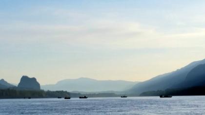
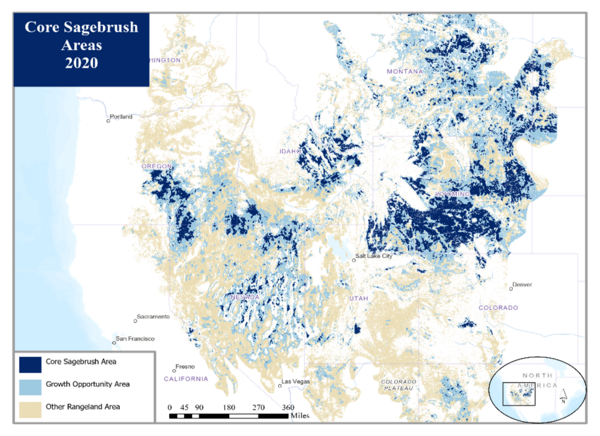

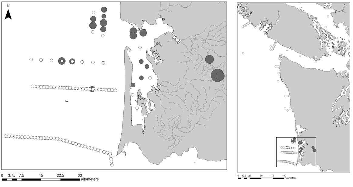


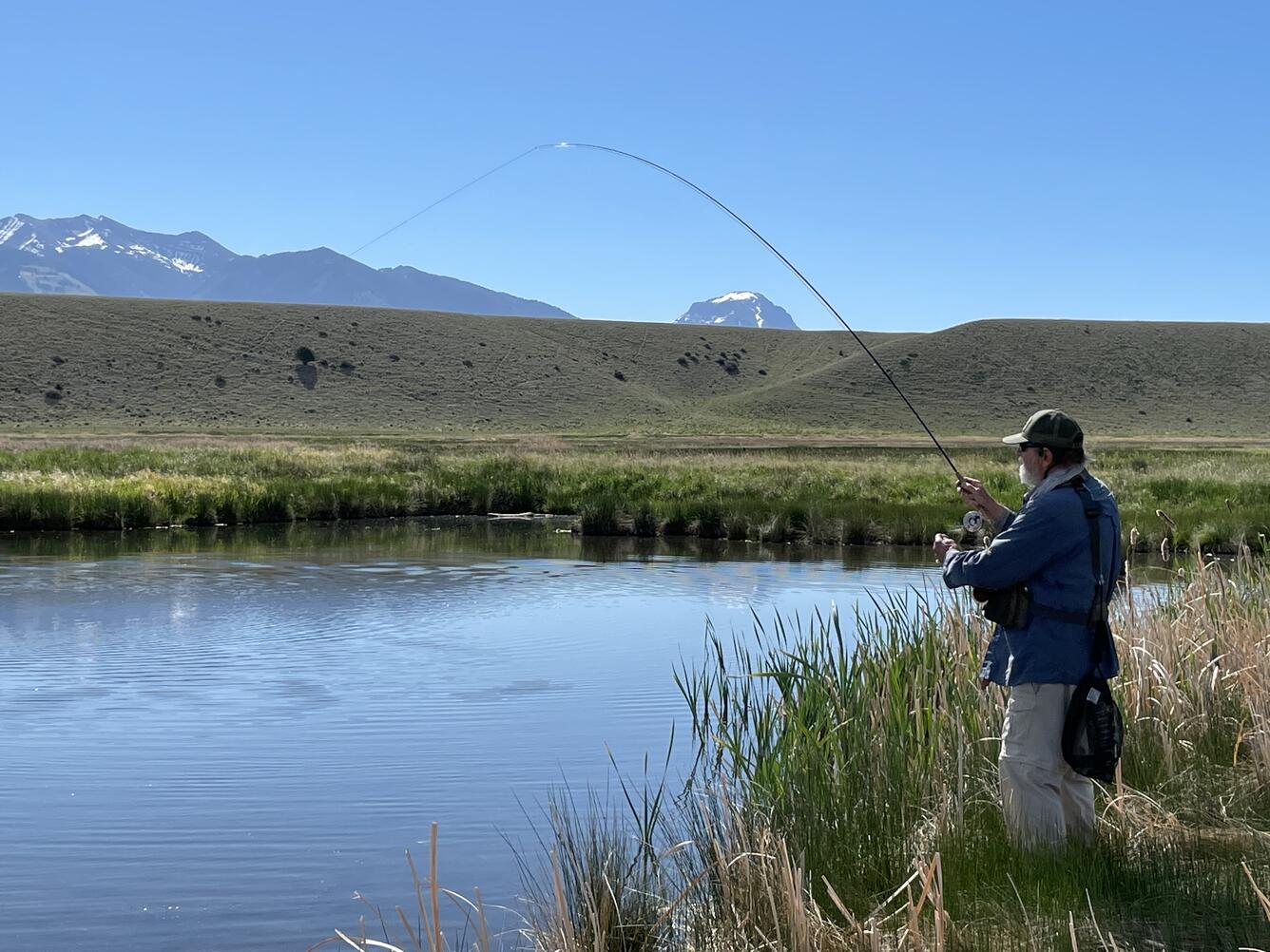

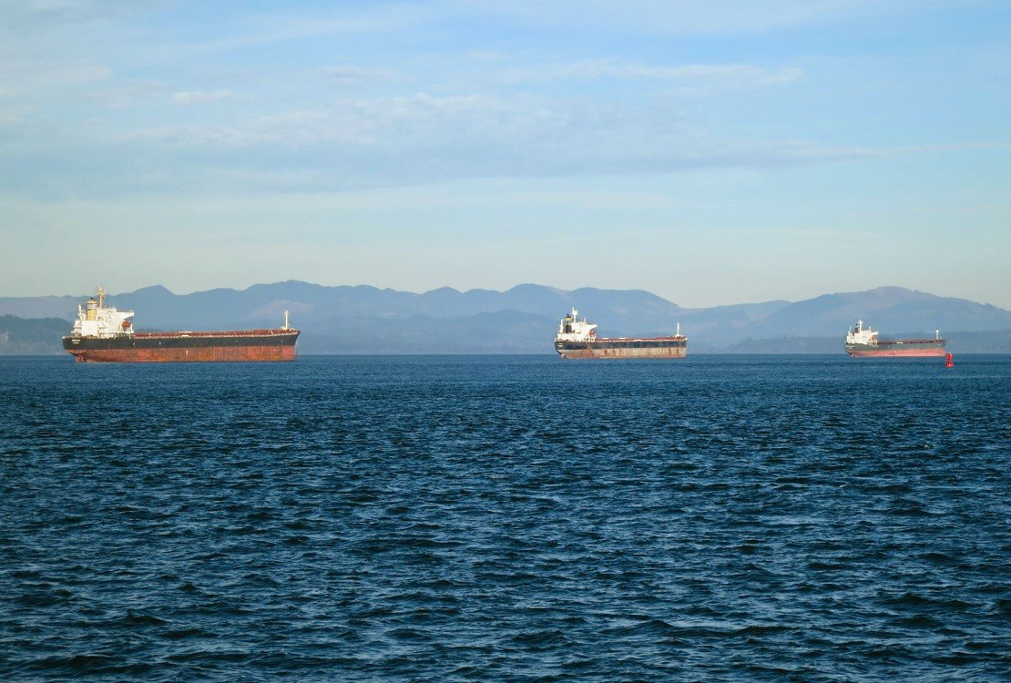


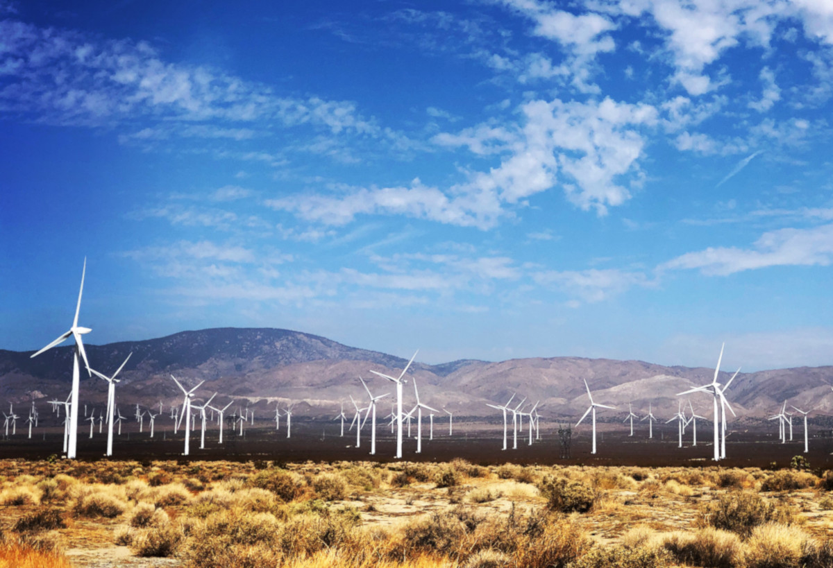
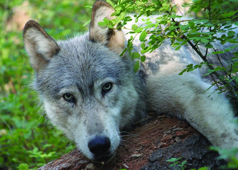
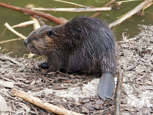
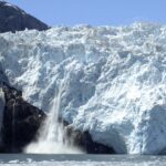

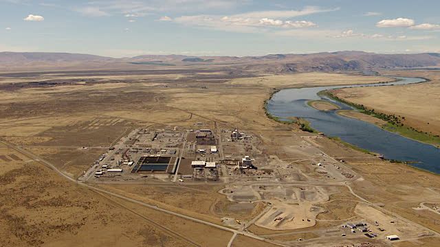

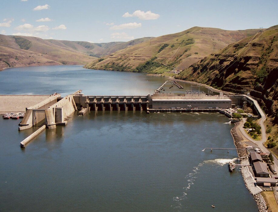
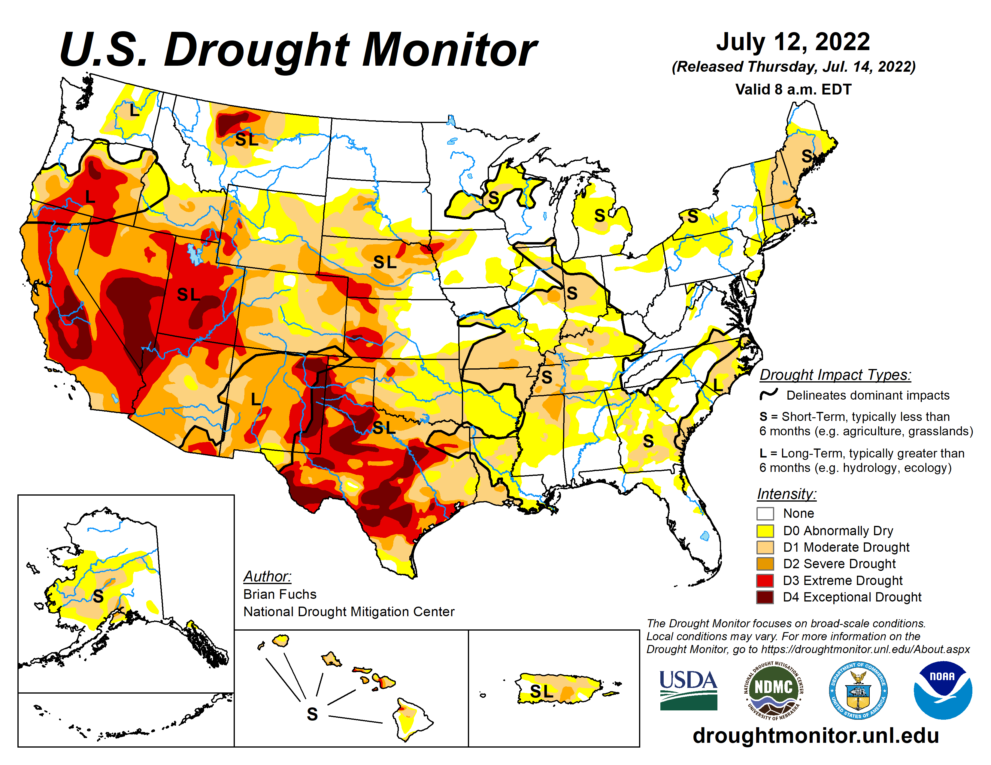
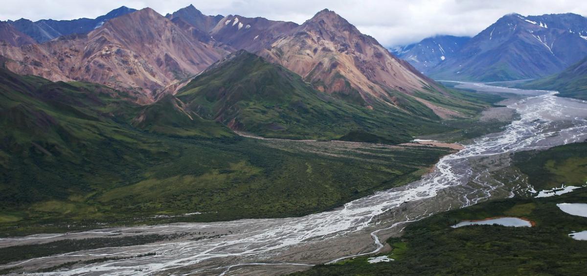
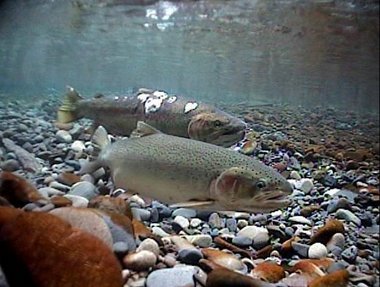


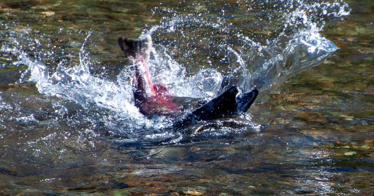
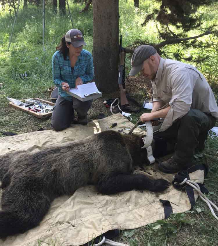
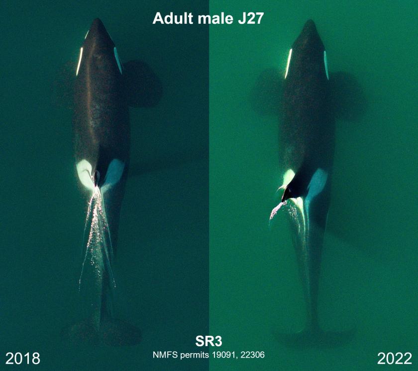

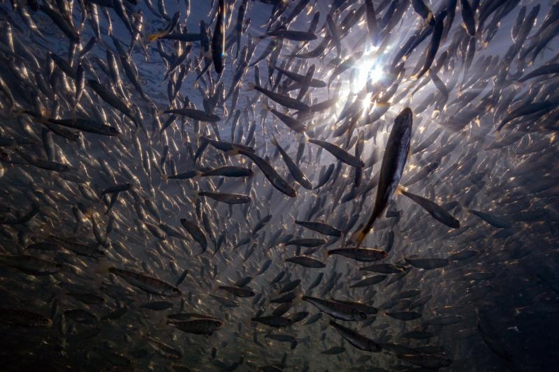
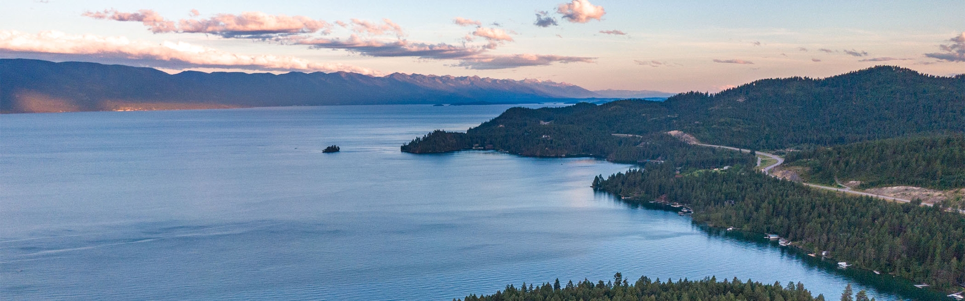

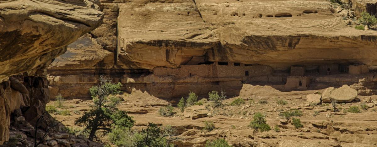

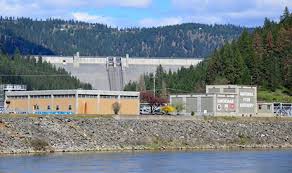
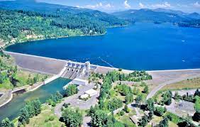
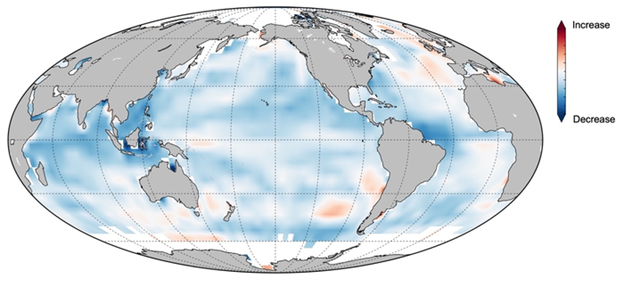
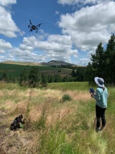
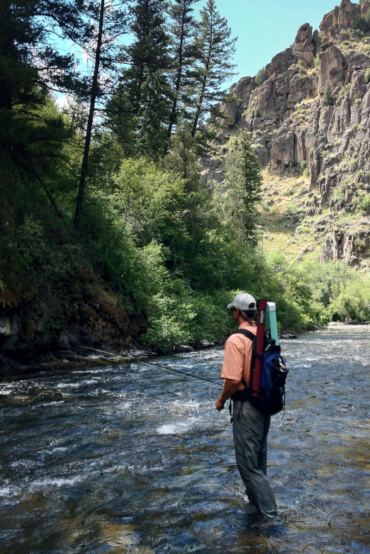
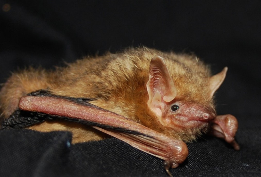


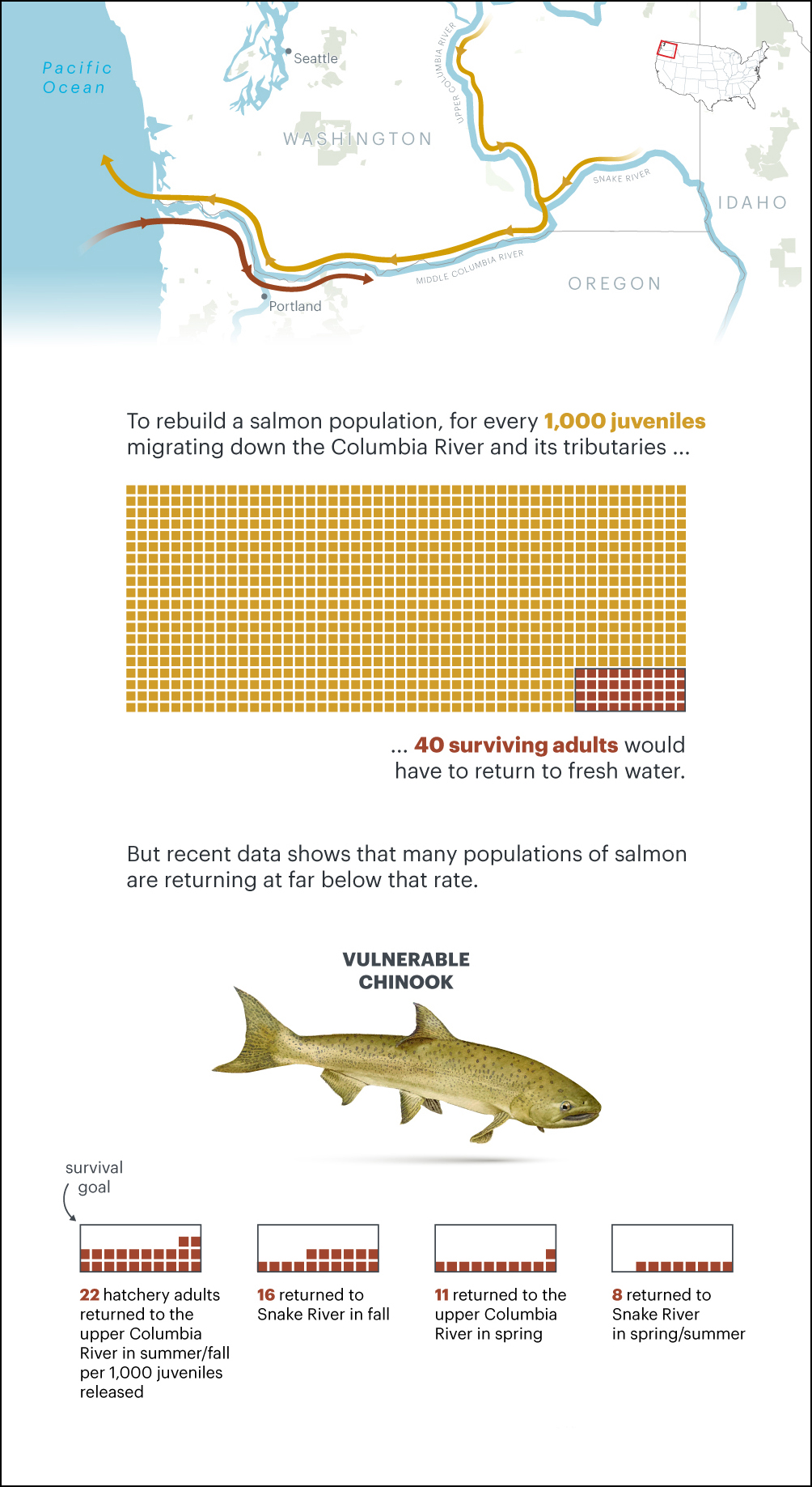
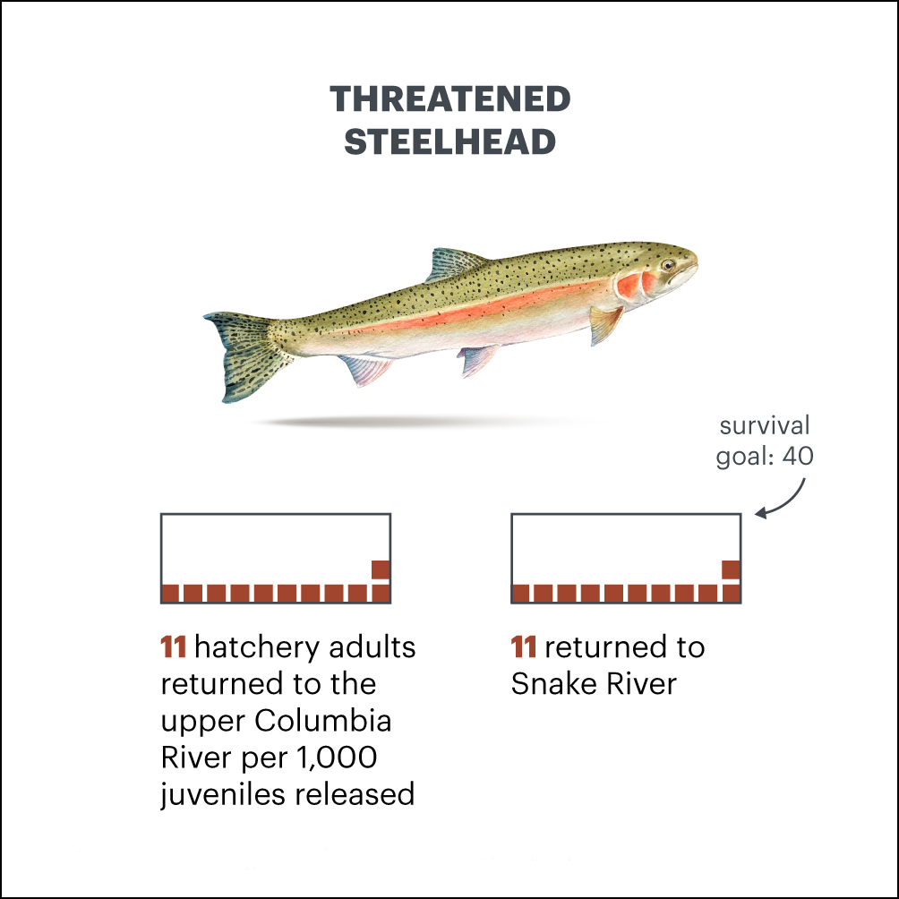
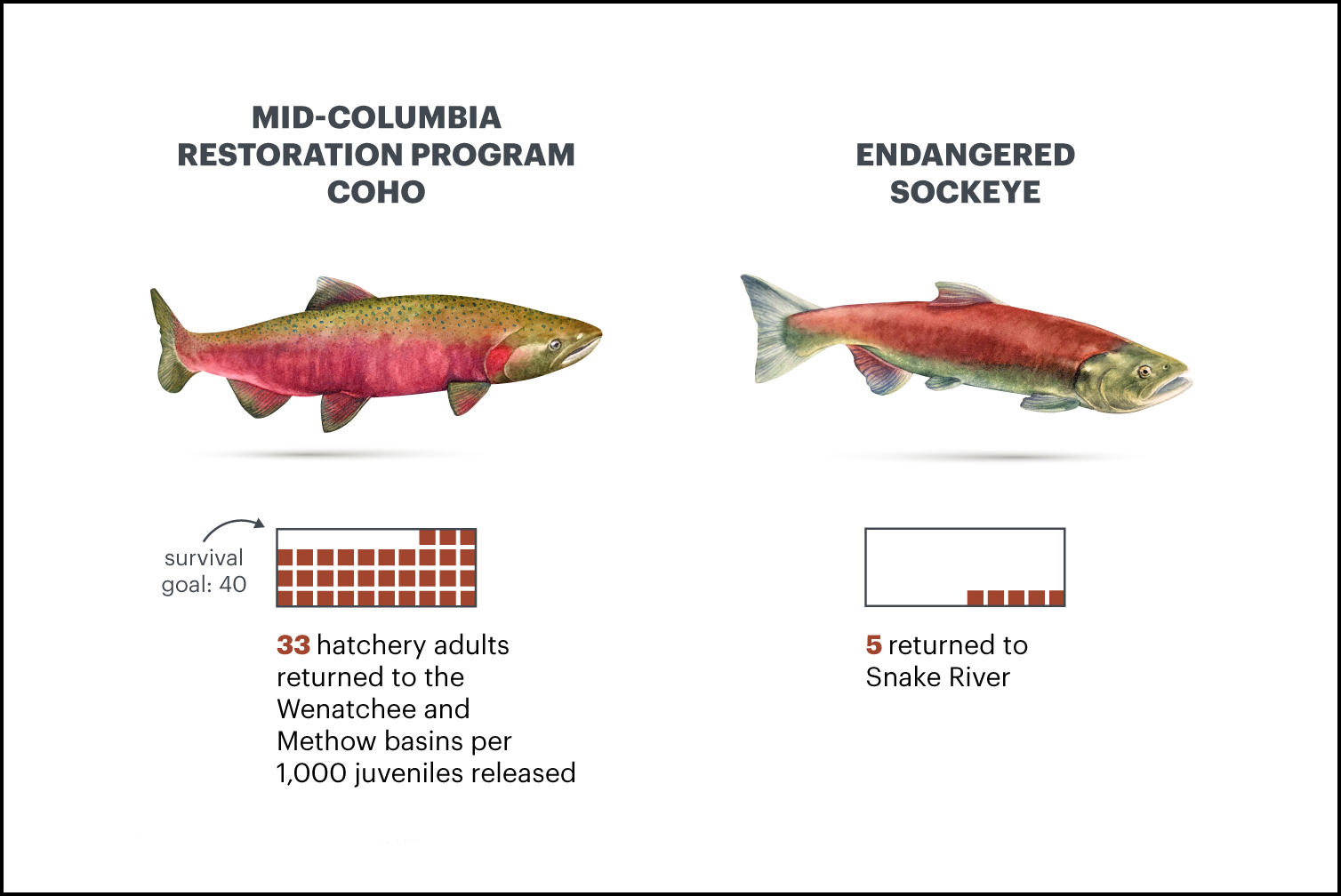
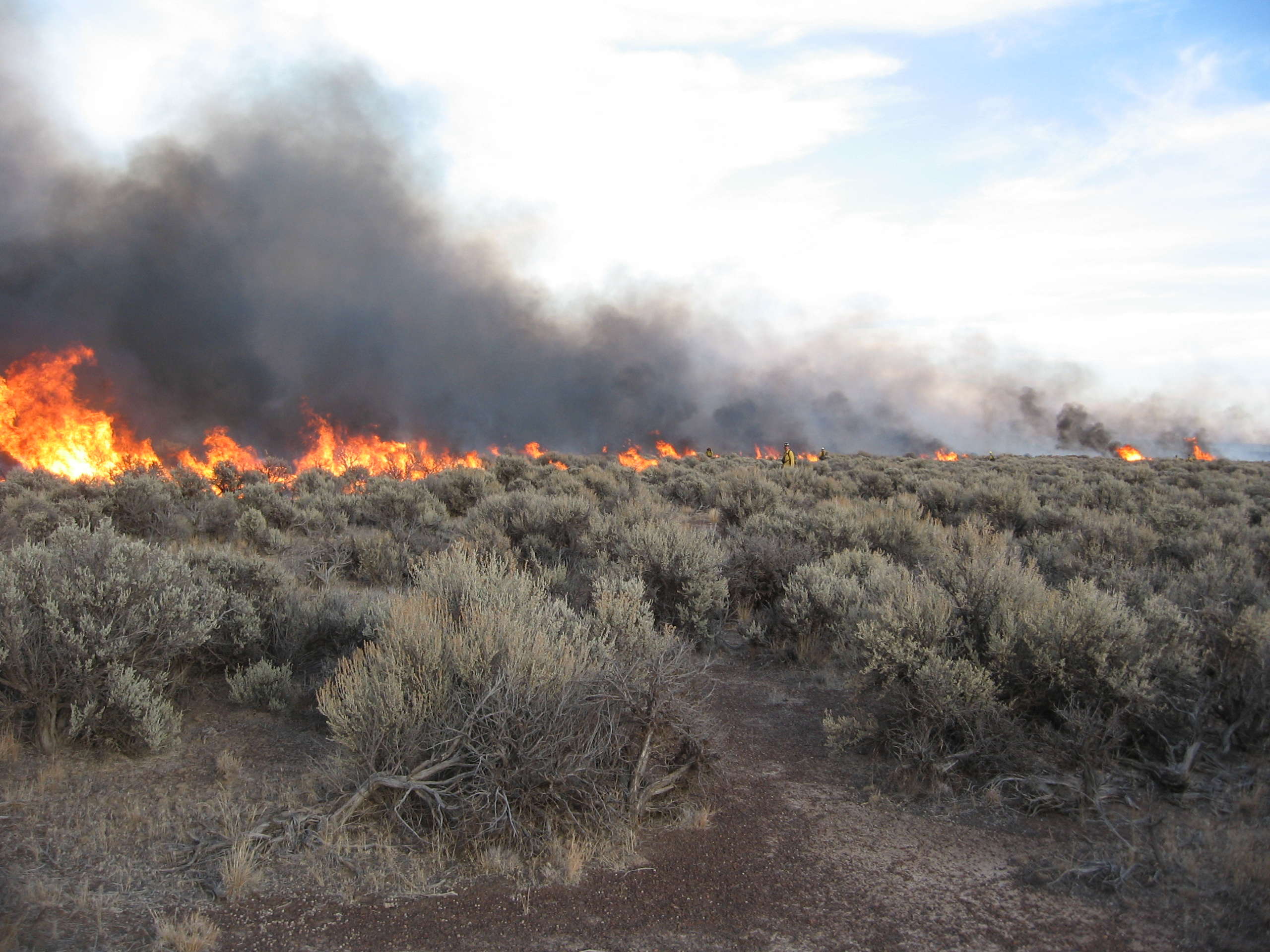

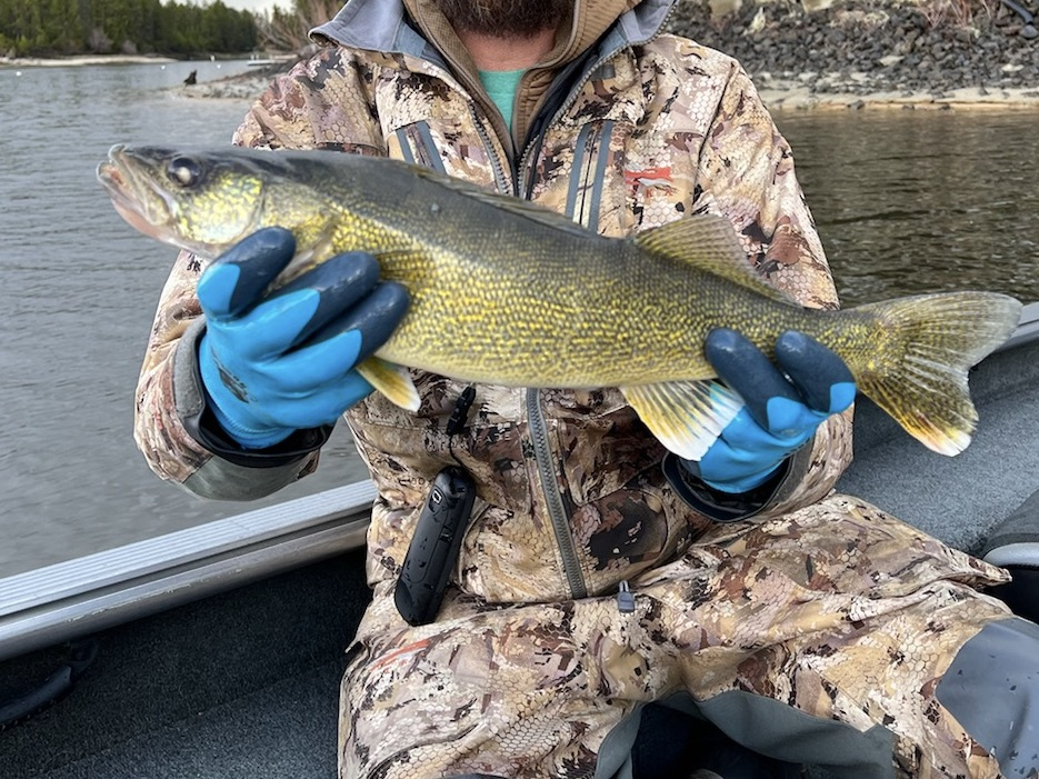
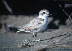

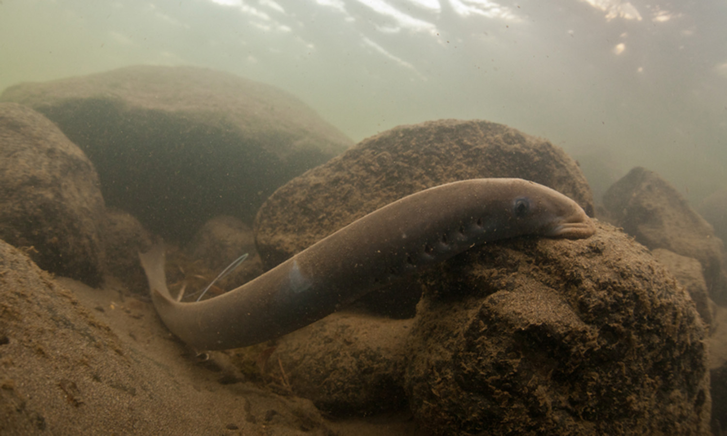


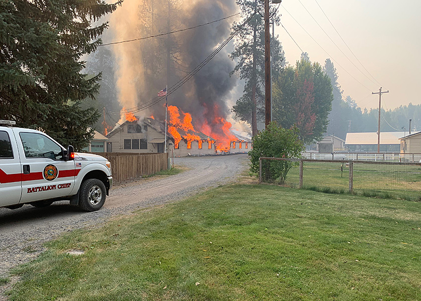
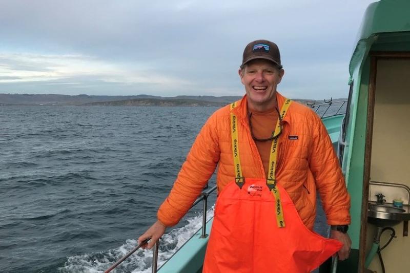
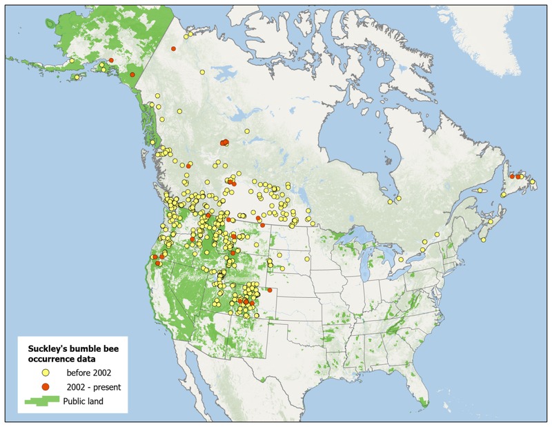


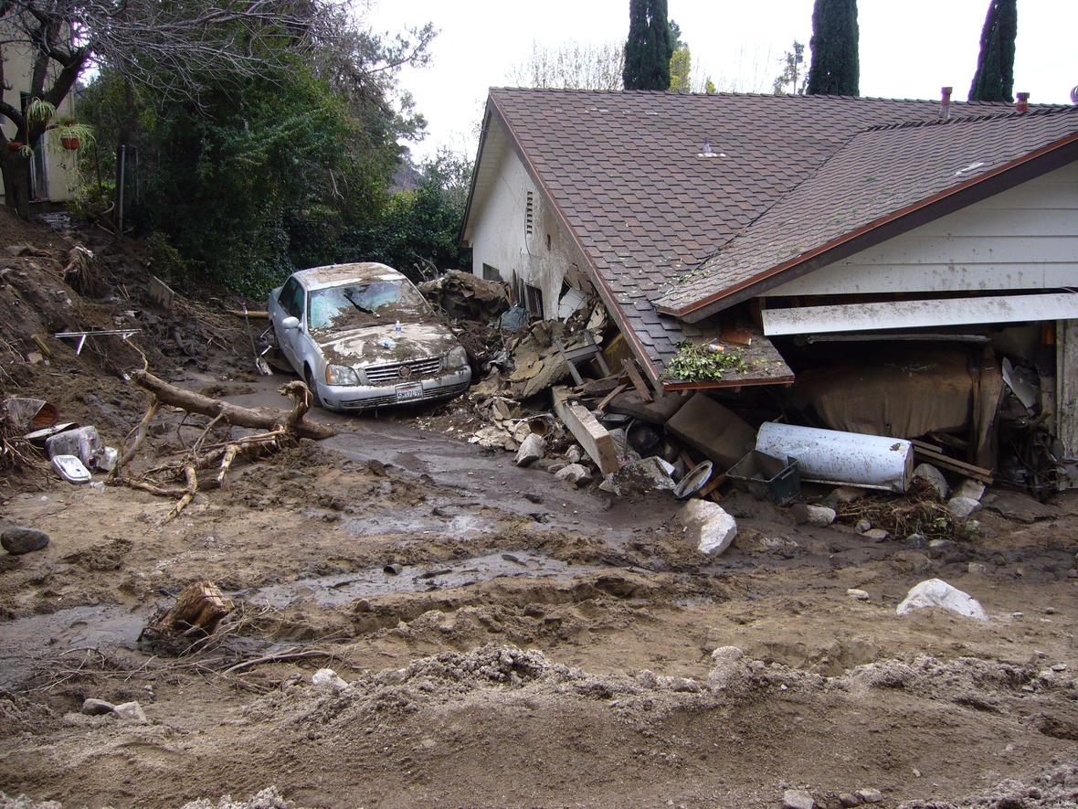


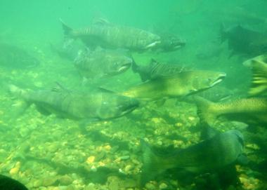

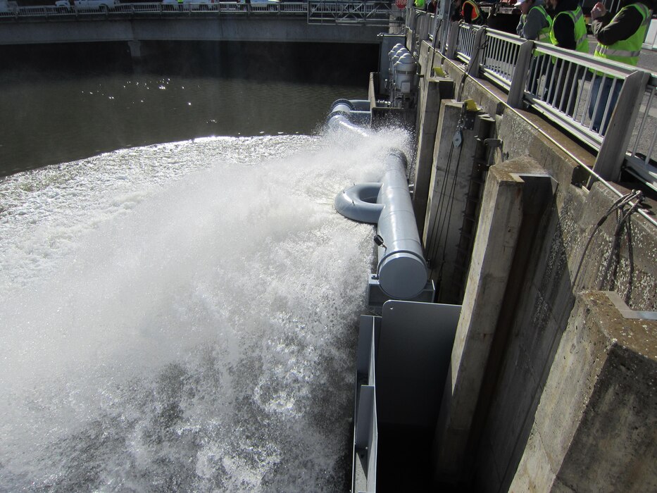
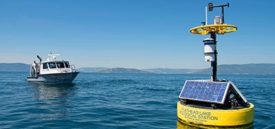
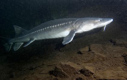

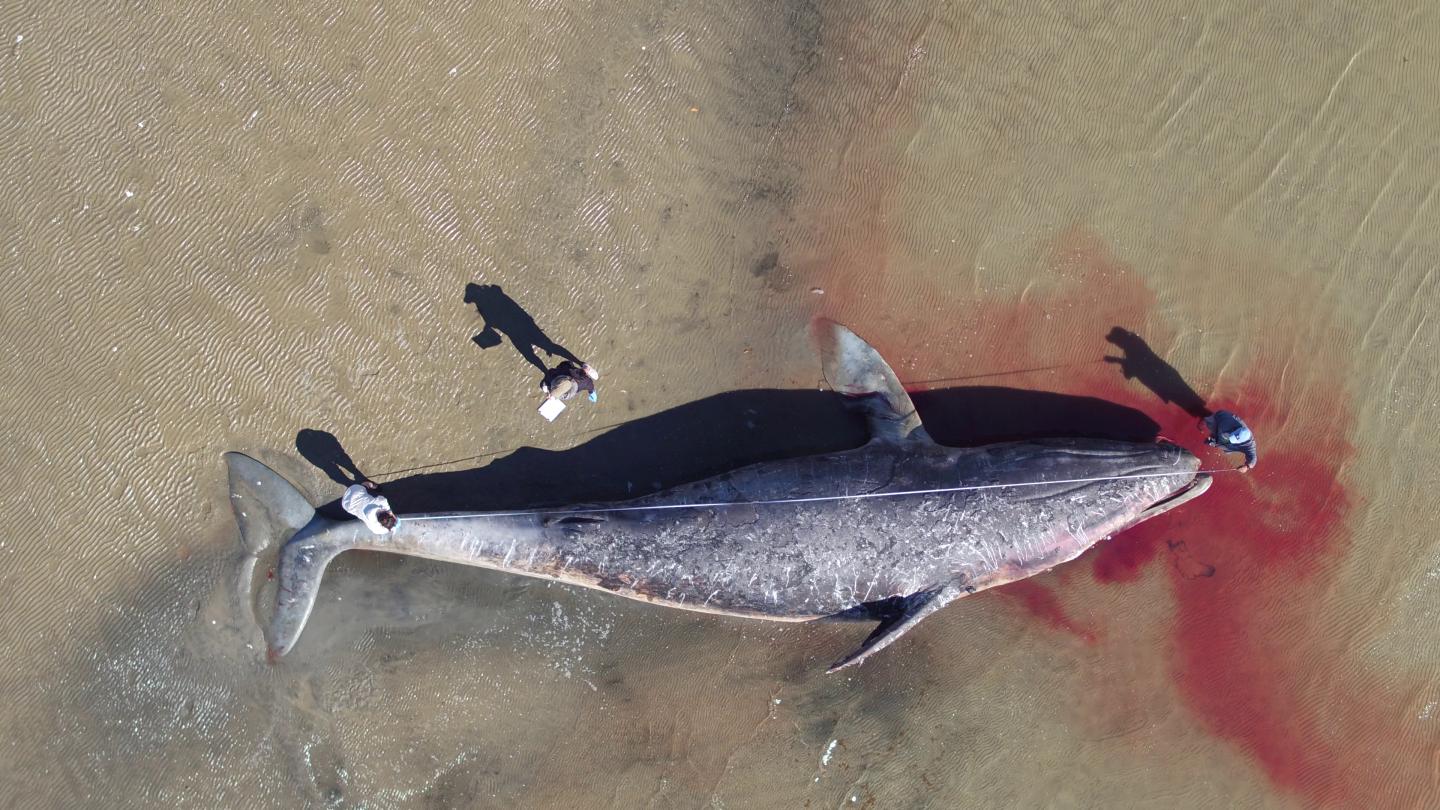

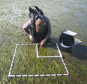
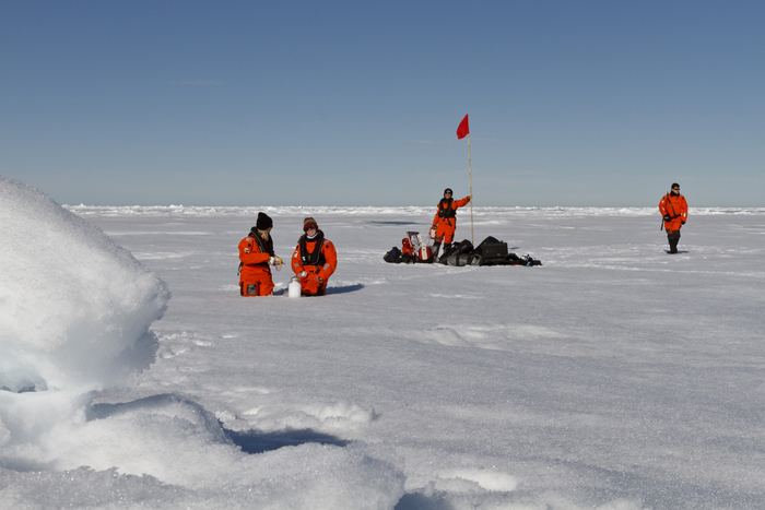


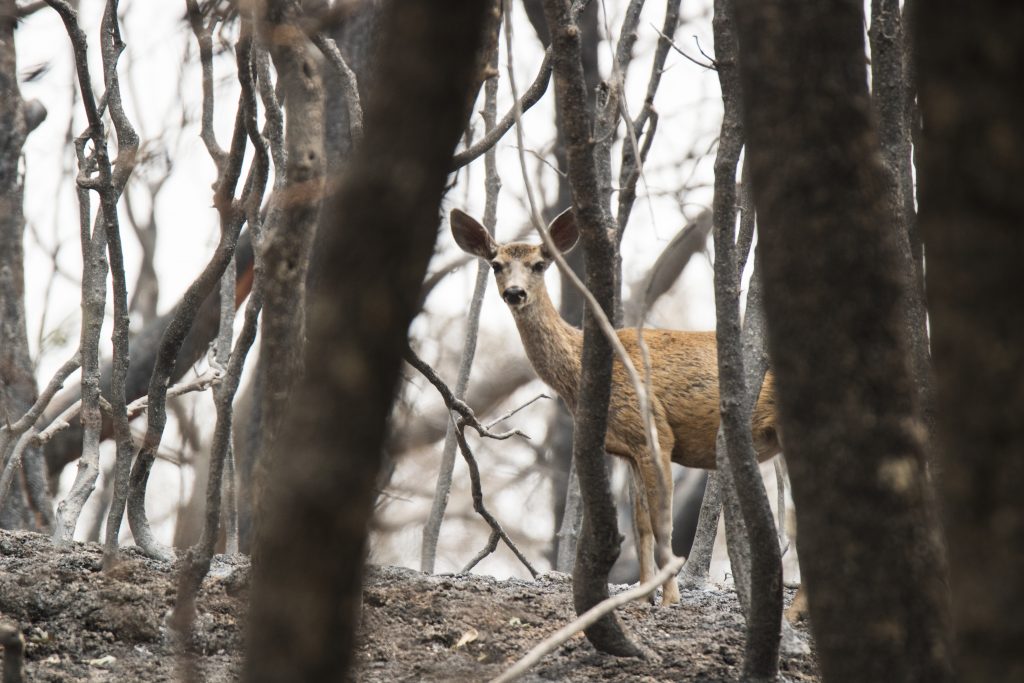
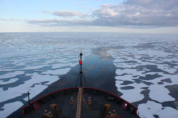
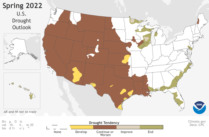
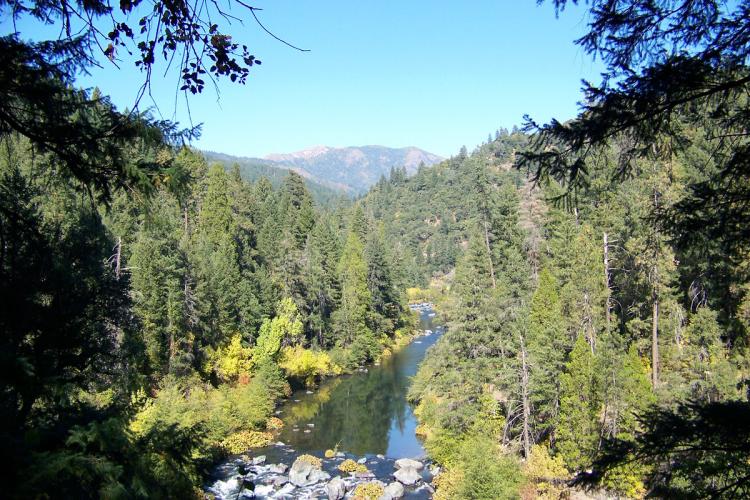


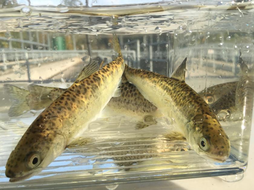

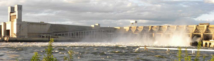
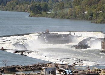


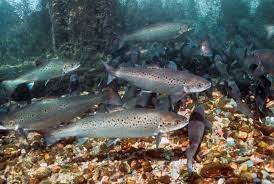
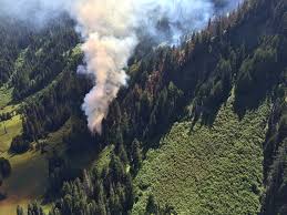

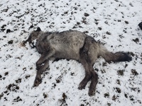
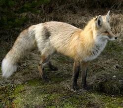

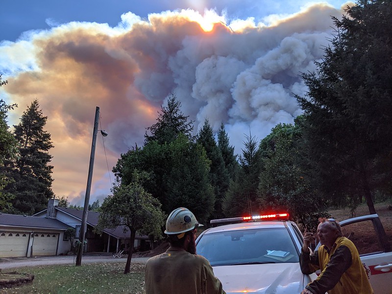

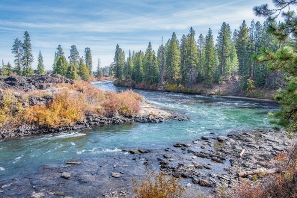


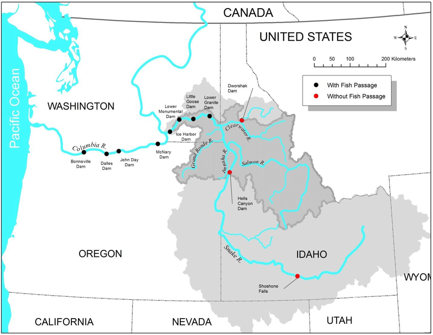
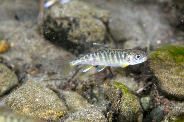
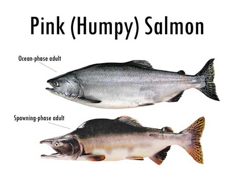
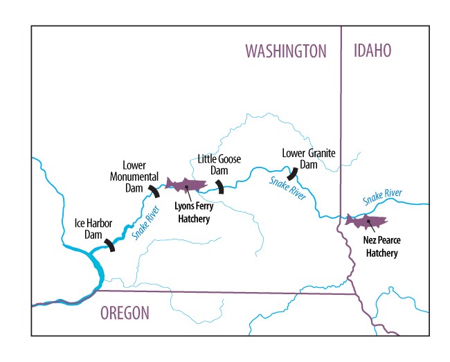
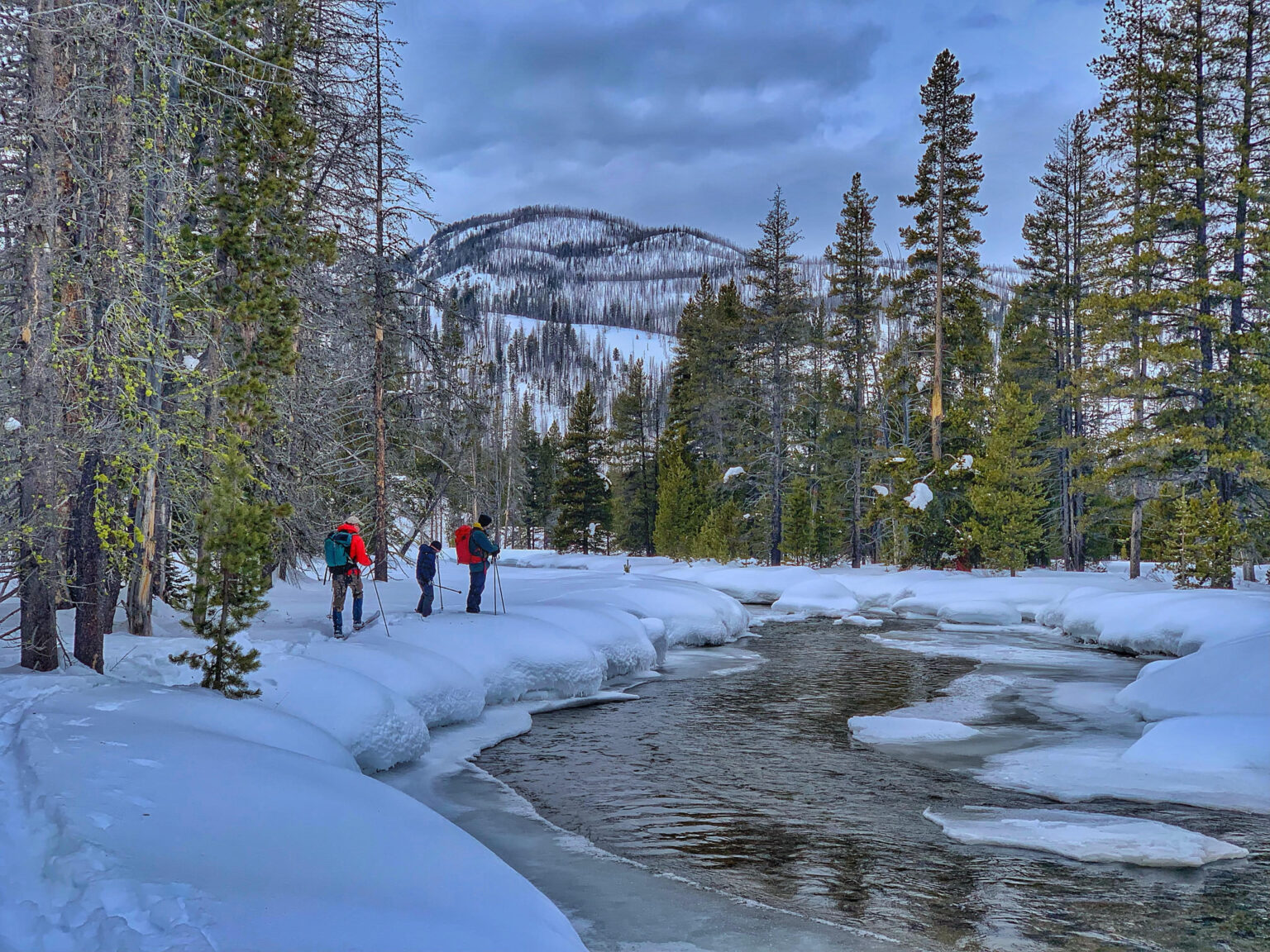


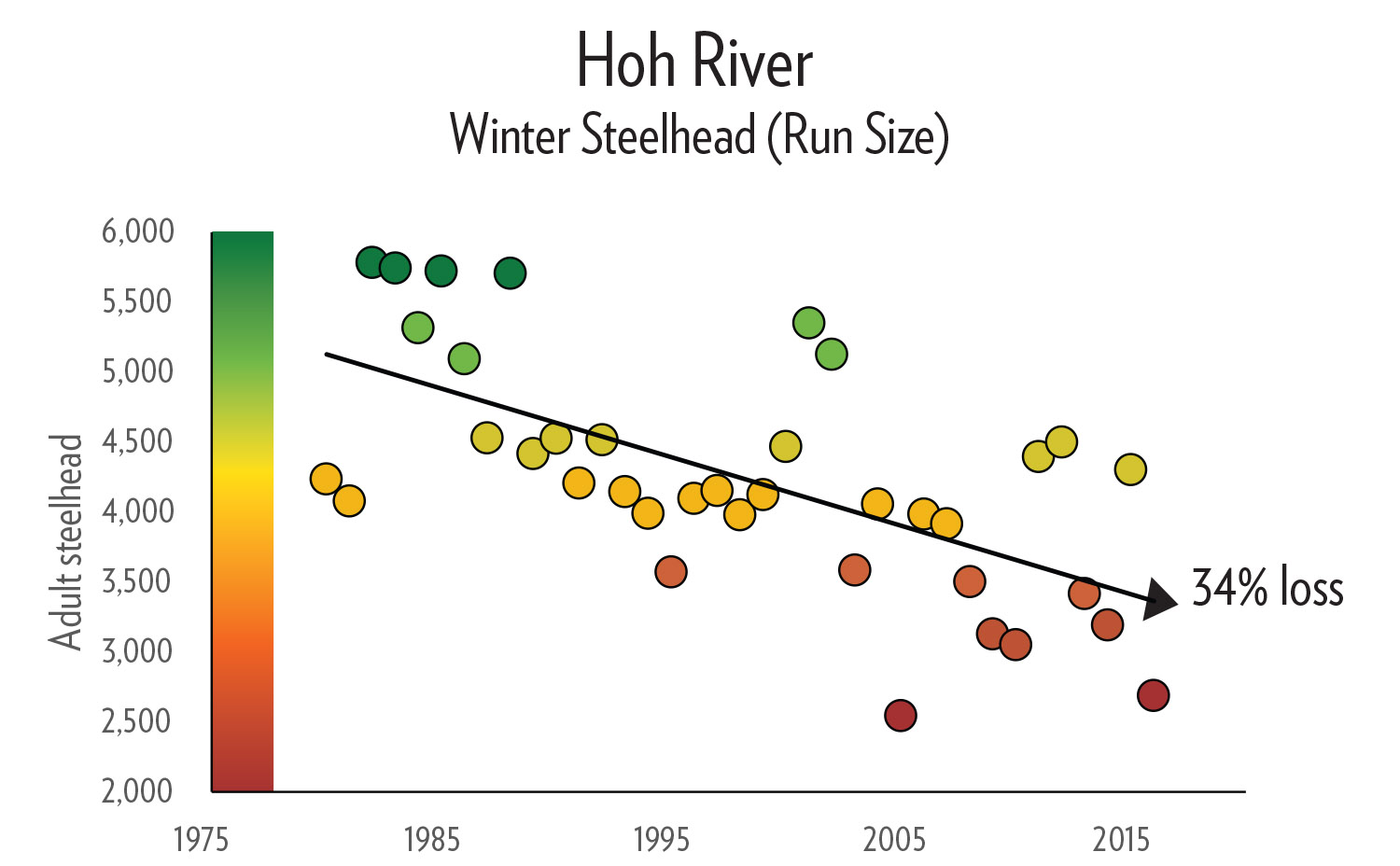

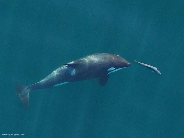


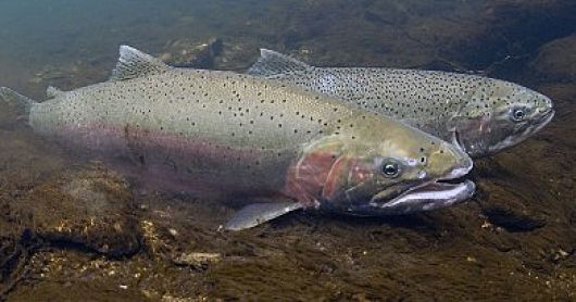

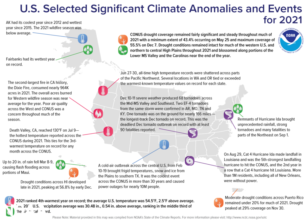


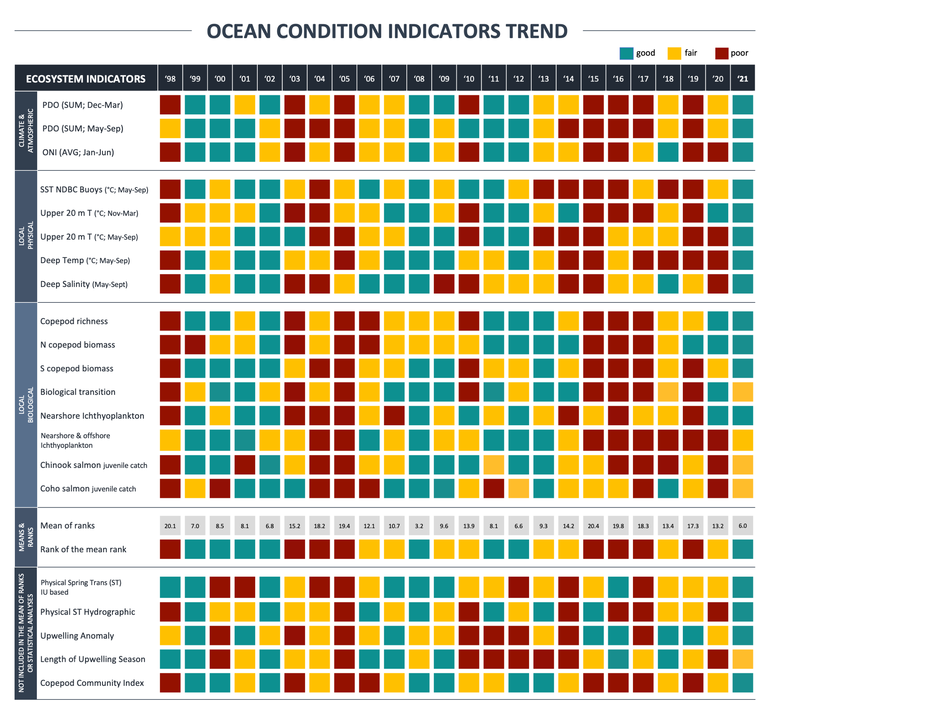
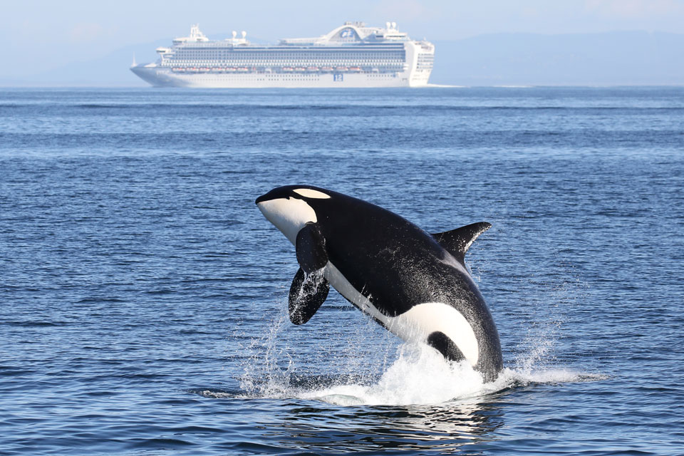


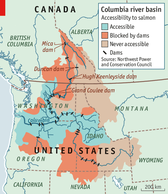
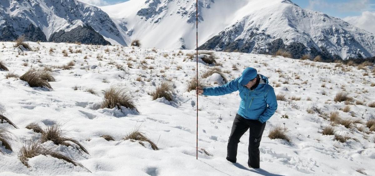

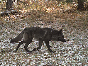
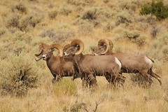


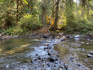
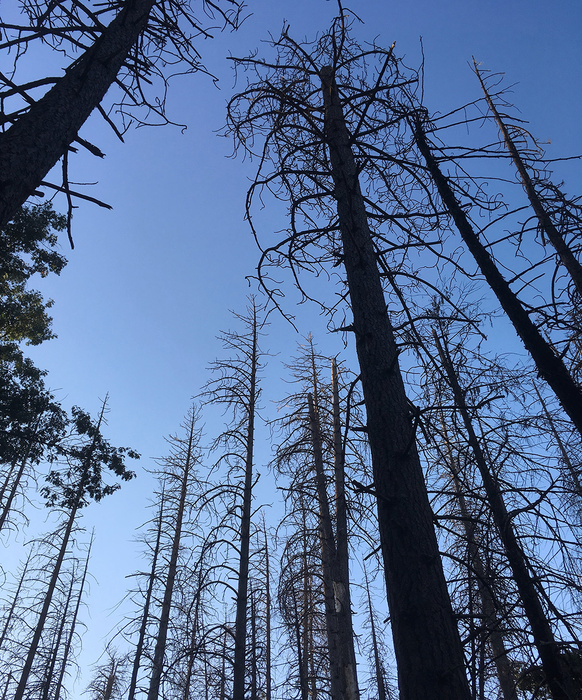

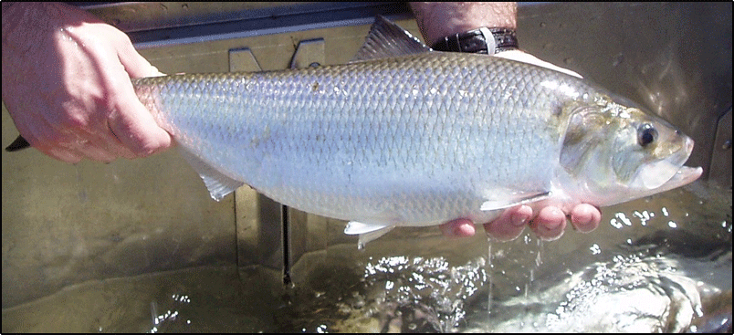
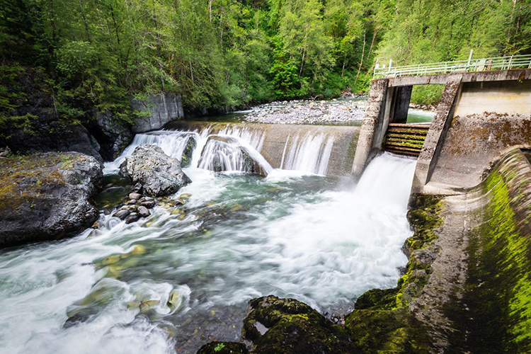


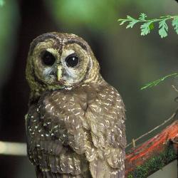

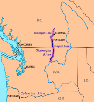


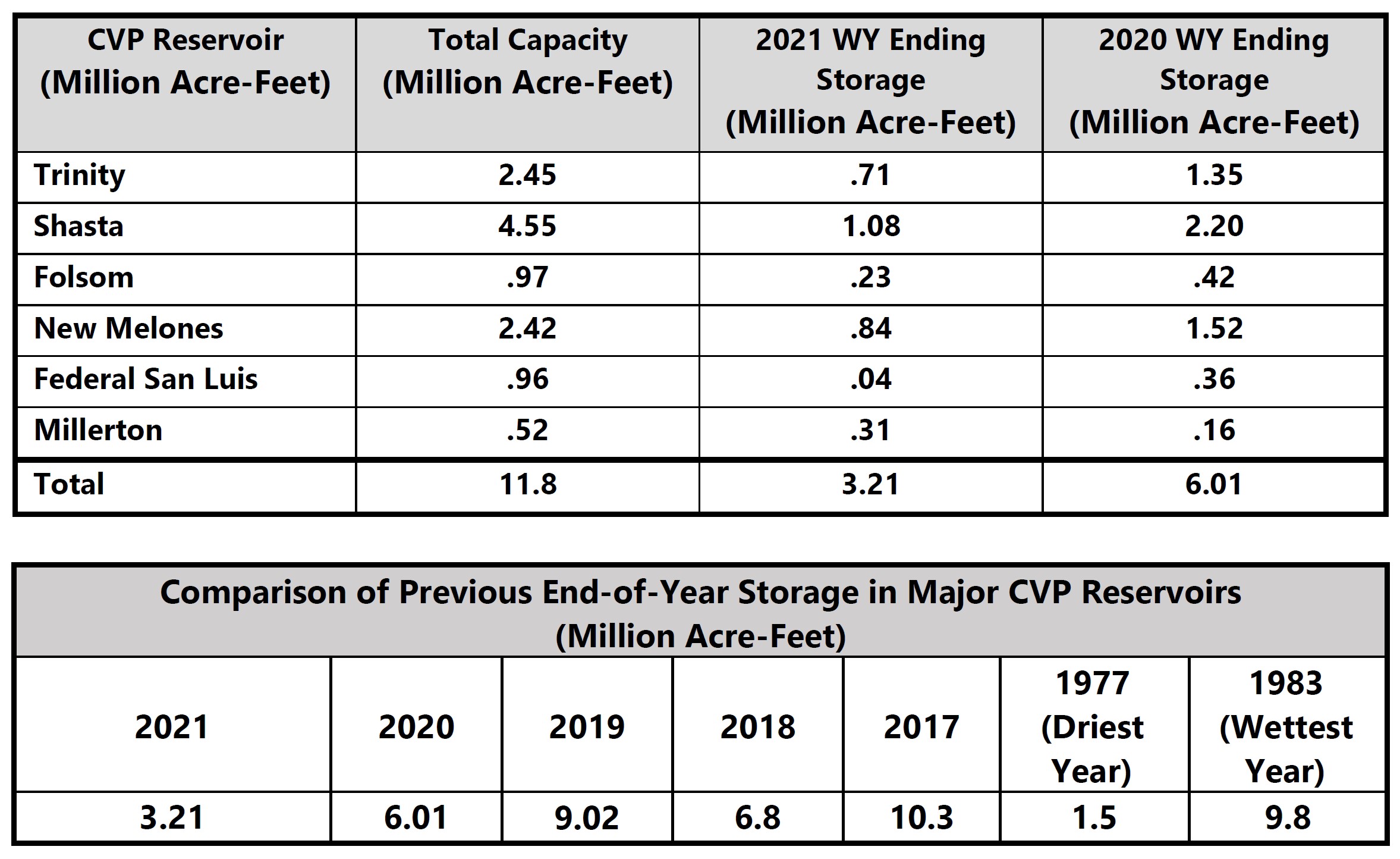
")
")